
ROLLING: Victoria River urged to prepare for ex TC Lincoln
Victoria River is next in line to feel the effects of Ex Tropical Cyclone Lincoln, authorities say. Latest.
News
Don't miss out on the headlines from News. Followed categories will be added to My News.
LATEST, 4pm: Victoria River is next in line to feel the effects of Ex Tropical Cyclone Lincoln, authorities say.
The warning comes as the system proceeds on its path from The Gulf of Carpentaria across central Northern Territory.
On Saturday, Incident Controller Superintendent Daniel Shean said “now is the time to act” for residents near Victoria River.
“There should be some lessons learned in terms of our preparation and planning for people in those communities and also for land holders around those communities and as I said before – now is the time to act,” he said.
“Now’s the time to prepare and get ready for inclement weather coming through those areas and the potential for being cut off by road closures.”
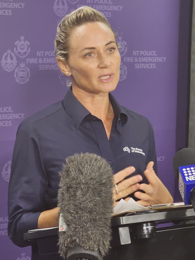
Shenagh Gamble from the Bureau of Meteorology said heavy rainfall was expected along the system’s path.
“While this system moves quite quickly across the Northern Territory, (rainfall totals) of around 100 millimetres up to around 180 millimetres in the heavier falls (are expected).”
Ms Gamble said flood watches were current for the regions of Barkly, Tanami, and the Victoria River catchment.
“We will be monitoring particularly that Victoria River catchment for any need for flood warnings and it is quite reasonable to think that we will have flood warnings issued over the weekend and into next week.”
For residents off The Gulf of Carpentaria, Superintendent Shean and said there were “no issues” to report from the overnight passing of the severe weather.
“We were fortunate that Cyclone Lincoln passed between two communities and neither community was directly impacted by the cyclone, therefore the experience in those communities was normal wet season weather,” he said.
“I’m pleased to say that community members in (those) communities heeded all directions, warnings and information provided by various agencies and we had no issues in terms of community safety at either Borroloola or Robinson River.”
Update 12.30pm: The Bureau of Meteorology says Lincoln is “no longer a cyclone” and is moving through central Northern Territory.
A spokeswoman for the Bureau told the NT News that heavy rainfall was expected as its route continues west.
“(Lincoln) is downgraded – it’s no longer a cyclone and has moved south to south-west over the last 12 hours, and is tracking towards Western Australia,” she said.
“Large amounts of rainfall and damaging gusts can occur but rainfall is what is most common.”
The spokeswoman encouraged Territorians to stay up-to-date with their local conditions as the situation unfolds.
“Be aware there is going to be heavy rainfall out there and be mindful of the information that emergency services and other authorities issue.”
On Saturday, Roper Gulf Mayor Tony Jack said locals were in “good spirits” despite Lincoln remaining a “threat”.
“(It is) worrying times, you know, big rain like this, the cyclone coming in – we’re sort of used to it in The Gulf (of Carpentaria) region and as a category one (cyclone is) it’s still a threat,” he told ABC Breakfast.
“It brings a lot of water, a lot of rain and (also) cutting the roads off and all of that.”
With Lincoln tracking west, Mr Jack said the Stuart Highway could be affected.
“(Lincoln) is travelling that way now, inland, and there will be (a lot) of water up on the heads and all the catchments of The Gulf.”
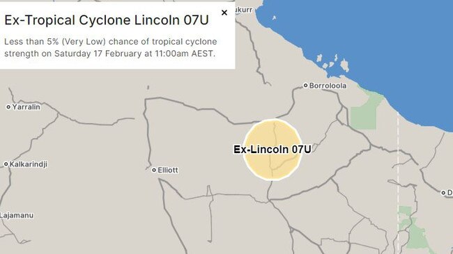
9.30am, February 17: Cyclone Lincoln weakened below tropical cyclone intensity as it passed over Borroloola last night and is now tracking towards the Barkly region.
Strong winds of up to 60km/h and damaging winds of up to 100km/h are forecasted in the warning area, according to the Bureau of Meteorology’s forecast.
A flood watch remains open for Barkly, Tanami and Victoria River catchments, with SecureNT warning residents not to enter flood waters and keep clear of fallen power lines.
The Bureau said Lincoln was expected to move west across the Central NT over the weekend and onto the Kimberly region and bring heavy rainfall near its path.
The cyclone is currently forecasted to reach waters west of Kimberley and north of the Pilbara by the middle of next week.
Update 8pm: Tropical Cyclone Lincoln has slightly increased in speed and is moving further inland.
In an update issued at 7.30pm, the Bureau predicted the system to weaken below tropical cyclone intensity tonight.
It is currently moving south southwest at 12 kilometres per hour and is just inland of the southern Gulf of Carpentaria coast between Borroloola and the NT/Qld Border.
There are sustained winds near the centre of 75 kilometres per hour with wind gusts to 100 kilometres per hour.
“Gales with damaging wind gusts to 90 kilometres per hour are occurring along the coast between Bing Bong and NT/Qld Border but should ease tonight,” the Bureau said
“Heavy rainfall is expected along the southern Gulf of Carpentaria coast with locally intense rainfall possible around Lincoln’s centre. Refer to separate Flood watches and warnings, as well as the Severe Weather Warning.
“Tides will be higher than normal across the southern Gulf of Carpentaria tonight and Saturday.”
BOM observations show 170mm of rain has fallen in the past 11 hours at the Centre Island weather station.
Updated, 6pm: Tropical Cyclone Lincoln has crossed the coast between Port McArthur and the Northern Territory / Queensland border hours after it was upgraded from a Tropical Low.
A warning zone remains in place from Bing Bong in the NT to the border, which includes Borroloola and Port McArthur.
The Bureau of Metrology upgraded the system from a tropical low 07U earlier on Friday after it had formed into a category one cyclone in The Gulf of Carpentaria.
TC Lincoln has sustained winds near the centre of 75km/h with wind gusts to 100km/h.
The system is estimated to be 105km east of Borroloola and 215km west-northwest of Mornington Island, which is now a cancelled warning zone.
It is moving south southwest at 11km/h.
Tropical Cyclone Lincoln is expected to continue moving inland and is likely to weaken below cyclone level intensity during the evening.
The system will then move west across the central Northern Territory across the weekend.
NT emergency services advise people near Borroloola, and surrounding areas, to stay alert and prepared, and ensure their properties are now properly secured.
Essential services could possibly be disrupted as the weather picks up.
For the latest cyclone information go to the: SecureNT website, Bureau of Meteorology site and the Northern Territory Road Report app.
Updated, 2.50pm: Incident Controller Superintendent Daniel Shean has reassured Territorians that evacuation shelters are not expected to be needed ahead of Cyclone Lincoln’s passing.
“The Emergency Operation Centre has been liaising with industry groups and stores and engaging with local communities to ensure that residents remain safe,” he said.
“Preparations for emergency shelters are underway if required, however I stress at this stage there is no indication that emergency evacuation will be required in any of the communities that the tropical cyclone will pass (through).”
Superintendent Shean confirmed local food stores would have enough stock to provide affected residents.
“Local controllers will prepare people in the communities and keep people informed as to what is occurring,” he said.
“There is no need for people to be evacuated from their houses or leave their homes and we’re making sure that communities area safe as the weather event progresses.
“In terms of food security, local stores are being contacted to ensure that they have plenty of food on stock – while there may not always be supplies of fresh fruit and vegetables, there are plenty of other food essentials for sustaining life.”
Superintendent Shean reminded pet owners that animals were not to be taken with them in the event that emergency shelters be used.
He said the Carpentaria Highway had been closed ahead of TC Lincoln’s arrival.
“And remember – if it’s flooded, forget it. Don’t risk your life and the lives of others by bypassing the road closure signs and going into areas where there is danger …,” he said.
Residents of the impacted area were urged to stay inside and stay sheltered until the storm passed.
For the latest cyclone information go to the: SecureNT website, Bureau of Meteorology site and the Northern Territory Road Report app.
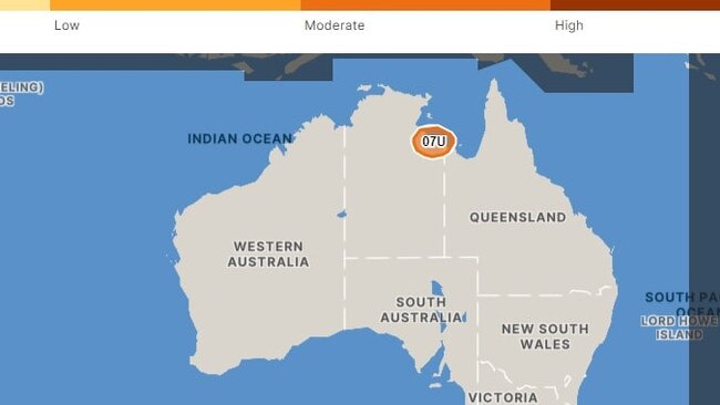
Initial, February 16: The Bureau of Meteorology has upgraded its NT cyclone warning for tropical low 07U to category one Cyclone Lincoln.
The Bureau announced a short while ago Lincoln had formed in the southern Gulf of Carpentaria, with a coastal crossing expected between Port McArthur and the Territory-Queensland border sometime on Friday afternoon.
The Bureau said the warning zone is between Bing Bong in the Territory to Mornington Island in Queensland including Borroloola, Port McArthur and Mornington Island.
TC Lincoln formed as a category one cyclone including sustained winds of about 75kmh with wind gusts up to 100kmh.
The system is currently 140km east-northeast of Borroloola and 220km northwest of Mornington Island.
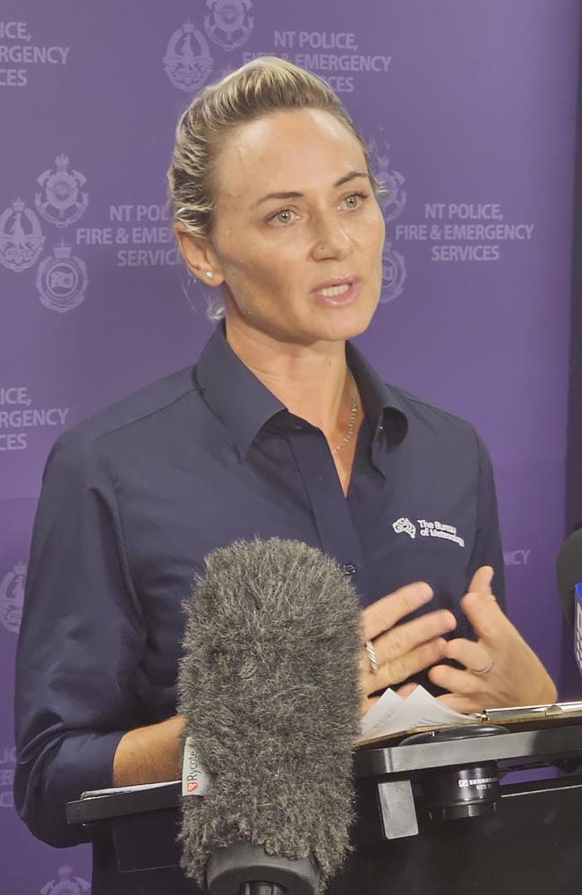
Shenagh Gamble of the Bureau of Meteorology confirmed TC Lincoln would cross the south of The Gulf of Carpentaria tonight.
“Our current forecast is that we expect tropical Cyclone Lincoln to cross the southern Gulf
of Carpentaria coast in vicinity of Borroloola and Robinson River at around 7.00pm tonight,” Ms Gamble said.
“After crossing the coast that system will downgrade quite quickly to a tropical low,
however the wind and heavy rainfall associated with this broad area of circulation (means) the risk of those hazards still continue.”
The Bureau is forecasting damaging wind gusts to 110km per hour to develop along the coast between Bing Bong and Mornington Island during the day as Lincoln approaches and crosses the coast.
The Bureau recommends people in Borroloola and surrounding areas should have completed their cyclone-readiness preparations.
While coastal communities batten down in readiness for the full fury of Cyclone Lincoln, repercussions from the storm are already being felt in Darwin, with Council relocating Bombing of Darwin commemorations on Monday from The Esplanade to the Convention Centre.
Remotely, Roper Gulf Regional Council announced the Wugularr School in Beswick would operate as an evacuation centre after the nearby Waterhouse River flooded following rain brought on by the tropical low.
Photos show the Waterhouse Creek crossing inundated with water making it impassable and cutting the town off to the west.
UPGRADED: Cyclone watch upped to warning
Earlier, February 15: A cyclone watch for the Northern Territory has officially been upgraded to a cyclone warning, with communities on the northern coast from Port Roper across to the Queensland border in the firing line.
Developing tropical low 07U continues to be tracked by the Bureau of Meteorology on Thursday, while flooding in the Katherine River around Nitmiluk continues to rise after a rain deluge earlier this week.
Communities on the north coast were first warned to brace for wild weather after a cyclone watch was announced by the Bureau on Wednesday afternoon.
The Bureau’s Shenagh Gamble told media on Thursday afternoon that the low was currently situated in The Gulf of Carpentaria, but that it would likely head back towards land in the coming days.

“The tropical low is located south of Groote Island and north east of Borroloola,” she said.
“At the moment it’s got around 55 km/h winds sustained with 85 km/h gusts and the system is in a fairly favourable environment.
“During today we expect it to be fairly slow moving, taking a bit of an easterly track before slowly heading south over Friday and Friday evening and southwest towards the Northern Territory border.
“[On] Wednesday, we issued a cyclone watch for communities between Port Roper and around to the Northern Territory/Queensland border. This morning, we’ve upgraded that now to a cyclone warning because we do expect the impacts of that system to be felt within the next 24 hours.”
Ms Gamble said the low being in The Gulf meant it had the potential to grow exponentially.
“In the past 24 hours we have seen this low potentially develop into a cyclone at a moderate level,” she said.
“We are still looking at a 40 to 45 per cent chance of this becoming a tropical cyclone, however we do take precautions when the system is in The Gulf of Carpentaria, because those conditions there are really favourable for system development.
“If this system does develop, it could develop quite quickly and it could develop into a stronger cyclone, even potentially develop into a category 2.”
Evacuation centre opened as community keeps eye on cyclone watch
Earlier, February 15: On Thursday morning the Roper Gulf Regional Council announced the Wugularr School in Beswick would operate as an evacuation centre after the nearby Waterhouse River flooded following rain brought on by the tropical low.
Photos show the Waterhouse Creek crossing inundated with water making it impassable and cutting the town off to the west.
The latest forecast from the Bureau has the tropical low listed as most likely turning into a cyclone at around 9.30am Friday, with a 40 per cent chance, when it will be situated in The Gulf just north east of Borroloola.
Remote Housing and Homelands Minister Selena Uibo, whose Arnhem electorate is most at risk from the potential cyclone, said preparations were in place.

“We are making sure we’re getting the message out to our communities, also keeping a keen eye on any disruptions around power outages and telecommunications,” she said.
“I’ve been privy to some of the local emergency committee management processes, for example Wugularr, a community in my electorate had one yesterday where they brought all the service providers together to work out the management plan.
“We have teams that go into places that are identified for emergency management ahead of time, so it’s almost like a scouting team to be able to support locals on the ground and service providers on the ground.
“Then of course if there is a natural disaster whether it’s a cyclone flood or bushfire, we have a recovery team to come in after so there’s a lot of management on the local level.”
Meanwhile the NTES have also issued flood advice for the Katherine River near Nitmiluk Centre, and though they said there is “no immediate danger” the community was to remain alert.
With rainfall totals of 120-200mm for the Katherine River catchment area this week there is a moderate danger of flooding, with more rain now forecast for the next few days.
People could potentially become isolated, as well as their being a risk of damage to property and livestock.
EARLIER, WEDNESDAY FEBRUARY 14: Communities from Port Roper across to the Queensland border were first warned to brace for wild weather with a cyclone watch announced by the Bureau of Meteorology on Wednesday afternoon.
The BoM’s Shenagh Gamble said they had been closely monitoring the tropical low as it passed across the top of the Territory earlier in the week.
“Over the past few days this week we have seen this monsoon trough redevelop across the base of the Top End after and it has brought a fair bit of rain with it, especially to coastal parts of the north west,” she said.
“Embedded within that monsoon trough we have seen a tropical low slowly develop and move from the western coast over to the eastern coast of the Top End.
“Today we have seen further development of that tropical low around Groote Eylandt in The Gulf of Carpentaria and we do expect, with the favourable conditions in The Gulf, that this system could develop into a tropical cyclone.”

Ms Gamble said there was a “moderate or 40 per cent chance” a tropical cyclone will develop and communities in the firing line need to be alert.
“Coastal communities in the Northern Territory within that area could see damaging wind gusts developing from Friday night,” she said.
“It is also important to note that damaging winds could develop around the tropical low before its development into a tropical cyclone. We expect the tropical low to be fairly slow moving in The Gulf.
“Over the weekend it is expected to head back west again into the NT where it will, if already a tropical cyclone, decrease in intensity rather quickly while moving across the central districts.”
Northern Territory Emergency Service’s Fleur O’Connor said that an emergency situation was “invoked” as soon as the cyclone watch was issued.
“What that means is it provides authorised officers with powers to undertake emergency actions if required,” she said.
“What we really want to advise to everyone in the area of the watch is to start preparing for the development and threat of a cyclone.
“Make sure you have your emergency kits prepared, your emergency plans finalised, don’t forget about your pets and make sure you have supplies sufficient to sustain you for three days.”
For more information and to keep track of the tropical low head to bom.gov.au/cyclone/


Join the conversation

‘Fundamental freedoms’: Controversial discrimination laws introduced
The NT's anti-discrimination watchdog warns new reforms will erode Territorians rights, while the CLP says it is 'restoring balance' between protections and free speech.
Read more

30+ photos: Racing fans enjoy Corporate Cup day
As racegoers and those in the action turn their eyes toward what will be a huge weekend of racing, the Darwin Cup Carnival celebrated the Dabble Corporate Cup. Check out all the photos.
Read more