
Wind, weather radar plans for Barkly after pastoralists’ eight year wait
An enhanced weather radar for the Barkly region is on the horizon, bringing much-needed insight to pastoralists and communities after an eight year wait.
News
Don't miss out on the headlines from News. Followed categories will be added to My News.
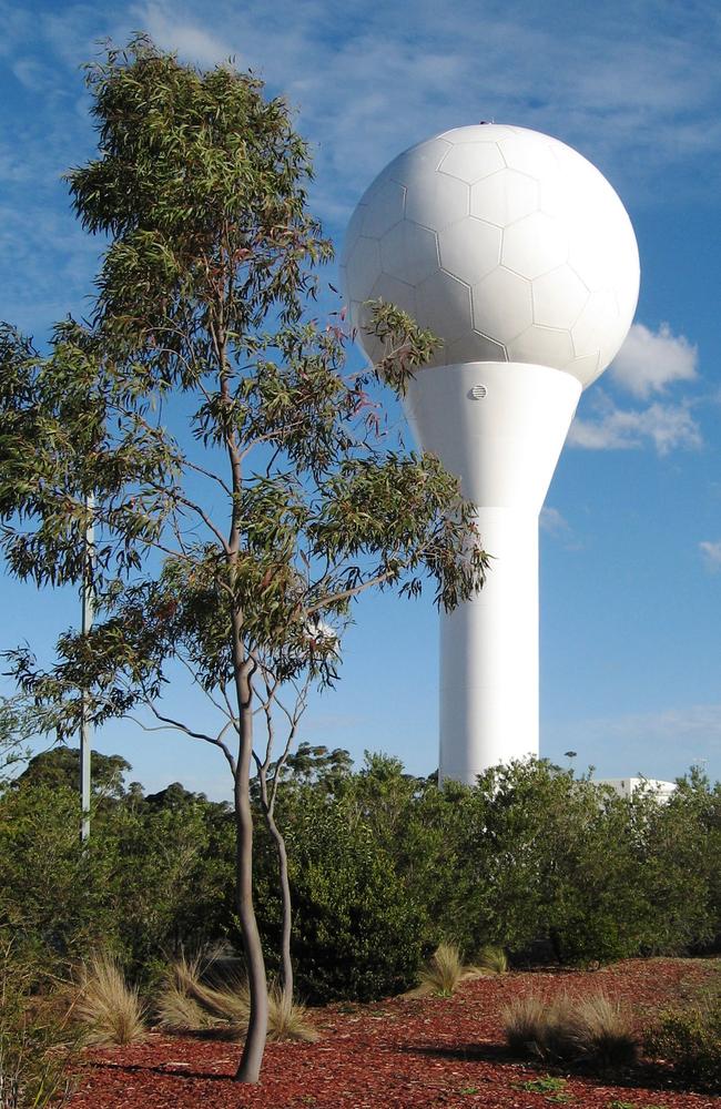
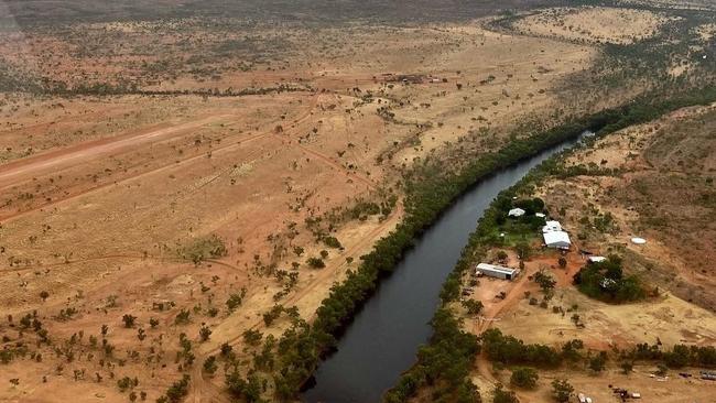
The Barkly region is set to install another Doppler radar more than eight years after its wind radar in Tennant Creek was shut down.
A Bureau of Meteorology spokeswoman said the new radar was a big step up from the region’s old tracker.
“The new weather radar is a high power S band Dual Polarised Doppler radar which has enhanced performance and range characteristics compared to the original Tennant Creek radar,” she said.
“We have selected a preferred site for the radar and will start work there when we receive the appropriate land-use approvals.”
The spokeswoman said the Bureau expected the radar would be operational about 12-18 months after “access to the site is secured”.
She urged pastoralists, local communities, and emergency service to rely on the Bureau’s alternative resources for the Barkly region in the interim, including imagery from the Himawari satellite and temperature, rain, and wind graphics via MetEye.
‘Directly threatening’: NT farmers left to tackle bushfires alone
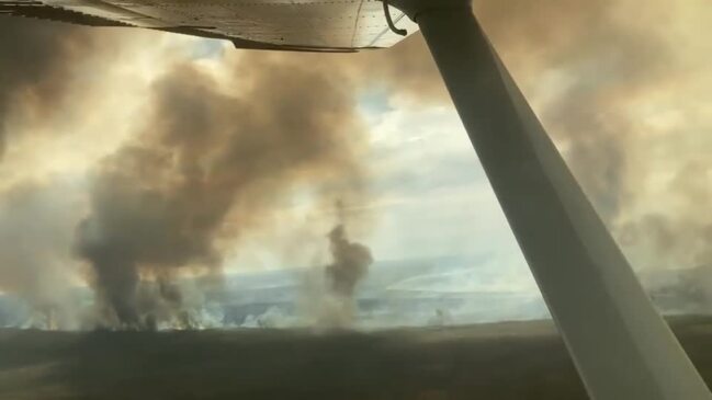
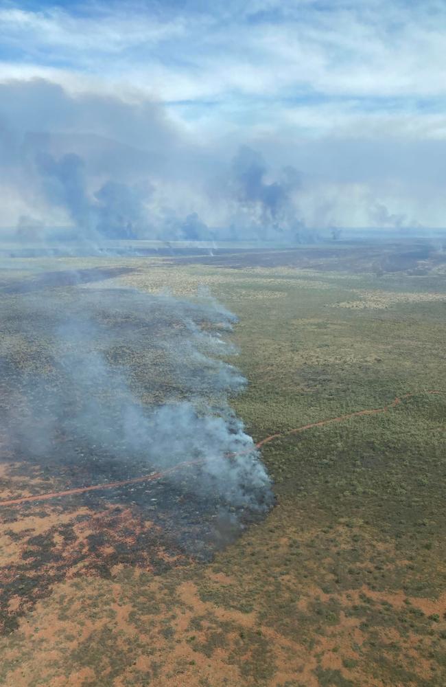
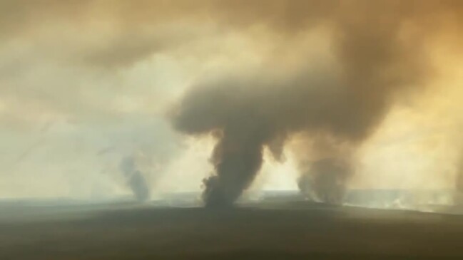
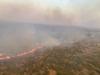
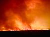
Central Australian pastoralists continue battling countless bushfires four months on from the catastrophic Barkly blaze.
While the rest of the Territory celebrated the new year with fireworks, live music, and drinks aplenty, pastoralist Amber Driver was fighting to keep her home safe from the flames.
Ms Driver works on Elkedra and Annitowa stations, which encompass 10,000 square kilometres between them – or one million hectares.
She said the stations had been working to douse the flames with very limited external help since the fires sparked in September.
“We sort of have been left to our own devices and I think that is felt across the pastoral industry,” Ms Driver said.
“It’s a tricky one because in order to attract external help – like water bombers or volunteers from interstate – we’re led to believe (the fire) has got to be directly threatening.
“For us, our house isn’t under threat but our livelihoods are.”
Ms Driver said the stations had “personally poured a lot of money” into tackling the Barkly blaze alone, which destroyed more than 70,000 hectares.
“We’ve estimated that we spent over $35,000 in fuel … the use of the heavy machinery was calculated over $55,000,” she said.
“Our labour costs in that time I think calculated just under $30,000.
“(They are) the numbers that people don’t see, everybody just gets on with it.”
As such, Ms Driver said the stations were forced to look at offloading cattle early due to slowed productivity and loss of grass.
“The impacts on our business and livelihood are massive and the more the fire burns, the more critical it is for those business decisions to happen,” she said.
“It is so emotional because we try and keep it all in check and under control because you’ve got a job to do, but when people ask you, you go, ‘oh my god’, it actually does affect you.”
Ms Driver said pastoralists were able to calculate their costs and ask for help.
“The proof will be in the pudding there, what happens when people do put their claims in and how they’re assessed?” she said.
“We’re in the middle of all of that at the moment.”
Ms Driver said real-time wind forecasts would put fire management plans on the front foot.
But after the Bureau of Meteorology decommissioned its Tennant Creek Doppler wind radar in 2015, she said it was difficult to predict how the region’s weather would feed the flames.
“The only thing that exists in Tennant Creek is just a weather station, and that only tells us the weather that’s currently happening at that exact point,” Ms Driver said.
“The difference with the Doppler radar is it can forecast the wind at any point, so it enables use to watch the wind direction and how strong it is over a fire.”
Join the conversation
Darwin man arrested after alleged gunpoint threat to partner, man
A 25-year-old man has been arrested in Darwin after allegations of a serious domestic violence incident involving a firearm.
Read more

Outback Wrangler’s Top End property goes on the market
The home of Outback Wrangler Matt Wright has gone on the property market with expressions of interest open now. Check out the photos.
Read more