
South Australia's ultimate road trips
New-look Escape travel supplement How to rent an apartment in Paris Win one of 13 family Aussie holidays
New-look Escape travel supplement How to rent an apartment in Paris Win one of 13 family Aussie holidays
EXPERIENCE the liberation and the exhilaration of the open road as we give you the state's ultimate road adventures:
Click here for the complete Australia drives map
OODNADATTA TRACK
This renowned unsealed track explores the remote desert country in the northern part of the state.
The 620 km route, which was originally carved out by aborigines, begins in Marree, former hub of Afghan camel-train drivers, and finishes at Marla, a small town serviced by the modern replacement version, The Ghan train.
The track is much about railway history as it is about springs, wells, and lakes, even if they are of the salt variety.
Take trails to observation points to view Lake Eyre. At full capacity it becomes Australia's largest lake, spreading 9,690 square km. The white salty crusts are a brilliant white, while the water takes on subtle pink hues. And when the rains arrive, so do thousands of waterbirds, including pelicans and gulls.
Along the way, vast plains of red stone resemble planet Mars. Old telegraph stations, railway sidings and buildings from the old Ghan Railway appear.
The town of Oodnadatta was the terminus from Adelaide during 1890 to 1929, before the track was eventually extended to Alice Springs.
When the railway line moved in 1980, so did most of its population. But the remnants of its history and the imprinted landscape are indeed enthralling.
More: Visit the Oodnadatta Track map
KANGAROO ISLAND DRIVE
Australia's third largest island, is increasingly garnering national attention because of its natural beauty and diversity of wildlife. High end lodges are helping too.
The 420km circular navigation of the island, on sealed roads, begins from the eastern end of the Island at Penneshaw, where visitors are delivered from the mainland, via Cape Jervis.
Seal Bay, 100km into the journey, is the first attraction of the trip, and the island's most popular. This is where the cute and whiskered sea lions spread out on the beach to bask and play.
Further on, the sweeping sandy beach of Vivonne Bay has been declared Australia's best beach, after an evaluation of the nation's 10,000 beaches. The surf is great too.
In Flinders Chase National Park, native animals abound, including koalas, wallabies, echidnas, platypus, fur seals, goannas, possums, bandicoots. And of course, the island's namesake, kangaroos.
The colourful flora includes eucalypts, banskia, bottlebrush and wattle – classic Aussie natives.
One third of the island consists of national parks with varied landscapes of pristine beaches, wetlands, lagoons, coastal cliffs and enormous granite boulders.
While bird watchers drool over the 267 recorded species, including cockatoos, pelicans and penguins, all of Australia is drooling over this little bit of protected paradise.
More: Visit the Kangaroo Island map
YOUR SAY: Tell us your best South Australia drives below
THE EYRE HIGHWAY
This is Australia's iconic piece of road stretching 1675 km, starting at the head of the Spencer Gulf, Port Augusta to the goldfield town of Norseman in Western Australia (600km east of Perth).
The legendary route has carried many migratory Australians, hauling their lives west or east. If pesky sandgropers try to claim it as their own, claim "possession" as most of it resides in South Australia.
Through mining and grain growing belts, the sealed road leads to The Nullarbor Plain, which is the centrepiece of the journey – a great slab of limestone that stretches 1200 km above the Great Australian Bight.
Short signposted detours allow visits to the stunning sea cliffs of the Great Australian Bight.
In the heat of the day, this is where a single, lone tree can shade a group of kangaroos, and where the sight of a wild camel and roadhouse can stir excitement.
Flat and almost treeless is what it this drive is mostly about. But there is excitement at Border Village, the quarantine checkpoint on the border, where fruit and veg are confiscated.
Oh yeah, and there's the longest straight road in Australia, 146km long, signposted with "90 mile straight". But that excitement wanes after only a few kilometres. Nevertheless, this a must-do journey.
More: Visit the Eyre Peninsula map
YORKE PENINSULA DRIVE
Sun, sun, sun. Yorke Peninsula is a coastal playground.
The vibe of the peninsula lends itself to chill-out style driving and discovery. Easy sealed roads, gorgeous coastline and windswept hair. Vroom. Vroom.
Fuel up at Port Wakefield on the top eastern edge of the peninsular to begin the return 490km sealed-road journey.
Heading west, the first stop is Kadina, an inland copper town, which is the peninsula's largest (population 4000), and boasts examples of early-settler, Cornish architecture. Kadina, along with seaside towns, Wallaroo and Moonta, celebrate their Cornish heritage via the annual Cornish Festival.
Dramatic coastal scenery, and world renowned surf beaches, can be found at the southern tip of Yorke Peninsula in Innes National Park. Emus play here, too.
Unspoilt ocean waters make diving and snorkelling popular. Two underwater Maritime Heritage Trails have 18 shipwrecks to explore. The sheltered bays and coves are perfect for swimming and picnicking frolics.
And jetties strategically placed all around the peninsular make fishing easy; although you can catch large whiting right off the beach at Port Victoria.
This is a drive with so many good distractions, that you'll easily forget about plans. Although, you will certainly be plotting your return.
More: Visit the Yorke Peninsula map
YOUR SAY: Tell us your best South Australia drives below
FLEURIEU WAY TOURING ROUTE
Yes, it is more fun in the sun. And another peninsular. But add a touch of nudie beach, glorious wine country, and new fandoogled GPS technology.
Around one hour's drive south of city-slicking Adelaide, the 235 km sealed Fleurieu Way Touring Route begins at on the eastern side at Strathalbyn, antique-hunting heaven, and weaves around the peninsular to the coastal town Port Noarlunga, a popular diving spot.
In a first for Australia, this route comes with a high tech personal guide. GPS devices can be hired from visitor information centres, which plug into your car's cigarette lighter. Not only do you get the drive's highlights, but also insider tips from locals.
Local winemaker, Rebecca Wilson, talks up McLaren Vale – one of the nation's best wine producing regions, with 50 wineries and dozens of cellar doors, for tippling. Wilson has been awarded producer of "Australia's Best Red".
Regional produce overlflows at Victor Harbor Farmers market. And along the way, there are steam train rides, horse-drawn tram rides, and colonies of waddling penguins.
With eyes on the home stretch at Maslin Beach, it is time for wild abandon – cast off the togs for the nudie beach. The scenery is spectacular, in more ways than one.
More: Visit the Fleurieu Way map
Best drives: News South Wales' ultimate road trips
Best drives: Western Australia's ultimate road trips
Best drives: Queensland's ultimate road trips
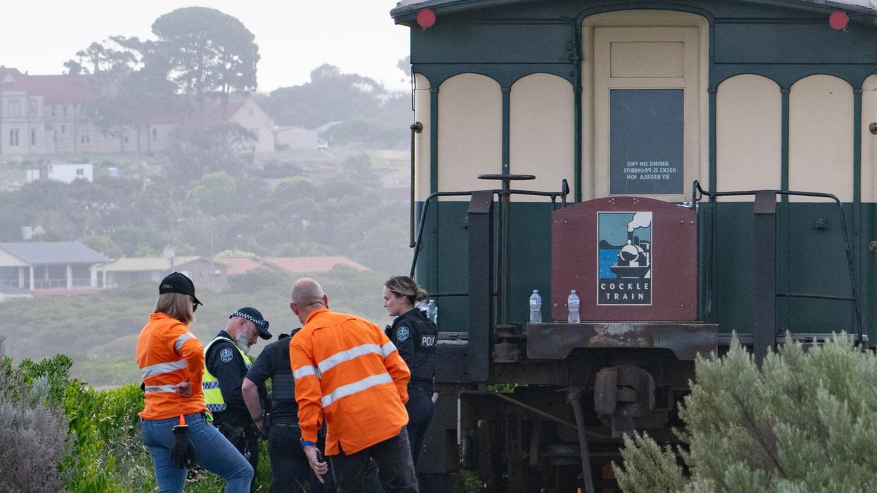
‘Absolute tragedy’: Train hits 89yo tourist
Distressed passengers watched on in horror as the 89-year-old was struck and killed by the packed tourist train.
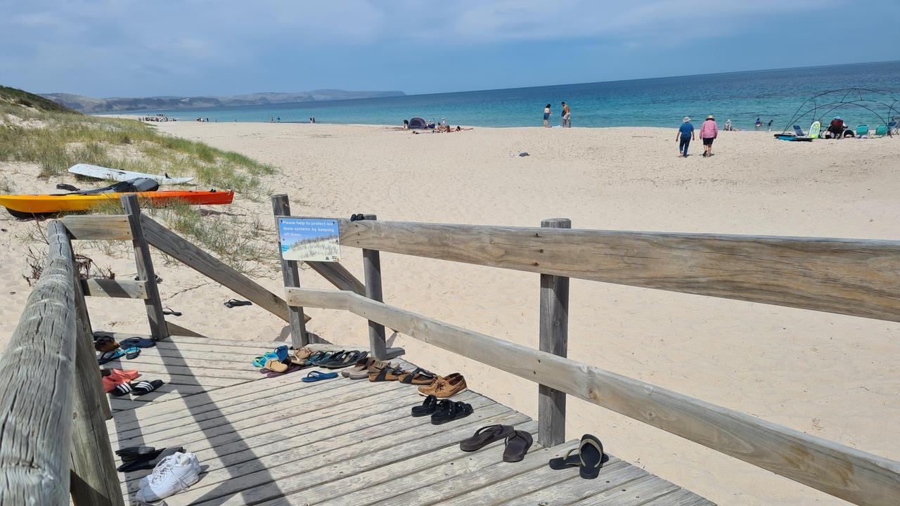
Detail in Aussie beach pic stuns internet
An image of an Australian beach is doing the rounds online but there’s one detail that has people talking.
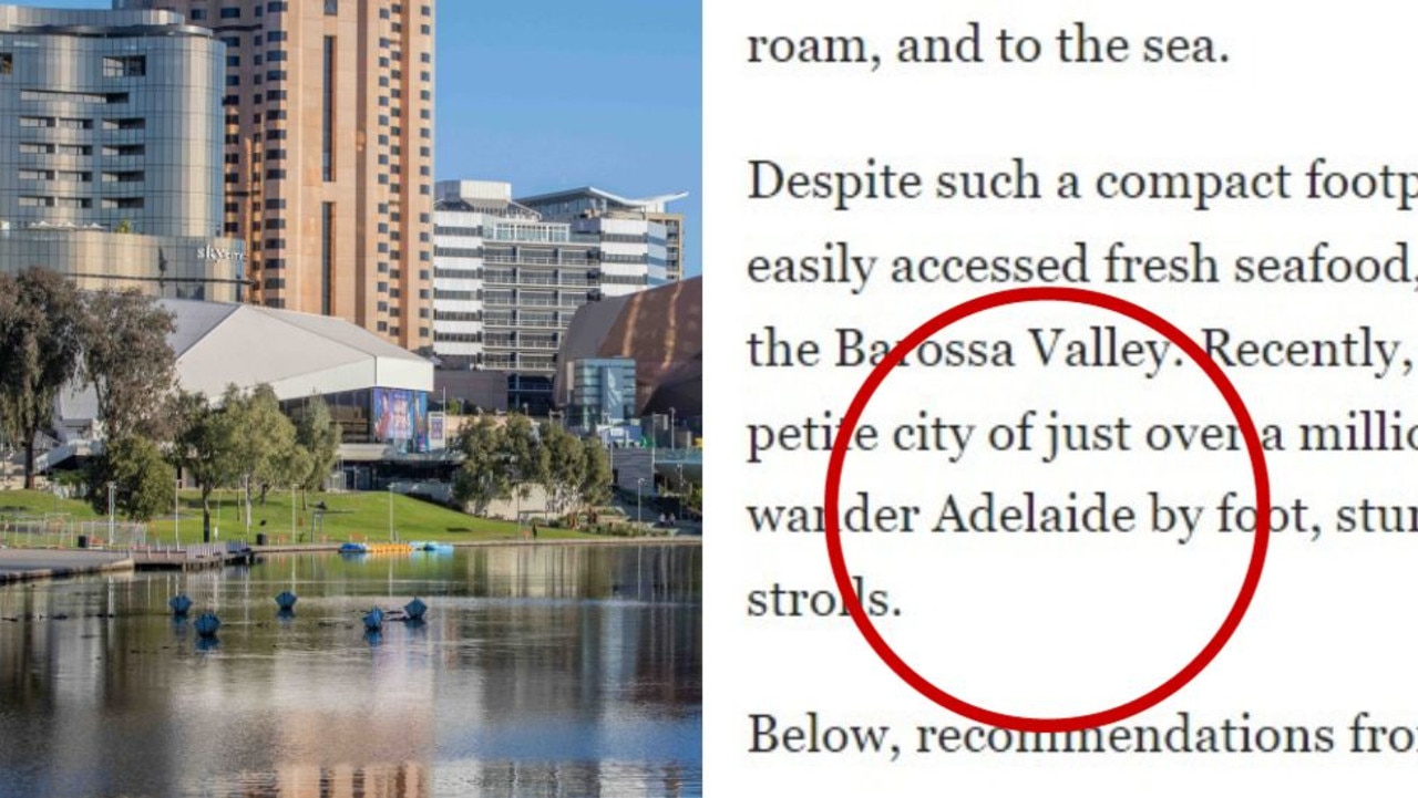
‘Surprise’ Aussie city Americans raving about
Do you agree that this “underrated” Australian city is the “coolest” in the country?