Satellite images reveal China’s large villages in Bhutan
New satellite photos show a controversial plan from Beijing is well underway with the move likely to inflame tensions.

Satellite photos have caught China constructing two large villages well within the territory of neighbouring Bhutan to outflank nearby Indian border forces. And it’s not the first time it’s done so.
Chinese and Indian forces have been squaring off over a disputed Himalayan plateau in the Doklam region since a 2017 clash between their troops.
About 270 Indian troops took bulldozers into a contested patch of land to destroy a road being built by the Chinese military. The two nations are deadlocked in talks attempting to resolve the exact location of Doklam’s border with occupied Tibet.
Beijing hasn’t been deterred.
It established a “Tibetan” village on a new highway reinforcing the frontier in 2020.
But it wasn’t.
It was actually 2.5km over the border inside neighbouring Bhutan.
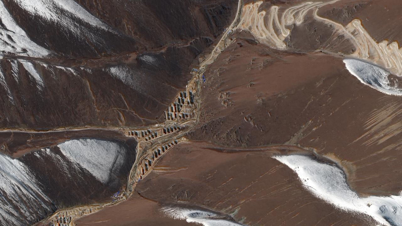
Now new satellite images reveal the total number of villages under construction astride a road being cut through mountain passes to be six.
They’re all well within Bhutanese territory.

China’s creeping invasion
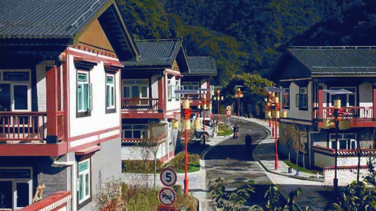
The first such arbitrary incursion into Bhutanese territory was discovered in 2020. Beijing accidentally spilt the beans when it announced a new “Tibetan” town named Pangda.
It was presented as a model village, full of party-approved smiles, national costumes and billowing flags.

But a quick check of regional maps revealed it to be about 2.5km across the border from occupied Tibet, inside the sovereign nation of Bhutan. Its presence was an excuse to resume work on the highlands military highway from another direction.
The tiny mountain nation of Bhutan (with a population of just 800,000) is unable to oppose China’s might. It has traditionally relied on India for assistance with its international affairs.
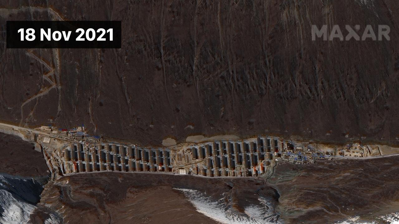
Intel Lab researcher Damien Symon found four new Chinese villages in November. Now he’s found another two.
He told India’s NDTV that the satellite photos are “irrefutable evidence” of a co-ordinated Chinese occupation of the disputed region.

The photos from Earth observation firms Maxar and Capella reveal “multiple chalet-like structures” built at various points along a mountain pass. “In addition, heavy machinery and earth moving equipment is observed preparing similar pockets of land for future use,” Symon said.
Some 200 new structures have been identified.
Seeking the high ground
At the heart of the dispute is a military-grade road being built into the contested region by the People’s Liberation Army. China cut the road south through the Sinchela pass in the early 2000s. That territory is indisputably that of occupied Tibet.
It then advanced the road through the Doka La pass to within 68m of an Indian border post. Ownership of this whole area is disputed.
An attempt to further extend this road southward was behind the 2017 border clash.
2/ The U.S. DoD Report noted that despite dialogues to reduce border tensions, the PRC has “continued taking incremental & tactical actions to press its claims at the LAC.â€
— Indo-Pacific News - Watching the CCP-China Threat (@IndoPac_Info) November 6, 2021
In this context, the recent MoU between Bhutan & China was significant & could have implications for India. pic.twitter.com/2FopT4MxTH
The new work seeks to bypass the Indian garrison by cutting through Bhutan.
Whether the settlements are military facilities is uncertain. But the photos do not reveal similar embellishments to that seen in the ‘model’ village of Pangda. And the areas they occupy are highly inhospitable.
Bhutan’s foreign ministry refused to address the issue. “It is Bhutan’s policy not to talk about boundary issues in public,” a statement reads.
#China's military developments opposite #Sikkim, #India have continued steadily through 2020-21, enhancing PLA positions with new posts closer to the border, supported by freshly constructed/improved roads, regular exercises & drills along with large deployments of troops pic.twitter.com/ynfZPSVTRM
— Damien Symon (@detresfa_) December 30, 2021
Beijing’s position is bold: “It is within China’s sovereignty to carry out normal construction activities on its own territory,” the foreign ministry told Reuters. The work was “entirely for the improvement of the working and living conditions of the local people.”
Indian army head General NN Naravane told NDTV that the Line of Actual Control – or the physical border with China – remains undefined. “As far as we are concerned, we are very well poised all along our borders, and there is no question that any status quo as it exists today will be altered by force,” he said.
Bridge of troubled waters
The Chinese incursion into Bhutan isn’t the only cause of heightened tensions with India. A new bridge is being built over a Himalayan lake that straddles the border.
Pangong Lake, situated some 4km above sea level, is Chinese-controlled territory. But the portion that extends into the region of Ladakh is also claimed by India.
About 20 Indian troops died after a high-altitude brawl with Chinese soldiers there in 2020. Beijing has never revealed the full extent of its own casualties.
Some 50,000 troops from both sides have since been assembled in the region. The bridge’s construction will allow Chinese troops to reinforce the area rapidly.
Media reports of #PangongTso allege a new bridge is under construction connecting the north & south bank of the lake, in turn enhancing road connectivity for #China's troops in the area, GEOINT of the area identifies the location & progress of the alleged structure https://t.co/b9budT3DZZpic.twitter.com/IdBl5rkDhR
— Damien Symon (@detresfa_) January 3, 2022
“This bridge is being constructed in areas that have been under illegal occupation by China for around 60 years now,” India’s foreign ministry spokesman Arindam Bagchi said earlier this month.
Beijing retorted by saying infrastructure work in the region was “aimed at safeguarding China’s territorial sovereignty and security as well as peace and stability on the China-India border.”
Such work includes new barracks, armoured vehicle compounds, helipads, airstrips and roads.
20 Months, 14 talks later, #India & #China continue to be in a stalemate regarding east #Ladakh, in the meanwhile however, Chinese construction & development activity around the area of contention continue to highlight an intent to stay, some broad details below pic.twitter.com/dfCrfvkj8O
— Damien Symon (@detresfa_) January 15, 2022
India has responded by building its roads and bridges to ease troop movements. However, it faces a significant challenge as its side of the border is more mountainous. One of the new roads soars 5.8km high above sea level.
More Coverage
News of the new villages in Bhutan and the new bridge has further soured relations between the two nuclear-armed neighbours. Beijing also recently announced it had given new Chinese names to 15 locations within Indian-occupied Arunachal Pradesh. It claims this as South Tibet.
India has denounced the claim as a “ridiculous exercise to support untenable territorial claims”.
Jamie Seidel is a freelance writer | @JamieSeidel


