Wild wet weather lashes southeast bringing rain, floods and snow
A SPECIAL delivery from Antarctica has caused chaos across the southeast of Australia with 100km/h blasts in Melbourne.
AUTUMN has arrived with a loud bang in the country’s southeast, bringing wild weather, flooding and snow.
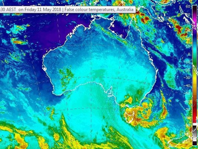
The special delivery straight from Antarctica has caused chaos across parts of the country and is set to continue.
Rain has battered Tasmania and Victoria have copped snowfalls and freezing winds, causing havoc for motorists.
Gusts of 93km/h were recorded at St Kilda, south eat of Melbourne CBD just before 3pm.
Several people have had to be rescued from floodwaters in Tasmania, including a man lifted to safety by a helicopter from a cricket oval in New Norfolk.
The cold front is so fierce that temperatures in Alice Springs could sink to freezing overnight, eight degrees below the average for May.
Flooding, damaging winds and storms sent temperatures plunging with in the Tasmanian capital which received almost three months’ worth of rain in one day.
The record-breaking rain and flash flooding sent cars floating down the streets in Hobart, and forced the closure of several roads and 19 schools.
The University of Tasmania’s Sandy Bay campus is also closed after some buildings flooded and power was cut.
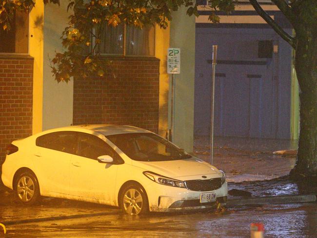
Sky News Weather chief meteorologist Tom Saunders said parts of Tasmania have received their heaviest rain falls on record.
Mt Wellington received a whopping 233mm since 9am yesterday, the heaviest falls on record.
Grove received 159mm, while Hobart copped 129mm making it the heaviest May rain on record.
Heavy rain and gale force winds, with 90-100 km/h gusts forecast for Melbourne this afternoon, which may lead to flash flooding. Peak period for Melb is between 1pm – 5pm. Drive to the conditions, stay away from trees and low lying areas. Stay informed → https://t.co/r2dtI2bKaN pic.twitter.com/N4unFTGfQN
— Victoria Police (@VictoriaPolice) May 11, 2018
“This is also the heaviest rain in 58 years for any month,” Mr Saunders said.
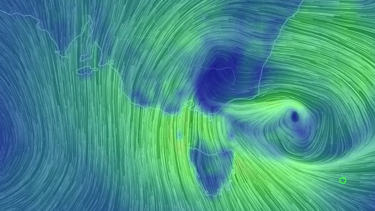
“A deepening low-pressure system is causing widespread severe weather across southeast Australia. Hobart was struck with thunderstorms late last night which has triggered widespread flash flooding.”
The state has also been battered by strong winds with Mt Wellington recording a 131km/h gust.
Gusts of 113km/h were recorded at Grove while Hobart copped a 89km/hr gust this morning.
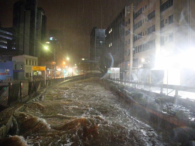
The Tasmanian capital will hit a high of just 13C today with further heavy winds and rain expected.
The Bureau of Meteorology (BOM) issued a severe weather warning for most of the island, including Hobart and Launceston.
#BREAKING: Flooding now impacting some UTAS Sandy Bay buildings. This video is from the Engineering building @togatus_ pic.twitter.com/a3jUJYxOcY
— Monte Bovill (@MonteBovill) May 10, 2018
“We have a complex area of low pressure extending across the state, which will bring rainfall over the east, southeast,” Bureau meteorologist David Matthews told AAP.
The BOM has warned the intense low-pressure system will continue to be felt today.
The wild weather has left more than 13,000 people without power with 137mm recorded at Mt Wellington, 107mm at Buckland and 95mm at Nugent.
ABC Hobart-based reporter Edith Bevin tweeted that roads in the CBD were closed and littered with flood debris.
Cars swept away by flash flooding are piled up in Hobart’s cbd this morning @abchobart pic.twitter.com/bTRPAkYYbX
— Edith Bevin (@EdithBevin) May 10, 2018
Workers wade through the underground car park of the Grand Chancellor to assess the damage @abchobart pic.twitter.com/c9h2kmbyHc
— Edith Bevin (@EdithBevin) May 10, 2018
Two evacuation centres have been set up as emergency crews deal with hundreds of calls for help, The Mercury reported.
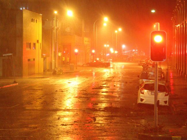
Council officers are assessing road closures while police have urged people to avoid unnecessary travel.
Flood Event – greater Hobart area
— Tasmania Police (@TasmaniaPolice) May 10, 2018
Overnight, the greater Hobart area has experienced an extreme weather event.
Motorists are strongly urged to avoid unnecessary travel in the CBD, New Town and Sandy Bay areas.
Major roads in... https://t.co/7i0uX1TVCW
Tasmania Police said major roads in the CBD were affected by floodwaters while power outages meant some traffic lights were not operating.
The State Emergency Service said flash flooding has occurred in Blackmans Bay, Kingston, Sandy Bay and the Hobart CBD.
The multi headed complex low lurking over and around #Tasmania produced a swarm of storms in the southeast, producing high rainfalls of 137mm at Mt Wellington, 107mm Buckland, 103mm Nugent, 95mm #Hobart, 85mm Triabunna. pic.twitter.com/c8IDBAFmbn
— Bureau of Meteorology, Tasmania (@BOM_Tas) May 10, 2018
THE BIG CHILL
Mr Saunders said conditions will gradually ease across Tasmania today, but warned NSW and Victoria were still in for some wild weather ahead.
“Gale-force winds and flash flooding will continue today across eastern Tasmanian and southern Victoria, however for Hobart the exceptional rain of last night will not be repeated,” he said.
“Melbourne’s strongest winds will hit this afternoon and could gust to 100km/h.
“The band of gales will then spread up the NSW coast and ranges over the next 24 hours as the deep low heads into the western Tasman Sea.”
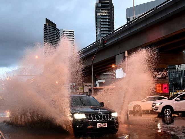
Mr Saunders said many areas were seeing the coldest weather so far this year.
Snow has fallen on the southern and central ranges of NSW overnight.
Further falls were recorded in Oberon, Orange and the Blue Mountains for the first time this year.
Up to 40cm of snow is predicted to fall across the alpine regions until Sunday.
According to the BOM, Sydney can expect a top of 17C today, Orange will reach a maximum of 6C and Perisher will hit a high of just 1C.
However the wind chill is making it feel much colder.
#NSWWeather #WindChill is definitely making it feel much cooler across NSW. Forecasts at https://t.co/Ss766eSCrL pic.twitter.com/sIF8W8R5i0
— Bureau of Meteorology, New South Wales (@BOM_NSW) May 11, 2018
Snow has also fallen across the Central West with Oberon and Orange recording flurries this morning.
The flurries caused hazardous conditions on NSW roads with a family trapped in their car near Orange.
Two adults and a 4-year-old child were inside the car when it slipped and left the road, before becoming lodged in a ditch off Mitchell’s Way, Lidster, according to the Daily Telegraph.
It is understood the family were later released after paramedics arrived.
Slow-mo snow. #oberon #snow pic.twitter.com/wD6LOXZG0E
— Chris Bowen (@TheBowen) May 10, 2018
Snow snow snow! @CWD_Orange @WINNEWS_CW pic.twitter.com/ZRFGokW6qA
— Brooke 🤖👩ðŸ»ðŸ—½ðŸŒ¯ (@boing345brooke) May 10, 2018
Perisher also received 4cm of snow overnight with 30cm predicted to fall over two days.
WILSONS VALLEY TO PERISHER GAP: Snow & ice is affecting traffic on Kosciuszko Rd so exercise caution. Snow chains required. Kosciuszko Rd is closed beyond Perisher Gap. pic.twitter.com/jIUrgl81AR
— Live Traffic NSW (@LiveTrafficNSW) May 10, 2018
#Powder - 30cm+ Snow forecast for Perisher over 2 days - #Perisher #SnowReport #Ski #J2Ski - https://t.co/Cxs6vFV9EN
— J2Ski Snow Reports (@J2SkiSnow) May 10, 2018
40mins out of Bathurst! #snow pic.twitter.com/X3i9ByZ1pV
— Chris Bowen (@TheBowen) May 11, 2018
Sydney is due to be hit with two icy winter blasts.
The first is already sending a chill over the NSW capital today, with a second trough from the low-pressure system moving through on Sunday.
#NSWWeather A delivery from Antarctica. #Autumn arrives Late, but Loud! Max temps below 20 over all but the far NE today. Cold, windy and showery in the SE with #snow over the central and southern ranges. Forecasts at https://t.co/9bj3Jd2TrS
— Bureau of Meteorology, New South Wales (@BOM_NSW) May 10, 2018
Melbourne is due to cop a month’s worth of rain in three days making it the wettest period so far this year.
The 13C maximum for Melbourne today will also be the coldest two days this early in autumn since 1978.
The city has received 18mm of rain in under 24 hours, the Herald Sun reported.
Commuters have been hit with flash flooding while severe weather warnings remain in place across the state.
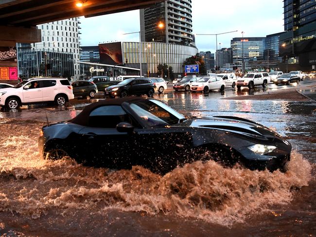
Bureau of Meteorology duty forecaster Stuart Coombs said southwest areas of the state have been hit the hardest with rainfall totals of 46mm in Mortlake and 40mm in Benwerrin.
Meanwhile Victoria’s highest Alpine ski resort Hotham recorded 20cm of falls overnight with a -6C low.
A Minus 6 start at #Hotham with 20cn of #snow. Heavy #snowfalls forecast today in the May #coldsnap. ☃ pic.twitter.com/qIo4wyPJd5
— Hotham (@_hotham) May 10, 2018
Queensland will also cop the big chill, with temperatures in Brisbane dropping by about 7C across the weekend.
The city is expected to be hit with the lowest temperature for this time of year since 2015.

Meanwhile Canberra is due to cop its coldest day in almost two decades.
Mr Saunders said Canberra would hit a high of 9C today, which is the coldest May day in 18 years.
He said the entire southeast of Australia was being affected by a cold polar air mass moving through western Victoria.
“The cold air is causing temperatures to drop sharply, and is also leading to showers, hail and storms over much of southeast Australia,” he said.
Today 17C, Saturday 20C with showers, Sunday 20C with showers.
Today 9C with showers, Saturday 15C, Sunday 16C.
Today 13C with showers, Saturday 15C with showers, Sunday 16C with showers.
Today 17C with showers, Saturday 19C, Sunday 19C.
Today 13C with heavy rain, Saturday 14C with heavy rain, Sunday 15C.
Today 23C, Saturday 22C, Sunday 23C.
Today 30C, Saturday 30C, Sunday 25C.
Today 34C, Saturday 32C, Sunday 31C.


