
Wild weather: 3500km line of storms, ‘giant hail’ to smash east
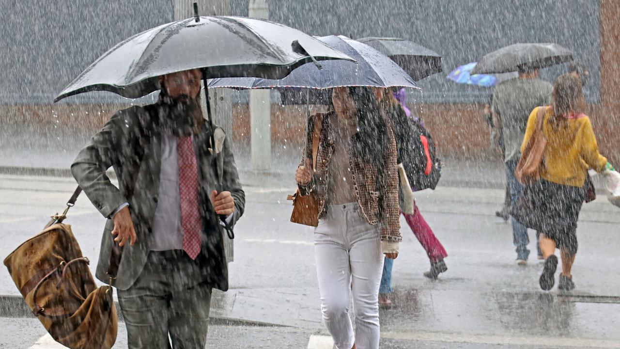
An enormous band of storms, stretching from Tasmania to Queensland, will bring wild weather today with rain deluges and giant hail


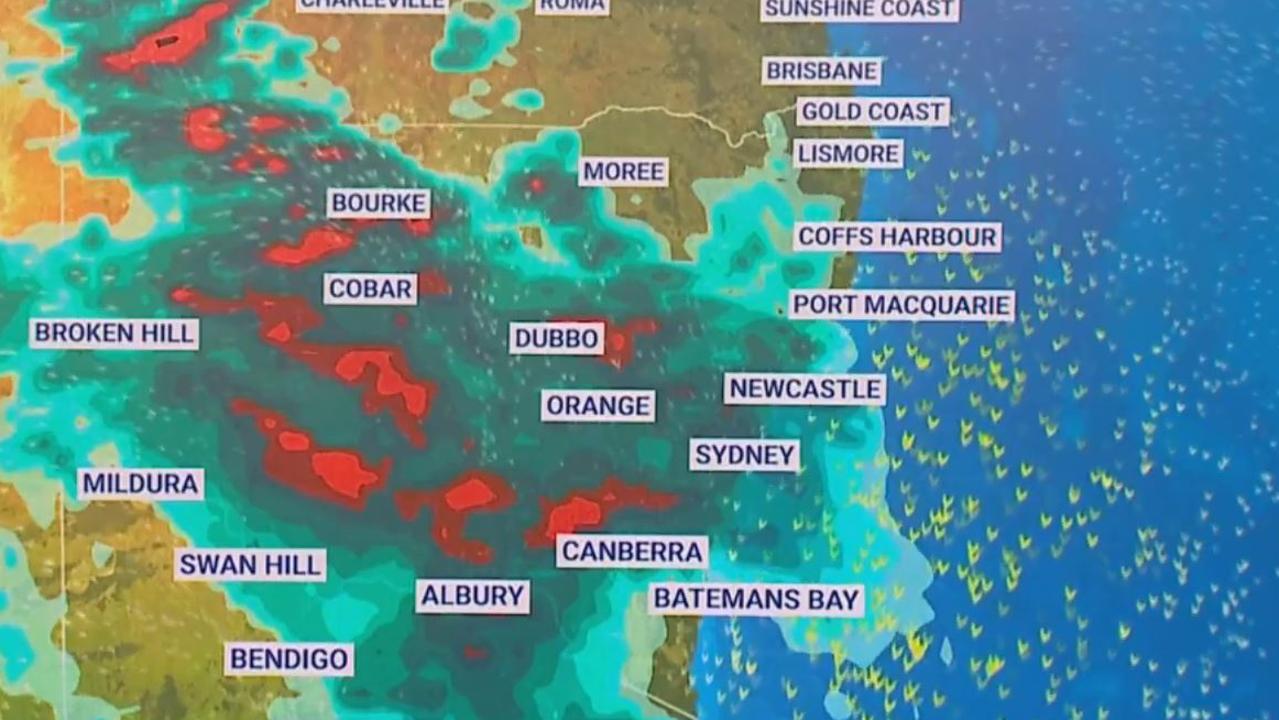
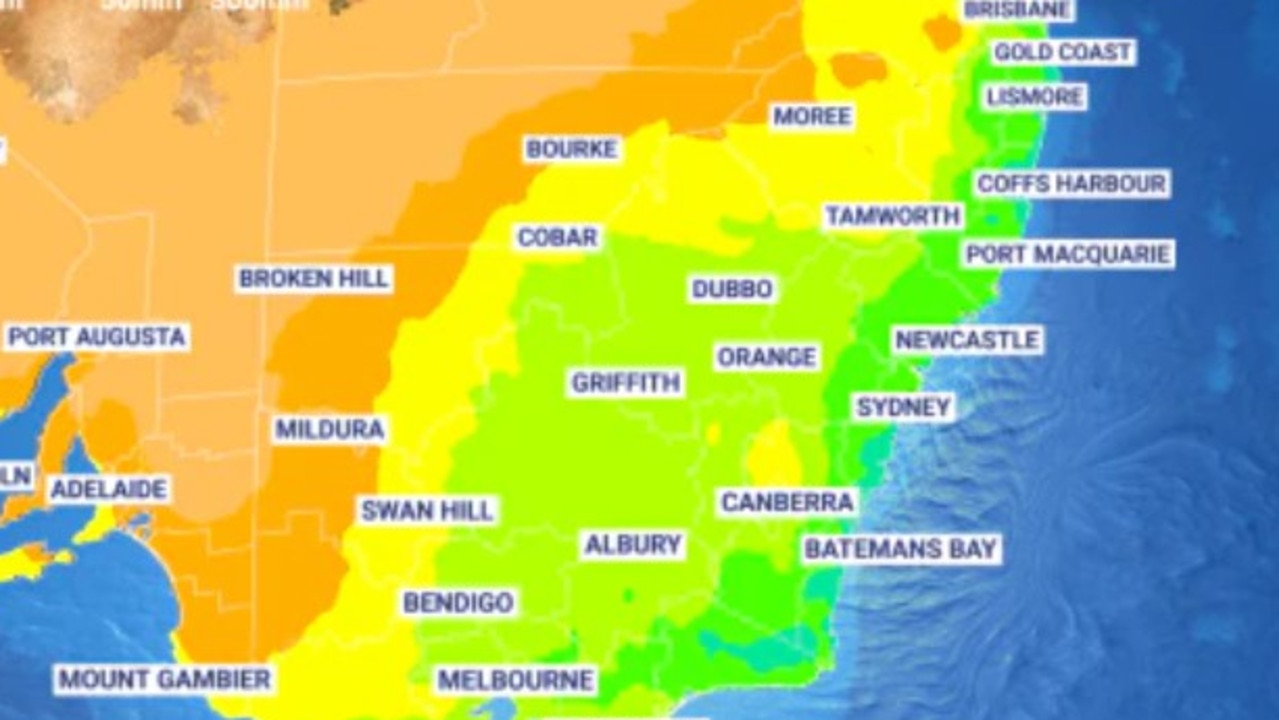
A monster multistate band of thunderstorms, up to 3500km in length, is stretching across the east from Tasmania to Mount Isa in Queensland encompassing much of Victoria and New South Wales on Sunday will bring “wild” weather.
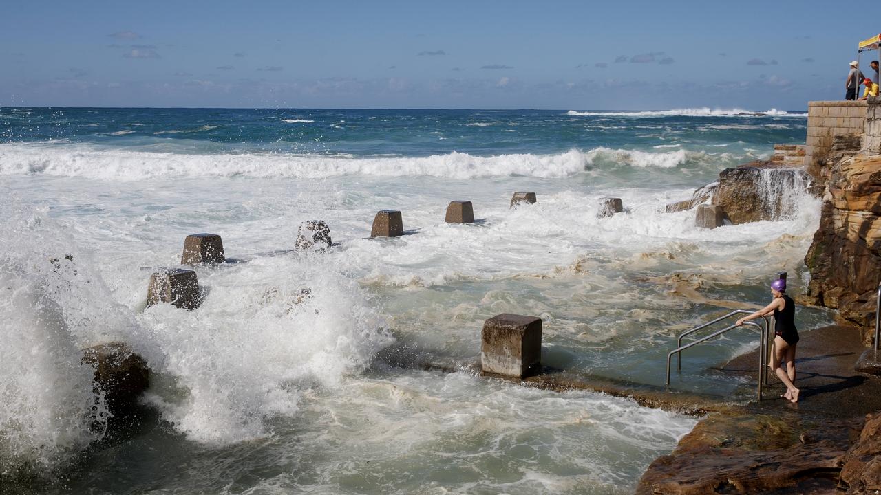
Forecasters are warning of damaging winds, heavy rainfall and “giant hail”.
Severe thunderstorms warnings are currently in place for central NSW and severe weather warnings for heavy rainfall are active for north east Victoria and southern NSW.
In places 70mm of rain could bucket it down today.
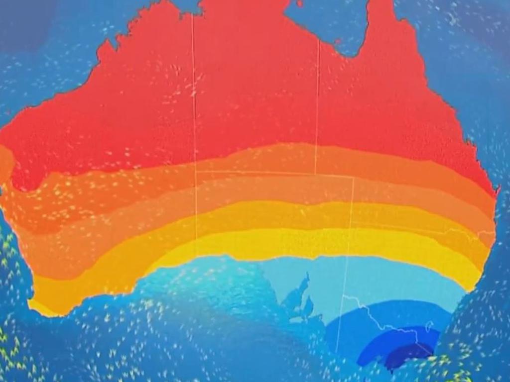
The extreme conditions could mean treacherous weather throughout eastern Australia from desert to sea.
And after it passes, temperatures are set to drop to unseasonal lows.
Line of storms up to 3500km long
“The atmosphere is extremely unstable,” said Sky News Weather meteorologist Alison Osborne.
“A line of storms will stretch some two to three and a half thousand kilometres long at its highest point during Sunday afternoon.
“These dangerous thunderstorms and heavy rain will flash up from Victoria all the way through inland NSW reaching the coast during the afternoon including Sydney and Newcastle.
“The severe thunderstorms will extend all the way up towards the Gulf country and Queensland. These storms will be dangerous, particularly over outback parts”.
Ms Osborne said two weather systems smashing into one another was fuelling the “wild conditions”.
“Warm tropical air has been dragging over south eastern Australia this week making it humid and unsettled,” she said.
“Now colder air moves and as that happens the colder air destabilises and lifts the warm air and this means severe thunderstorms developing across a widespread area”.
70mm of rain today in places
Hobart can expect up to 10mm of rain increasing during Sunday with a high of 16C and down to 12C overnight.
Much the same for Monday but on Tuesday the temperatures will struggle to get to even 12C and then 13C midweek.
Stormy and wet on Sunday in Melbourne. Watch out as those thunderstorms could be severe. Between 10 and 20mm of rain is forecast and potentially more in the south east of the city. Temperatures will reach 26C and then dip to 14C overnight.
A 20C high on Monday with more rain and then a maximum of just 14C on Tuesday where temperatures will get more or less stuck until the end of the week.
Much wetter as you head north. Wangaratta could see as much as 60mm of rain on Sunday with possible storms and hail. Indeed much of the state is looking at 20-30mm of rain today.
Across the border in Albury and 70mm of rain on Sunday is not out of the question with 8-15mm on Monday. Like many other areas, the border town is right in the centre of this huge line of storms.
Temperatures drop to start the week
Maybe just stay indoors and watch telly in Canberra with storms and 35-60mm likely on Sunday. The mercury will get to 23C then 14C after the sun goes down.
A 19C high on a wet Monday with up to 15mm in the gauge.
Sydney will escape the worst of the rain with just 3-10mm forecast on a warm 28C day with a low of 21C. But a Sunday storm is a real possibility which could bring localised heavier falls.
More showers for Monday where the maximum will be a toasty – and humid – 30C. But then the temperatures begin to fall with a high of 21C on Wednesday and 20C on Thursday.
Showers for Tamworth on Sunday and then 10-20mm of rain on Monday. Storms are possible up the coast but the moisture should head inland before Byron Bay leaving the state’s far north east warm and sunny.
A mostly clear day on Sunday in Brisbane with a 29C high and low of 20C. Then Brisbane could see consecutive days north of 30C with Thursday topping out a 33C.
Head inland however and those storms are a menace. Charleville, St George, Longreach and Mt Isa are all in the path of the monster storm cloud.
Adelaide also has the possibility of a storm on Sunday with 6-10mm of rain. Temperatures will peak at 23C sinking to 13C first thing on Monday.

Maximums will head down to the high teens from Monday to Wednesday with some clearing showers on Monday.
Partly cloudy in a dry Perth on Sunday with a high of 23C and low of 11C. Then getting warmer during the week hitting 29C on Tuesday.
Storms in the Top End. Darwin will see highs of 34C and 26C lows and as much as 15mm of rain as daily as those thunderstorms pass through.
Major city rocked by earthquake
People have rushed onto the streets after the city was hit by a 6.2 magnitude earthquake on Wednesday.
Millions set for long weekend drenching
A cool front is threatening long weekend plans for millions as it continues to drench Australia’s southeast.
Easter weekend drownings deadliest ever
A fateful combination of weather conditions has created the deadliest Easter long weekend in Australia’s recorded history.