
Weather forecast: Sydney, Melbourne, Hobart, Adelaide, Brisbane
GUSTY winds, heavy rain and a cold front will continue to batter us today. That’s right, the wild weather isn’t over yet.

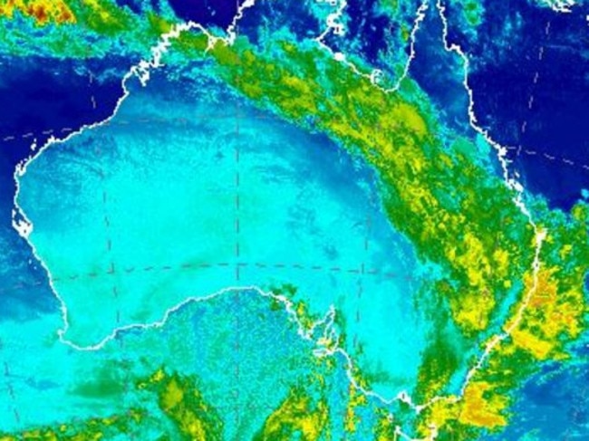
GUSTY winds, heavy rain and a cold front will continue to batter southeastern Australia today with warnings that more wild weather is on the way.
South Australia and Victoria, which last week copped heavy falls, storms and floods are due for a further drenching, with several weather warnings in place.
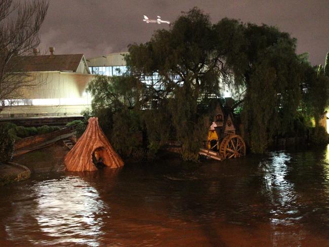
Victoria is bracing for more windy conditions today, as the Bureau of Meteorology warns heavy rainfall could lead to flash flooding in major centres as the strong cold front moves east.
Victoria was smashed by strong wind gusts last night with the BoM recording wind speeds of 111km/h in Mr Hotham and 93km/h at Melbourne Airport.
The SES responded to 400 calls for help across the state as hundreds lost power after fallen trees caused damage to powerlines, The Herald Sunreported.
Updated Severe Weather Warning. Heavy rain and strong winds contracted to NE. Flood warnings still current elsewhere https://t.co/HLs2UYFQyQ pic.twitter.com/k0pjBdci9D
— BOM Victoria (@BOM_Vic) October 2, 2016
Two men also to be rescued by water police after their dinghy capsized in Corio Bay.
Another man was treated for hypothermia after his kayak capsized in Mentone and drifted more than 20km south to Oliver’s Hill, near Mt Eliza
The State Emergency Service urged Victorians to stay safe and to secure lose items with more severe weather expected for the next two days.
There are 20 flood warnings in place across the state including for the Loddon and Avoca rivers.
Melbourne can expect a top of just 16C today with showers hanging around until Wednesday.
SOUTH AUSTRALIA
The extreme weather is far from over for storm-hit SA with thunderstorms forecast for western and southern coasts, Pastoral, Flinders, Riverland, Murraylands and Upper South East districts.
It comes after days of widespread flooding and wild weather that saw the entire state lose electricity.
Cold temperatures, showers and strong westerly winds are expected for the next 36 hours.
The BoM said a cold front which moved across the state last night will be followed by further fronts today and tomorrow.
It also predicted further falls of 15-40 mm over the Mid North and 40-80 mm over the Mt Lofty Ranges in the next 48 hours.
Rain has already begun falling in the soaked areas along Gawler River catchment with the BoM predicting peak falls of 60mm at the Mount Lofty Ranges today.
Crews have been stationed at Gawler and Virginia, north of Adelaide, monitoring the situation and helping residents prepare with sandbags.
SES deputy chief officer Dermott Barry told Today authorities are expecting quite sizeable rainfalls in the next two days.
“Our crews have been busy overnight consolidating the defences we put in place but also we’re starting to get calls come in for assistance as the rains come through and our crews are responding and helping the community as they can,” he said.
Heavy rain is expected to hit the Adelaide area, Adelaide Hills, Metropolitan Adelaide and to the north.
“We’re concerned about the Gawler River, that’s already elevated and the inner Adelaide creek systems,” he said.
“We have seen with the saturated catchments now many of the creeks are responding almost instantly to the rain. People need to be aware of it that especially with children and those around creeks that the water comes up quickly and it’s flowing fast.”
Several flood alerts and warnings remain in place across the state.
Today will remain a cool 16C as the cold front hangs around. The weather will improve by Wednesday and the mercury is set to hit 27C by the end of the week.
NSW
While Sydney has escaped most of the weather, the rest of NSW has not been so lucky.
The BoM has issued a severe weather warning for strong winds extending down to Canberra and all the way up to the Hunter today.
Strong winds averaging 60 to 70km/h with peak gusts of 100 to 110km/h are also forecast in the Alpine regions.
A dozen flood warnings remain in place, including for the Bogan, Lachlan and Murray rivers.
Meanwhile more than 100 volunteers will return to flood-ravaged Forbes in central west NSW for a third day in the search for a missing man.
The 49-year-old was last seen at 12.30pm on Friday at a lake near Burcher, southwest of Forbes, where his car and boat trailer were found.
The search comes as families in nearby Condobolin and Willow Bend, near Jemalong, have been told to leave their homes because of the risk posed by the rising waters.
It will reach a top of just 17C in the state’s central west, before showers ease today and hit a top of 22-24C for the rest of the week.
Sydney can expect showers and a top of 26C today, clearing with temperatures of 25-29C for the rest of the week.
TASMANIA
The island state will reach a top of just 17C as a cold front hits.
The state can also expect showers until Thursday before further rain sets in for Friday and the across the weekend
The mercury will dip as low as 7C and will hover between 16-19C for most of the week.
There are also at least six flood warnings in place, including for the Macquarie and Derwent rivers.
#Hobart Rivulet has calmed down since Friday. BUT Flood Warnings still current for other parts of #Tas. See https://t.co/NHL3HY0zFO pic.twitter.com/WW7jtJQseP
— BOM Tasmania (@BOM_Tas) October 2, 2016
QUEENSLAND
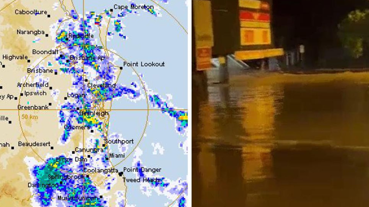
Brisbane’s sunny long weekend has come to a rainy halt today with showers and storms hitting the state’s capital.
While storms have weakened, the city can still expect showers and a top of 25C today before rains clear to sunny conditions for the rest of the week with tops between 28C-30C.
Storms have weakened over #SWQld so #SevereStorm warning now cancelled. Situation will be monitored carefully as trough progresses east. pic.twitter.com/8ukyRD0ZUt
— BOM Queensland (@BOM_Qld) October 2, 2016
However showers and possible storms are predicted for Mackay and Hamilton Island with the BoM also issuing several flood warnings across the state.
WESTERN AUSTRALIA
The big wet hasn’t spared Western Australia with Perth expecting showers and rain for much of the week.
Today will bring rain and tops of just 20C, which will clear by Wednesday.
But the break won’t last long with showers and tops of 19-23C for the rest of the week.
NORTHERN TERRITORY
The Top End will also see some rain with storms and tops of 32C forecast for today and tomorrow.
Showers will clear by Wednesday with tops of 36C for the rest of the week.
- with AAP
Women injured by lightning amid Anzac deluge
Two women have been injured in separate lightning strikes after one Aussie state was pounded by more than 200mm of rain over Anzac Day.

Millions facing long weekend washout
Long weekend plans could be under threat across swathes of the country as millions brace for heavy rain and thunderstorms.

Major city rocked by earthquake
People have rushed onto the streets after the city was hit by a 6.2 magnitude earthquake on Wednesday.