
Sydney weather updates: Rescuers stabilise stranded cargo ship, NSW flooding continues
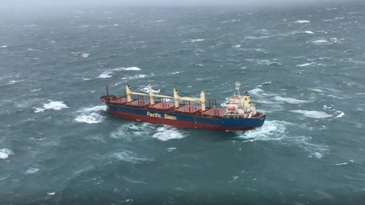
Rescuers have battled to help the 150-metre Portland Bay cargo ship off Sydney’s coast after 21 crew members lost power in heavy seas.
The east coast wild weather has whipped up drama off the Sydney coast, as rescuers battled to help the 150-metre Portland Bay cargo ship with 21 crew which lost power in heavy seas.
The Hong Kong-registered bulk carrier is double-anchored, a police spokesman said.
A plan to airlift crew members off the boat with two helicopters had been delayed because of safety concerns, he said.
Two tugboats were headed to the ship to take it further offshore. Australia’s east coast has suffered repeated flooding in the past 18 months. More than 20 people died only in March this year as floodwaters lapped at rooftops and torrents swept cars off roads.
Incident controller of the operation John Finch said rescue teams will “slowly” retrieve the anchors before towing it out to safe waters.
“That‘s probably going to take two to three hours, because the vessel, when she anchored, deployed both her anchors,” Finch said.
The current weather system over Sydney is being fed by warm, wet air from near the equator, said Kimberley Reid, an atmospheric scientist at Monash University.
“However, our research of the March 2021 Sydney floods found that similar events over Sydney were likely to occur 80 per cent more often by the end of the 21st century,” she said.
#WATCH // @Lifesaverhelo is responding to a stranded container ship off the Royal National Park. Conditions are currently too rough to attempt to winch the crew from the ship.
— Surf Life Saving NSW (@slsnsw) July 4, 2022
The ship has no power and is currently 1nm offshore. IRBS from #thirroulslsc and a jetski are on standby pic.twitter.com/O5s5TViek5
Speaking at a news conference on Monday, NSW Premier Dominic Perrottet said Australia must prepare for more regular flooding events.
“There is no doubt these events are becoming more common,” he said.
“Governments need to adjust and make sure that we respond to the changing environment we find ourselves in.”
Prime Minister Anthony Albanese urged NSW residents to keep checking on Bureau of Meteorology updates and to keep safe as the situation continues to develop.
It’s a constantly changing situation. Check @NSWSES and @BOM_NSW for the latest advice and please stay safe.
— Anthony Albanese (@AlboMP) July 4, 2022
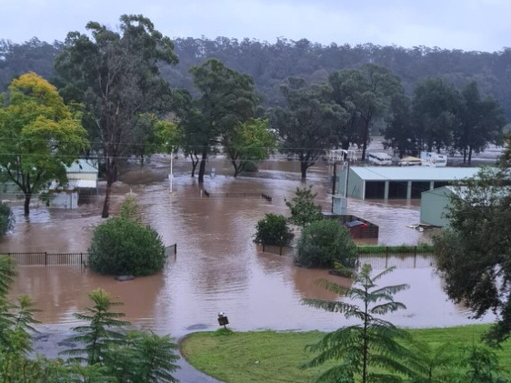
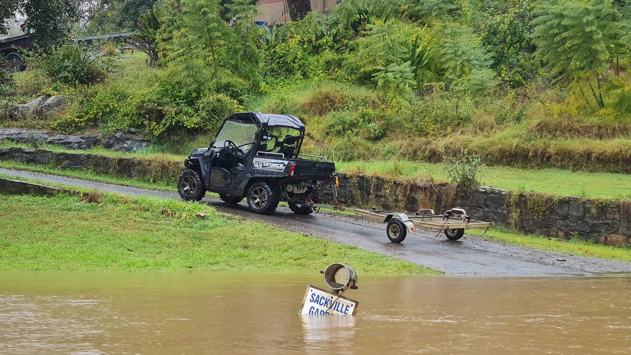
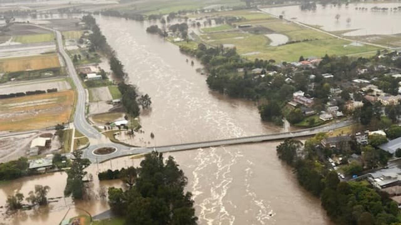
‘Devastating’: Sackville overwhelmed by downpour
A local business owner has described the current scene in the flooded suburb of Sackville as “nothing except devastation”.
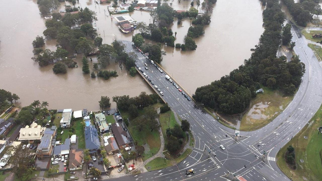
With floodwaters currently approaching 7.8m in the hardest hit areas, an evacuation order was issued earlier today for residents in the northwest Sydney suburb.
While Shane Earl lives above the flood zone, the caravan park he co-manages, the Sackville Ski Gardens has been completely flooded for the third time this year. Assessing the damage from a motorised tinny, what was once an office and tall undercover structure has been completely overwhelmed by rising brown, murky water.
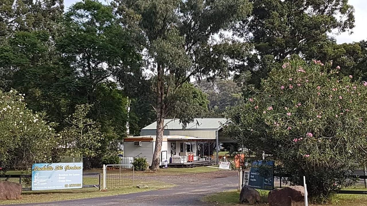
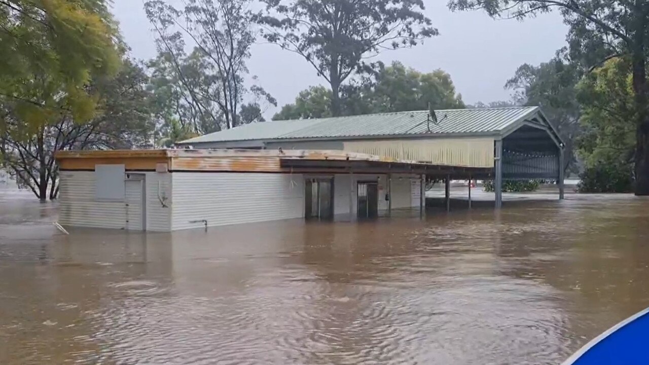
“We go from a nice outlook of a beautiful location and now it’s just completely underwater.
There’s nothing to see except devastation and water, and the water just keeps coming,” Mr Earl told news.com.au.
“It’s devastating to go through it again and the immense amount of work in recovery and the drain on emergency services is just overwhelming.”
While the Bureau of Meteorology predicts the flooding will be lower than the 9.8m peaks from March, the situation will worsen on Monday afternoon before conditions are slated to improve.
Although the rain has been constant since Friday, it’s the intense chill he finds most difficult to overcome, Mr Earl said.
“In the last two to three days we’ve been working on the evacuations and you just get wet through to your core. You’ve got to keep going hard because the minute you stop your freeze and then it’s all over,” he said.
“Trying to keep going is just impossible.”
While Mr Earl believes he will get through the current rain OK thanks to his well-stocked supply of food, water and petrol, he’s aware of the immense recovery ahead of him.
He estimates rebuilding from the major floods of March and April 2022 have cost the business more than $500,000. In comparison they were given hard-won support grants of $100,000.
“You feel like you’re a criminal for even claiming or attempting to claim the money. The hoops you have to jump through are crazy and you’ve got to spend the money before you can claim it,” he said.
“When you’ve got mounting bills and total devastation in front of you, to find the money while only being able to claim back a small amount is really, really hard.”
Having lived in the flood-prone Sackville area for his whole life, he describes the recent bout of consecutive flooding as the unfortunate “new normal”.
They no longer wait for the State Emergency Service (SES) to issue a warning, and make early preparations to initiate their evacuation processes – which this time, began on Friday.
“We can’t afford to wait for bureaucracy to make decisions on things like that,” he said.
“We live in the real world out here and we’re on the found. We see it, we know what’s happening.
“We’ve lived in this area all our lives. We know what the river does.”
BOM looking at ‘tornado’ as town flattened
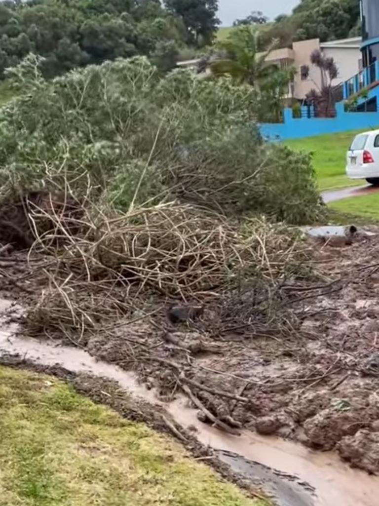
The Bureau of Meteorology (BOM) are investigating whether a tornado was responsible for the widespread damage seen in the Illawarra region on NSW’s south coast.
Over the weekend, the area was pelted with heavy winds, rain and flooding. In the 24 hours up to 7pm on Saturday, areas were smashed with more than 200mm of rain, four times more than the 50mm average for the month of July.
As of Sunday 11.59pm, the Wollongong State Emergency Service (SES) unit received 224 requests for assistance, with the BOM issuing several severe weather warnings for the area.
Went for a drive through East Corrimal, Bellambi this morning. Path of ‘mini-tornado’ clearly evident. #weather#wollongong@abcnewspic.twitter.com/j7QVrGC7rv
— Nick McLaren (@nickpmclaren) July 3, 2022
The ABC reports that the BOM could not “completely” rule out the instance of a tornado or waterspout, which is a term given for a tornado that forms over a body of water. This comes after local stormchaser groups posited that the weather event saw roofs ripped off houses and a trampoline dislodged into a powerline in the Wollongong suburbs of Bellambi and Corrimal.

“The radar imagery that we had concurrent with the time of the reports of the tornado, it will need to have a bit more investigation,” said forecaster Helen Reid.
“But it did look like there was a potential for an extra circulation in what was happening at the time.
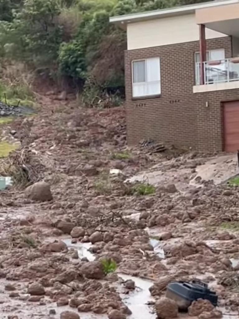
A landslide was also reported in Berkeley – a suburb in Wollongong – on Sunday, after a tree slid down a street. While no one was injured in the incident, footage from the street showed a lengthy road covered in mud, dirt and debris.
Meanwhile, the Federal emergency management minister Murray Watt said he expected the state government would declare the weather event as a state of disaster.
This would allow the NSW government greater powers in administering directives to help affected areas. In particular, the police minister would be responsible for directing and co-ordinating the activities of all government agencies. The state would also be given extra access to federal emergency services and support.
“I’m not surprised to hear that people are at breaking point,” he said.
“Obviously there has been assistance provided, whether it be payments or mental health support, after past disasters in the region and I’m sure that we will be very generous in our approach this time as well.”
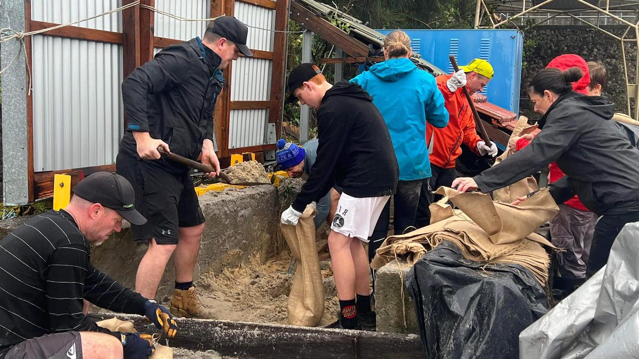
‘Not a good sign:’ Residents to brace for horror 48 hours
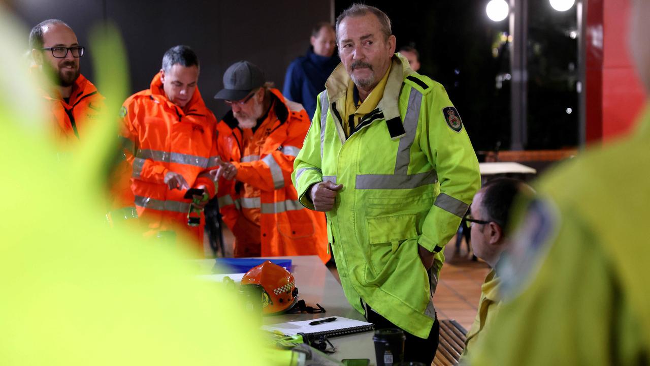
The SES has told flood-affected residents to expect another treacherous 24 to 48 hours, with the NSW SES Deputy State Duty Commander saying the forecast of strong winds and heavy rain was “not a good sign”.
Ashley Sullivan said this could see rivers rise at a quicker speed “because of the levels of saturation in the ground”.
“That is meaning things are happening quicker, rivers are rising quicker, evacuation orders and warnings are happening quicker and more frequent than what we did expect,” the ABC reports.
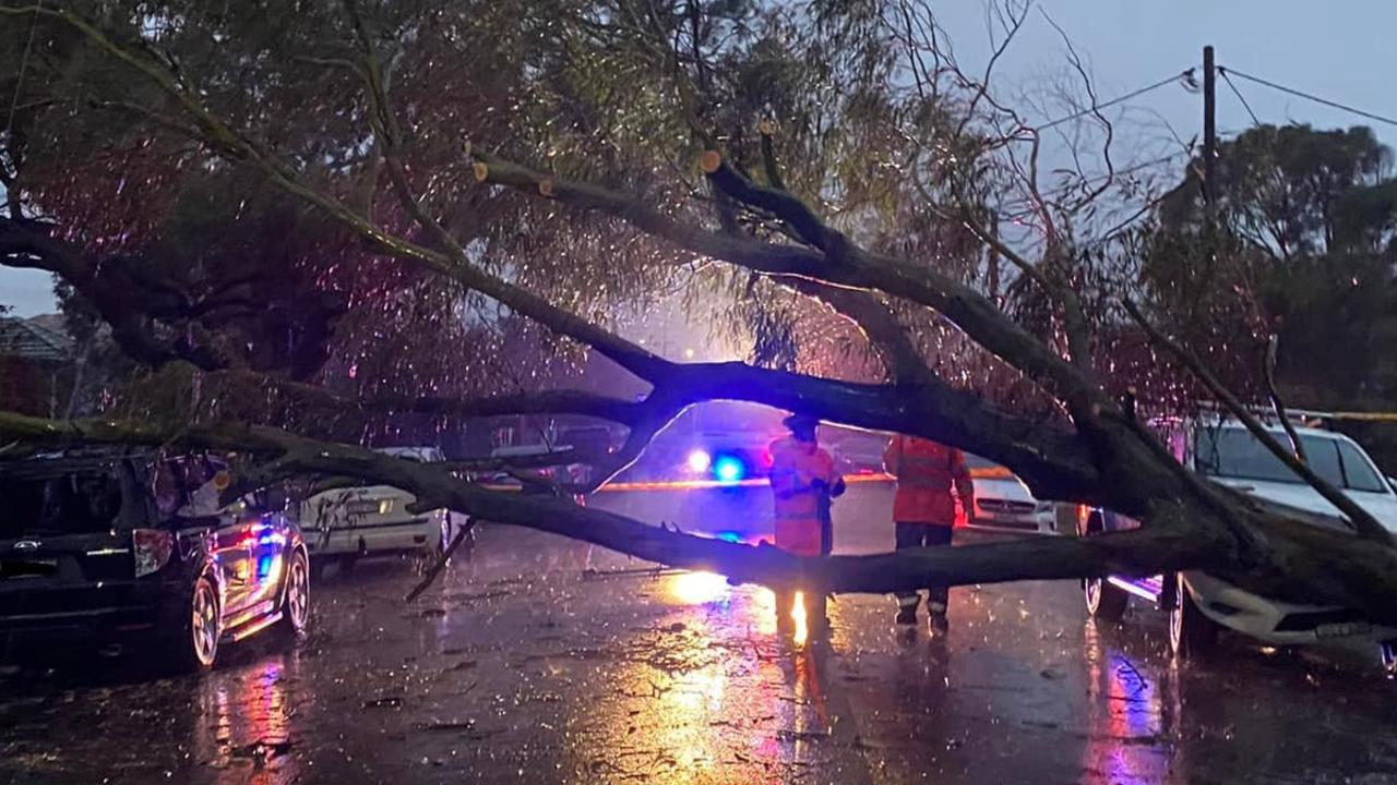
“If we do get the strong winds, that’s going to cause a lot of concerns for the trees, the levels of saturation in the ground. It won’t take a strong wind at all to start blowing them over so consider where you park your car and, like I said, stay off the roads if you don’t need to travel.”
Residents are also advised to avoid parking under trees, as well as removing or tying down loose objects from outdoor spaces.
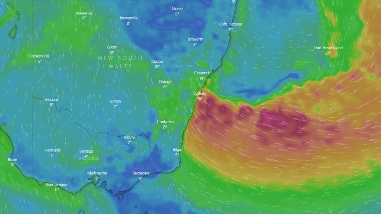
With the East Coast Low making landfall on Sunday night, bringing with is rain, strong winds and treacherous surf.
Sydney can expect up to 100mm of rain on Monday and Wollongong as much as 150mm. Heavy falls are expected in Newcastle and the central coast as the system moves north.
The key message for Monday is to stay put if you can and if you see water – be it rivers, the sea or flooded roads – steer clear.
“The next 24 hours will decide how high the floods peak along the Hawkesbury River such as around Richmond, where the water levels have already risen substantially,” said Sky News Weather meteorologist Rob Sharp.
“And they could go a lot further than that depending on how much falls with this system.”
The rain is due to linger right through Monday with damaging winds gusts potentially bringing bring down trees, power lines and causing property damage.
“The rain is then going to edge slightly further northwards along the coastline with heavy falls, possibly drifting into Newcastle for a time,” said Mr Sharp.
The sodden conditions should begin to ease by Tuesday as the East Coast Low dissipates.
But that still leaves an extremely wet Monday with up to 200mm potentially falling in isolated areas on top of what has already come down.
And the flooding may not peak in some areas until after the rains have subsided as all that extra water makes its way through the catchments.
In addition, major dams such as Warragamba, have been spilt or may well be spilt soon, adding to the flood risk.
Man dies in floodwaters
People in and around Sydney have been warned that the torrential rain being dumped on the city is a “life threatening situation” and further fatalities could occur on Monday as an East Coast Low batters populated areas.
One man died on Sunday after he was swept away by floodwaters in the Parramatta River in the city’s west, with at least 140 rescues and 3000 calls made to the State Emergency Service (SES) for help.
By late on Sunday, 41 evacuation orders and 44 evacuation warnings were in place in western, south western and north western Sydney with more than 30,000 people told to leave their homes.
That has only grown overnight with a further eight evacuation orders issued by the SES including for parts of Penrith, Emu Plains, Pitt Town and Yarramundi.
‘Life threatening situation’
On Sunday, Emergency Services Minister Steph Cooke said the horrendous weather had led to a “life threatening situation”.
“If you know your local community is prone to flooding, please be prepared to evacuate on short notice.
“If you were safe in 2021 do not assume you will be safe tonight,” Ms Cooke said.
A string of full or partial evacuation orders have also been issued on Sunday and early on Monday impacting parts or all of the following suburbs: Pleasure Point, Bents Basin area, Wallacia, Woronora, Camden, Pitt Town, Emu Plains, Emu Heights, Penrith, Moorebank, Yarramundi, Chipping Norton and Warwick Farm, Liverpool, Lansvale and Georges Hall.
A man died after being pulled from a Sydney waterway on Sunday.
Emergency services including Polair attended the Parramatta River off Abbotsford Parade in the city’s inner west, after reports a boat had capsized and a man was struggling in the water.
Despite being assisted by a member of the public, the kayaker died at the scene.
At 4am, the rain gauge at Holsworthy barracks in Sydney’s south had recorded 75mm of fresh precipitation since 9am Sunday, on top of the 167mm on Saturday and almost 100mm the day before that.
Lucas Heights in Sydney’s south added 70mm to the almost 250mm from Saturday.
Albion Park, south of Wollongong, has now seen around 400mm of rain over three days.
— with AFP
Join the conversation

Ignition point found in suspicious bushfire
Read more

Millions to be smashed by 4000km heatwave
Read more

BOM grilled over ‘nightmare’ $96m website
Read more