
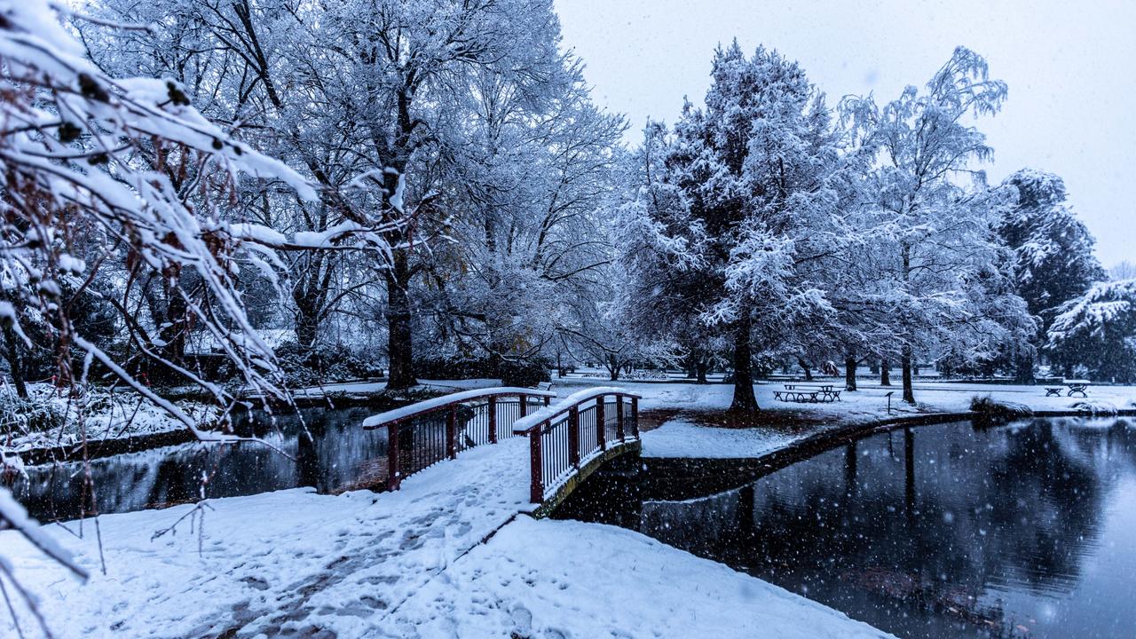
Southeastern states set to shiver through a sprinkling of snow
A cold front sweeping across southeastern parts of the nation this weekend will bring chilly temperatures, hail, frost, and even snow.
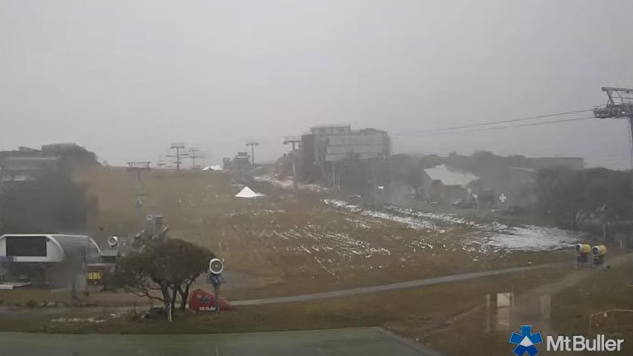
Hail, frost, and snow are in store for southeastern states this weekend as the combination of cold air and showers delivers the perfect “recipe for snow”.
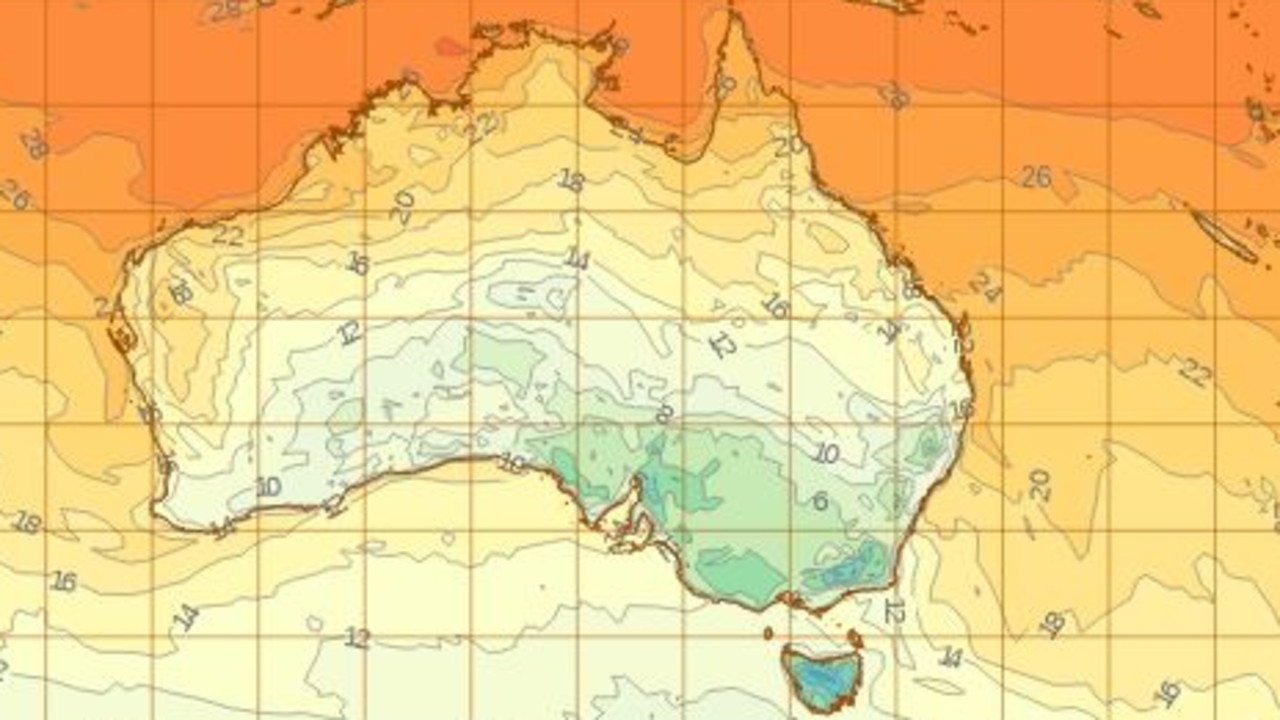
The first weekend of May is set to be the coldest for southeastern states in nearly three years as snow is predicted to fall in multiple states over the next few days.
Bureau of Meteorology (BoM) meteorologist Angus Hines said snow levels will “start to lower” across Tasmania on Saturday, getting as low as 500m or 600m by the end of the day.
Snow will also begin to appear in alpine regions of Victoria and southern NSW on Saturday, and the cold weather systems are expected to reach lower areas by the end of the day.
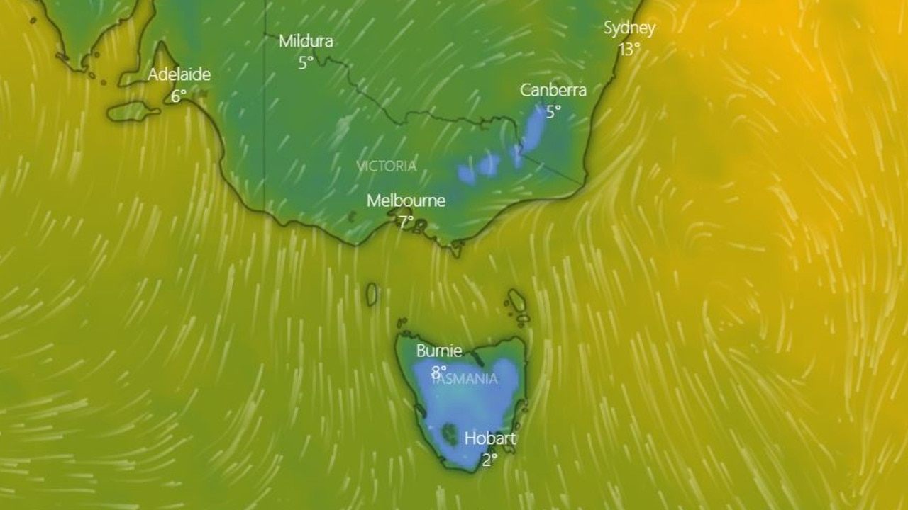
Through the overnight period into Sunday, snow levels in these areas could get as low as 800 or 900m.
Some snow is also expected to fall around the Blue Mountains and other elevated parts of regional NSW on Sunday.
Hail is forecast for some areas in southeastern parts of the country on Sunday with persistent cool and showery conditions, as a low off the coast of NSW sends strong winds up the east coast.
These harsh winds have led to a hazardous surf warning being issued for the Illawarra Coast and Batemans Coast on Sunday, extending north to other coastal regions on Monday.
Temperatures are forecast to plunge throughout southeastern states on Sunday.
Chilly conditions overnight into Monday morning could see widespread frost across parts of Australia, potentially reaching into southern parts of Queensland and the Northern Territory.
On Wednesday a large cold front will begin to make its way across western parts of the country, bringing rain and minimum temperatures of 7C in Perth later in the week.
Sheep graziers in various regions across Victoria, NSW and the ACT have been warned of winds, cold temperatures, and showers over the weekend which pose a hazard for lambs and sheep.
The BoM has also issued a frost warning for parts of Tasmania as severe frosts send temperatures down to -4C on Saturday and -3C on Sunday.
The department cautions that temperatures at ground level can be much colder than those recorded by standard weather stations, especially in calm conditions with clear skies.
BoM meteorologist Miriam Bradbury warned Australians are in for “a pretty wintry weekend ahead”.
“May is really the month where we start to see these strong fronts coming through, bringing those wintry bursts of air from the south,” she said.
“It’s nothing unseasonable but it will feel cold nonetheless.”
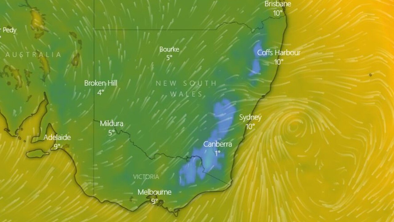
Sydney will sink to its lowest maximum temperature since October on Sunday when temperatures peak at 18C.
There will be some showers on Sunday with minimum temperatures falling to 11C.
Melbourne is set to shiver through low temperatures down to 7C and its coldest maximum temperatures since September at a peak of 13C.
Showers which moved across the Victorian capital on Friday afternoon will persist until Tuesday.
Adelaide will sink to a low of 7C on Sunday, while showers are expected throughout the weekend and into early next week.
Canberra dropped to a low of 1C on Saturday, reaching its weekend peak of 16C on the same day, and can expect showers until Monday.
Rain is expected to persist in Hobart until Tuesday, with residents shivering through minimum temperatures of 3C this weekend.
Elsewhere, Brisbane is in for a low of 14C on Saturday, while maximum temperatures will hover around 26C over the weekend.
Similar weather for Perth, with temperatures ranging from 11 to 24C and a high chance of showers on both Saturday and Sunday.
It’s mostly sunny skies in Darwin this weekend and temperatures ranging from a balmy 25C to 34C.
Looking to the week ahead, Melbourne’s maximum temperatures aren’t expected to climb above 20C with showers expected until and including Wednesday.
Meteorologists say Sydney’s maximum temperatures won’t exceed over 21C and residents can expect weekend showers to persist into Monday, and return on Thursday and Friday.
Brisbane will sink to a minimum temperature of 9C on Tuesday, while Canberra will plummet to 0C on Monday, where its minimum temperature will stay until Friday.
Perth will reach lows of 7C on Friday, with maximum temperatures peaking at 25C on Monday and Tuesday, while Darwin temperatures will range from 23C to 35C over the next week.
Adelaide will receive showers early in the week, with temperatures ranging from 7C to 21C, while Hobart residents will have to wait until Friday’s top of 17C to get some relief from the cold.
While temperatures will shift cooler in the Northern Territory and Queensland, it won’t feel quite as “dramatic” as in the south.
“It’s more likely to affect overnight minimum temperatures,” Ms Bradbury said.
“If you look at the forecast over the coming days for Brisbane, we’re dropping from 26 to 22 degrees from Sunday to Monday, so it’s still leaving these parts with fairly mild conditions, though it is cool for Brisbane standards.”
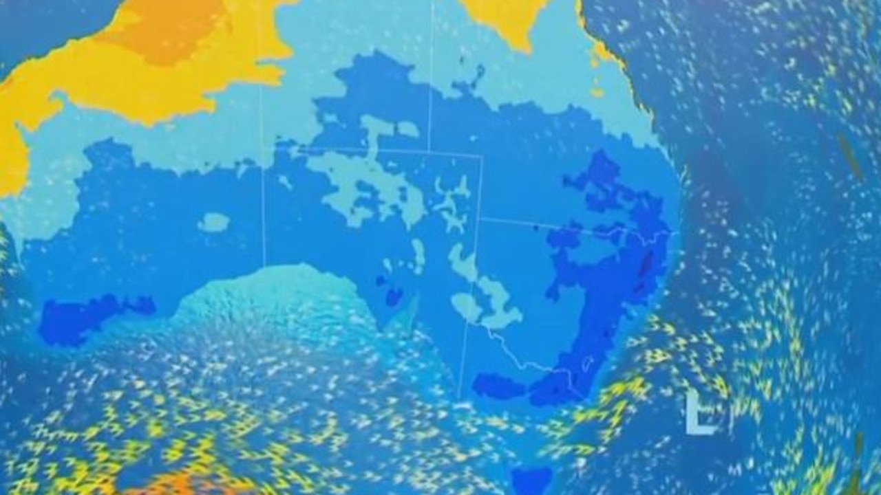
The bureau has issued weather warnings associated with the system across parts of Tasmania, Victoria and NSW, although none are severe.
More Coverage

Snow levels will gradually rise in Victoria and Tasmania around Tuesday or Wednesday, while communities have been encouraged to keep an eye out for widespread frost increasing early next week.
As the front moves across the NSW coast and offshore, a developing low pressure system could bring increased winds along the southern NSW coast next week.
A hazardous surf warning has been issued for the Illawarra Coast and Batemans Coast on Sunday, extending north to other coastal regions on Monday.


