
Thick smoke from earlier bushfires may have saved NSW from catastrophe
All the signs were that NSW was heading for catastrophe. But the bushfires themselves threw up a surprise that thwarted their progress.

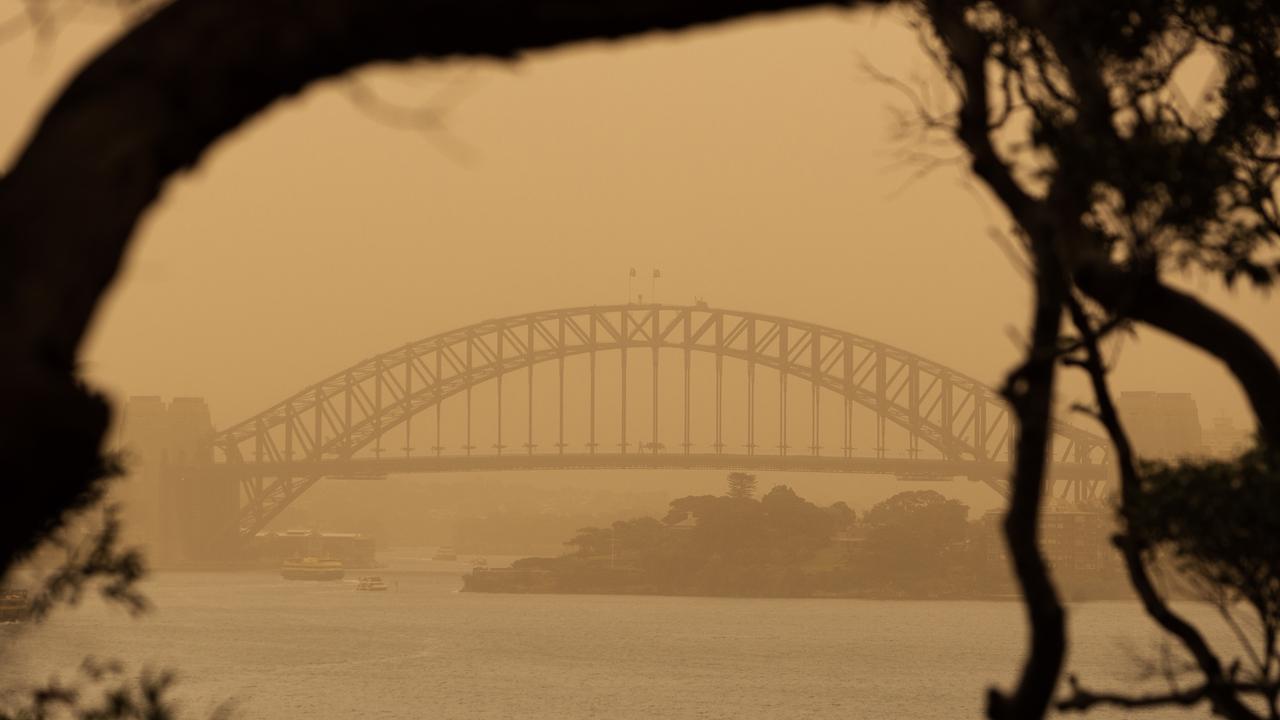
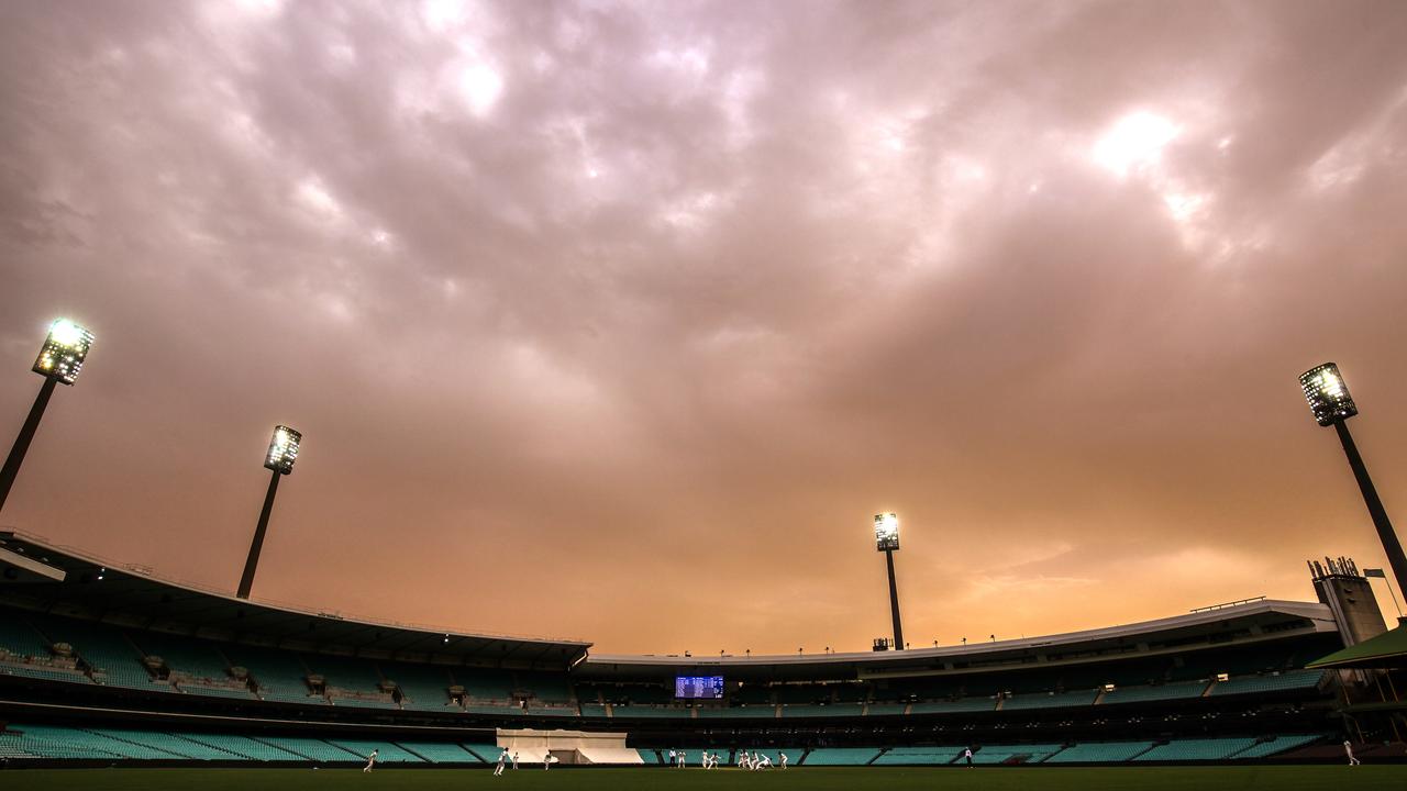
Sydneysiders spent much of yesterday snapping eerie pictures of the skies blanketed in the thick haze spewed up into the atmosphere by the various bushfires that have raged throughout the state.
Along with the pungent stench of the fires, it was one of the most obvious signs of the blazes.
But that thick haze, which smothered much of coastal New South Wales, may have been one of the reasons the bushfires couldn’t take hold and Tuesday’s catastrophic day of dread didn’t actually become an actual catastrophe.
Worrying as it looked, the smoke acted as a safety blanket, experts have observed. The bushfires themselves restricted the bushfires’ progress.
That isn’t always what happens though. Bushfires can sometimes do the exact opposite. Particularly fierce blazes can create their own weather giving birth to dangerous “fire clouds” which trigger thunderstorms, throw burning embers from the sky, disgorge black hail and even create fire tornados.
RELATED: Follow news.com.au’s live coverage of the bushfire crisis
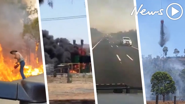
But first, back to the past few days in NSW. Certainly there have been ferocious bushfires – three people have died and 200 homes are gone.
However, NSW Rural Fire Service Commissioner Shane Fitzsimmons said the smoke released by those fires may have actually got in the way of the cold front re-energising the flames.
“The amount of dense smoke that effectively blanketed northeastern NSW served as an insulation layer, a buffer, that prevented those strong winds that were building throughout the morning mixing down and influencing the fire behaviour,” he told reporters.
“The effort of the winds was really about trying to clear that smoke and it wasn’t until some several hours later – once the smoke was clear – that the wind was getting down and influencing that fire behaviour.”
He said the wind’s inability to get straight down to the fires was one of the key reasons the fires didn’t spread as far as expected.
“And thank goodness because as discomforting as that the smoke layer might have been, it served as an insulator and prevented the fires from spreading as early as otherwise would have been the case.”
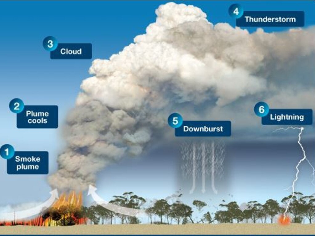
BUSHFIRES CAN CREATE THEIR OWN WEATHER
However, often intense bushfires can do the very opposite and create their own weather systems which spawn other fires.
It’s the same process to how storms can rage inside mushroom clouds from nuclear blasts or volcanic ash clouds.
During a bushfire, smoke from the fires rises. If the fire is strong enough and the weather conditions are right, the turbulent plume can suck in cool air and start to stretch kilometres into the atmosphere.
If it cools enough, the moisture sucked in condenses effectively turning the plume into a giant cloud in its own right.
They are similar in shape to cumulus clouds but are called “pyrocumulus,” essentially fire clouds.
Recently a dramatic picture of a plane overflying the bushfires did the rounds. The bubbling white cloud beneath the jet was likely a pyrocumulus.
If that’s what the fires look like from up here on the NSW Mid Nth Coast, huge prayers and thoughts for those down there! 🙠@NSWRFS @7NewsSydney pic.twitter.com/AlgiOgAHQI
— Matt Hope (@MattHope4) November 8, 2019
The process of condensation can cause the cloud to warm up again which is why it rises so high, even into the stratosphere.
As the cloud hits ice particles an electrical charge can build up. That in turn can create a thunder storm and lightning. The cloud then becomes a “pyrocumulonimbus”.
That lightning descends to earth and can spark bushfires many kilometres away from where the where the original blaze took place, dangerously spreading the fire to unexpected locations.
Embers and even soot covered hail can also be deposited from pyrocumulonimbus clouds. In some instances, fire tornados have even formed which are just as scary and destructive as they sound.
A formation of a pyrocumulonimbus would be the worst outcome for fire fighters in the coming days.
Looking ahead, conditions on the east coast show little sign of easing. Barely any rain is forecast and yet more hot air is bubbling up.
Friday could reach 30C in Sydney, 32C in Taree and 35C in Grafton. Brisbane will dip to 29C tomorrow but on Saturday it will be at 34C, which is higher than today.
Early forecasts for next Tuesday predict as high as 37C in Moree and 33C in Newcastle and Tenterfield.
The only saving grace is the wind, which may be less blustery than this week and so should provide less energy for the fires to take hold and spread.
Nevertheless, the bushfire danger is far from over.

Millions brace for brutal cold snap
Residents in the southern part of Australia should rug up extra warm this weekend as a cold snap settles in, bringing lashings of rain and damaging wind.

Reason housing crisis could get worse
Australians are already facing a shortfall of more than 640,000 affordable homes. There’s one reason that might get even worse.

Severe frost alert for Aussie farmers
Farmers are being urged to keep their livestock warm as a freezing start to winter puts animals at risk.