
Sydney set for driest winter since 1938, good news for snowgoers
One state is poised to record one of its driest winters, with more clear skies ahead – and that’s having a bizarre effect on another part of Australia.

Sydney is on the verge of recording its driest start to winter in more than 80 years, but it’s good news for snow lovers in the nation’s south.
And it comes just days after unseasonable rain smattered large swathes of Northern Australia.
Between the beginning of June and July 13, Sydney’s Observatory Hill weather station recorded just 22.2mm of rain, according to the Bureau of Meteorology.
With no substantial rain forecast for the coming days, that dry spell will mean Sydney will record its third driest start to winter ever and the driest since 1938.
The dry but cool conditions have resulted from a dominance of dry westerly winds and absence of eastern rain-bearing winds, according to Weatherzone.
“Another factor contributing to Sydney’s parched rain gauge is a lack of East Coast lows and Tasman lows this season,” according to Weatherzone.
“These low pressure systems can bring periods of heavy rain to the east coast of NSW in the cooler months of the year, and typically have a peak frequency in June.
“However, we haven’t seen any of these lows so far this winter.”
Large swathes of southeastern NSW and the Hunter and North Coast regions were battered by an East Coast low last year that inundated towns and devastated infrastructure.
Sydney, meanwhile, received 362.4mm of rain over the same six-week period until July 15 last year, a staggering 16 times the rainfall the city has recorded so far in winter 2023.
Wind warnings are in place for Victoria and Tasmania as a burst of northwesterlies picks up today. See https://t.co/4W35o8i7wJ or the BOM Weather app. pic.twitter.com/AfPeXSXUKX
— Bureau of Meteorology, Australia (@BOM_au) July 13, 2023
The city is expected to reach highs of 20C over the weekend and into early next week, while a high pressure system continues to raise the prospect of frost and cold mornings.
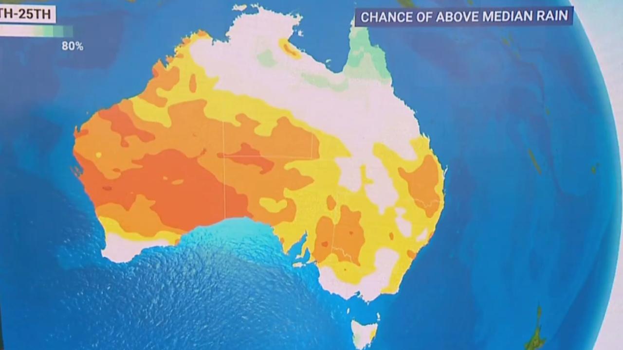
But a dry Sydney means snow in the Alps, thanks to the Southern Annular Mode (SAM), which determines the extent of westerly winds circumnavigating Antarctica.
A negative SAM phase, which it has been for most of winter thus far, forces westerly winds into Southern Australia from the Southern Ocean and dries out coastal areas.
And a dry coast means more powder on the Alps, with natural snow depth at more than a metre in higher regions, while the Victorian snow resort town of Falls Creek reported 90cm of snow on Wednesday.
Snowfall had also increased over the first six weeks of winter with a strong blanketing of snow falling over the Perisher Valley last week.
Further south, parts of Tasmania could receive more than 100mm of rain in coming days, Sky News reported on Thursday, with moderate to heavy falls also forecast for southeastern Western Australia.
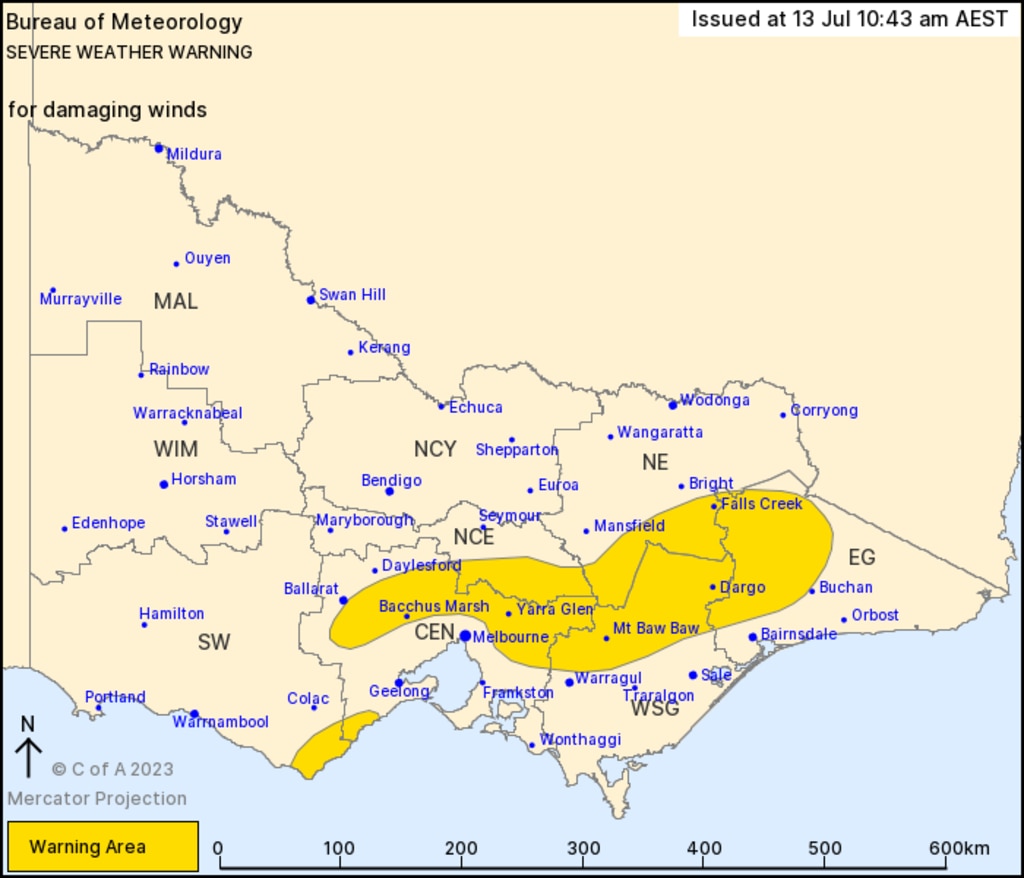
A severe weather warning is in place in Victoria, with damaging wind gusts possibly reaching up to 60km/h forecast to batter the southeast of the state, while winds in the Otways could each up to 90km/h.
Brisbane will reach a top of 24C over the weekend, with SkyNews reporting drier conditions to take hold in coming days and weeks across the central and northeast of the country.
Canberra is warned to expect frosty conditions with a high of 16C and a frigid low of -1C forecast over and the weekend and into early next week. Adelaide will also reach just 15C.

Aussie’s ‘insane’ catch in floodwaters
A man has made the most of the devastating floods in north Queensland as the state continues to battle unrelenting deluge.
Extreme heatwave warning for Aussies
A very hot air mass is sloshing around the country, causing temperatures to reach the mid-to-high 40s over several states.
Devastating floods claim another life
Another person has died in flooding that is devastating large parts of the North Queensland coast, in scenes of “incredible devastation”.