
‘Super’ El Niño could leave Australia cooking for three months
El Niño is coming but the danger it poses to cook Australia has drastically increased, according to a new study.

The threat of the El Niño weather pattern turning into a “super” event before the onset of the Australian summer has soared, according to a new study.
The US National Center for Atmospheric Research has this week released the results of an experimental forecast model that takes into account the unusually fast formation of the pool of hot water in the central Pacific so far this year.
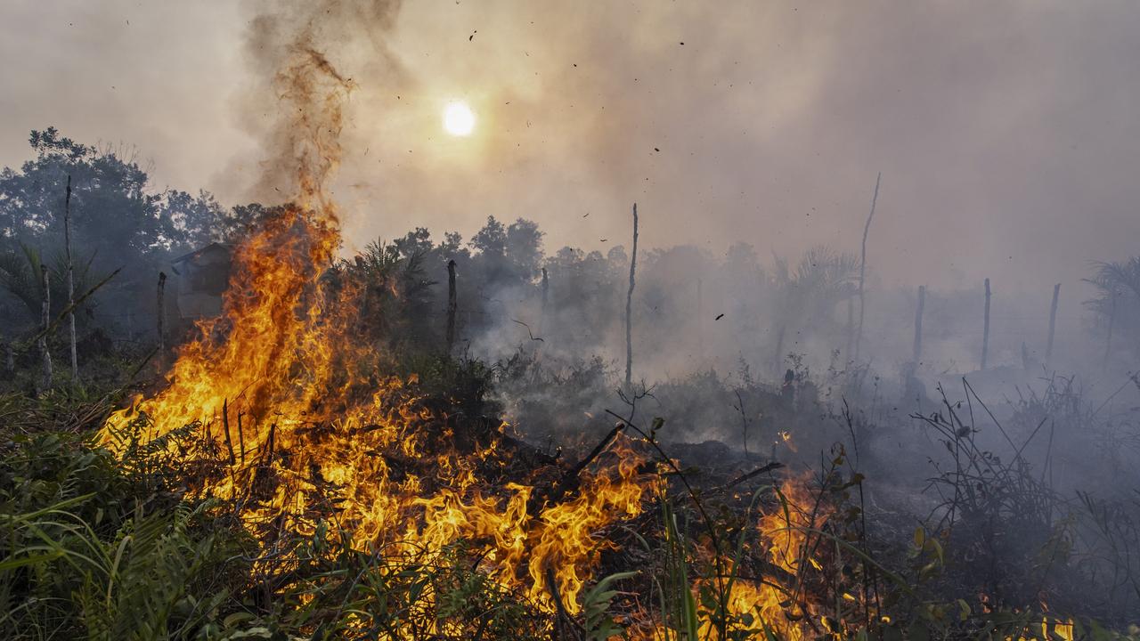
It warns it could reach the “super” El Niño strength levels previously linked to devastating drought, fires and floods worldwide.
And it’s not the only study released this week to make the warning.
Research from the Chinese Academy of Sciences’ Institute of Atmospheric Physics (IAP) has warned Beijing of a looming “climate crisis”.
“In addition to the surge in surface temperatures, the strong El Niño in 2023-2024 is predicted to trigger a cascade of climate crises,” says Professor Zheng Fei, primary author of the study.
This cascade could include intense marine heatwaves, similar to that which devastated the coast of Florida this year, reaching across the Pacific. This will contribute to ocean deoxygenation, damage to marine ecosystems and damage to inland crops from extreme weather events.
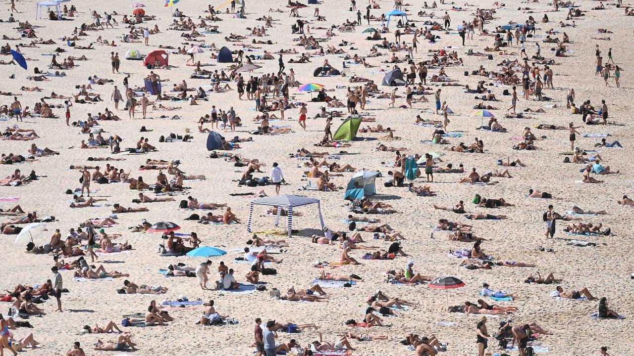
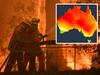
With sweltering weather sweeping Australia even before the seasons officially switched from winter to spring, fears are rising of a repeat of the devastating 2019 fire season.
But the increasingly erratic weather patterns have caused Australia’s Bureau of Meteorology (BOM) to take an ultra-cautious approach to its forecasts this year. Whereas an El Nino event was declared as early as June in the Northern Hemisphere, the Australian government agency waited until the first week of September to confirm its influence Down Under.
“This summer will be hotter than average, and certainly hotter than the last three years,” forecaster Karl Braganza said. “Importantly, with the El Nino now settling into that pattern in the Pacific Ocean, that increases our confidence that this pattern is going to last until the end of summer.”
Tipping point
This El Niño is forming after the world experienced its hottest year since records began.
And the weather phenomenon is all about heat.
The mechanics behind the weather system are not entirely understood. What is known, however, is that a surge in warm surface water along the equator of the eastern and central Pacific Ocean unsettles the atmospheric jet streams above.
The hotter the water, the stronger the El Niño and the greater its flow-on effects on global weather patterns.
This year, global ocean temperatures have been breaking records.
While still early in the El Niño cycle, NOAA has already categorised its intensity as moderate. But its forecast states there is a 71 per cent chance of it edging into the “strong” end of the scale over the next two months.
However, the new National Center for Atmospheric Research (NCAR) predictive modelling indicates the weather system will likely be among the top three strongest El Niño events in recorded history.
The 1997-1998 “super” event in Australia produced one of Victoria’s top ten driest-ever summers.
Their model anticipates this year will be slightly less intense than 2015-2016. That event produced severe coral bleaching in the Great Barrier Reef, drought and fires across Australia, and record-breaking cyclones in the Pacific.
The Chinese researchers are less optimistic. Their findings record a 56 per cent chance of it being the worst-ever El Niño cycle since 1950 and a 79 per cent chance that it will be among the top three.
Double-barrel blast
A Bureau of Meteorology assessment released this week reports the atmosphere above the Pacific is attaching itself to rising Pacific Ocean surface temperatures.
“This coupling is a characteristic of an El Niño event and is what strengthens and sustains an event for an extended period. El Niño typically leads to reduced spring rainfall for eastern Australia,” it warns.
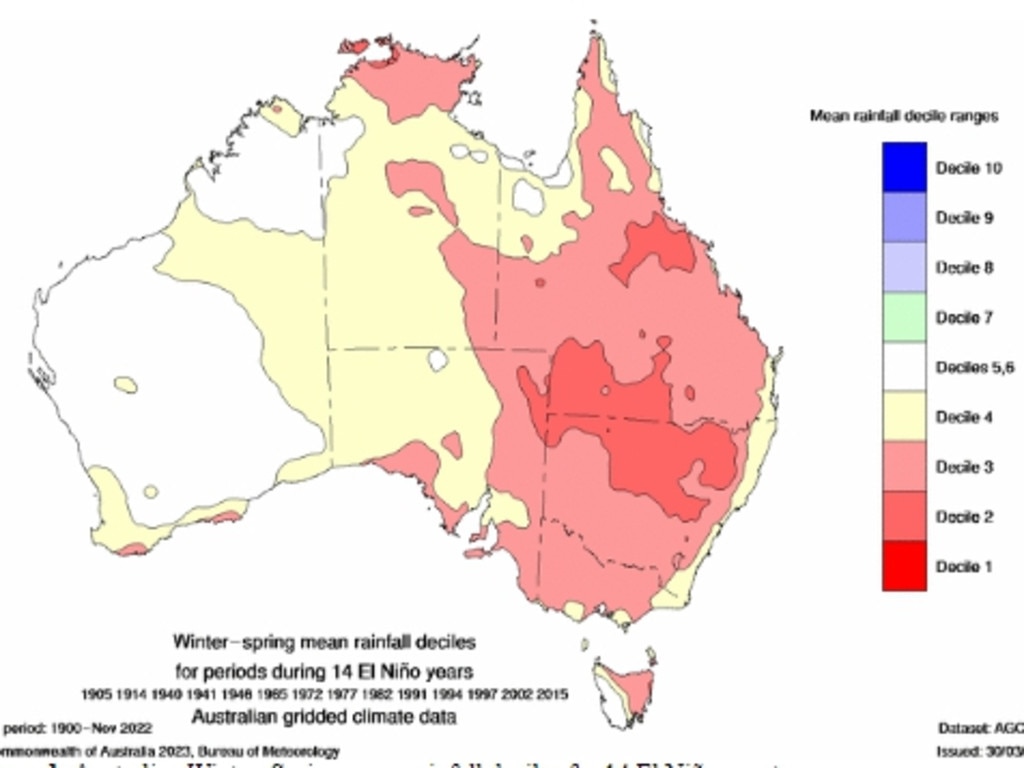
A typical El Niño usually peaks in December. This year is not typical.
“Climate models indicate this El Niño is likely to persist until at least the end of February. El Niño typically leads to reduced spring and early summer rainfall for eastern Australia, and warmer days for the southern two-thirds of the country.”
Australia’s weather, however, is also influenced by a separate climate phenomenon.
It’s called the Indian Ocean Dipole.
A “positive” dipole is when the ocean is hotter in its west, off the coast of Africa, than in the east, off Indonesia.
“A positive IOD typically leads to reduced spring rainfall for central and southeast Australia,” the BOM explains. “All models predict this positive IOD will persist to at least the end of spring.
“When a positive IOD and El Niño occur together, their drying effect is typically stronger and more widespread across Australia.”
The NCAR study says Earth System Prediction Working Group prediction expects El Niño temperatures of 2.4C above average extending through December, January and February.
“Our system is predicting a warmer event than many other systems,” says NCAR project lead Stephen Yeager. “But it isn’t out of the realm of possibilities. Only time will tell if we’re accurate, but we believe our system has something to offer, and we’re excited to be able to contribute this knowledge to the conversation going on right now about the impacts El Niño may have in the coming months.”
Jamie Seidel is a freelance writer | @JamieSeidel


