
September records could be ‘challenged’ as front brings burst of heat
One of the strongest cold fronts of the year is set to batter Australia and it could lead to extreme conditions from coast to coast.

At least three capital cities could “challenge their September heat records,” next week, a forecaster has said.
“It’s going to get very hot into the start of next week, in particular in the southeast,” said Sky News Weather meteorologist Rob Sharpe.
But before that, Perth is looking at some wild weather with heavy rain and damaging winds over the next 24 hours or so.
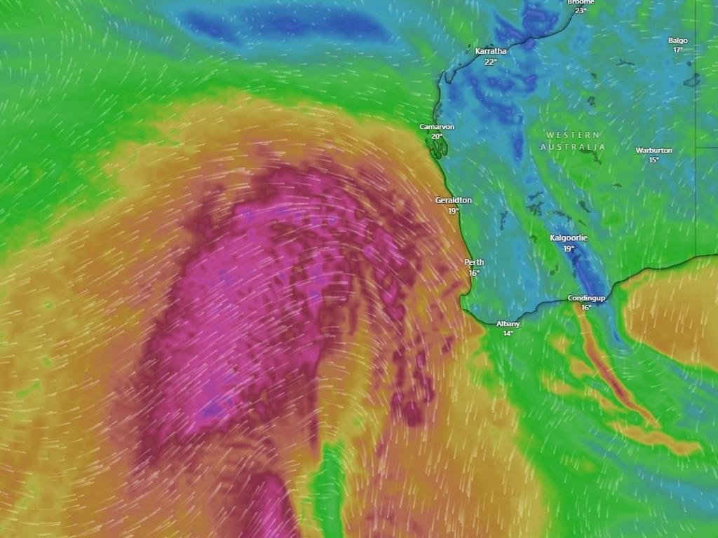
A significant cold front is pushing through Western Australia with severe weather warnings for a huge stretch of land from the south west corner at Albany, north beyond Geraldton, encompassing Perth, and west to Kalgoorlie and Esperance.
‘Only seen once or twice a year’
On Wednesday afternoon, the front will cross the coast bringing substantial rainfall.
Perth could see between 20-40mm over the next two days and it could be heavier elsewhere.
Much of that moisture could arrive over short periods as the front and its band of storms ploughs through.
The Bureau of Meteorology’s (BOM) severe weather warning states that damaging to locally destructive wind gusts are expected over southwest parts of WA from Wednesday morning of up to 100km/h or more.
“This will be windier than your typical front, bringing the kind of weather usually only seen once or twice a year,” said the BOM’s Miriam Bradbury.
Not hot though with temperatures in Perth only peaking at around 20C.
Conditions should ease in Perth during Wednesday as the front heads east.
Temperatures will settle into late teen maximums, or perhaps 20C, into the weekend.
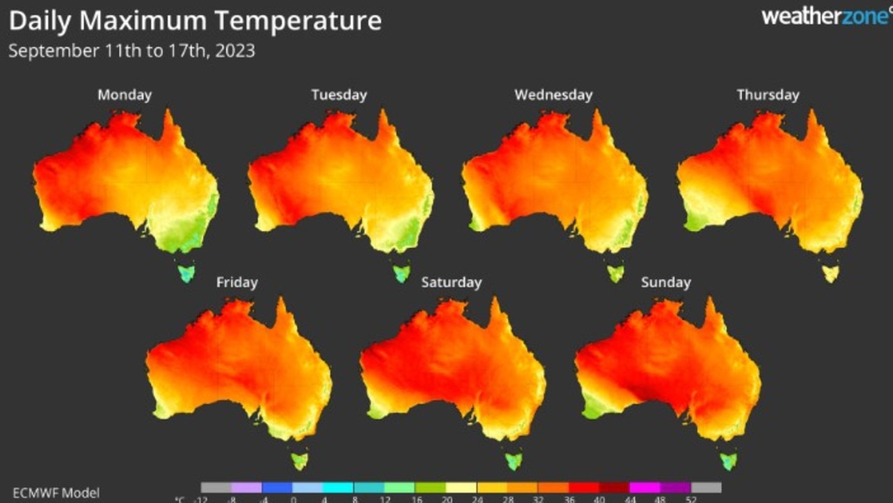
September records ‘challenged’
By Thursday, that cold front will push the mercury higher in Adelaide to 28C while Sydney could get to 30C on Saturday and Canberra 25C.
It won’t end this week either, said Sky’s Mr Sharpe.
“Early next week, that heat will filter down into the south.”
Currently, Adelaide is forecast to peak at 26C on Sunday and 29C on Monday. However Mr Sharpe suspected those temperatures would rise.
“Most forecast models are predicting something closer to 35C which would be indeed the September record,” said Mr Sharpe.
So far, Sydney is looking at 27C on Monday and 30C on Tuesday, Melbourne 25-27C and Canberra 26-27C. But, again, the BOM could hike up those temperature estimates.
“Adelaide, Melbourne and Sydney will all challenge their September records early next week with 30-35C a possibility,” said Mr Sharpe.
Hobart looks like it will sit this one out. While Wednesday and Thursday could reach 23C, it will slip to a maximum of 16C on Sunday, only getting to 20C on Tuesday of next week.
Brisbane is solidly in the mid-twenties for the rest of the week, then climbing to 27C onto the weekend and early next week.
Darwin will see a string of warm and dry 34C days.

Icy blast hits millions on shortest day
Australia’s shortest day of the year has arrived, bringing with it icy temperatures, frost, snow and severe weather warnings.

Millions brace for brutal cold snap
Residents in the southern part of Australia should rug up extra warm this weekend as a cold snap settles in, bringing lashings of rain and damaging wind.

Reason housing crisis could get worse
Australians are already facing a shortfall of more than 640,000 affordable homes. There’s one reason that might get even worse.