
‘Remarkable’: Heavy rainfall set to hit large areas of southern and eastern Australia
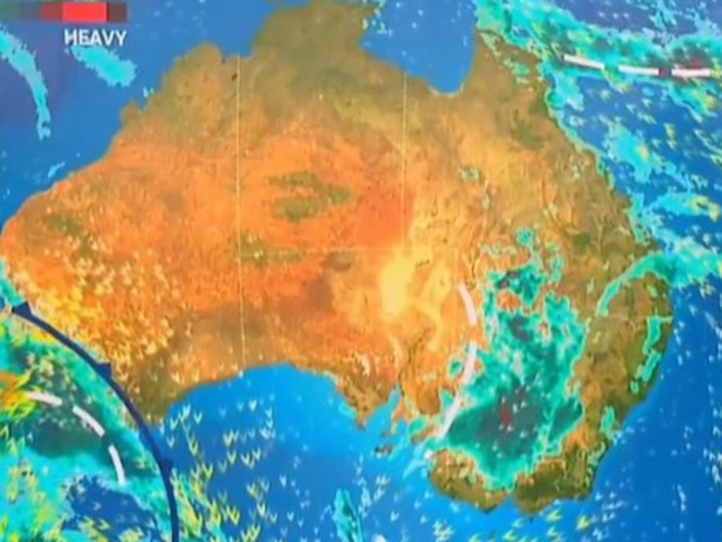
A fierce cold front has already walloped WA, and now it’s headed east with warnings it could bring “easily” a month’s worth of rain.

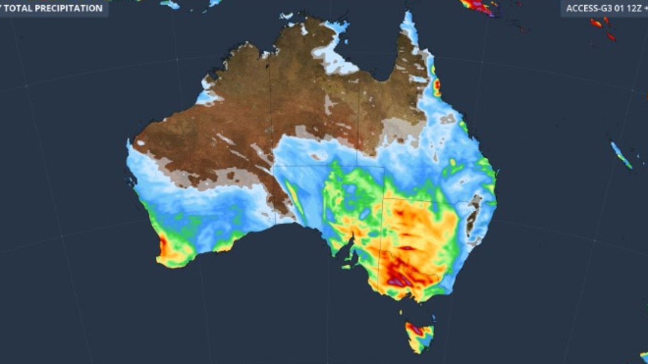
A “remarkable” level of rain for this time of year could bring “easily a month’s worth” of moisture in inland areas of the east in the coming days.
In addition, a number of major cities will also see heavy falls this week including Perth, Adelaide, Melbourne and Canberra.
Totals of 70mm across several days are forecast in many areas of the country’s south east.
It comes as Perth recorded a whopping 71.2mm of rain on Monday – its heaviest single day of rain in five years – as a strong winter cold front pushed across the Western Australian coast.
Flash flooding was reported in parts of the state’s south west, hail was recorded in Mandurah, south of the city, and wind speeds of approaching 100 km/h buffeted the coast.
Perth will continue to see wet conditions this week with 10-25mm of rain on Tuesday with possible thunderstorms.
The city will see chilly temperatures dipping to a high of just 14C on Tuesday but then rising to 19C by Thursday. Lows will be around 7-8C.
‘Remarkable’ level of rain
“The front then pushes through South Australia, Victoria and New South Wales between Wednesday and Thursday, generating a big rainband over the three states,” said Sky News Weather meteorologist Alison Osborne.
“The heaviest falls are expected in southern NSW and northern Victoria.”
Sky’s Rob Sharpe added that it would lead to a “remarkable level of rain for this time of year in the south east inland”.
Tuesday will be fine and sunny in Adelaide, with the front yet to arrive. Expect a warm 23C high and 12C low. But a storm in the evening could herald the approach of adverse weather.
Wednesday is looking soggy in the SA capital with anything up to 20mm of rain and more storms with the maximums falling to around 20C. The rest of the week could also see showers.
Like Adelaide, Tuesday will be mostly settled in Melbourne – albeit not as warm with a high of 19C.
But come Wednesday, the skies will likely open with anything from a dribble to 30mm over two days. The downfalls should begin to ease later on Thursday.
Head inland, though, and the downfalls begin to enter deluge territory.
Bendigo may get less than 10mm on Tuesday, but 25-40mm of rain is forecast on Wednesday with a possible further 20mm on Thursday.
Mildura could see 40mm on Wednesday too, as could Horsham. Across Wednesday and Thursday Shepparton and Wodonga are looking at 20-55mm.
Downpours due in NSW
Cross the Murray and it's much the same. Wagga Wagga is forecast to see up to 15mm on Tuesday, then a shower or two on Wednesday before 15-30mm on Thursday. Griffith could get 25mm of rain on Thursday; Dubbo 15mm and Broken Hill 20mm on Wednesday and
For Canberra, a few showers on Tuesday should clear on Wednesday but then 7-20mm of moisture is expected on Thursday.
The capital should see maximums of 15C through much of the week, peaking at 18C on Wednesday with lows around 5C.
The rain should begin to dissipate the further north you head into NSW. Tamworth, for instance, can expect only around 6mm on Thursday if it gets any rain at all.
Additionally, areas on the coast will likely be shielded from the worst of the downfalls by the Great Dividing Range. Ulladulla, for instance, is forecast top only get 6mm on Thursday in sharp contrast to communities further west.
Mostly dry in Sydney this week with highs of around 21C and 11C lows. Thursday could see some increasing showers in the Harbour City but the totals will be relatively low, under 5mm. Friday could be very sunny and dry.
Hobart will see some rain this week with showers between Wednesday and Friday but the totals won’t be particularly high.
Maximum temperatures of 18C are expected for much of the week although Friday could be a very mild 13C. At dawn in Hobart, between 7-11C is on the cards.
In contrast to much of the rest of the country, Brisbane will be dry and mostly sunny this week with a string of days reaching 23C and minimums of 13C. Friday could get to 25C.
Further north, Cairns could see some light showers on most days.
Darwin will be sunny with temperatures of 33C sinking after dark to 22C.

Millions of Aussies set for soaking
Lashings of rain and destructive winds are on the way for the majority of Australia, with more wet weather on the way.

‘Never seen before’: Shock pics of algal bloom
A federal minister has spoken out about the dead marine life from a toxic algal bloom as new pictures reveal the extent of the devastation.

Albo reconnects with Aussie icon in China
Anthony Albanese has gotten a big dose of panda diplomacy in China, reconnecting with an Aussie favourite as he winds down his state visit.