
NSW, Queensland weather: Evacuation warning as heavy rainfall smashes coast
A 34km-long sand island north of Brisbane is copping the brunt of the wild storms after its sand dunes were broken by furious waves.
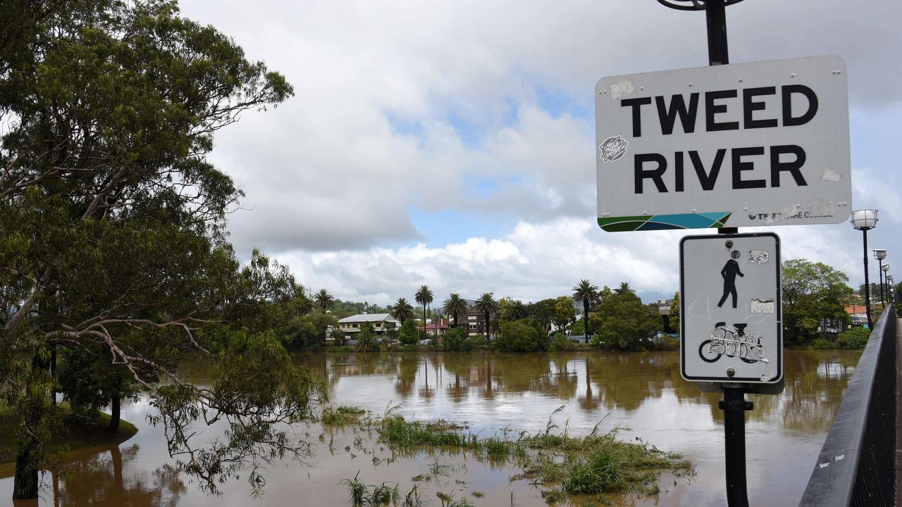
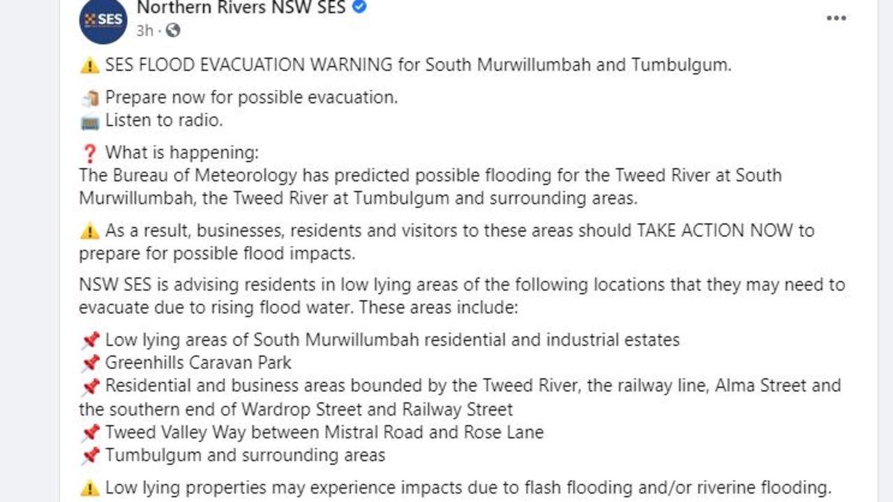
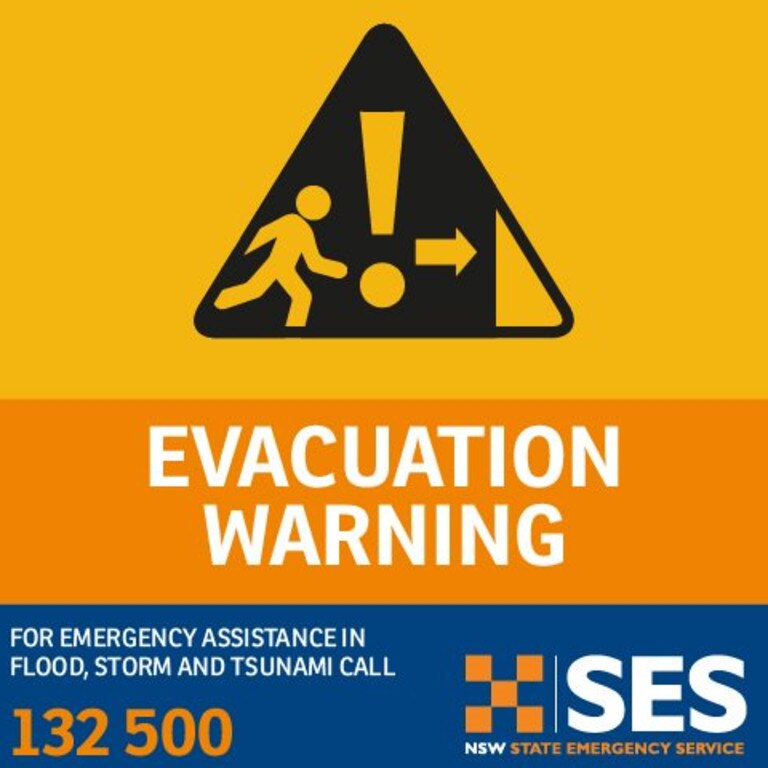
An official Evacuation Order has been issued for Tweed River at Condong, Tumbulgum and surrounding areas in northern NSW, with residents told to flee the “high danger area” via Tweed Valley Way.
The order to “evacuate now” was issued late this morning by the State Emergency Service for some north coast communities as flood waters began to close low-lying roads and the Tweed Valley Way to the north of Tumbulgum.
Around 1000 properties are believed to be affected, including those on the Tweed Valley Way north of Murwillumbah, Condong and the low-lying areas of Tygalgah and surrounding areas.
Homes in Tumbulgum seem to have been spared but according to reporter Johnpaul Gonzo, water is “lapping at driveways and doors”.
“Once flood water begins inundating the area, road access, water, sewerage, power, phones, and internet may be lost,” the evacuation order reads.
“If you remain in the area you will be trapped, and it may be too dangerous for SES to rescue you.”
Homes haven’t been impacted by the water at Tumbulgum. It’s lapping at driveways and doors. Residents say they’re relieved - but worried about more rain @10NewsFirstSyd @10NewsFirstQLD pic.twitter.com/M7LWa9SBb8
— Johnpaul Gonzo (@JohnpaulGonzo) December 15, 2020
The Tweed River was expected to peak around midday but instead peaked at 2.2 metres around 10:00am this morning with moderate flooding.
A severe weather warning remains in place for the NSW Northern Rivers.
Meanwhile ABC reporter Leah White said despite the intense weather, “quite a few residents were at the (Tumbulgum) pub, somewhat relaxed, watching the water slowly creep up”.
Despite conditions easing this evening there are still concerns over more rain and flooding forecast overnight and into Wednesday.
BRIBIE ISLAND DIVIDED IN TWO
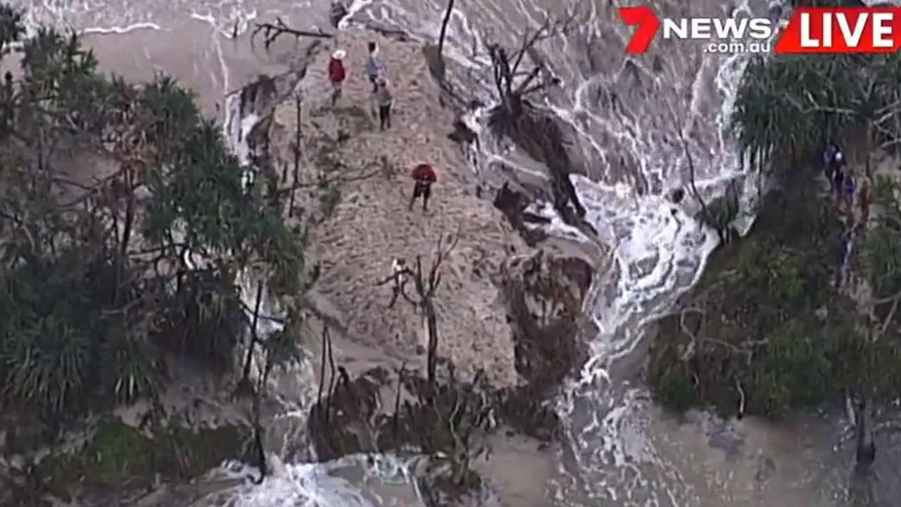
Meanwhile wild weather continues to wreak havoc in parts of Queensland, with latest reports revealing Bribie Island has been divided in two.
For the first time in recorded history waves broke through dunes at the northern section on the tiny island, north of Brisbane.
The 34km-long sand island hugs the coastline and tapers to a long spit at its most northern point near Caloundra, and is separated from the mainland by Pumicestone Passage.
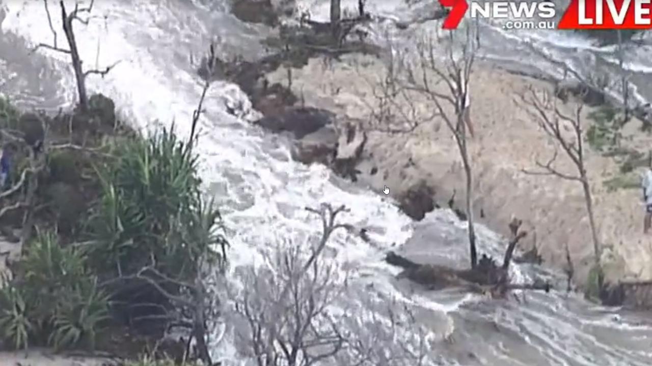
But the wild storms have exacerbated a long term erosion problem on the island, allowing water to break through into Pumicestone Passenger.
“The dunes have got so narrow from previous erosion events that they were just waiting for the big event to come along and overwash those dunes,” Principal Coastal Scientist Sel Sultmann told The Courier Mail.
Our Chief Coastal Scientist Sel Sultmann explains exactly what's happening on Bribie Island. Also check out some amazing drone vision taken by @realPeterJacko @QldParkAlerts pic.twitter.com/76F4ogjcir
— Queensland Environment (@QldEnvironment) December 15, 2020
As a result, experts have said “little vortexes” have appeared and divided the island into two.
“At this stage it’s holding together but who knows. When the water is at the same level as the inside passage we’ll get a lot more damage,” Flotilla Commander Caloundra Coast Guard Roger Pearce told Sunrise.
He warned locals to “keep away” and said hopefully the sand island – which is home to a 55.8 square kilometres national park – will survive.
“At this stage there are still plenty of tree roots holding it together,” he said.
Social media users have been sharing images of the tide overtopping the dunes which currently threaten dozens of beachfront mansions.
A few clips of the overtopping during the king tide at Bribie Island this morning@CouncilSCC pic.twitter.com/sVecWFqpP7
— Peter W. Jackson (@realPeterJacko) December 15, 2020
Dramatic footage of a thundering waterfall in Dorrigo, NSW has also emerged on Twitter which reveals the true extent of the heavy rainfall in the region, with storms already destroying one home and damaging popular beaches.
Amazing footage from Dorrigo Mountain this morning, west of Bellingen. Waterfall Way is well and truly living up to its name! The BOM says more than 100mm of rain fell across the Bellingen Shire, which has endured torrential rainfall in recent days. pic.twitter.com/MsmKahj8LF
— Claudia Jambor (@claudiajambor) December 14, 2020
A family from Tintenbar – a tiny village 12km from Ballina on the NSW Far North Coast – have lost their home after it was crushed by a falling fig tree during the storms, with a GoFundMe page raising almost $8000 in less than 24 hours.
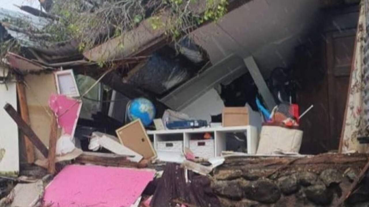
The home – owned by popular local entertainer Shorty the clown, her partner and son – was completely ruined, leaving the family “homeless”.
RELATED: Incredible image as megastorm hits
Meanwhile, University of NSW Professor of Civil and Environmental Engineering Stuart Khan revealed on Twitter that Byron Bay’s Main Beach had lost around 2 metres of sand due to erosion.
A Byron Bay lifesaver (my dad!) says the beach has dropped about 2 metres. “Those are old wooden piers. They were last exposed about 30 years ago and the tops were cut off. Thinking that we would never see them againâ€. pic.twitter.com/seuhEsmJeh
— Stuart Khan (@stukhan) December 14, 2020
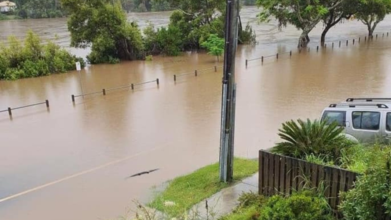
And new photos shared by Northern Rivers NSW SES show just how serious flooding is in the region, with a snap revealing water was “starting to come up (the) driveway” at 102 Riverside Drive, Tumbulgum.
More storms are set to smash a 1000km stretch of Australia’s east coast today, with a combination of high-spring tides and severe weather warnings in place as residents rush to protect properties.
âš ï¸ #Flood Warning updated for #Tweed River. Moderate Flooding at Murwillumbah and Tumbulgum today. Minor flooding at Chinderah. See https://t.co/TAQb6SeKXO for details and updates; follow advice from @NSWSES. #NSWFloods pic.twitter.com/Ddu5hSZoC8
— Bureau of Meteorology, New South Wales (@BOM_NSW) December 14, 2020
Sky News meteorologist Rob Sharpe told news.com.au showers and thunderstorms will spread across eastern and northern Australia with heavy falls at times throughout the rest of the week.
“It seems like La Nina is really impacting our weather patterns after a drier than normal November,” Mr Sharpe said.
“Up north, the monsoon is likely to reach Darwin later this week. A tropical low should form near the Top End and shift west.
“It is now a pretty decent chance to become our first tropical cyclone for the year, just before Christmas. If it forms it will be called Tropical Cyclone Imogen.”
NSW
Mr Sharpe said the rainfall event started late Friday in NSW before easing back on Sunday and Monday and then ramping up again last night.
“Casino has picked up more than 150mm in the last 24 hours, bringing its event total beyond 300mm – already it’s the wettest December in 50 years,” he said.
“The rainfall is ramping up today for northern NSW with heavy falls on the North Coast with bands of rain, showers and thunderstorms. Widespread falls of 50-100mm for much of the Northern Rivers and Mid North Coast and isolated heavier falls.
“Parts of the coast will see abnormally high tides and damaging surf, similar to Queensland, before we see the easing tomorrow. Tomorrow the focus will shift even further south with the south coast potentially seeing some bands of heavy rain leading to flash flooding, but the duration of the event won’t be long enough for significant river flooding.”
Mr Sharpe said Sydney will see a series of showers today, mainly during the morning, and that wet weather was a chance all week, although Friday would bring the wildest weather, with severe thunderstorms on the cards.
The Bureau of Meteorology’s Jenny Sturrock told news.com.au “major flooding” was expected at Tumbulgumin in northern NSW from around noon today.
Severe weather warnings are also in place in the area with heavy rainfall, damaging surf conditions and abnormally high tides expected today.
“In northeastern NSW rainfall will continue today and will start to ease later tonight into Wednesday as the weather system that produced all this starts to weaken,” Ms Sturrock said.
NSW SES Deputy Commissioner Daniel Austin has warned residents of Northern New South Wales to prepare themselves and their properties for what might come amid raging storms along the Northern Rivers. https://t.co/ULRgnf36JP
— Sky News Australia (@SkyNewsAust) December 14, 2020
“We expect more rainfall today with rainfall easing overnight but we will continue to have thunderstorm activity.
“There will be damaging surf conditions with waves exceeding 5m onshore in the surfzone north or Port Macquarie which will continue during today, and there will be a chance of significant beach erosion as well.”
Ms Sturrock said there was also a threat of “abnormally high tides” north of Ballina today.
QUEENSLAND
Mr Sharpe said the worst of the wind and rain had now passed for Queensland, however there were still severe weather threats.
“Damaging surf from king tides and dangerous surf combination continues – high tide is around 9am-10am. The water will probably not come quite as far inland, however the risk of coastal damage continues because there has already been so much beach erosion. In fact, some areas could face more damage than yesterday due to the longevity of this event,” he said.
“Severe thunderstorms are still a chance in southeastern inland QLD and central eastern QLD today with the possibility of heavy rainfall and damaging wind gusts with any severe thunderstorms that develop. So in Brisbane, Gold Coast and Sunshine Coast I’d only except a shower or two today.
“Yesterday, storms in the Wide Bay Burnett delivered up to 191mm at Fairlies Knob (east of Gayndah). Upper Springbrook has the highest storm total with almost 1 metre of rainfall since the event began, including more than 200mm in the last 24 hours.
“Much of the Sunshine and Gold Coasts have seen more than 200mm for the event. Sunshine Coast Airport has collected almost 300mm this month – its wettest December since 2010 – another year where we had a La Nina event.”
FOUR-DAY RAINFALL
According to the Bureau of Meteorology, a staggering amount of rainfall has been recorded over the past four days to 9am Tuesday, December 15 across NSW and Queensland.
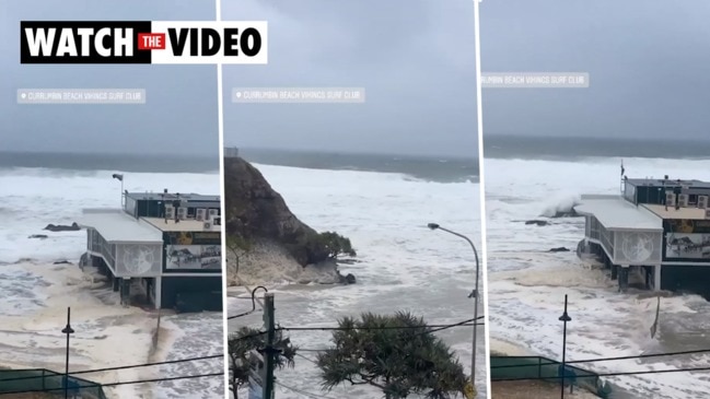
In the Sunshine State, there has been 953mm recorded at Upper Springbrook, with 734mm at Lower Springbrook and 669mm at Currumbin Creek.
In NSW, 578mm has fallen in that period at Terania Creek, 575mm at Limpinwood and 552mm at Burringa.
It comes after Byron Bay’s Main Beach was “swallowed” according to some observers, with the local mayor warning it had all but “disappeared”.
Residents have been told to expect “damaging winds and heavy rainfall” in Queensland while NSW fared no better, with the BOM stating “dangerous rain and coastal erosion” is expected to worsen in the affected areas.
âš ï¸Severe weather warning updateâš ï¸
— Bureau of Meteorology, Queensland (@BOM_Qld) December 14, 2020
The threat of damaging winds and heavy rainfall has eased over Queensland, but surf & tide hazards continue on the coast. A severe thunderstorm warning for heavy rainfall continues further north in the #WideBay. Warnings: https://t.co/3xfTNPaeNb pic.twitter.com/HBToRrH6nd
Severe Weather Update: dangerous rain and #erosion continue in northeast #NSW and southeast #QLD. Video current at at 11:30 am AEST Monday 14 December 2020.
— Bureau of Meteorology, Australia (@BOM_au) December 14, 2020
Latest forecasts: https://t.co/boJ4ZEiUYA @QldFES @NSWSES pic.twitter.com/hR9sMkXFcU
A spokeswoman said there will be increased rain, wind and waves on Tuesday morning but said conditions would ease “at some point.”
“The expectation at the moment is later in the day. But, certainly, [Tuesday] morning we’d be expecting some increased rain, wind and waves. The surf does look like it’ll hang around for a bit longer now.”
The BOM’s Queensland branch issued a flood watch and severe weather warning from Fraser Island to the Queensland-NSW border, warning of river level rises and minor flooding.
“The Logan, Albert and south coast River catchment areas are now saturated with renewed river level rises expected with forecast rainfall,” it said. “Storms are expected throughout the flood watch area during Monday and into Tuesday.”
In NSW heavy rainfall was expected to intensify on Monday evening before easing late Tuesday or early Wednesday.
Heavy rainfall is expected in the mid-north coast along with thunderstorms, flash flooding, damaging winds and surf and abnormally high tides that could lead to “significant” beach erosion north of the Ballina area, the BOM said.
RELATED: Byron Bay’s Main Beach washed away


BYRON’S MAIN BEACH ‘SWALLOWED’
The coastline has been pummelled by gale-force winds and extreme high tides in the last few days, leading to over 900 requests for assistance over the course of the savage weather event. Karlene York from the SES said “most of the jobs we’re assisting with are fallen trees, leaking roofs and windows”.
As the areas prepare for another day of up 104km/h winds which were recorded in Cape Byron Monday morning, social media has been filled with images of damage inflicted in the 1000km danger zone.
Byron Bay saw 6m waves and abnormally high tides. Byron Shire Mayor Simon Richardson told Sky News he hopes the main beach will be able to recover.
“It’s a beach that we all hold really dear,” he said. “We’ve had quite a lot of erosion events leading up to this previously and obviously we’ve got another big king tide tomorrow and some more gnarly weather so hopefully we all batten down the hatches and so does this particular area and when the water recedes the beach can begin to restore itself.”
Mr Richardson called for locals and tourists to be responsible and remain safe by not driving on flooded roads.
“Along the coast the waves have been huge, we’re looking up to five metre waves, we’ve got large swells, crazy water, we’ve also got king tides and really high water levels smashing along the whole coast,” he said.
The tides have finally receded here at #ByronBay and this is what’s left of the beach... @7NewsSydney pic.twitter.com/WCBKufQg3Q
— Sarina Andaloro (@sarina_andaloro) December 14, 2020
#ByronBay's Main Beach was swallowed by the ocean this morning as damaging surf and an abnormally high tide hit parts of Australia's east coast.
— Weatherzone (@weatherzone) December 14, 2020
🎥 Video by @wrecklanecoffeeco/IG pic.twitter.com/hEnfK92Btk
Queensland Police shared photos of a “serious landslide” in Mount Tamborine that showed huge boulders that had closed Tamborine Mountain Road, locally known as the goat track.
“Now that’s a big rock,” one post read, showing a police officer beside a giant boulder.
Now that is one BIG rock! pic.twitter.com/Kq3TsNFudJ
— Queensland Police (@QldPolice) December 14, 2020
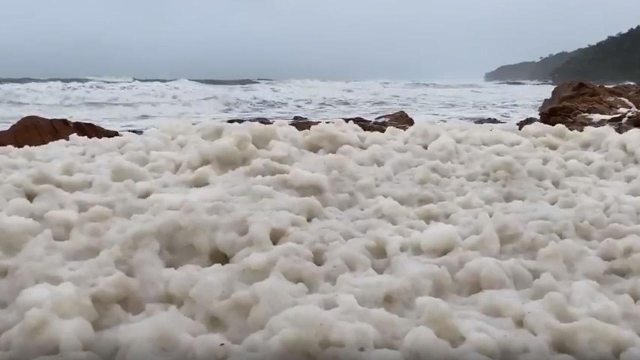
A jaw-dropping video of First Bay Coolum’s usually pristine beach completely encased in thick mounts of murky white foam also captivated social media, showing the lathery white substance wobbling on top of the water in the aftermath of the brutal weather.
Sunshine Coast Daily shared a video of water surging over a spillway at Wappa Dam which was currently sitting at nearly 110 per cent capacity with more rain expected.
Check out the water gushing over the spillway at Wappa Dam!
— Sunshine Coast Daily (@the_daily) December 14, 2020
Seqwater is reporting the dam is currently sitting at a capacity of 108.7 per cent as more heavy rainfall is expected to drench the region today. 💧🌧ï¸
READ THE LATEST HERE: https://t.co/62pK1tBCfk pic.twitter.com/LnndiLzz1T
Thousands were left without power in many areas with police closing roads as debris falls from buildings and trees.
INSURANCE RISK
Meanwhile, as the east coast is battered by wild weather, comparison site Finder.com.au has revealed that 4.6 million households – or 46 per cent – are not covered by insurance in the event of a flood.
Of these Aussies, one in seven don’t have home and contents insurance altogether, while a further 32 per cent have insurance but are not covered by floods while one in four aren’t sure of their cover.
And according to a Finder analysis of the Insurance Council of Australia data, floods have cost insurers $5.6 billion in damages in the past decade.
“It’s important to gather as much information as possible so your insurer has no reason to deny your claim. Take photographs and document everything you can,” Finder insurance specialist Taylor Blackburn said.
“It’s also vital to prove you took measures to prevent any damage. If you’ve had gutters cleared, removed low-hanging branches from around your house or repaired roof leaks, give this information to your insurer, along with dates and receipts if possible.
“In many cases you have to actively take out flood cover, so check it was included in your policy before claiming.
“We’re in for a wet summer so if you’re yet to take out home and contents insurance, now is the time to do it. Precautionary measures can save you thousands of dollars in the long run.”
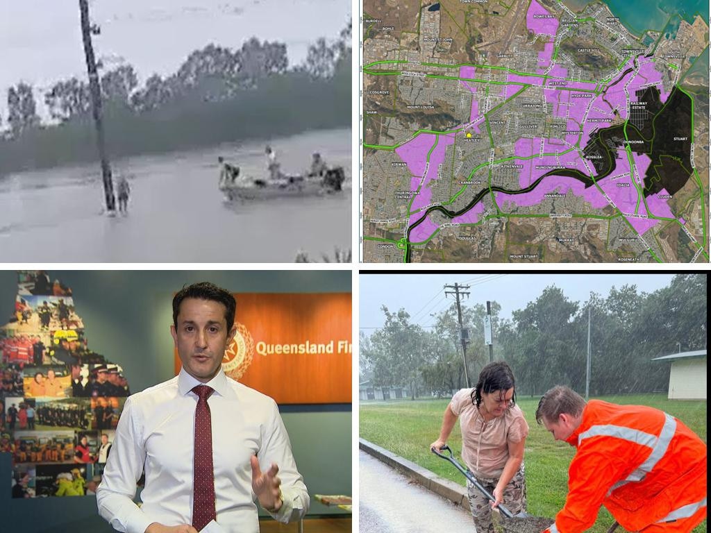
‘Leave now’: Urgent plea amid flooding event
A person has died and thousands remain without power as dangerous floodwaters inundate towns and cities in north Queensland.
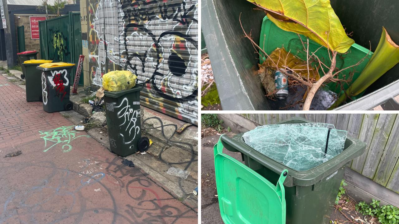
Trendy Aussie area now ’maggot-infested’
A statewide mandate has divided residents and councils with some saying the scheme has turned their area into a “garbage tip”.
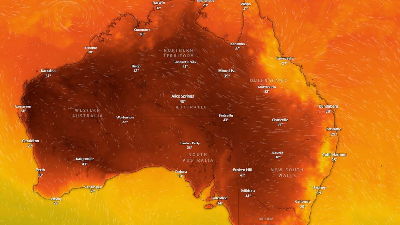
Millions to swelter through new heatwave
Heatwave warnings have been issued for Aussies across several states ahead of a scorching weekend.