
NSW, Queensland weather: Road swallowed by spilling waterfall amid heavy storms
Mammoth rain fall have caused a waterfall to spill over a busy NSW road, as flood and erosion warnings are issued for parts of the state.

As heavy rain continues to fall in northern New South Wales, motorists have been forced to find an alternate route after a waterfall overflowed onto a road.
Waterfall Way at Dorrigo was cut off on Tuesday morning, after Newell Falls spilled over the bitumen, having received 499mm since Saturday morning.
It comes after flood warnings were issued for northern NSW residents, as a massive rain band continues to make its way down the coast, coupled with the year’s biggest king tide.
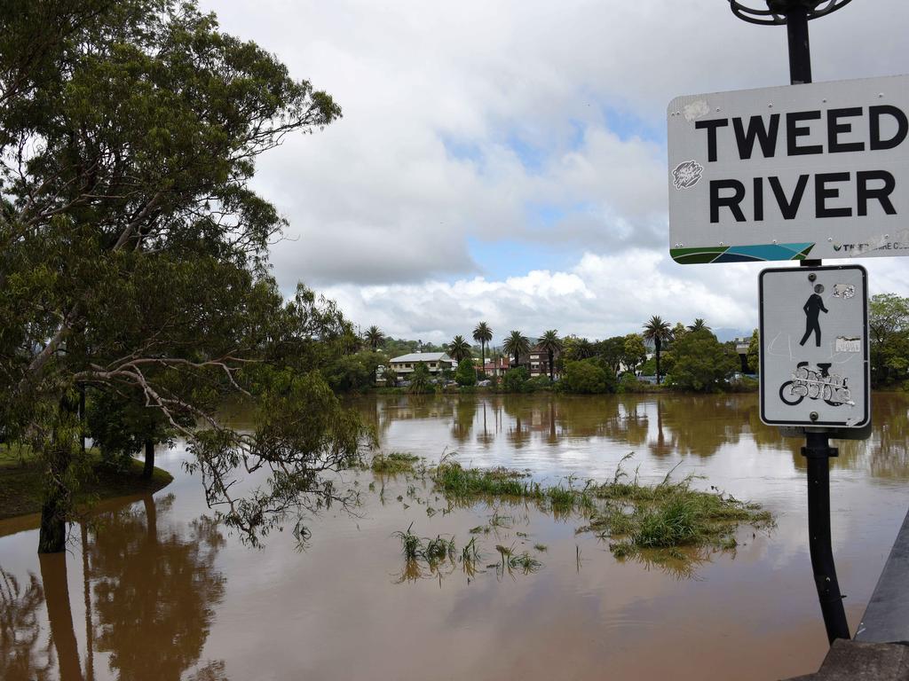
On Tuesday morning, residents within Condong, Tumbulgum and surrounding areas were ordered to evacuate after the Tweed River peaked at Chunderah earlier in the morning.
A host of other rivers in the northern part of the state were expected to reach minor or moderate flood levels throughout Tuesday morning.
At least 1000 properties were expected to be affected, including some in Murwillumbah and Tygalgah.
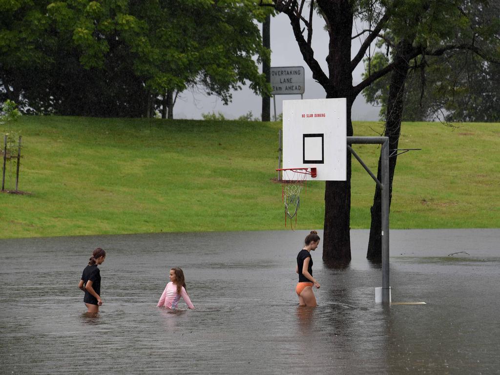
Rain is continuing to lash hundreds of kilometres of coastline from Byron Bay to Broken Bay, although conditions were set to “generally ease” on Tuesday, according to the Bureau of Meteorology.
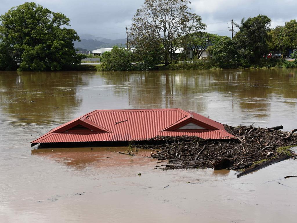
Meanwhile, landslides forced the closure of regional southeast Queensland roads, after the region received more than 700mm of rain in three days.
Forecasters have warned there could be even more damage to come, with warnings of flash flooding, dangerous surf conditions, extreme coastal erosion and record tides along southeast Queensland and northern NSW on Tuesday.

Queensland Police said Tamborine Mountain Road, locally known as the goat track, will remain closed for a “significant time” after massive rocks came away from the mountain and crashed onto the street below.
Now that is one BIG rock! pic.twitter.com/Kq3TsNFudJ
— Queensland Police (@QldPolice) December 14, 2020
In nearby Currumbin, a landslip on Currumbin Creek Road brought a tree down on Tuesday morning, blocking the road and prompting massive delays.
Wild weather has caused a landslip on Currumbin Creek Road. A tree has landed upright smack in the middle of the road. @sunriseon7 pic.twitter.com/n6yjxB8wmj
— Bianca Stone (@Bianca_Stone) December 14, 2020
The Gold Coast hinterland took a battering during the “cyclonic” weather system that hit southeast Queensland over the weekend, with Upper Springbook receiving more than 800mm of rain in four days.
Rain is expected to ease on Tuesday, but abnormally high tides will continue, with the king tide set to hit just after 9am.
RELATED: ‘Evacuation warning’: Australia on notice
RELATED: Foam tragedy kills five experienced surfers

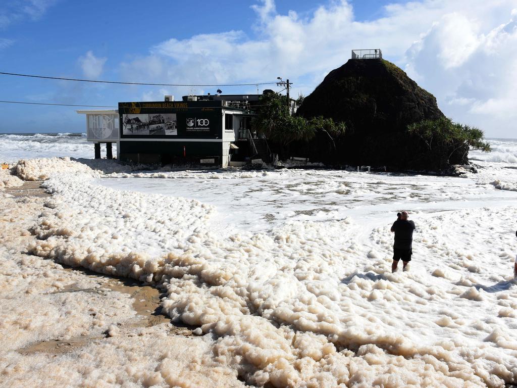
On Monday, entire beaches were covered with foam, while others were completely washed away as massive swells, storm systems, and winds lashed the coastline.
Currumbin Vikings SLSC was cut off, as the massive swell flooded the carpark.
Rain is continuing to fall in tourist haven Byron Bay, where another high tide was expected about 9.30, and more flash flooding expected in nearby waterways.
The Bureau of Meteorology was warning coastal and riverine residents to be on high alert with a stretch of the coastline expected to take another battering on Tuesday.
Forecaster Dean Narramore said a number of minor and moderate flood warnings were current, with coastal communities urged to be on high alert as erosion continues.
“This is a major coastal erosion event,” he said.
There are warnings Tuesday tides could be up to 30cm higher than usual king tides could cause further damage to the coastline.
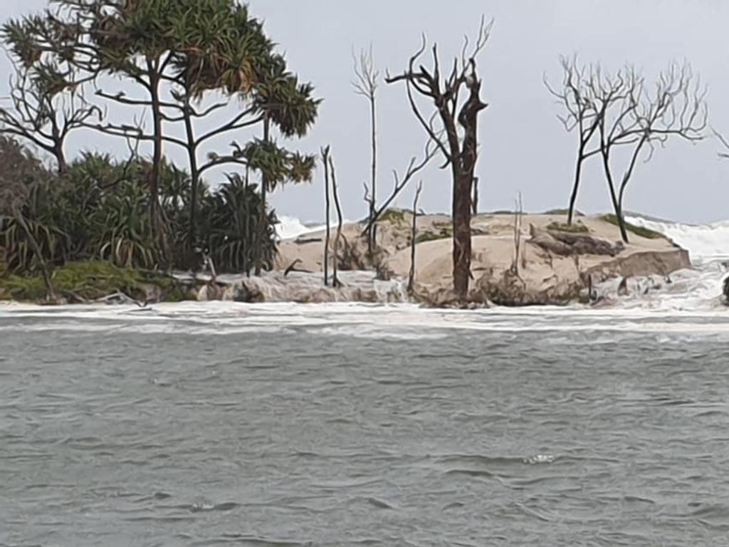
Eyes are on Bribie Island, after the Pumicestone Passage on the northern end of the island eroded, the first time waves had broken through the dune.
“The northern section of Bribie Island has eroded due to unusually high tides and large waves associated with the weather system,” Parks and Wildlife said in a statement.
“This section has a long history of erosion and is part of the natural process for the area, however this is the first time this section of the island has had waves break through the dune.
“This section is closed to vehicle traffic … Boaties are advised to stay away from the area.”
New South Wales flood warnings:
- Flood watch for Mid North Coast and Northern Rivers Catchments
- Richmond River – minor to moderate flooding
- Clarence River – minor to moderate flooding
- Orara River – moderate flooding
- Coffs Coast – minor flooding
- Nambucca River – minor to moderate flooding
- Macleay River – minor flooding
- Hastings River – minor to moderate flooding
- Manning and Gloucester Rivers – minor flooding
- Wilsons River – moderate flood warning
- Bellinger and Kalang Rivers – minor flood warning
‘Leave now’: Urgent plea amid flooding event
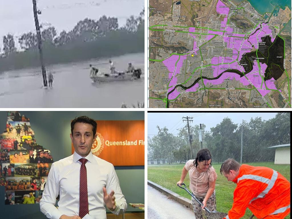
A person has died and thousands remain without power as dangerous floodwaters inundate towns and cities in north Queensland.
Read more

Trendy Aussie area now ’maggot-infested’
A statewide mandate has divided residents and councils with some saying the scheme has turned their area into a “garbage tip”.
Read more
Millions to swelter through new heatwave
Heatwave warnings have been issued for Aussies across several states ahead of a scorching weekend.
Read more