
‘More cold and frosty mornings’ in store during icy blast following last week’s rain lashing
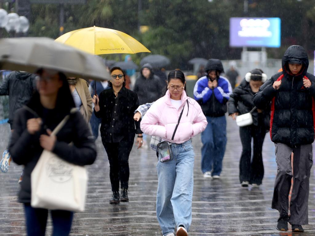
Australians hoping for some reprieve after a wet weekend have been left bitterly disappointed, with chilly conditions forecast to continue through the week.

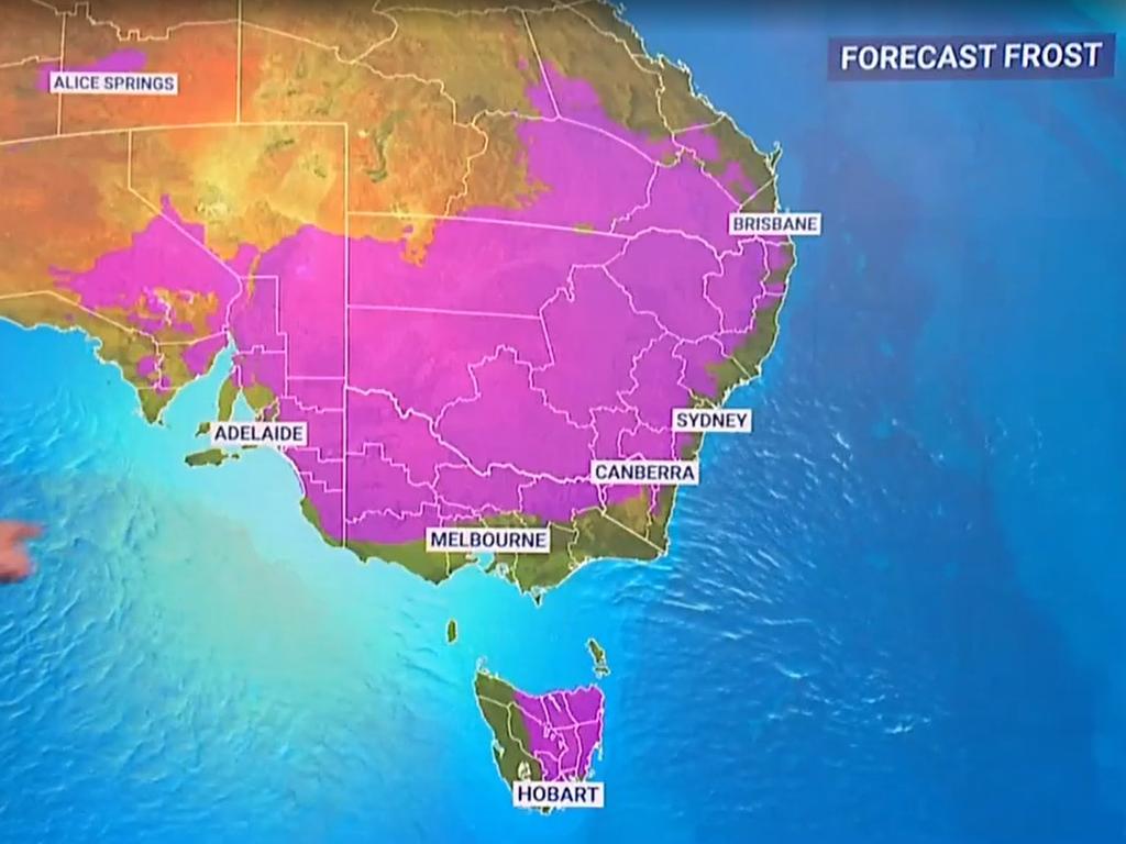
Millions of Australians woke up to frosty temperatures on Tuesday as a polar blast sends temperatures plummeting.
NSW appears to be being hit the hardest by the icy weather, with conditions expected to continue through the week, according to Buereau of Meteorology meteorologist Jiwon Park.
“We can expect more cold and frosty mornings across NSW up until midweek,” Mr Park said on Monday.
“The cold snap is nothing unusual, but the minimum temperatures reaching that low is unusual.”
Temperatures are expected to dip below zero in some areas, with the potential for records to be broken in central and southern NSW.
The Lower Central West, South West Slopes, and eastern Riverina are forecast to have lows that are below the July record.
Temora in the southwest of NSW has a July record of -6.4C, but was forecast to hit -7 on Tuesday.
Young, Forbes and Parkes were also predicted to freeze.
“If we are seeing -6 degrees (Tuesday) morning, it will either be reaching the record, or record-breaking July minimum temperatures,” Mr Park said.
Across much of the state, the minimum temperatures are expected to drop below the average for the season.
Canberra is set to shiver through minimums of -3C this week, while a minimum of 2C is forecast for Thursday in Melbourne.
However, Melbourne is expected to reach a maximum of 15C on Thursday and Friday, with the rest of the week ranging between tops of 13C and 14C.
Sydney is in for maximum temperatures ranging between 16C and 19C throughout the week.
In South Australia temperatures will drop to a minimum of 7C on Wednesday, with maximum temperatures ranging between 15C and 18C the rest of the week.
Perth is set to experience possible thunderstorms on Wednesday, with maximum temperatures ranging between 16 and 21C throughout the week.
Brisbane and Darwin can expect a mostly sunny week with Brisbane set to hit tops of 32C the entire week.
Hobart will experience partly cloudy conditions with a top of 15C over the week.
However there will be relief in some form, as showers are expected to ease after parts of the country were lashed with high rainfall last week.
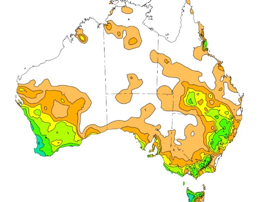
The south west and south east were hit with high rainfall last week amid a series of cold fronts, according to the Bureau of Meteorology.
South west Western Australia recorded rainfall totals between 50 and 100mm along the west coast last week, while south east Australia — including the southern coast, the ranges, and southern and coastal Queensland — brought in totals of 5 to 50mm.
Tasmania’s highest rainfall was between 25 to 100mm in the north and west, while Western Australia clocked the highest weekly total rainfall and daily rainfall.

Mount William managed to record both the highest weekly total rainfall of 180.6mm, along with the highest daily rainfall total of 91.2mm in the 24 hours leading up to 9am on July 23.
Sky News Weather meteorologist Rob Sharpe said a high pressure system is now “dominating”, with this week’s showers being restricted to the NSW coastline.
“But for the south west we’ve got showers rebuilding again ahead of this next strong front that could bring some heavy rain late Wednesday into Thursday,” Mr Sharpe said.
“At the same time showers will start picking up again in far northern parts of Queensland. We could see as much as 50mm with heavy falls on Wednesday into Thursday for a number of spots, especially in the south west and the lower west.”
Showers will begin to pick up in tropical parts of Queensland by Thursday, while Central Australia may see a bit of rain too.
“But all in all there’s not that much brewing for the second half of this week or the start of next,” Mr Sharpe said.


“Not that much rain around for the east of the country although in parts of Queensland we could see pockets of up to 100mm.
“In Western Tasmania, more than 15mm, but even then that’s well below normal for this time of the year.”
Mr Sharpe said this week should be “drier than normal” across the south east, except for some rain moving through Central Australia.


