
Major rain event threatens worst floods in Queensland since 1974
PARTS of Queensland are gearing up a flooding event “so significant that nothing has ever been seen like it in this state”.
WESTERN Queensland is bracing for what could be the state’s biggest flooding event since 1974 this weekend.
The state’s leading independent weather forecasters are predicting a downpouring of rain around the Channel Country that could “rival anything during the past 44 years”.
More than 400mm of rain is expected to fall around Boulia and Cloncurry over the next eight days.
However, the Bureau of Meteorology said the path of the upper-level low system was unpredictable and warned that some uncertainty remained about its strength.
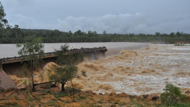
The heavy rain is driven by a low pressure system currently near Richmond which has already dumped up to 400mm of rain on Townsville and added an extra 55 per cent of water to the Ross River Dam over two days.
The storm clouds rolling towards the northwest corner of the state will be a welcome sight for drought-stricken farmers, however the deluge has prompted warnings for the potential of major flooding.
Higgins Storm Chasing yesterday warned western Queensland residents to prepare for a potential “major flood” in the next five days.
“It may even be so significant that nothing has ever been experienced like it in this state,” they wrote.
The Bureau of Meteorology said it was aware of the reports but it was too early to pinpoint exact strength and location of the rain.
Forecaster Michael Knepp said the bureau was monitoring the low.
“That’s the issue. There is potential for some significant rainfall in that area but ... there is a lot of uncertainty with those areas too so it depends on the movement of this upper low.
“You can’t lock in a path with this sort of system. It could move any way. More than likely it’ll move to the south and start moving north again early next week.
“Even if it moves 50km to the east or west, that means one place could get nothing or 200mm of rain.”

The heavy rainfall in the state’s west comes off the back of the driest summer on record for towns and regions including Cloncurry, Mount Isa and Richmond.
The Bureau of Meteorology’s seasonal climate summary also found the state went through its second-warmest summer on record.
Originally published as Major rain event threatens worst floods in Queensland since 1974


