
‘Major polar outbreak’ to hit Australia from Sunday morning
A “major polar outbreak” is surging towards Australia, bringing widespread chilly temperatures, heavy rain and damaging winds.

A “major polar outbreak” is surging towards Australia, bringing chilly temperatures, heavy rain and damaging winds to almost the entire southeast of the country.
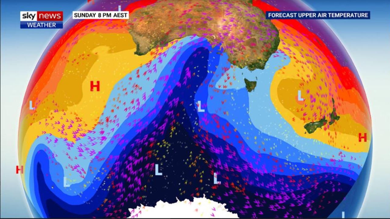
Sky News Weather’s chief meteorologist Tom Saunders said the large wintry weather system is now tipped to make its presence felt from Sunday onwards.
He said that from Sunday morning, it will hit the mainland, bringing strong southerly winds to the south coast of Western Australia.
From late Sunday night, that front will cover South Australia and begin creeping over Victoria.
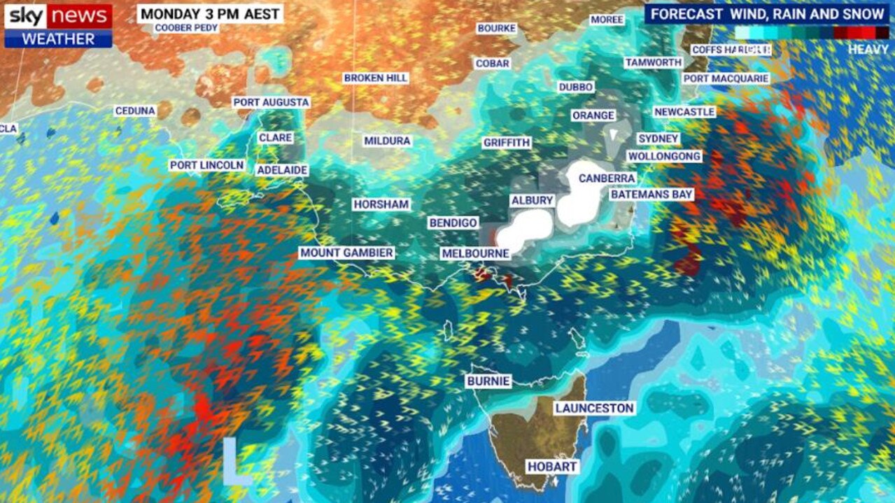
“From Monday, showers will spread through Victoria and NSW,” he said. “But the strongest winds will hit the South Australian coast and ranges. We anticipate a severe weather warning for damaging wind gusts.”
He said there will also be damaging gusts sweeping into northern South Australia and western NSW on Monday.
Stream more weather news live & on demand with Flash. 25+ news channels in 1 place. New to Flash? Try 1 month free. Offer ends 31 October, 2022 >
He said there will be widespread windy and showery conditions for almost all of the nation’s southeast from Monday afternoon, bringing up to 25mm of rain for many areas.
Meanwhile, snow is now tipped to spread as far as the central and northern ranges of NSW.
Between late Sunday and Tuesday, the system is forecast to bring strong to gale-force winds across the NSW, Victoria and Tasmania.
“We’re likely to have severe weather warnings for damaging wind gusts for parts of the coast and the ranges during that period,” he said.
“It’s a very wintry weather pattern with strong westerly winds and widespread showers.”
He said over 50mm of rain was forecast for the next seven days along the South Australian coastline, the Victorian coastline and ranges, and across western Tasmania.
“And, it’s not just rain,” Mr Saunders said. “There will be snow and some heavy snow developing in the alps and dropping below 1000m on Tuesday.”
There’s good news for snow sports enthusiasts as up to half a metre of fresh snow is forecast to be dumped in the alps, and because it is so late in autumn it should be cold enough in the coming weeks that it forms a decent winter snow base.
La Niña to last until August and spring
The cold front comes as wet weather is forecast to hit Australia and the southern hemisphere, with another weather system bringing more rain into winter and spring.


Recent research suggests there’s a “high probability” (62 per cent) of La Niña, which began more than 18 months ago, continuing into June and August, with a 55 to 60 per cent chance of the event lasting into the spring.
This means Australia could continue being lashed by above-average rains, the likes of which have caused disastrous flooding in NSW and Queensland.
It would be only the fourth triple La Nina observed since 1900, and the first time the phenomenon had occurred in 22 years.

200 species dead in ‘unprecedented’ disaster
Scientists have offered a grim outlook for Aussies hoping for an immediate solution to an ‘unprecedented’ disaster leaving the water at Aussie beaches toxic.

Australia told to brace for a soaking
Parts of Australia that have already experienced a wet weekend should expect more downpours in the week ahead.

‘Big’: Wild weather warning to Aussies
Aussies in several states have been warned to brace for a weekend of wild weather, with the risk of floods and damaging winds.