
La Nina set to be declared: The dangerous change to Australia’s weather
An ominous sign in the Pacific means a major climate driver is cranking up bringing extreme, record breaking weather not seen since the deadly year of Cyclone Yasi.

Australia could be set for a summer of intense, record breaking and potentially very dangerous weather as a climate driver cranks back up to full pelt.
It means the current cool, sodden and stormy conditions seen across much of the east in the past few weeks are just a taster of what’s to come for possibly the next six months.
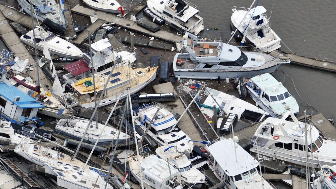
The conditions are all set for a summer similar to 2010/2011 that delivered Cyclone Yasi and the Brisbane floods.
The Bureau of Meteorology (BOM) is expected to officially announce as soon as this week that La Nina has returned. The US equivalent of the BOM, which uses a slightly different definition of La Nina, has already declared its formation.
If it is called, it will be a double La Nina with last summer also afflicted by the climate driver. Back to back La Ninas can have even stronger effects on the weather.
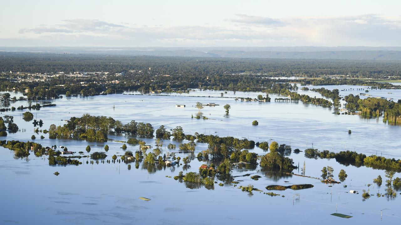
La Ninas increase the potential for more storms and wet weather across particularly eastern Australia. In March, five people died after severe flooding hit the east coast from Sydney to the Gold Coast during a La Nina.
“Australia’s most significant driver of weather patterns, La Nina, is now active for a second consecutive year and will fuel weather systems with moisture for up to six months,” Sky News Weather senior meteorologist Tom Saunders said.

Australia on cusp on La Nina
In its climate driver update in late October, the BOM was officially on “La Nina alert”, one notch away from La Nina being declared.
But Mr Saunders said that since then sea surface temperatures had dropped. Potentially this drop might be sufficient for it to be declared at the next update on Tuesday or in a fortnight’s time.
“Last week, sea surface temperatures across the central equatorial Pacific officially dropped below La Nina thresholds,” he said.
“This change in ocean temperatures coupled with the atmosphere and leads to a shifting of weather patterns across the entire globe.”
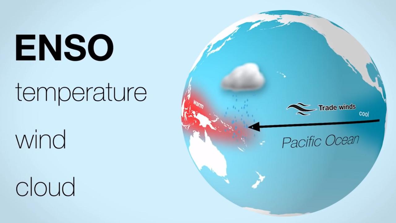
La Nina and its counterpart El Nino are two ends of what’s known as the El Nino Southern Oscillation, or ENSO.
ENSO can mean the difference between devastating droughts and bushfires and much needed rains and far less welcome cyclones and floods.
Rainfall over eastern Australia can be around 20 per cent higher than usual from December to March when La Nina is in play.
La Ninas crank up the rain
The climate driver is a measure of sea surface temperatures and winds in the Pacific Ocean that impacts not just us, but also the Asia Pacific and the Americas as well.
During a La Nina event, trade winds ramp up dragging cooler waters from the depths of the ocean to the surface in the central and eastern equatorial Pacific.
These winds, travelling from east to west, in turn push warmer seas closer to Australia. That helps in cloud formation which brings more rainfall. La Ninas often coincide with more tropical cyclones.
But with all that rainfall concentrated on Australia somewhere has to miss out and it’s usually the southern US. A La Nina year could mean even more bushfires for California.
An El Nino can do the opposite. It can see the east to west winds weaken, or even reverse, which means those warmer waters drift further from Australia leading to drier conditions here, but wetter in the Americas.
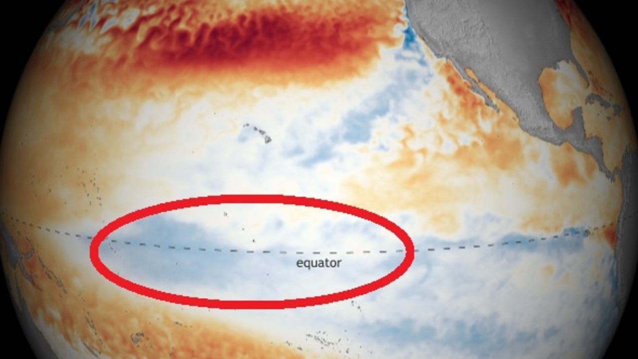
What ENSO stage is currently occurring is based on the sea surface temperatures in a relatively small patch of the central Pacific Ocean either side of the equator and south of Hawaii, called “Nino 3.4”.
When sea surface temperatures at Nino 3.4 are more than 0.8C below average, La Nina is officially declared. Another factor is the Southern Oscillation Index, a measure of air pressure between Tahiti and Darwin, which is also signalling a La Nina.
Back to back La Nina’s greater risk
“La Nina should ensure a flood risk continues through summer and it would be no surprise to see a repeat of the Hawkesbury-Nepean floods from March,” said Sky Weather’s Mr Saunders.
“Indeed the current La Nina follows an event last summer which culminated in record flooding along parts of the eastern seaboard in March,” said Mr Saunders.
It was also significant that this La Nina was arriving so soon after its previous visit, said Mr Saunders.
“The last time back to back La Nina’s were declared, around a decade ago, Australia recorded its wettest 24 months on record, including major Brisbane floods and Severe Tropical Cyclone Yasi.”

On the other side of the continent, the Indian Ocean Diploe – a similar climate driver to ENSO – is heading towards a neutral phase which also brings more rain to much of the continent.


La Ninas have a definite silver lining though – they generally bring a reduced chance of bushfires. That’s not across the board, there may be areas that are drier than others and bushfires don’t need a lot to get going.
But more moisture in the air and increased rainfall are not ideal conditions for severe, prolonged blazes.
Even during La Ninas there can be heatwaves and spells of dry conditions, but all the signs are that there will be more rain, more floods and cooler temperatures to come this summer.

Snow predicted in surprising state
Residents of a state renowned for its beautiful beaches and tropical climate have been warned to prepare for potential snow this weekend.

200 species dead in ‘unprecedented’ disaster
Scientists have offered a grim outlook for Aussies hoping for an immediate solution to an ‘unprecedented’ disaster leaving the water at Aussie beaches toxic.

City soaked in ‘wettest day of year’
One Australian city has just experienced its wettest day of the year thanks to a wild and wet cold front that is still lingering in the state.