
Icy cold front to chill cities with coldest temperatures in decades
PARTS of Australia are being warned to prepare for the coldest day in decades as a front brings freezing conditions.
SYDNEY is set to be hit with two icy winter blasts as a chilly Melbourne braces for a month’s worth of rain in three days.
The first polar blast will send a chill over the NSW capital by Friday afternoon, with a second trough from the low pressure system moving through on Sunday when icy winds are forecast to strengthen to 90km/h.
Sydneysiders can expected a frosty Friday with forecasts predicting the coolest day since November 2017. Temperatures are currently about five degrees above the averages for May, sitting at 25C.
While Sydney will be spared heavy rain during the chill, Melbourne is facing a month’s worth in three days — the wettest period so far this year.
Today and tomorrow’s expected 13C maximum for Melbourne will also be the coldest two days this early in autumn since 1978.
The heaviest of the rain is predicted for tomorrow when at least 20mm is expected to fall on the state.
The Bureau of Meteorology has issued a severe weather warning for large parts of Victoria, including for Melbourne, which is bracing for heavy rainfall.
Usually warm Queensland will also feel the cold when temperatures in Brisbane drop by about 7C this weekend.
A Severe Weather Warning has been issued for parts of #Victoria including #Melbourne: https://t.co/JrHe5r6hFC Heavy rainfall and damaging winds are possible later today and Friday. Please check warning text for your particular location. pic.twitter.com/VVDmXRyjG2
— Bureau of Meteorology, Victoria (@BOM_Vic) May 10, 2018
The shock change comes after warmer temperatures across many capitals during April, with Sydney experiencing the hottest day on record for the month and what felt like an endless summer.
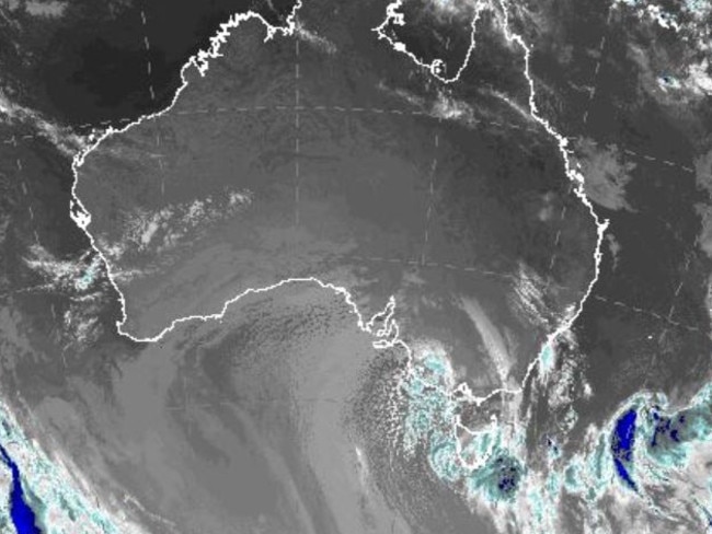
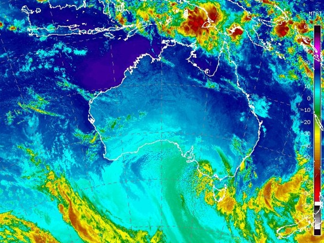
A stray low pressure system with a polar air mass behind it moving north from the Southern Ocean is responsible for the cold front, bringing rain, chilly air, thunderstorms, small hail and even snow.
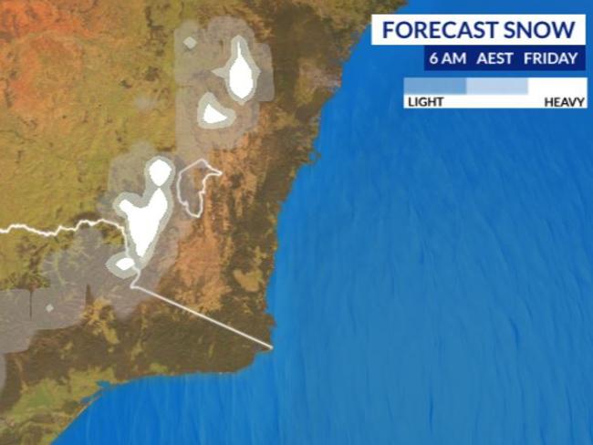
Between 20-40cm of natural snow is predicted for the alpine region until Sunday.
Snow is also expected to fall in central and western Victoria and over the Central Tablelands in New South Wales on Friday.
Canberra is due to cop its coldest day in almost two decades.
Sky News Weather chief meteorologist Tom Saunders told news.com.au Canberra would hit a high of 9C tomorrow which is the coldest May day in 18 years.
“For this early in the year it would be the coldest day in 48 years,” he said.
Queensland will largely be spared the icy blast with a warmer maximum of 23C and only a slight drop in temperatures.
Certain parts of regional Queensland will still feel the cold when temperatures in areas such as Townsville plummet to 15C.
Brisbane is expected to be hit with the lowest temperature for this time of year since 2015, a shock from the 29C maximum felt today.
Area such as the Gold Coast will get down to single digits with a low of 6C predicated.
What a difference a day can make! Patchy sunshine today in #Melbourne with a mild top of 19°C. Tomorrow showers, possible hail and thunder, and a chilly max of 13°C - the coldest day since last September! #ColdSnap #Melbweather #Vicweather https://t.co/Wa2EsgYKRr pic.twitter.com/epIImRzxSN
— Bureau of Meteorology, Victoria (@BOM_Vic) May 9, 2018
Mr Saunders said the entire southeast of Australia was currently being affected by a cold polar air mass which was moving through western Victoria.
“The cold air is causing temperatures to drop sharply, and is also leading to showers, hail and storms over much of southeast Australia,” he said.
The biting weather is due to hit NSW within the next 24 hours with the nation’s capital set to bear the worst of it.
The NSW inland town of Mudgee and the Victorian city of Ballarat are also set to shiver through chilly temperatures, the coldest in some years.
“Mudgee will hit 10C on Friday, the coldest this early in the year for 24 years,” Mr Saunders said.
Ballarat will reach a high of just 8C today making it the coldest May day in 18 years.
Mr Saunders said the polar air is causing a low pressure system to deepen near Tasmania.
“This low pressure system will bring severe weather over the next few days,” he said.
“Warnings are already current for southeast South Australia and eastern Tasmania for damaging winds.
“Warnings will most likely follow over parts of VIC and NSW later today or tomorrow.”
Mr Saunders said heavy rain could also lead to flooding over eastern Tasmania and eastern Victoria today.
The chilly blast will continue into the weekend where conditions will gradually ease.
Here’s how the temperatures are looking across the capitals for the next few days.
Today 26C, Friday 18C, Saturday 18C with showers, Sunday 20C with showers.
Today 16C, Friday 9C with showers, Saturday 12C, Sunday 12C.
Today 13C, Friday 13C with showers, Saturday 15C with showers, Sunday 16C with showers.
Today 16C with showers, Friday 18C with showers, Saturday 19C, Sunday 20C.
Today 14C with showers, Friday 15C with heavy rain, Saturday 15C with heavy rain, Sunday 14C.
Today 28C, Friday 26C, Saturday 22C, Sunday 23C.
Today 27C, Friday 30C, Saturday 29C, Sunday 25C.
Today 35C, Friday 34C, Saturday 32C, Sunday 31C.

Veteran firefighter dies in bushfire horror

Urgent warning as heatwave smashes nation
