Polar air system to chill Australia’s east coast, bringing heavy rains, strong winds and snow
ENJOY the last moments of warm weather and get the heater ready. Snow, heavy rain and winds are set to smash parts of the southeast.
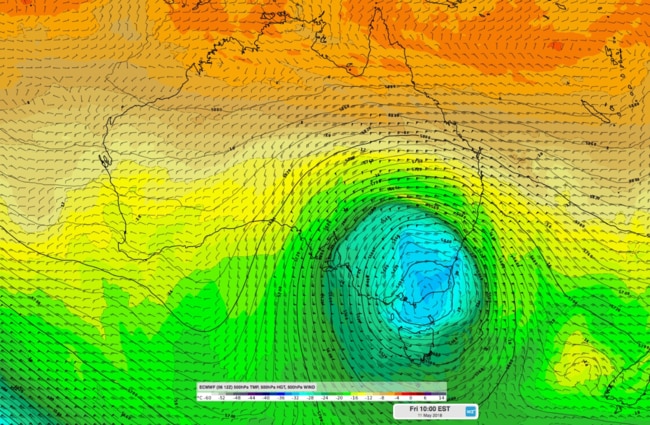
ICY Antarctic air about to blast the east coast of Australia will bring with it a month’s worth of rain, temperatures as low as 1C and even snow in regional towns.
A dumping of up to 80mm of rain is set to hit Melbourne by the end of the week, with forecasters predicating Victorians could see a month of rain in just three days.
Parts of New South Wales will see the mercury drop to 1C and there is a chance of snow near Bathurst in the Central Tablelands.
Temperatures are set to plunge by 10C across much of the country’s southeast but the biting wind factor will make things feel even cooler in some areas.
The shock change comes after warmer temperatures across many capitals in recent days, with Sydney experiencing the hottest April day on record last month and what felt like an endless summer.
The Bureau of Meteorology warned that by Friday the temperature will struggle to hit 17C in the city.
Canberra is set to shiver through one of its coldest days in the first half of May in almost 50 years on Friday with a high expected of just 9C.
For footy fans, Friday night’s MCG clash between Hawthorn and Sydney is set to be hit with heavy rain and high winds.
Southeastern Australia is in for a cold snap later this week, with the potential for heavy rain from Thursday/Friday. Here are three scenarios (different models) for where that rain could fall. Check https://t.co/4W35o8i7wJ regularly for updated forecasts and warnings. pic.twitter.com/llFou32UOF
— Bureau of Meteorology, Australia (@BOM_au) May 8, 2018
But in some good news to come from the chill, water temperatures around Sydney are almost a full degree warmer than usual, with the May average at 21.6C.
Sky News Weather chief meteorologist Tom Saunders said a cold front with a cold polar air mass behind it was moving north towards southeast Australia.
Mr Saunders said heavy rain, snow and damaging winds were all on the cards.
“The front will hit the southern coastline on Wednesday night but will not initially cause severe weather,” he said.
“The polar air mass will then cause a low pressure system to form near Bass Strait on Thursday which will deepen into Friday and bring the risk of severe weather until Sunday across large parts of southeast Australia.”
Mr Saunders said this could bring heavy rain and flooding over eastern Tasmania and southern Victoria.
“Hobart may even receive well over 50mm,” he said.
“Widespread showers along with isolated thunderstorms with hail will spread across northern Victoria, southern and central NSW and South Australia but areas north of the Victorian Great Dividing Range should not see significant flooding.”
Mr Saunders said gales with damaging gusts were forecast for Tasmania, Victoria and southern NSW throughout Friday and Saturday.
Australia's first widespread snowfall of 2018 will occur later this week as temperatures plummet across the southeast: https://t.co/tDyBzc65D1 pic.twitter.com/Di37bFyyXC
— Weatherzone (@weatherzone) May 8, 2018

“Canberra is forecast to drop from a maximum of 21C on Wednesday to just 9C on Friday,” Mr Saunders said.
“A maximum of 9C would be the coldest May day in 18 years for Canberra. For the first half of May it would be the coldest May day since 1970.”
The city is expecting an overnight temperature of just 1C on Friday and 0C on Saturday.
Snow is also forecast for much of the Australian Alps from Thursday.
“Heavy snow will fall across the Alps from Thursday to Sunday — possibly over 50cm,” Mr Saunders said.
“We may even see over 10cm across the Oberon Plateau in central NSW.”
Mr Saunders said conditions were forecast to only gradually ease through next week.
Queensland is also set to shiver through some pretty cold temperatures.
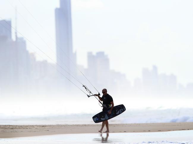
Brisbane will hit an average minimum of 9C at the weekend and temperatures at Ipswich will fall to just 5C on Saturday night.
The Gold Coast is also looking cold with a low of 6C forecast for Nerang.
Brisbane will shiver through lows of just 9C across the weekend and into Monday.
Victorians are set to freeze.
Temperatures are tipped to drop to 13C on Wednesday and Thursday with a low of just 6C on Friday morning.
South Australians won’t be much warmer.
Adelaide will dip to a low of 9C on Friday with overnight temperatures not getting much above double digits across the weekend.
Tasmania is also in for a further icy blast with the cold front already being felt with winds of 109km/hr recorded overnight in Hobart.
Overnight temperatures will hit 7C and 8C on Thursday and Friday in Hobart.
Cold front now over NE #Tassie, with winds easing behind front, so Severe Weather Warning now contracted to the Furneaux Islands. Max was 157km/h at Maatsuyker Island, with 109km/h in Hobart. pic.twitter.com/0vA7D71zYd
— Bureau of Meteorology, Tasmania (@BOM_Tas) May 7, 2018
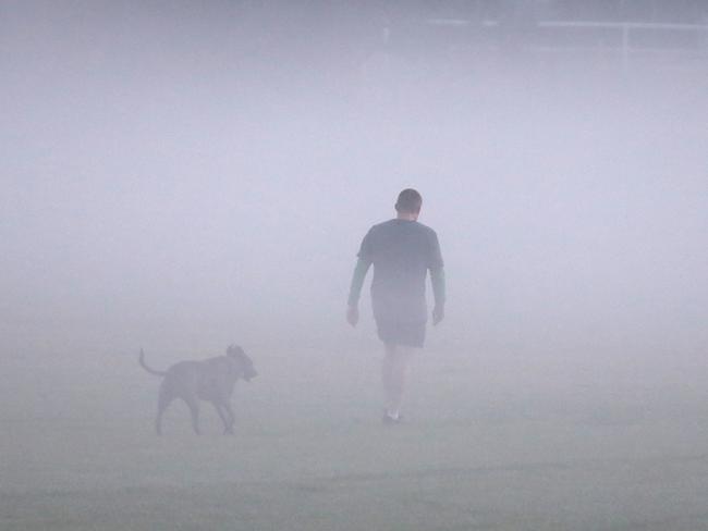
Here’s how the temperatures are looking across the capitals for the next few days.
Today 25C, Thursday, 26C, Friday 18C, Saturday 18C with showers, Sunday 20C with showers.
Today 21C, Thursday 16C, Friday 9C with showers, Saturday 12C, Sunday 12C.
Today18C, Thursday 13C, Friday 13C with showers, Saturday 15C with showers, Sunday 16C with showers.
Today 20C with showers, Thursday 16C with showers, Friday 18C with showers, Saturday 19C, Sunday 20C.
Today 18C with showers, Thursday 14C with showers, Friday 15C with heavy rain, Saturday 15C with heavy rain, Sunday 14C.
Today 28C, Thursday 28C, Friday 26C, Saturday 22C, Sunday 23C.
