
‘Extremely cold’: Rain, snow forecast in outback
Temperatures in parts of the desert are set to plunge to near-freezing as a rain band triggers flood watches over swathes of the Red Centre.


Temperatures in parts of the desert are set to plunge to near-freezing as huge rainfall triggers flood watches over swathes of the Red Centre.
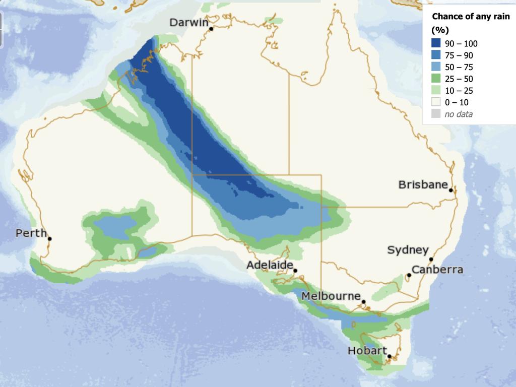
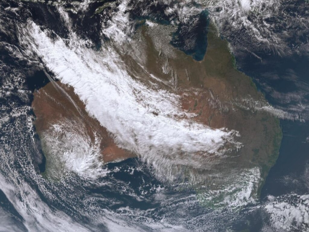
The Bureau of Meteorology warned over the weekend that a mammoth rain band was set to engulf Australia, touching every state.
The 3000-kilometre rain band formed on Monday, stretching from the Pilbara and Kimberly, across the outback and to the eastern seaboard.
Uluru is currently clocking the most rain, having received 30.6 millimetres in just 12 hours on Monday — about 10 per cent of its yearly average.
BOM senior forecaster Billy Lynch says the rain event is likely to come in “two pulses” in the typically dry southwest NT.
“The first one is (Monday) and (then) Tuesday,” Mr Lynch told the ABC.
“We can expect widespread rainfall of as much as 50 millimetres or more, which is going to bring the risk of flooding.
“It’s quite a prolonged event … For the month of June, the region would typically receive 5 to 20 millimetres. So, to be predicting 50 to 100 millimetres is well in excess of average.”
Temperatures are also expected to be “extremely cold” underneath the rain, Mr Lynch said.
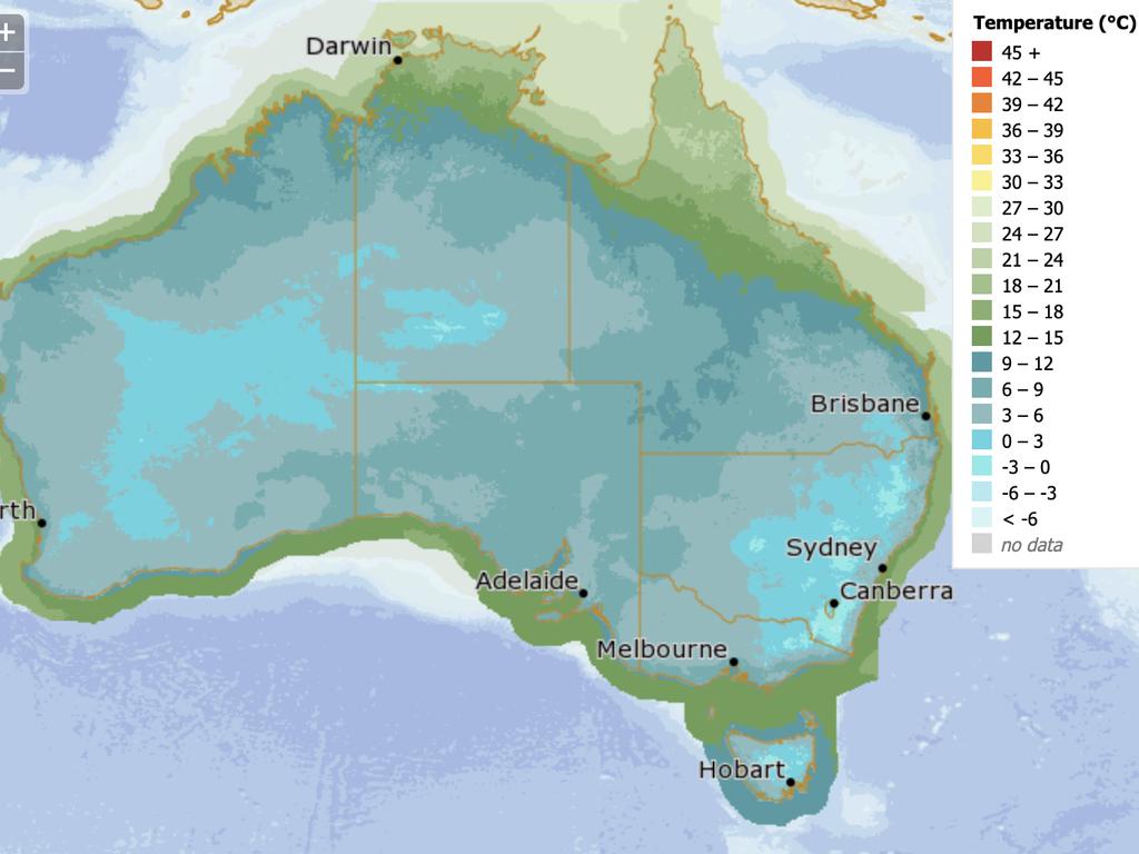
Rain is forecast every day in Alice Springs until the end of the week, with the mercury dropping extraordinarily low. On Saturday and Sunday, temperatures are slated to dip as low as 1C in the outback town, rising to just 10 and 12C respectively. Gusty winds of between 15 and 30km/hr are also forecast most days this week.
The situation in similar in Yulara, near Uluru, where single-digit minimum temperatures are forecast every day this week. Possible heavy falls are expected on Tuesday, making for an incredible opportunity to watch waterfalls tumble down Uluru.
Snow is even expected on some of the desert’s highest peaks.
“(Different weather models) need to be treated cautiously, but it is indicating that on Friday and Saturday there is a significant cold pool moving across Central Australia,” Mr Lynch said.
“So, as strange as it sounds, I’m not willing to rule out the chance of snow on some of those very high peaks.”
After a sunny weekend, rain is on the way for many states. 🌧ï¸
— Bureau of Meteorology, Australia (@BOM_au) June 24, 2023
A long rain band will stretch across the country from northern #WA to #NSW through the first half of next week.
Extensive Flood Watches have been issued around central Australia.
Latest: https://t.co/2kQZJWVOpgpic.twitter.com/KviWJxO3lf
A flood watch has been issued for southern and western parts of the NT on account of the record-breaking rain.
“Widespread daily rainfall totals of 10-30 millimetres are likely for parts of the flood watch area from (Monday) until Saturday, increasing to 20-50 millimetres across the southwest on Tuesday, with isolated heavier falls,” the BOM said in its warning.
“Event rainfall totals from (Monday) to Saturday could reach 50-100 mm, exceeding the June average of 5-20 mm.”
The catchments that are likely to be affected include: Tanami Desert, Barkly (Southern), Central Desert, Western Desert, MacDonnell Ranges, Finke River and Stephenson Creek, Warburton District Rivers, Eastern Great Victoria Desert, Simpson Desert and Sturt Creek District
NT Emergency Service urged people to stay away from flooded drains, rivers, streams and waterways, to prepare for flooding and move away while it is safe to do so, and not to drive into floodwaters.
In the capital cities, a smattering of rain is expected in Sydney on Wednesday and Thursday as well as through the weekend. Minimum temperatures are forecast to sit between 6 and 10C, warming up to between 16 and 19C.
Rain rolled into Melbourne on Monday and continues to be forecast for the rest of the week. Minimum temperatures are expected to sit at between 7 and 9C, warming up to between 13 and 15C.
The rain is expected migrate to Hobart from Tuesday and stick around for the rest of the week. Showers are forecast every day, with minimum temperatures of as low as 4C.
Rain is also on the cards for Adelaide, with showers forecast every day. Minimum temperatures are expected to hover between 8 and 9C, with maximum temperatures of up to 15C.
Canberra is expected to escape most of the downpour, with a sunny forecast most days save Wednesday. Temperatures, though, are expected to plunge as low as 0C on Friday and Sunday. Morning frost is expected from Friday, with minimum temperatures not set to break 3C all week long.

Showers cleared on Monday in Perth, making way for a sunny forecast for the rest of the week. Mornings in the city will stay crisp, with minimum temperatures forecast between 3 and 7C, warming up to the mid-to-high teens.
Brisbane, too, will stay dry with sun or light cloud cover forecast each day. Maximum temperatures are expected to reach between 21 and 24C, with minimums of between 8 and 15C.
Darwin is set to be warm with a few clouds in the sky and minimum temperatures of between 18 and 23C. The maximum temperature is forecast to reach between 29 and 32C each day.
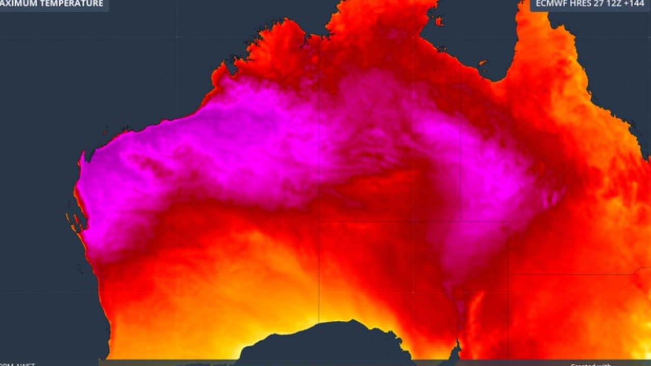
Scorching heatwave to smash Aussie region
The bureau of meteorology warns a heatwave will hit vast stretches of Australia over the weekend, including a key mining district.
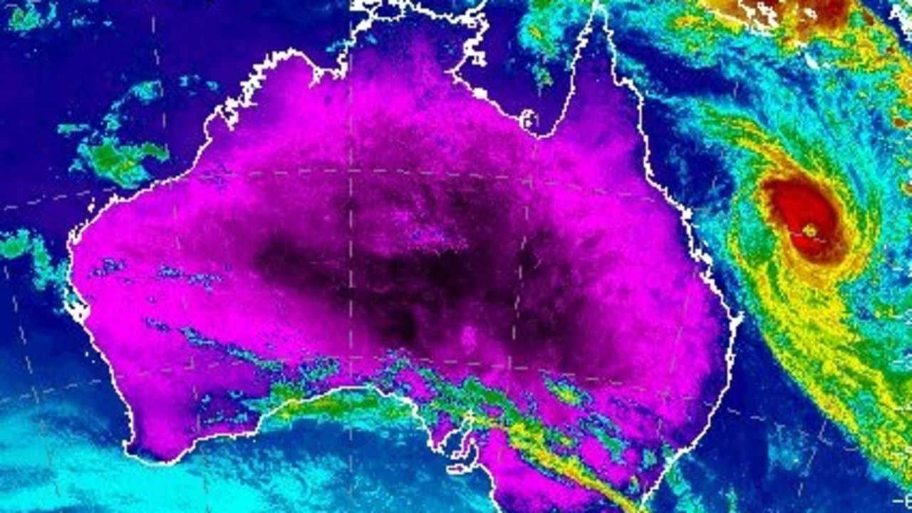
Hidden detail as mega cyclone misses Aus
Queenslanders are being urged to steer clear of the coast this weekend as Severe Tropical Cyclone Alfred brings powerful waves.
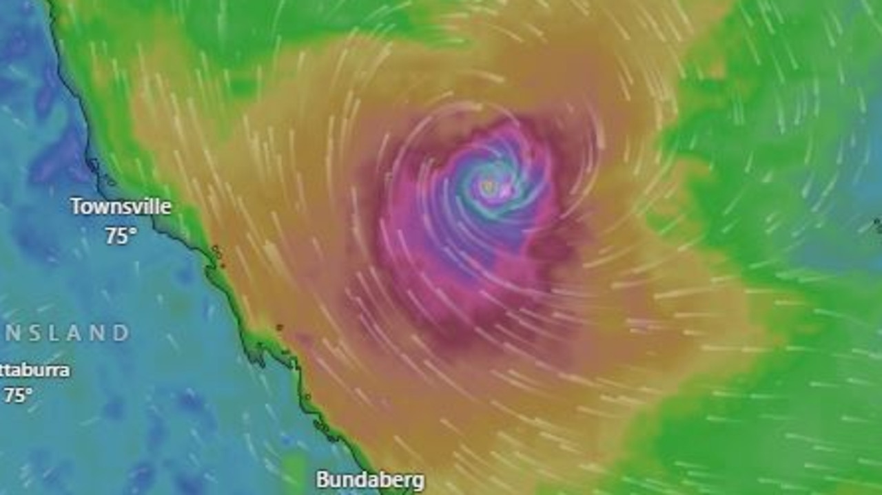
New details of looming cyclone’s path
Tropical Cyclone Alfred has intensified again with huge wind gusts of up to 220km/h, as new modelling reveals more about its expected path.