
Eastern states to be lashed by two massive rain events
Thousands of people have flocked to beaches as two massive rain events threaten to cause havoc in one region.

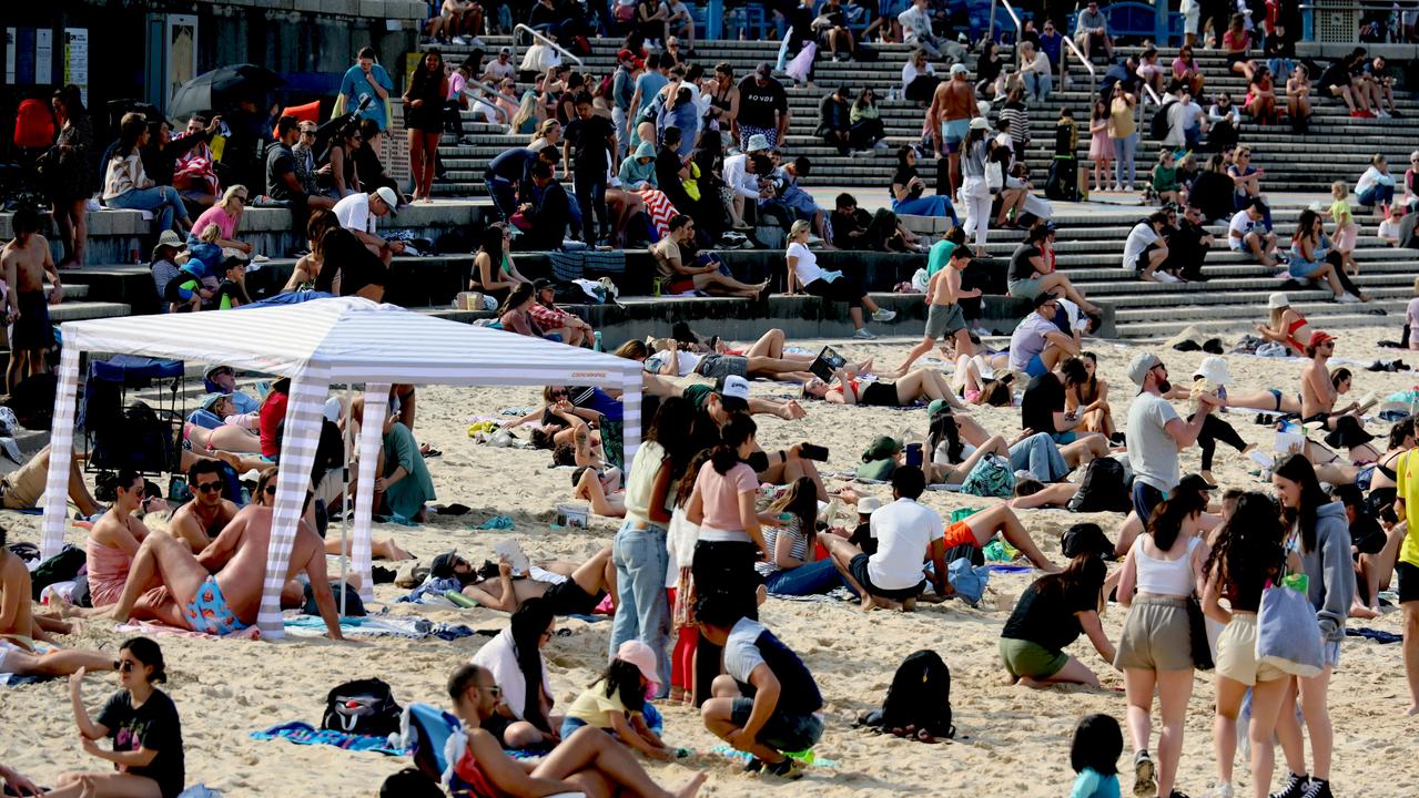
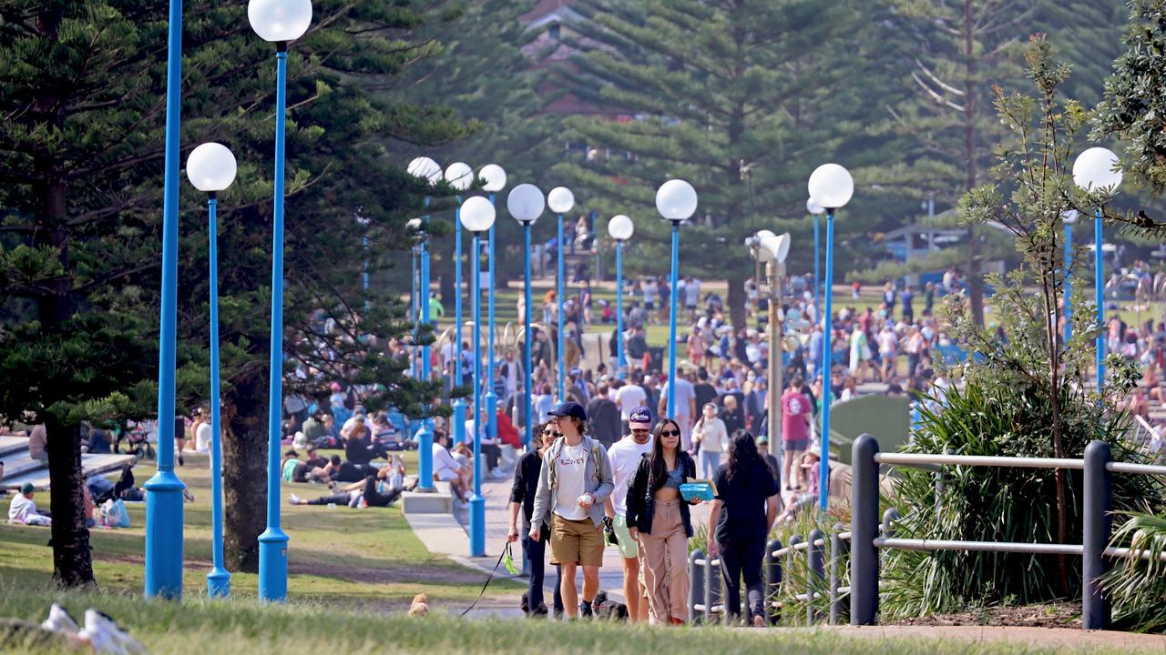
Sydneysiders have swarmed to the city’s beaches this long weekend, making the most of the fine weather before a huge drenching is set to force people inside later this week.
The sunny weather brought hundreds of people to Coogee, in Sydney’s east, where it was hard to find a free spot on the sand.

However, the sun is not expected to stay around for long, with two massive rain bands forecast to cover the country this week.
Residents in outback NSW have been warned to brace for more potential major flooding.
The fine weather is expected to stick around for the east coast until Wednesday when NSW, Queensland and Victoria will get a drenching.
Heavy rainfall will move across Australia over the next week caused by two significant weather systems dragging moisture from the Indian Ocean.
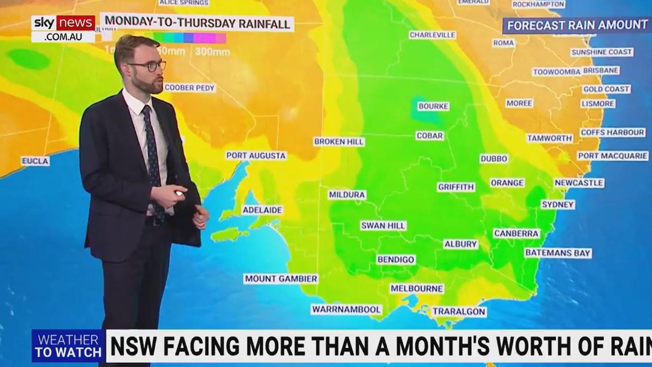
Widespread parts of northern Victoria, much of NSW and outback Queensland can expect between 50mm and 100mm of rainfall over the next eight days.
Communities exposed to riverine regions are warned to brace for major flooding events.
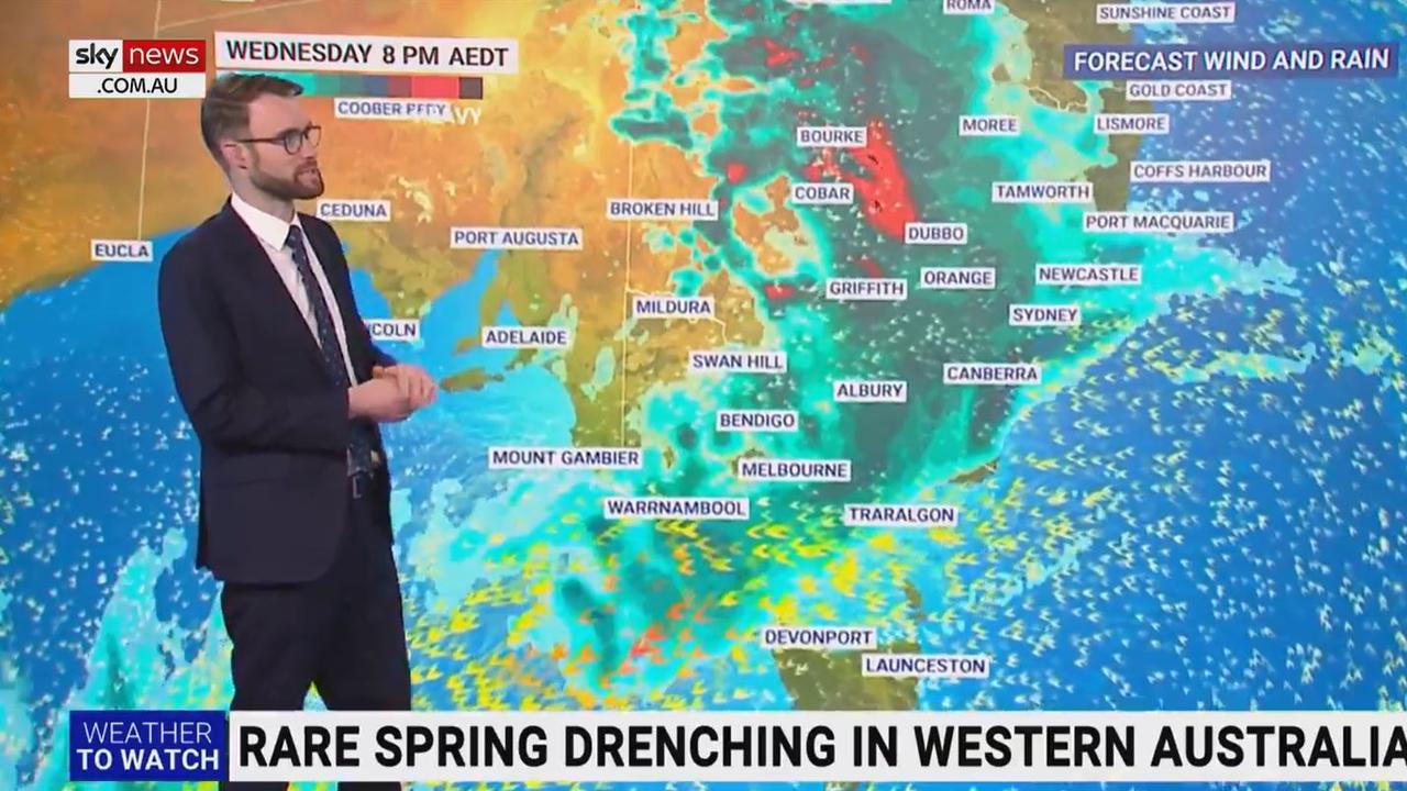
Sky News meteorologist Rob Sharpe said rain and storms were moving through the middle of the country, with heavy falls expected to hit outback NSW and Queensland by Wednesday.
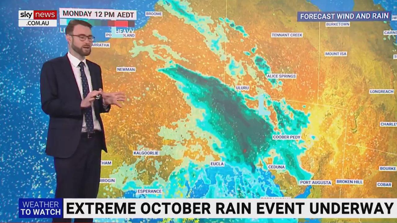
The weather system will weaken as it meets the coastline and stall over the eastern states before combining with a second weather system by next weekend.
“Over the next four days, we are talking about some pretty big falls, especially for the inland regions,” Mr Sharpe said.
The NSW south coast can expect between 25mm and 50mm.
Bourke in regional NSW could break its record for average daily rainfall in October, with more than 50mm of rain forecast to fall on Wednesday.
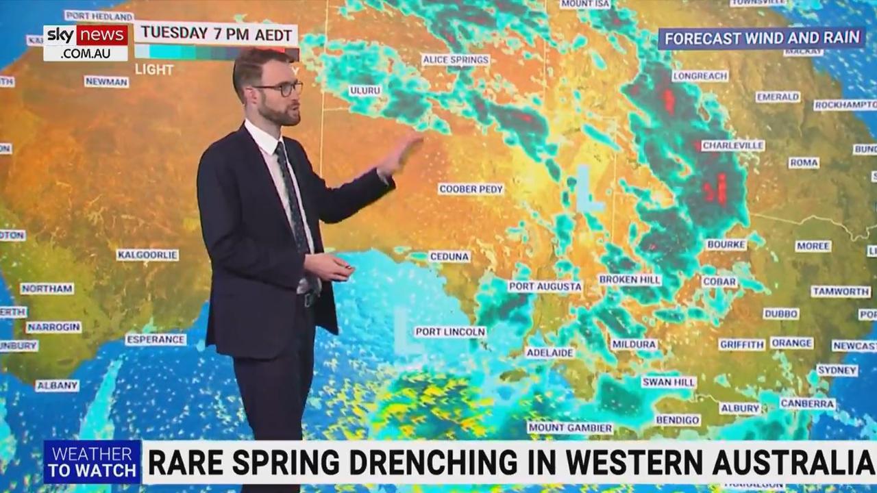
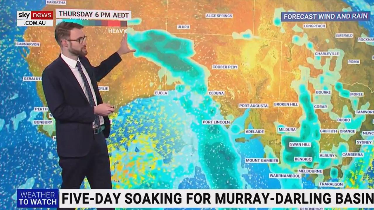
A second rainfall event will likely collide with the first by Thursday, bringing unseasonal rainfall to the outback regions.
“The next event will link up with that moisture that‘s already sitting there, producing a band of rain and storms on Friday across NSW,” Mr Sharpe said.
“Due to the strong nature of that upper level disturbance, we are going to see heavy rain and probably a low pressure system charging down and across NSW.”
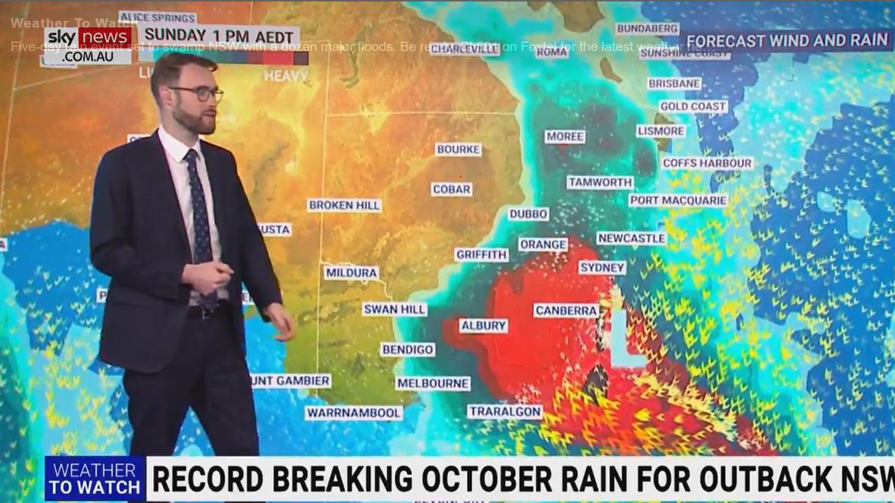
The second burst of rainfall is likely to be much stronger and bring heavy rainfall from Friday to Monday in central NSW, where 50-100mm is possible.
“There is of course uncertainty over exactly where this event will unfold,” Mr Sharpe said.
“But regardless there is a lot of rain in the forecast.
“Unfortunately, it could flood many homes over the coming weeks and months.”
Even Tasmania will be affected, with rain to drench the island state by Thursday.
The Kimberley region, southern inland Queensland and inland NSW are tipped to receive the biggest drenching on Wednesday night, with rainfall totals possibly in excess of 100mm.
Here’s how the weather is looking in your state.
NSW
The rain has largely stayed away for the last day of the October long weekend in Sydney.
It will be the last two days of sun before a rain band arrives on Wednesday bringing significant rainfall all the way to next week.
The worst will hit on Saturday and Sunday with a combined possible rainfall of up to 60mm in two days.
Victoria
Cloudy conditions will stick around until Tuesday in Melbourne before the rain settles in on Wednesday.
Rain will fall for the rest of the week, with the biggest downpour forecast for Friday when thunderstorms and up to 20mm of rain can be expected.
Queensland
Brisbane will have mostly sunny skies until Tuesday.
Showers will arrive on Wednesday in time with other states as the first of two rain bands hits.
Rain will continue in the capital for the rest of the week but is not expected to be heavy.
WA
Perth residents can look forward to a high of 26C on Tuesday and blue skies throughout the course of the day.
Showers will return on Wednesday but will ease for the rest of the week, with mostly sunshine until the weekend.
SA
A high chance of rains and thunderstorms is likely on Tuesday, with up to 20mm of rain forecast in Adelaide.
Conditions will ease but showers will persist through the weekend.
Tasmania
Grey skies and a chance of showers are the outlook in Hobart for most of the coming week.
Showers though persistent are unlikely to bring heavy rainfall, with averages unlikely to exceed 6mm a day.
ACT
The nation’s capital will be mostly cloudy for the start of the week.
As the rain band arrives on Wednesday, wet weather will persist for the rest of the week, with significant rainfall averages forecast.
The worst will arrive on Sunday when up to 25mm is expected to hit the Territory.
NT
The wet season is well and truly under way in Darwin, with thunderstorms likely through to the weekend.
A daily average of between 10mm and 15mm is expected to fall from Friday through to Sunday.
Read related topics:Weather
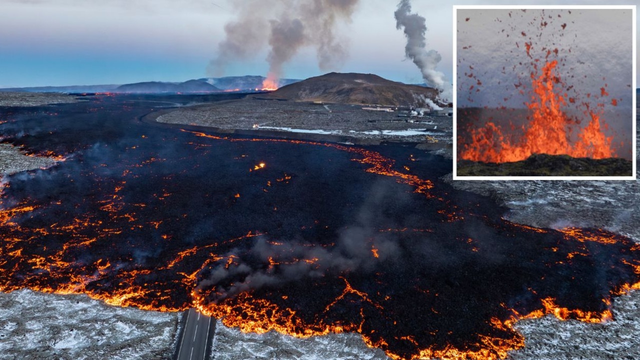
Tourist town evacuated as volcano erupts
A volcano has erupted in Iceland, sending orange flames and smoke in the air and triggering the evacuation of a popular tourist attraction.
Read more

‘300,000 deaths’: Japan’s horrific prediction
One of the world’s most populous nations has warned 300,000 of its residents could die in an ominous new prediction.
Read more
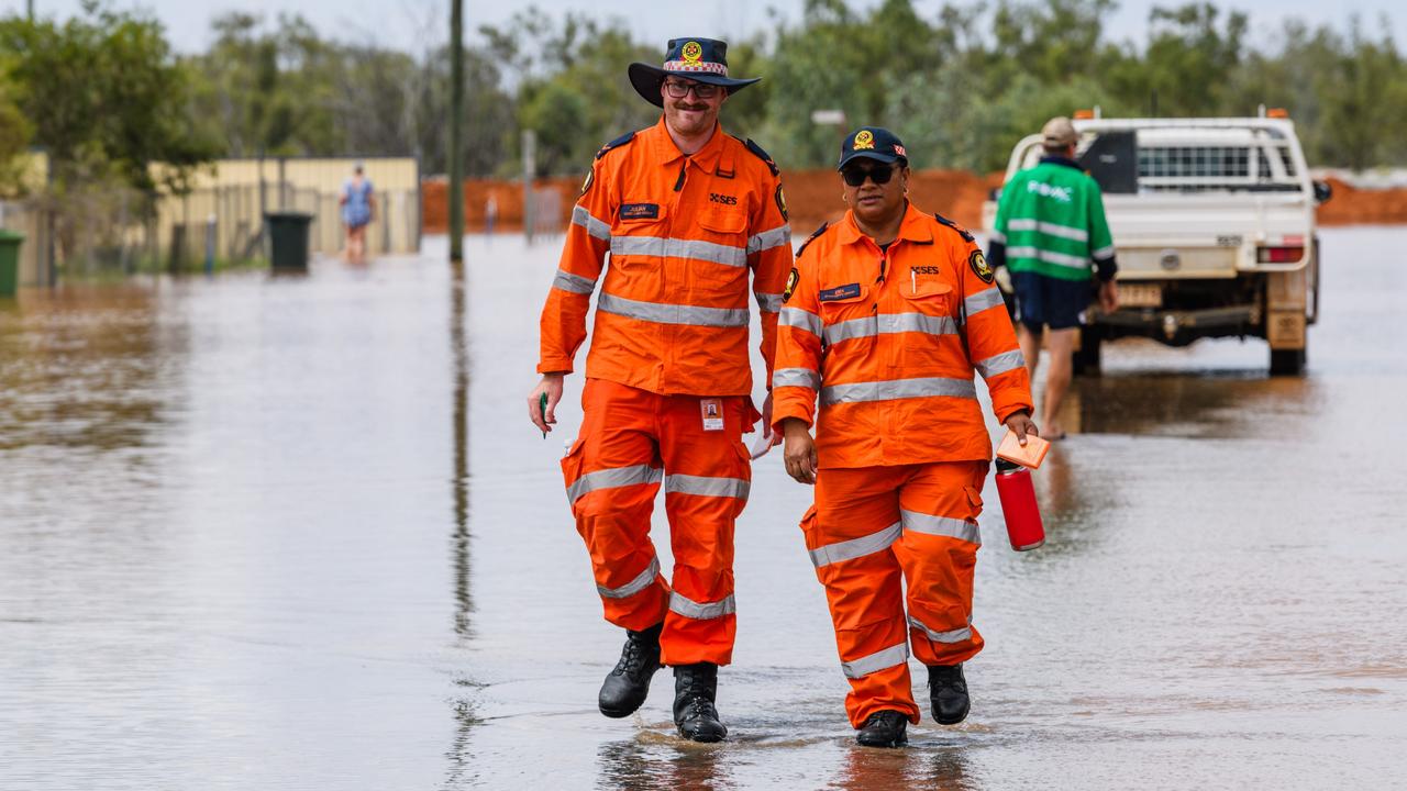
‘Copped it’: Flooded residents sleep in cars
Already isolated outback residents who are sleeping in their cars can expect more rain and flooding in the coming days.
Read more