
‘Copped it’: More rain to drench flooded western and central Queensland
Already isolated outback residents who are sleeping in their cars can expect more rain and flooding in the coming days.

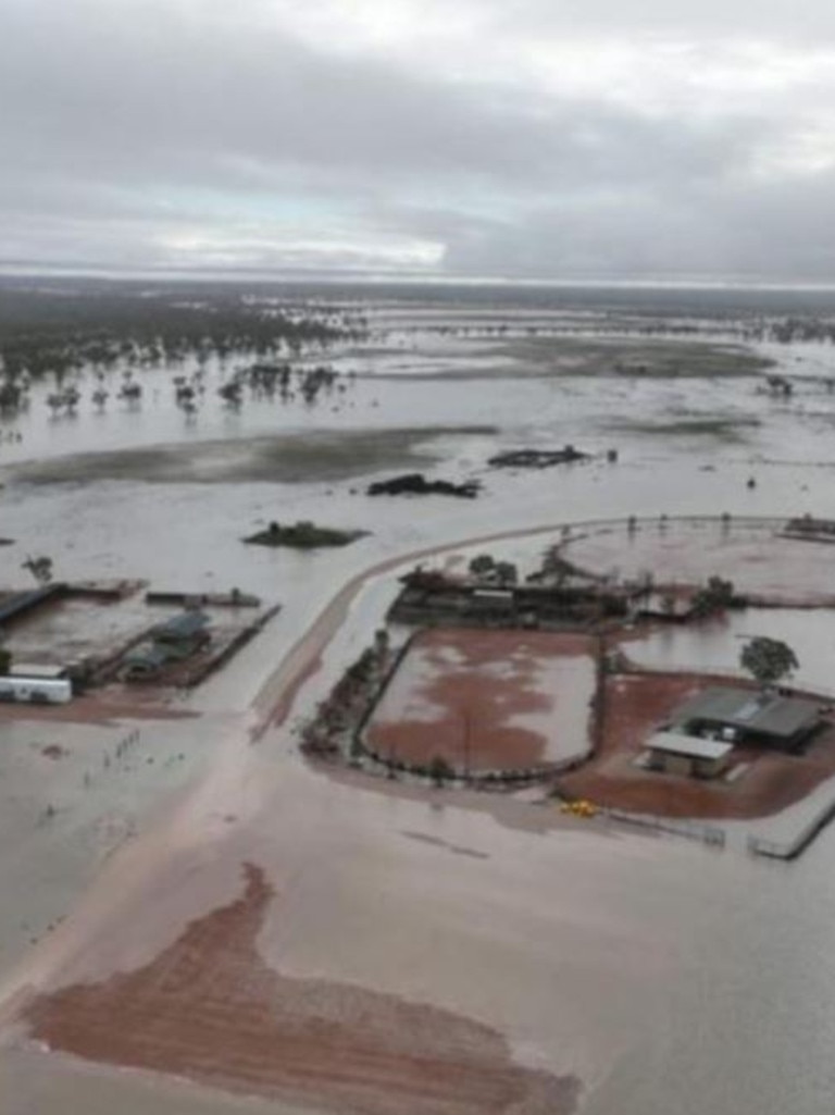
Flooded outback towns are bracing for more rain Tuesday as overwhelmed rivers and catchments kill tens of thousands of farm animals.
The 200 residents of Thargomindah slept in their cars at the town’s airstrip on Monday night.
Ex-Tropical Cyclone Dianne will likely dump another 50 to 100mm of rain on flooded areas in central and western Queensland on Tuesday and over the next few days as rains extend over the border into NSW as well.
The Bureau of Meteorology says already flooded rivers in towns and districts across a 700km stretch from Stonehenge all the way south to Thargomindah are likely to receive even more rain.
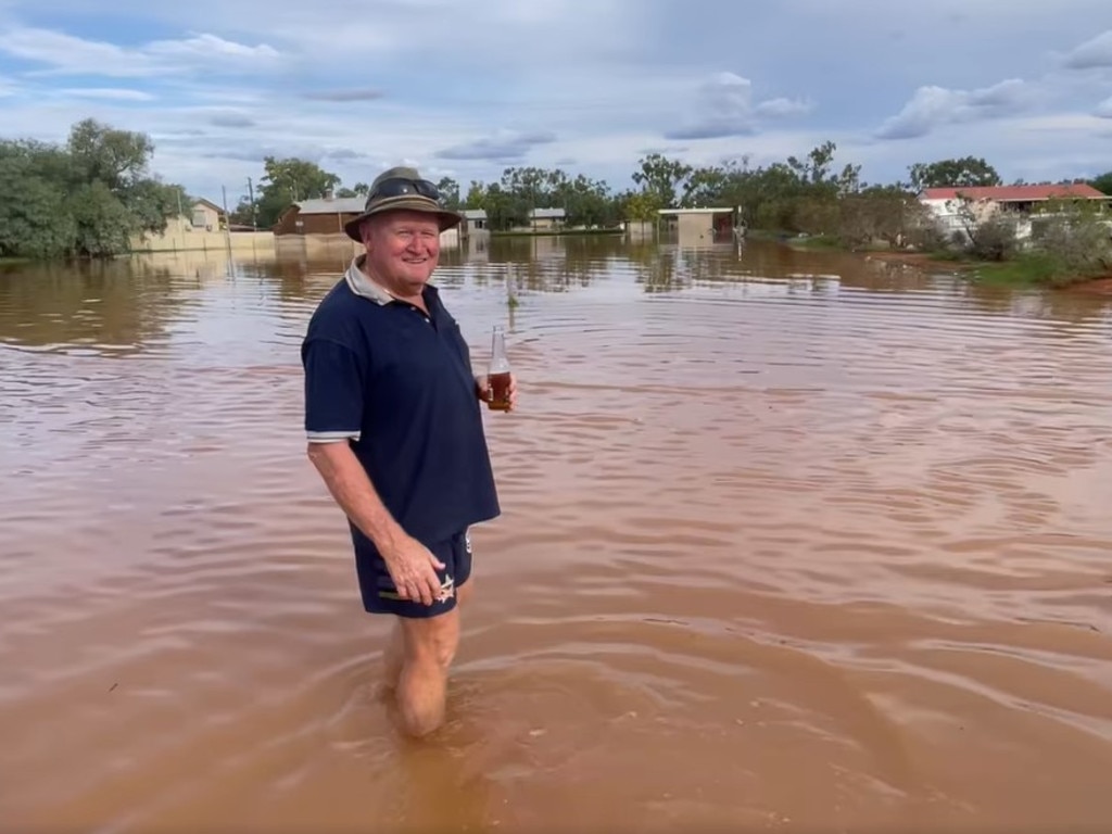
Alex Edwards farms between Quilpie and Thargomindah, 900km west of Brisbane. The land around his house is at a high point, and he told the Today show that his property had dodged the worst of the flooding.
“North of us in Adavale, and also in the south of us at Thargomindah, they’ve copped it, with all the tributaries and everything being so full.
“It’s receding, but we’ve woken up to rain this morning, so we’ve got to hold our fingers (crossed) together. Hopefully, it’s not going to get back to the heights again.
“I live right on the Bulloo River, my backyard is on the bank. The waters, there’s a house there right at the point (the water) that’s just rising,” he told Channel 9 on Tuesday morning.

“That’s just starting to rise. It just takes a long time for it to go away, but it is receding. I just feel sorry for those people up the river. There’s been some devastation and what I’ve seen, there’s fences, there’s dams, there’s people’s livelihoods just been washed down in a matter of days.”
The flooded area is estimated to be twice the size of Victoria. Most farmers have not been able to survey the damage, but tens of thousands of animals have likely been lost, plus all the damage to houses, fences and buildings.
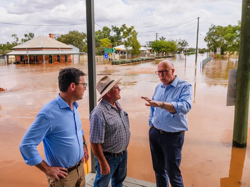
Peter Dutton flew in to Thargomindah on Monday and promised a $10m weather radar if he is elected. The town’s residents say upgraded forecasting equipment would have given them more time to prepare.
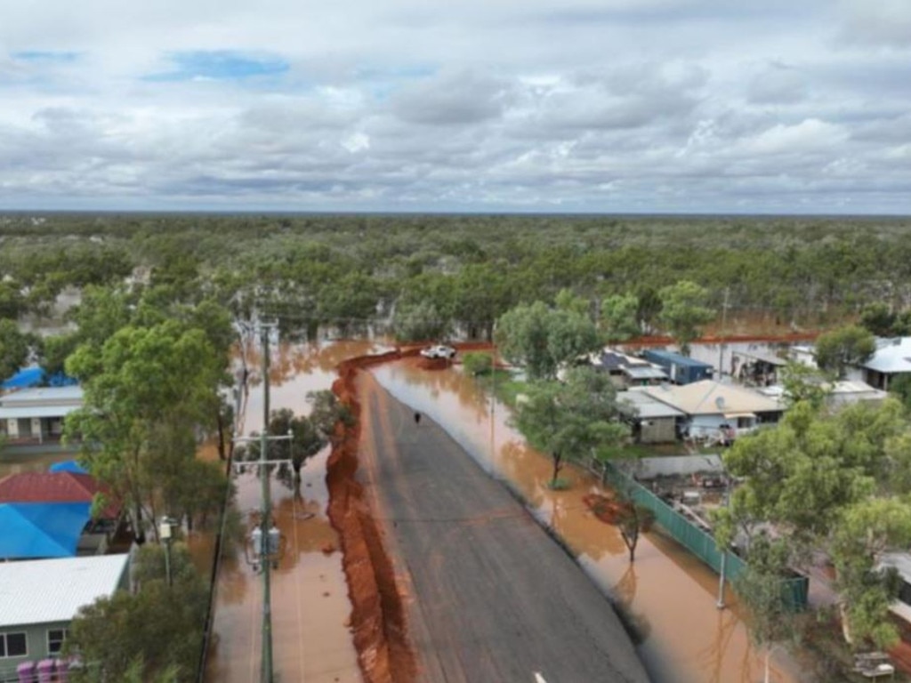
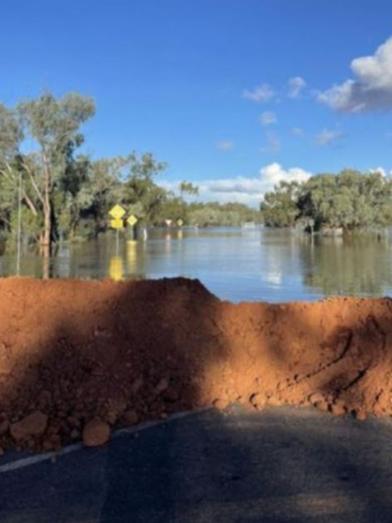
A temporary levee built around Thargomindah burst last week, and the town will be cut off for the next three to four weeks.
Speaking on Tuesday, federal Emergency Management Minister Jenny McAllister said Labor would match the radar promise. Before the wet season, three Defence heavy-lift helicopters were deployed to Queensland – two based at Charleville, Senator McAllister said.
The Queensland government had requested an extra aircraft to help with this flooding, and the federal government had deployed a Defence plane to southwest Queensland too, she said.
“They’ve been able to drop generators, fodder, food, personnel into different parts of this vast region over the last few days,” Senator McAllister said.
Some Thargomindah residents were expected to leave the town on Tuesday and go to evacuation centres in Charleville, she said.
“This is a dry part of the country, but it is a country where people are very practised at working at community-scale and dealing with difficult things,” Senator McAllister said.
River levels are steady above the major flood level at Quilpie on Tuesday morning. Major flooding is continuing to rise along the Bulloo River downstream of Quilpie, including at Thargomindah where the river level is above the level recorded in 1974.
The latest update from the bureau shows there’s more rain on the way on the back of the record flooding.
Senior meteorologist Angus Hines said overnight and into Tuesday morning the southwest of Queensland had been dry.
But on the eastern coast, severe storms over the Capricorn and central coasts dumped 140mm of rain from 9am on Monday to 5am on Tuesday.
The coast between Noosa and the Sunshine Coast also copped 50 to 80mm of rain in the same time period, he said.
But “extremely significant” flooding continued in inland, central and western Queensland, Mr Hines said.
“And it will be for days and weeks to come,” he said.
Floodwaters across huge areas are moving into the Northern Territory and NSW too.
“Showers and storms are possible today for the northern half of Queensland, from around about the central coast and Longreach northwards,” Mr Hines said.
“Unfortunately though, another spell of rain is forecast to arrive in many other spots today as well, including over those areas which are still dealing with flooding from last week’s rainfall.”
“We anticipate wet weather to spread into western parts of Queensland this afternoon or this evening and then across much of the state tomorrow.
“This will bring extensive falls across Queensland and maybe northern NSW over the next couple of days, with many areas, if not most areas, seeing the potential for 50mm-more rain and in some cases these totals will be even higher.”
Read related topics:Brisbane


