Body discovered near flood waters in Penrith, Sydney as NSW and Qld drenched
Authorities have found a body near flooded waters in Sydney, after areas of the city were hit with “life threatening” amounts of rain.
NSW Police have confirmed a body has been discovered in Western Sydney floodwaters after parts of the state were hit with up to 180mm of rain overnight.
Emergency services were called to King St in Penrith at about 7.45am on Saturday morning, after a member of public reported a man’s body in water near a reserve.
A statement from NSW Police said officers from Nepean Police Area Command and now established a crime scene, and said the man has yet to be formally identified.
“An investigation into the man’s death is underway and a report will be prepared for the Coroner,” the statement said.
The cause of the death has yet to be determined.
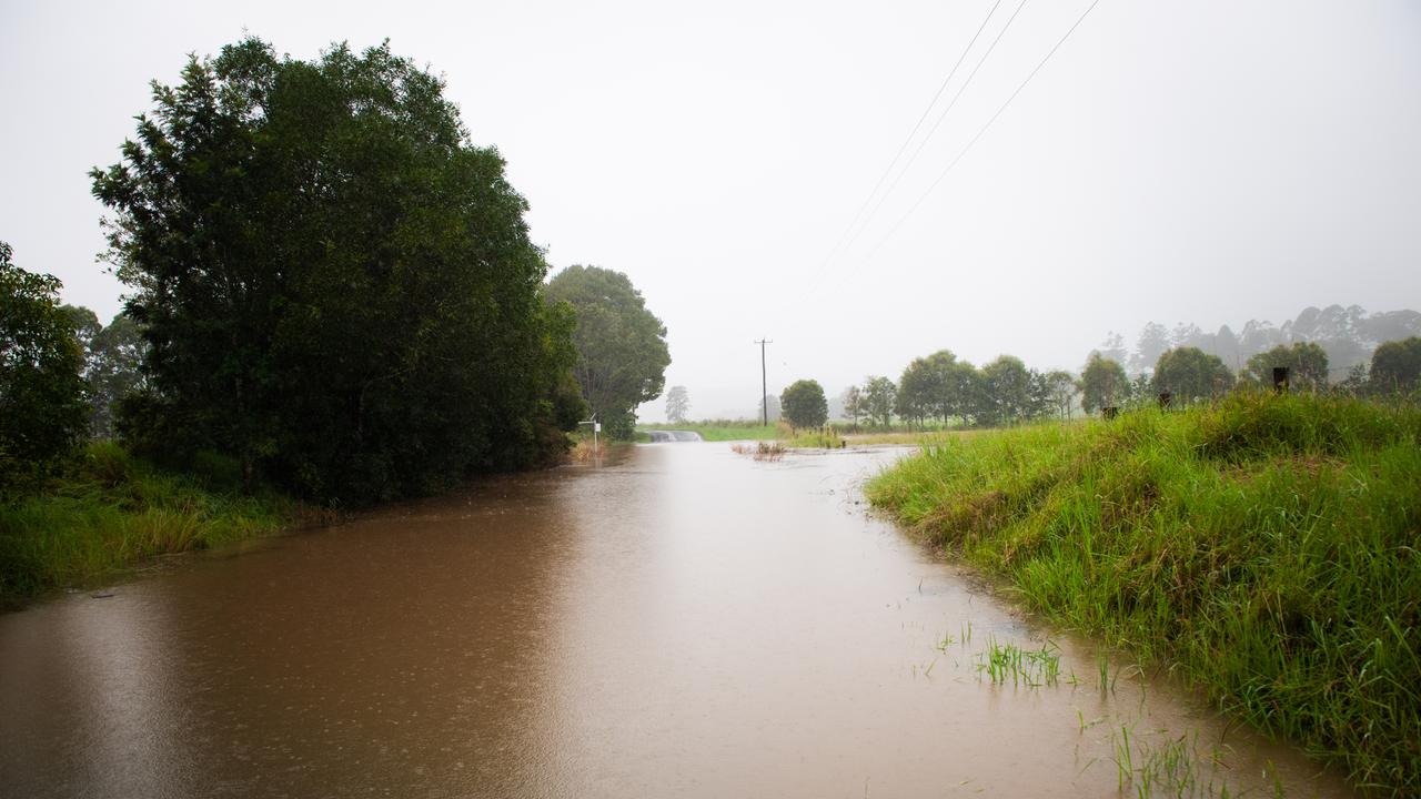
The grim discovery comes as residents of several Sydney suburbs have been told to evacuate by this morning or risk being submerged as NSW and Queensland continue to cop a heavy rainfall.
The Bureau of Meteorology has warned the situation is “dangerous” and “life threatening”.
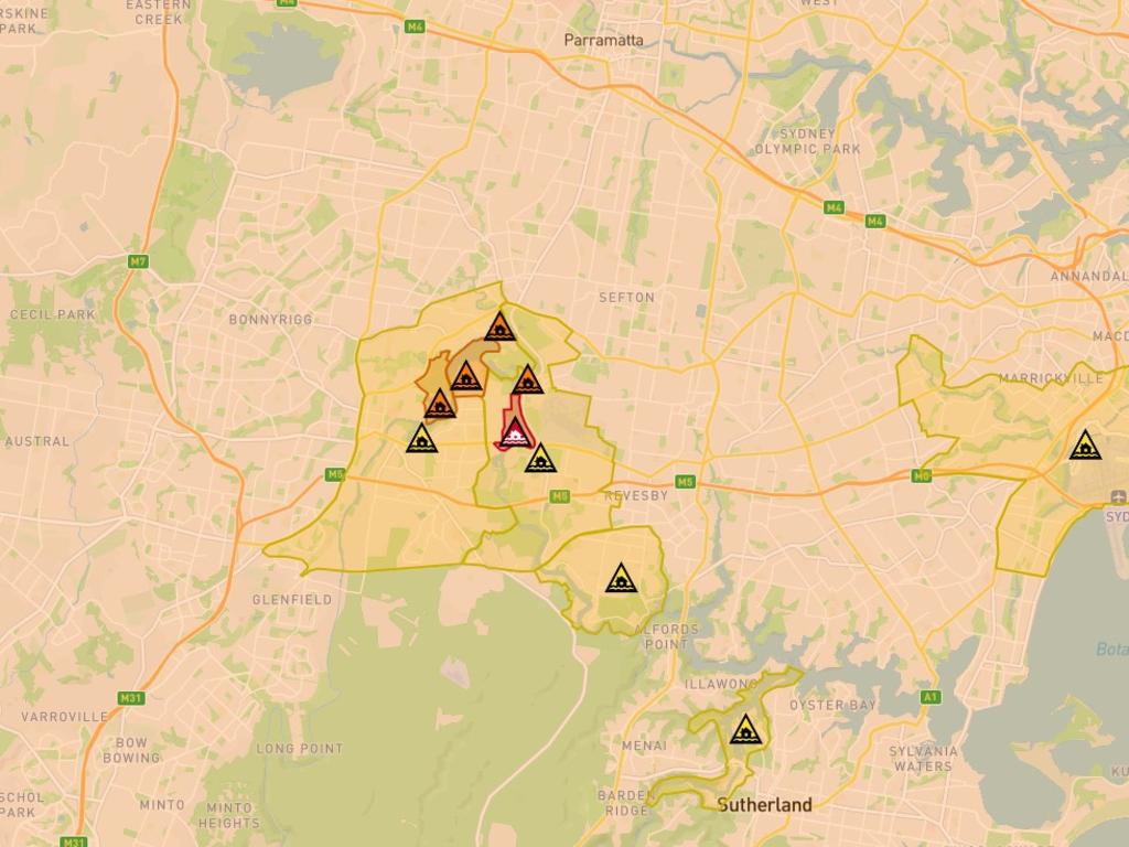
People on the eastern side of Chipping Norton — next to the Georges River, near Bankstown in Sydney’s south west — were warned of dangerous and rising flooding and to get out before 12 midnight last night.
If anyone is still there they should get out “now,” said the SES.
“You must evacuate before this time because evacuation route may be closed,” it says in the SES warning.
Now more evacuations have been announced.

Saturday morning evacuations
Residents of low lying parts of Agnes Banks and Cattai’s Riverside Caravan Park should leave before 7am, the SES has stated.
People in Cornwalis and parts of Richmond and the northern part of Pitt Town should leave by 7.30am and parts of Lower Portland by 8am.
Flooding is also possible at Emu Plains, Penrith, North Richmond, Lower Portland, Freeman Reach, Sackville North, Picton, Ebenezer, Bligh Park, Jamisontown, Mulgoa, Gronos Point and Agnes Bank – all in Sydney’s western fringes.
“You may be trapped without power, water, and other essential services and it may be too dangerous for NSW SES to rescue you,” the SES warning says.
Meanwhile, millions of Aussies are being warned not to drive as a major weather event wreaks havoc on schools, roads and flights, with the deadly deluge battering Australia’s east coast.
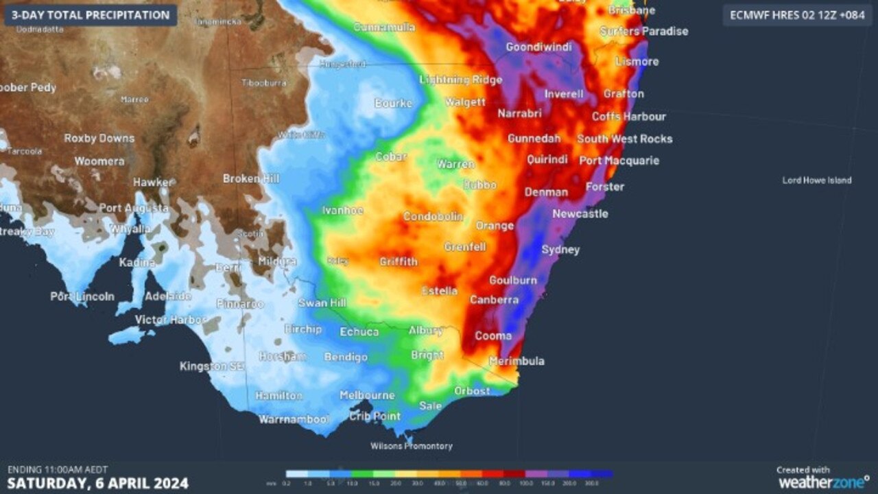
A dangerous rain event is unfolding across Queensland and NSW, with two weather systems prompting major flood warnings across both states.
Heavy rainfall of up to 300mm is expected to fall in southeast Queensland and eastern NSW on Friday and Saturday.
Queensland Police deputy commissioner Shane Chelepy urged everyone to reconsider travel plans if they can as heavy rain and flash flooding warnings remain in place for the southeast region.
“We are expecting to see continued showers and heavy rainfall,” he said.
“We have seen significant traffic incidents on the road today.
“If you don’t need to be out on the road in this period, please reconsider your travel.”
It comes as the M1 and Bruce Highway were at a standstill at multiple points on Friday due to traffic accidents.
FLOOD WARNINGS
Authorities are also monitoring rising flood waters in Charleville, with waters set to peak at 6.7m on Friday night.
The town’s levee gates, which reach a height of 7.9m, will be put in place about 3pm.
Deputy Commissioner Chelepy said the level gates will “protect the town”.
“We’re not expecting the waters to exceed that,” he said.
A major flood warning remains in place for the Warrego River, with moderate flooding expected to occur at Augathella and minor flooding at Cunnamulla Bridge.
The Bureau of Meteorology is forecast 50 to 100mm of rain will fall in southeast Queensland on Friday.

Senior meteorologist Laura Boekel said parts of the south and southeastern Queensland can expect rainfall to continue into the weekend.
Meanwhile, further south a severe weather warning has been issued for eastern and western parts of NSW from Newcastle to Bega pushing up to the central tablelands, with 100-200mm is predicted for from 24 to 36 hours.
Steve Bernasconi from the Bureau of Meteorology said Sydney had received more than 100mm of rain in less than 24 hours, with most of it falling on Friday morning.
The NSW SES is advising people in Sydney, Wollongong, Gosford, Nowra, Batemans Bay and Goulburn to stay indoors with predictions of damaging winds and heavy rain expected to hit.
WARRAGAMBA DAM TO SPILL
The deadly deluge is expected to cause Sydney’s Warragamba Dam to fill to capacity and overflow.
NSW Premier Chris Minns said the Warragamba Dam, 65 km west of Sydney is currently sitting at more than 96 per cent of its supply capacity.
“We require about 90mm of rain to fill [the dam] … we’re expecting 100 to 150mm of rainfall over that catchment as a result of this event,” he said.
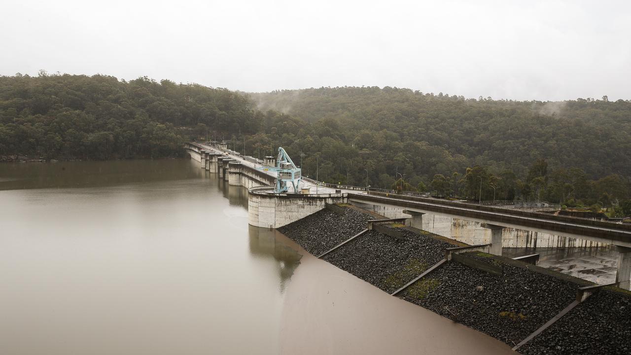
The Premier said the dam will likely spill on Monday as a result.
Water NSW has also taken to X, formerly Twitter, to issue a warning.
“Based on the developing weather event and BOM forecasting moderate to heavy rainfall across catchments, Warragamba Dam will probably fill to capacity over the weekend,” the warning reads.
Hawkesbury Mayor Sarah McMahon told the Today Show she was “very concerned” about the dam spilling.
“As a council, we have always recently supported the raising of the Warragamba Dam wall,” she said on Friday morning.
“So to have the new Labor state government a year ago when they were elected, remove that flood mitigation option off the table, has been devastating for many in our community.”
SCHOOLS
Nine schools across NSW have been closed after torrential rain blocked roads and forced the schools to cancel classes for the day.
State schools, Baryulgil Public School, Coffee Camp Public School, Longneck Lagoon, Environmental Education Centre, Megalong Public School, North Star Public School, Orama Public School, Tulloona Public School all remain closed.
Two independent schools, including AI-Faisal College in Liverpool and Bhaktivedanta Swami Gurukula School in Eungella have also closed their doors amid dangerous weather conditions,
ROADS AND TRANSPORT
The weather event is causing major disruptions on Sydney’s roads and train network, with damaged equipment at Redfern causing delays for commuters.
One of three northbound lanes on Centenary Dr between Hume Hwy and Weeroona Rd in Strathfield have been closed due “adverse weather” and water over the road.
Oxford road between Wakehurst Pkwy and Aroona Rd is closed in both directions due to flooding, as well as the Newell Highway from Moree to Boggabilla.
Westbound traffic travelling on Euston Rd approaching Campbell Rd are warned to exercise caution due to water over the road.
âš ï¸ Allow extra travel time from the City due to weather damaging equipment at Redfern.
— T9 Sydney Trains (@T9SydneyTrains) April 4, 2024
Trains are running frequently but, trips may take longer than normal & stops may change at short notice.
Tweet us for help with travel. pic.twitter.com/d29rgb3VhB
Motorists are being encourage to find alternative routes and allow for extra time.
Commuters using the T9 Northern Line, T1 North Shore and Western Line and T2 Inner West and Leppington Line have been warned: “trips may take longer than normal and stops may change at short notice”.
FLIGHTS
More than 100 domestic, arriving and departing flights at Sydney Airport have been cancelled as weather conditions continue to batter the state.
“Due to storm activity, there have been flight delays and cancellations,” a Sydney Airport spokesman said.
“We encourage passengers to check with their airline regarding the status of their flight.”
POWER OUTAGES
Flooding at a substation in Sydney’s CBD has caused a major power outage on Friday
The outage left about 1,300 Ausgrid customers without power.
Ausgrid crews worked quickly to pump water from the station in the early hours of the morning.

Power has now been restored to more than 1,250 customers, with a small number of customers to be without power for a longer period of time.
These customers will be contacted by Ausgrid directly.
FLOODING IN LISMORE
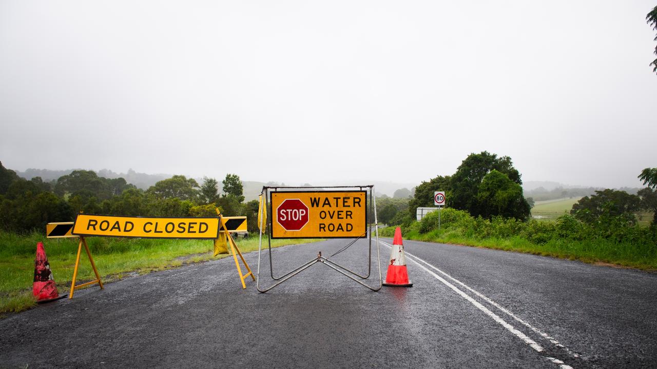
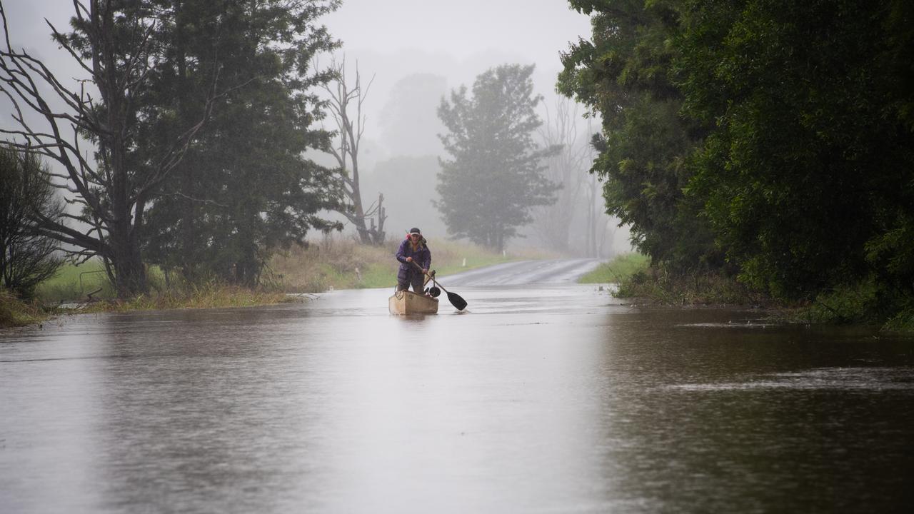
Significant rainfall on Thursday evening has caused major flooding in low-lying paddock areas in Lismore.
By 11am on Thursday, Boatharbour Rd just outside Lismore was covered by floodwater.
SES Zone Commander Greg Swindells said the largest overnight rainfall totals were in Houghlahans Creek, with 93mm, Coopers Shot with 86mm and Nashua with 80mm.
“The weather system affecting our area is slowly heading south with some rainfall still forecast for our area, he told The Daily Telegraph.
The Bureau of Meteorology has confirmed flooding is no longer expected in the Wilson’s River at Lismore
The river peaked at 3.8 metres about 3am on Friday, below the minor flood level of 4.2m and is currently at 3.55 metres and falling.
BYRON BAY WILDLIFE SANCTUARY FLOODED
Thursday’s heavy downpours have forced the Byron Bay Wildlife Sanctuary to shut down, amid serious flooding.
The sanctuary said keepers were able to get the animals to safety before the downpour hit.
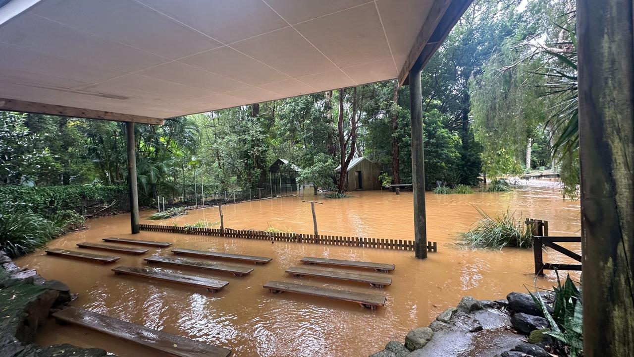
“A sudden downpour wreaked havoc on our beloved Sanctuary park in the Northern Rivers. In just thirty minutes, half of our sanctuary was submerged underwater,” they said.
“We’ve lost vital perimeter fences, endured substantial damage to enclosures, pathways, and buildings, and the threat of more rain looms over us. The Sanctuary remains closed until further notice as we assess the risks and work tirelessly to restore our haven for wildlife.”
The sanctuary has set up a GoFundMe page to raise funds to repair damages, provide food and care to the animals and to cover transportation costs.
SES WARNINGS
NSW SES has received 550 calls for help within the last 24 hours and undertaken seven flood rescues.
NSW SES Commissioner Carlene York told media that resources, vessels and high clearance vehicles have been positioned to help communities that may be affected by high rainfall and storms, but urged residents to take the necessary steps to keep themselves safe.
“Really important that people keep themselves safe and also that you look after yourselves and family and make sure that we don’t have to send our volunteers out to help you and put their lives at risk,” she said.
Ms York said residents should ensure their gutters have been cleared and items within their property are tied down.
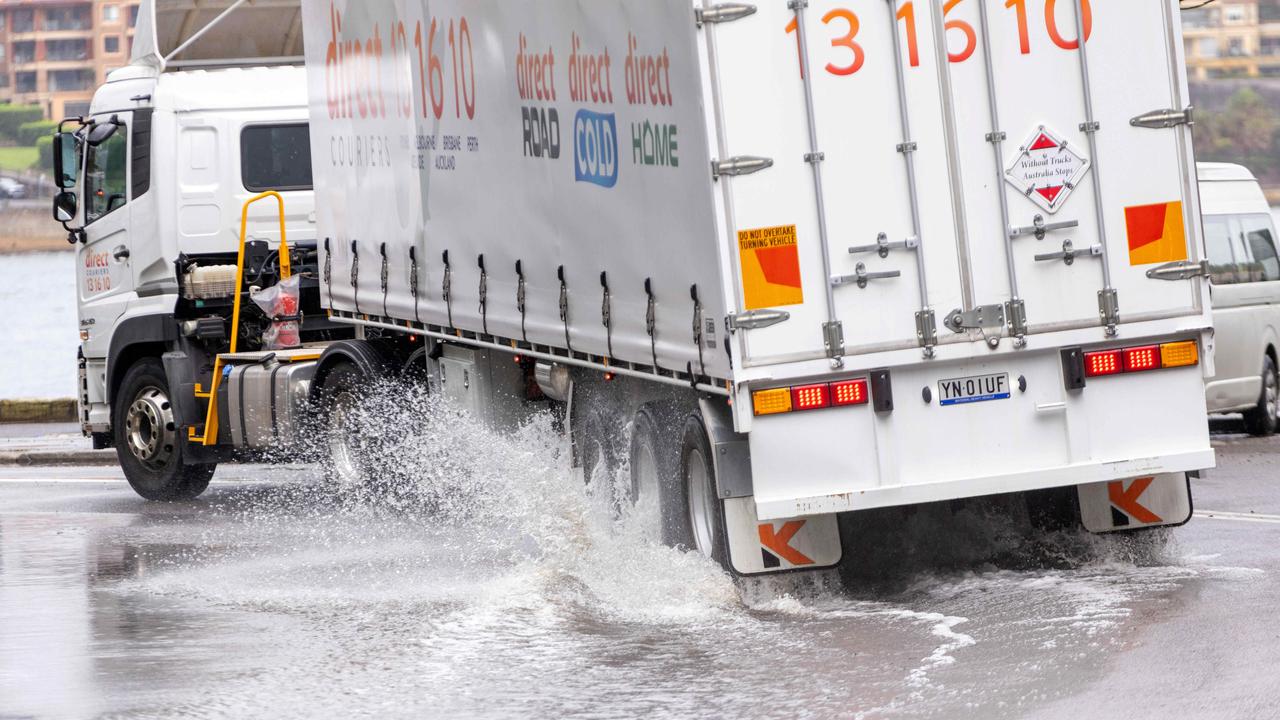
She also warned motorists to stay away from flood waters, noting only a small amount of water can move a vehicle or truck.

“The message to the community is, if you see a flooded road, don’t drive through it and take a longer way around because it’s better to get to your destination safely than put you or your family or other members of the car at risk by going in,” she said.
“It is probably the most guaranteed way to put yourself in harm’s danger and you could lose your own life.”
The dangerous weather battering the east coast has already claimed the life of a Queensland man as the wild weather extends across two states.
Grandfather Peter Wells has been identified as the Greenbank local who died in flash flooding on Thursday.
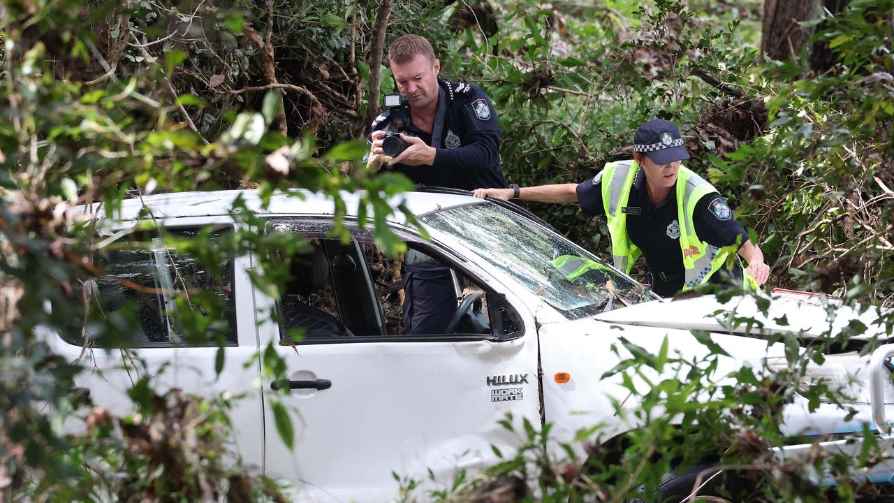
The 71-year-old was driving his ute on private property when his car was swept into floodwaters on Begley Road about 5.20am.
His body was found near his car after police were called to the property to conduct a welfare check.
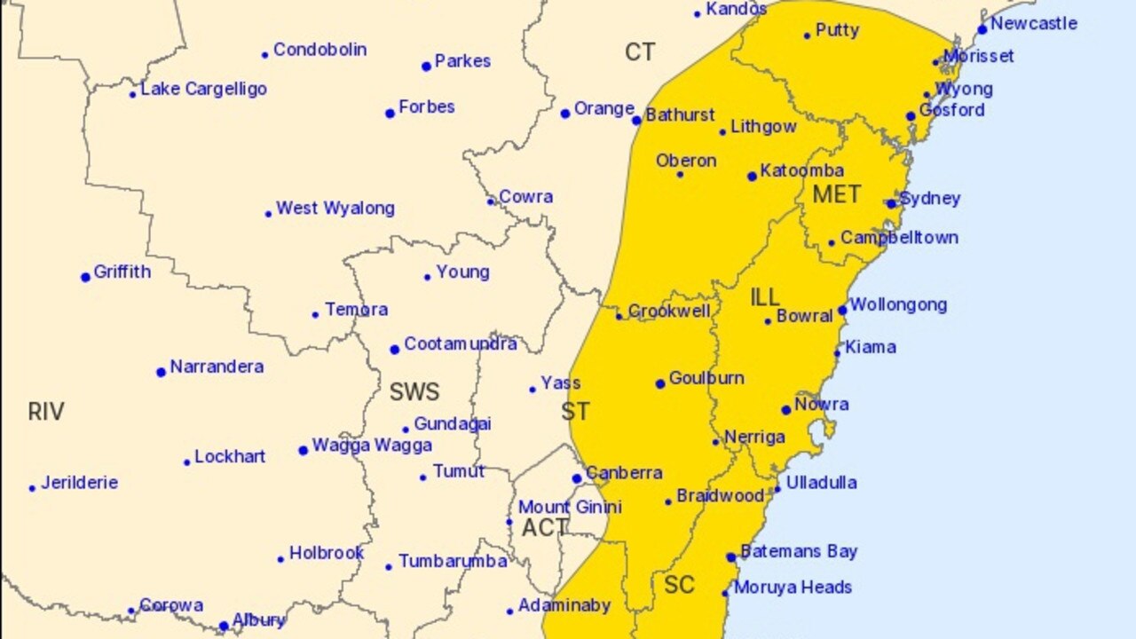
A severe weather warning remains in place for much of the NSW coast, from Newcastle to Bega.
Bureau of Meteorology senior meteorologist Angus Hines said heavy to locally intense rainfall was forecast for the regions within the severe weather zone, with the Illawarra escarpment expected to be the hardest hit.
“We are also expect damaging wind gusts through this area, exposed places could reach 90km/h,” he said on Friday.
Mr Hines said severe thunderstorms were also possible in the area that could lead to flash flooding and dangerous conditions.
Friday is anticipated to be the most “impressive, inspirational day of the combined system’s life”, according to Weatherzone.
The dangerous weather conditions are being caused by the meeting of cool moisture from the south and the north’s tropical moisture.
This could lead to a “black nor’easter”, a phenomenon where dark clouds of rain form, causing heavy rainfall and dangerous winds.
Widespread falls of 50 to 100mm are likely to batter Brisbane and regions down to the NSW South Coast, before the system moves south towards Victoria and eastern Tasmania over the weekend.
Sydney, the Blue Mountains and Illawarra could be hit with falls exceeding 200 to 300mm, with the possibility for 80 to 150mm of rainfall within six hours.

The Bureau of Meteorology is warning heavy rainfall, which may lead to “dangerous and life threatening flash flooding” is possible between the Blue Mountains and Narooma from Friday evening into Saturday evening.
Flood warnings remain in place for large regions of NSW including, Sydney, the Hawkesbury, Liverpool, Tempe and Camden as well as in multiple rivers across Queensland, including the Diamantina, Leichhardt, Flinders, and Norman.
Those in high rainfall areas are urged not to drive, ride or walk through floodwaters and keep clear of creeks and storm drains.
It will be a wet weekend for Victoria, with the Bureau forecasting a high chance of showers in Melbourne for the majority of the weekend and into next week. Despite the rainfall, Melbourne will escape the worst of the weather.


