
Thousands of cruise ship passengers stranded at sea by Cyclone Oma
At least one woman has reportedly been injured on a cruise ship trapped by Tropical Cyclone Oma, which is now directly threatening the coast of Australia.

A cruise ship with more than 2000 people on-board is stranded by Tropical Cyclone Oma with at least one passenger injured as the category one system intensifies and charges towards the coast of Australia.
P & O’s Pacific Dawn was supposed to arrive in Brisbane on Saturday but is being forced to remain in New Caledonia because it’s not safe to continue through high winds and difficult sea conditions.
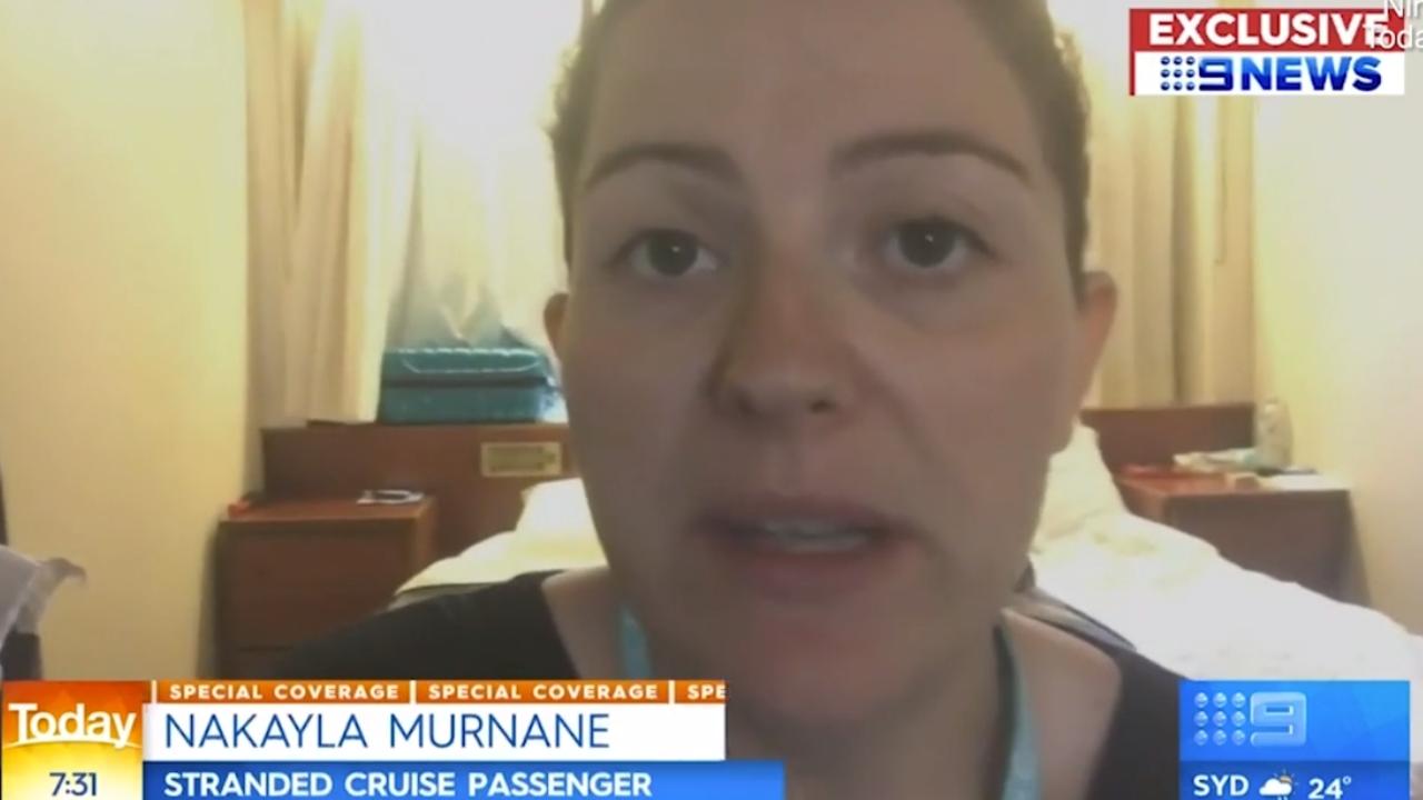
Passenger Nakayla Murnane told news.com.authe captain announced that the earliest they would arrive is on Tuesday. She said at least one elderly lady had “broken her arm due to the weather conditions on-board”.
“Once we set sail, the ocean was rough,” Ms Murnane said.
“The waves were strong and there were a lot of sick people the next morning.
“The next few days the conditions were appalling.”
A P&O Cruises spokesman confirmed a woman “hurt her wrist in a fall” but said it was “unrelated to Cyclone Oma”
“At the time, and at all times, Pacific Dawn has been hundreds of kilometres away from Oma,” he said.
“There has been no other injury that can be connected to the movement of the ship.”
According to Ms Murnane, staff “closed off all the water parks and emptied the pool” over safety concerns.
“We experienced five-metre swells just outside of New Caledonia,” Ms Murnane said.
“Right now we have docked in Noumea for the day and will set sail tonight at 7pm intended for the Coral Sea into Brisbane. But whether that happens, we are unsure.
“The trip home is going to be rough. A lot of passengers have got off the boat today with their luggage and are flying to Brisbane.”
The P&O Cruises spokesman told news.com.au “the ship and her guests are currently alongside the berth in Noumea on a calm sunny afternoon”.
Several other cruise ships have also been affected as the tropical cyclone bears down on the east coast of Australia.
The Sea Princess, a three-day cruise originally scheduled to depart Brisbane this weekend, has been cancelled. And several cruises which were set to end in Moreton Bay over the weekend will instead be diverted to other ports.
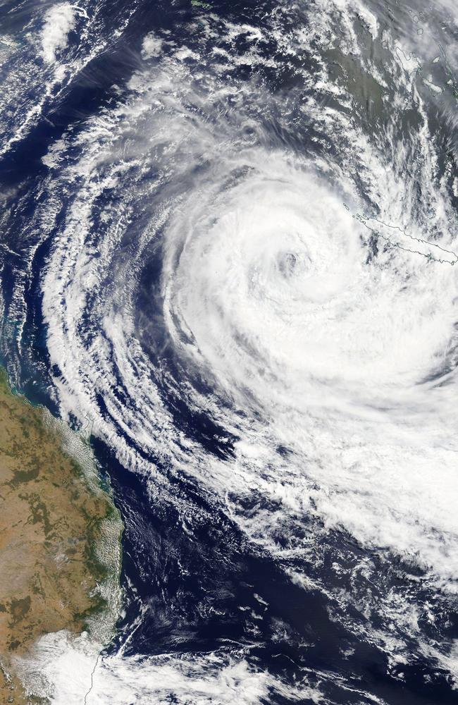
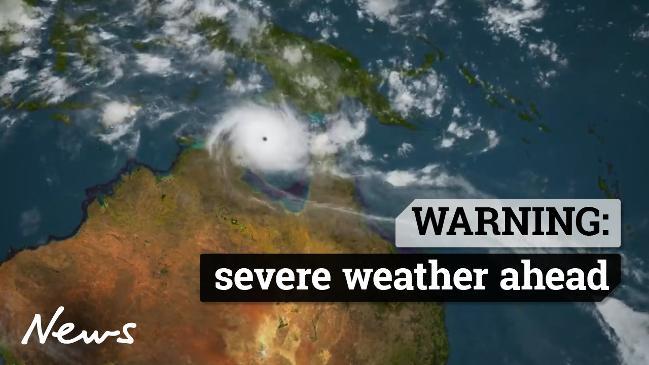
A cyclone watch for Queensland’s southern coast has been cancelled but category one Oma is still making its presence felt as it sits offshore.
Forecasters say the weather system will continue to bring high winds and dangerous surf conditions to parts of the Queensland and northern NSW coast in coming days.
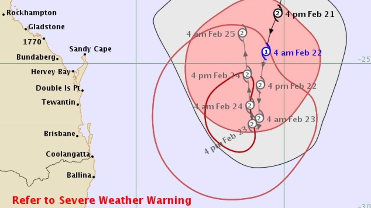
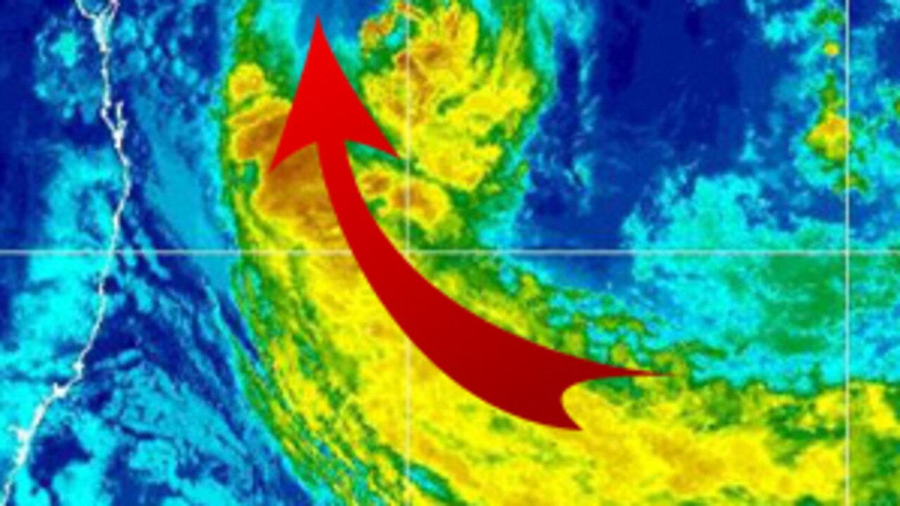
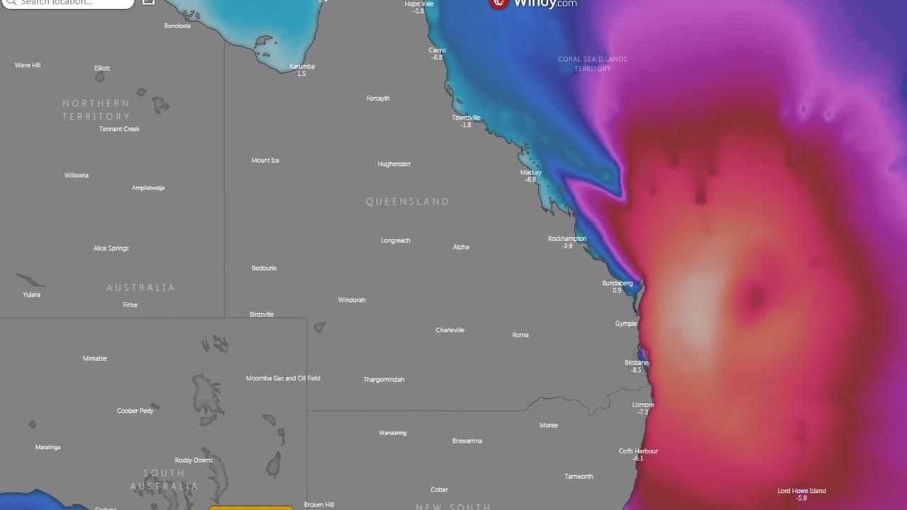
Early on Friday, Oma was about 700km east, northeast of Brisbane.
It’s slowly moving south and is expected to re-intensify to a category two storm later in the day, before making a U-turn on Saturday and heading north again.


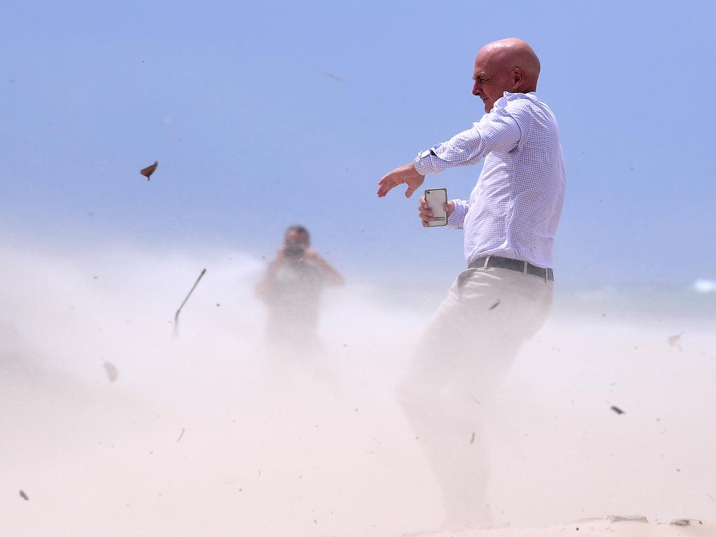
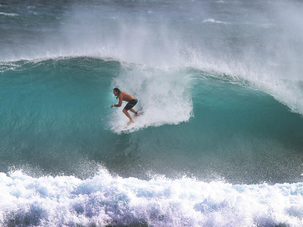
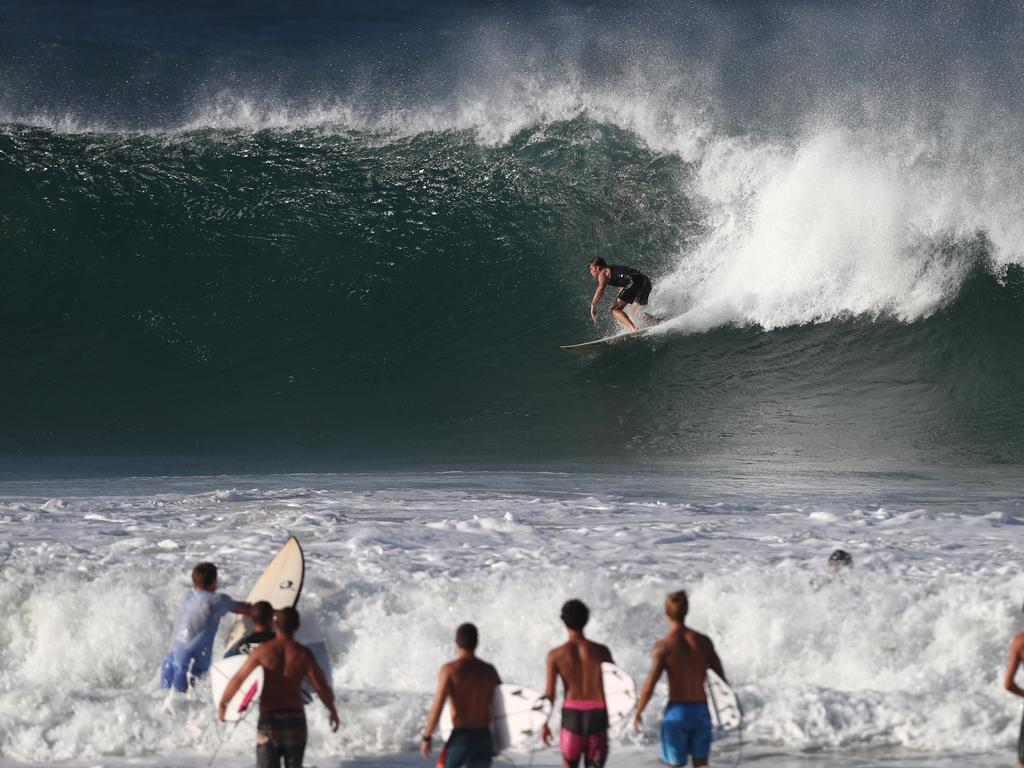
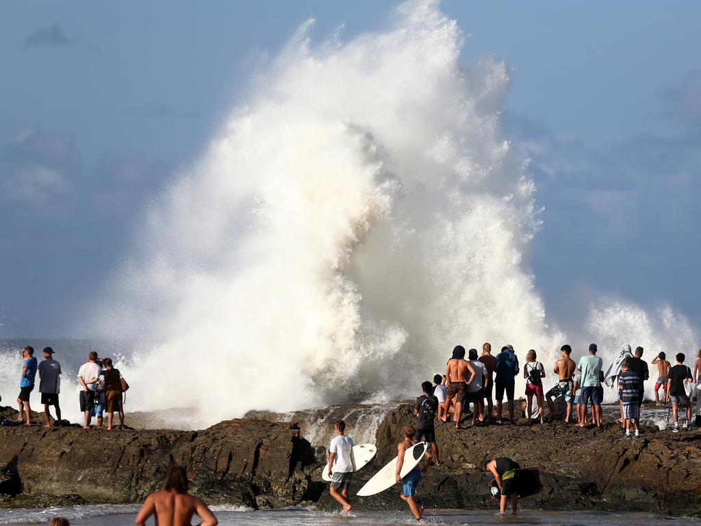
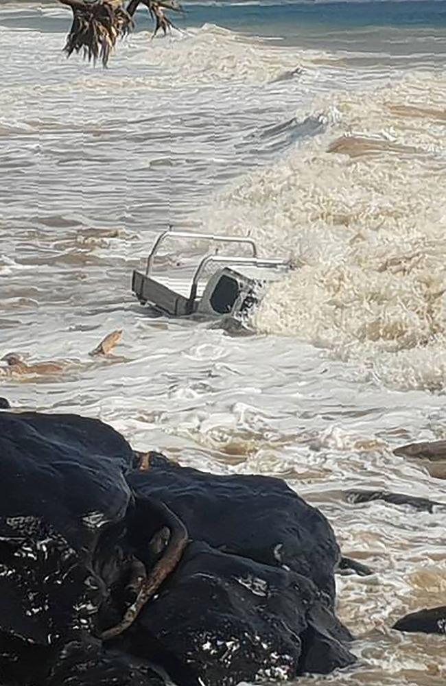
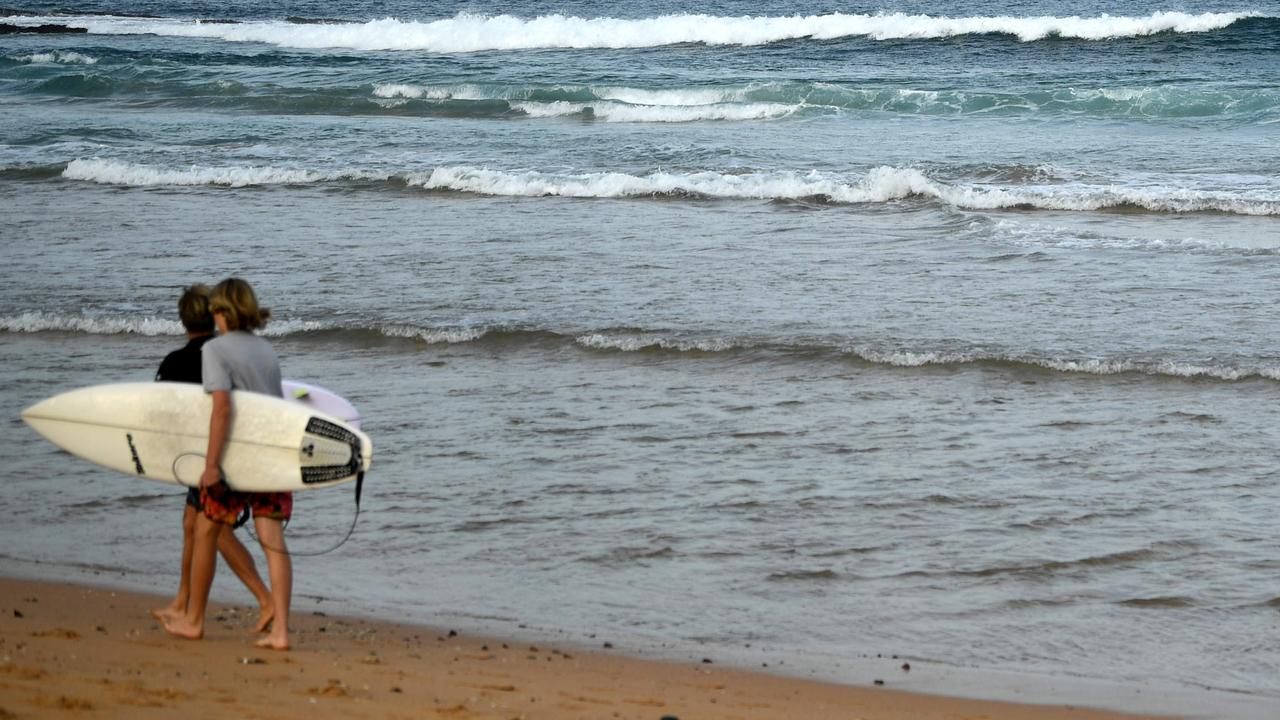
People are being warned against beach activities including boating, fishing, swimming and surfing as the swell picks up and winds intensify.
“There are going to be hazardous conditions on our surf and there could be waves up to seven metres over the course of the weekend, and in some instances it may be higher,” Premier Annastacia Palaszczuk said on Friday.
“We don’t want to put other people’s lives at risk to save you so please keep off our beaches this weekend.”
Waves as high as 7m have been forecast over the weekend at beaches on the Gold Coast and in northern NSW.
The cyclone has twice the diameter of Cyclone Debbie, but is notably less intense, Bureau of Meteorology (BOM) state manager Bruce Gunn said.
“We’re expecting it to continue moving to the south southwest for the next 24 to 36 hours and regain it’s category two intensity,” Mr Gunn said.
Some beaches will be closed as dangerous winds, surf and abnormally high tides continue into the weekend from about Fraser Island down to the NSW border.
Significant erosion to the coastline is being forecast.
The same conditions are expected as far south as Yamba in northern NSW.
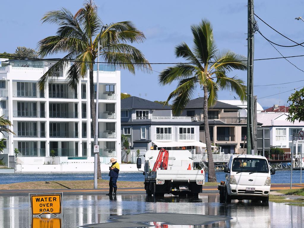
Rain forecasts for the weekend and into Monday have been revised down and the Bureau has cancelled a flood watch for southeast Queensland.
However, weather conditions will remain precarious, particularly in exposed coastal areas, Mr Gray said.
“Most rain will fall on Sunday and Monday, with around 30mm Brisbane, and up to 40mm from north of Brisbane to the Sunshine Coast and up to Fraser Island,” he said.
“The best news at the moment to come out of these changes is that most of the major impacts will be restricted to coastal areas, as opposed to flooding through large parts of the southeast.”

Large swells and king tides are expected to cause erosion, and communities from Bundaberg in Queensland south to Ballina in NSW have been issued a cyclone watch.
“Gale force winds are expected to develop along exposed coastal areas of southern Queensland during Friday, well ahead of Oma, and may extend into coastal parts of northern NSW on Saturday,” Mr Gray said.
Levels of morning high tides may exceed the highest recording of the past year by around one metre in coming days.
People in the cyclone watch zone have been urged to think about what preparations they might need to make if the cyclone threat increases.
Mother Nature, are you really going to do this to Townsville again? #Townsville #CycloneOma pic.twitter.com/Eis6RYb7LU
— Lozza (@ochreandsalt) February 21, 2019
Surf Life Saving Queensland announced a number of beaches were likely to remain closed through the weekend, as a result of the building swell.
“Beach closures are likely to occur down the coast,” SLSQ operations co-ordinator Jason Argent said.
Queensland water police have issued a warning to swimmers, fishers and boaters to stay out of waters and away from dangerous areas until at least next week.
Outdoor furniture, trampolines, wheelie bins, giant monsters & other items around your property could become dangerous airborne hazards in gale force winds⚠Secure loose items before the gusts arrive in coming days – not even Godzilla is a match for #CycloneOma 🌀 pic.twitter.com/dfTnh95WJD
— Qld Fire & Emergency (@QldFES) February 21, 2019
In Ballina and Byron Bay, residents were cautioned of rising tides, ocean swell and dangerous surf, with an abnormally high-tide warning issued for Ballina.
A hazardous surf warning has been issued for Tweed Heads, Hastings Point, Byron Bay, Ballina and Brunswick Heads.
Weather prediction models currently suggest Oma will be 300km off the Sunshine Coast on Saturday, but for how long, and where it goes next is anyone’s guess.
The Courier-Mail reported there were as many as 20 possible paths the cyclone could take.
“The beaches will get beaten up and there will be rain and flooding, particularly south of Bundaberg,” BOM forecaster Adam Blazak told the publication.
“If it crosses the coast, we could see 500mm in some areas in one day, but it might head inland and help farmers.”
Authorities are urging people not to panic but to prepare themselves and their properties.
The longer it stays offshore, the greater the potential damage to beaches as waves of up to six metres pound the shoreline.
The cyclone’s sudden change of direction has amplified the risk.
Queensland has not seen cyclonic conditions like this for some time, so it was unclear how severe the effect of Cyclone Oma could be.
Controversial move at iconic beach
Despite fears for what it might do to the tourism industry, a measure at one of Australia’s most popular swimming destinations is set to be removed.
‘Frosty’: Aussies suffer through icy blast
Australians hoping for some reprieve after a wet weekend have been left bitterly disappointed, with chilly conditions forecast to continue through the week.
Australia braces for rare weather event
Aussies turned their heads to the sky just months ago for what is usually a rare experience, but the lucky country will get another chance to witness it tonight.