
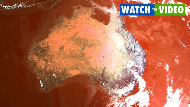
Christmas weather: Heatwave, storms all intensifying – and a monsoon is now brewing
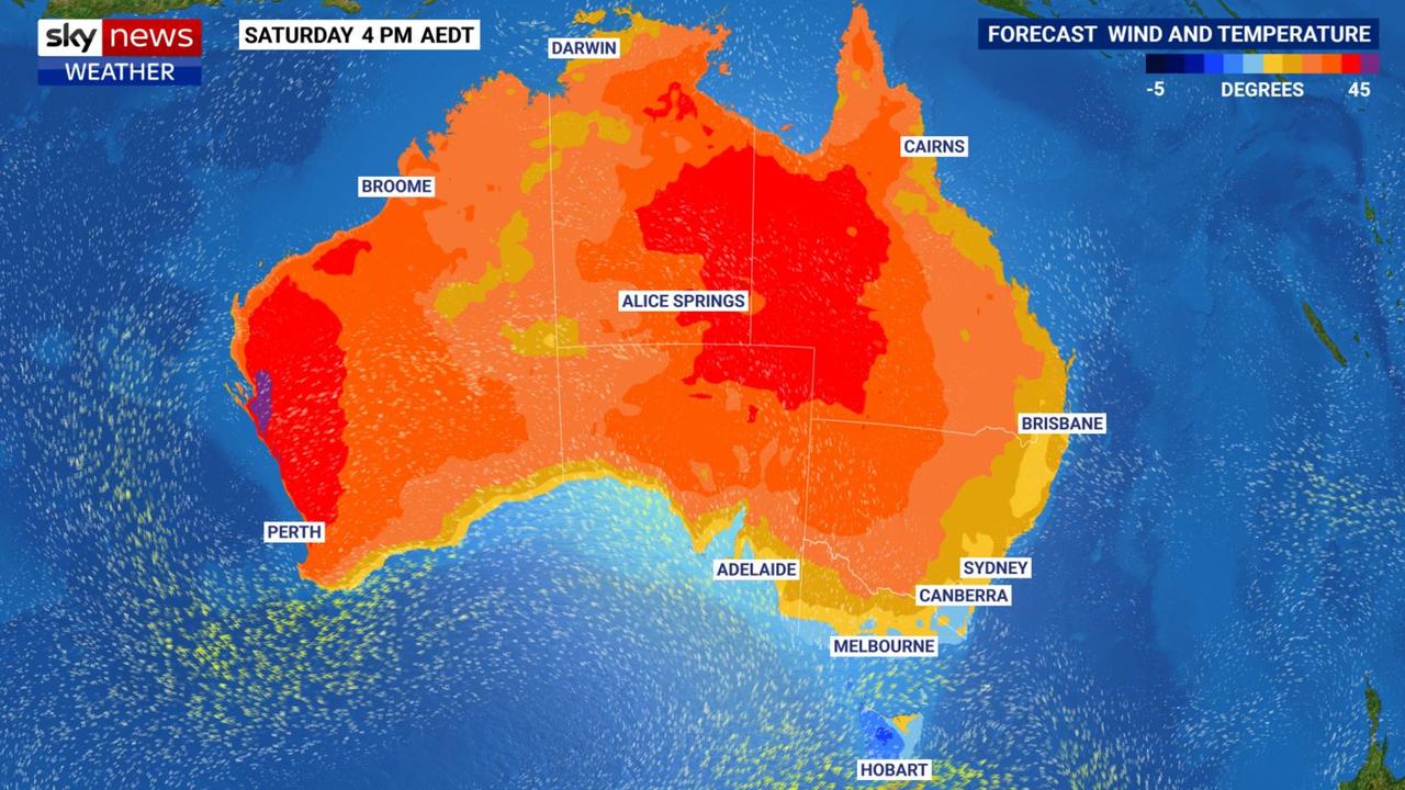
Weather of “historic” proportions is coming, with a record breaking heatwave on one coast, torrential rain on the other and a new threat looming.

Western Australians are being warned that Christmas is likely to be so blistering it will be of “historic” proportions with forecasters now looking at the entire festive weekend pushing above 40C. That’s a feat not seen for 25 years.
Meanwhile, in the east, storms are intensifying and the rain just keeps getting heavier.
And in the north a new threat is looming with the monsoon likely to kick in over Christmas bringing absolutely torrential rain to Darwin and maybe even a tropical cyclone.
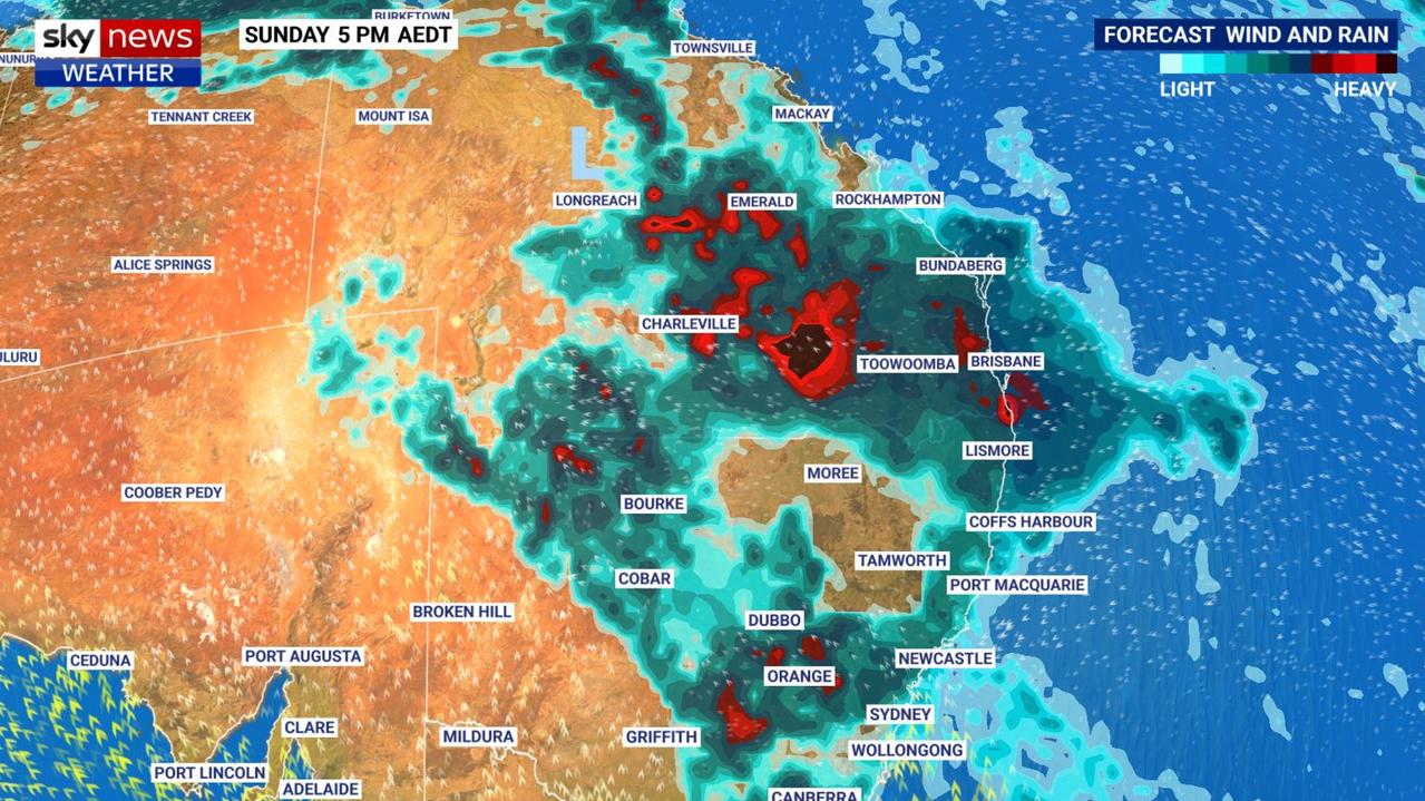
“Showers and storms are likely to intensify over New South Wales and Queensland today with the risk of heavy rainfall and flash flooding,” said Sky News Weather meteorologist Alison Osborne said on Thursday.
Onshore winds are driving moisture over the east bringing showers. Brisbane, the Gold Coast, Sydney and possibly even Canberra could are a possibility for storms. That could continue into Christmas Eve and while Christmas Day will start of calmer, those storms could return in the afternoon.
Over the next week, 50 millimetres of rain is possible through much of southern Queensland and north eastern NSW and in some places over 150mm of rain. That could easily lead to flooding.
Stream more weather news live & on demand with Flash, Australia’s biggest news streaming service. New to Flash? Try 14 days free now >
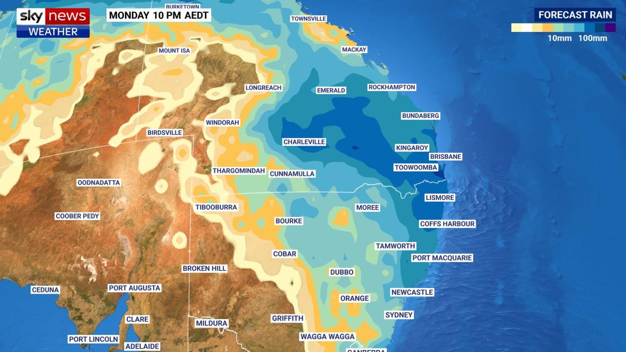
Brisbane will hover around the 30C mark, with lows of 22C, until Boxing Day with showers most days. The heaviest falls could be on Christmas Eve with up to 15mm falling and 10mm on Christmas Day.
As you go inland it’s likely to only get wetter with Toowoomba forecast to see as much as 90mm between Friday and Tuesday. Roma could get 40mm of rain on Monday alone. Further north, Townsville is looking at up to 10mm on Boxing Day and then getting steadily wetter as the week goes on.
Rain spreading into NSW
Across the border and Byron Bay is looking soggy with 15mm possible on Christmas Eve, lighter falls on Christmas Day, then 50 to a whopping 130mm between Boxing Day and Tuesday. Port Macquarie could see between 40 – 90mm on Monday and Tuesday alone.
Sydney could see showers too. Boxing Day may have some downpours of up to 15mm but it could ratchet up to 50mm over Monday and Tuesday.
There are forecast highs of around 27C on Christmas Eve in Sydney and then 29C on Christmas Day with a potential storm before heading into the mid-twenties again. Overnight temperatures should level off at about 19C.
A warm 26C in Canberra on Christmas Eve rising to 31C on a maybe stormy Christmas Day before falling again. Boxing Day could see a few spots of rain and a storm.
Perth heatwave ‘historic
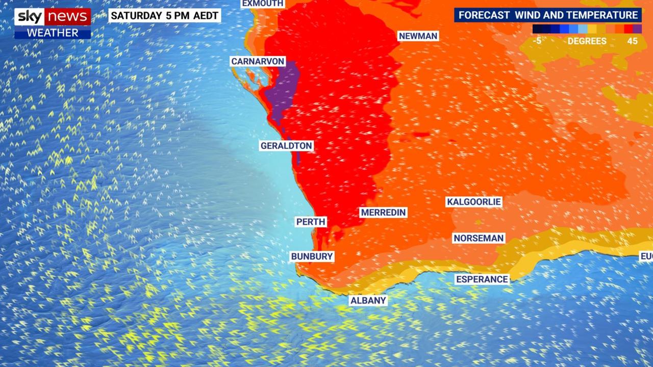
It’s all very different in Western Australia where forecasters have warned a “dangerous heatwave is gearing up to settle over Perth with consecutive days of temperatures surpassing 40C.
“From Friday to Sunday we’re seeing an extreme heatwave from south of Bunbury through Perth to north of Geraldton,” said Bureau of Meteorology senior metrologist Jackson Browne.
“Now this is historic, we haven't seen extreme category heatwave conditions in Perth since December 1996.
“At 42C, Christmas Day in Perth is going to be a stinker,” he added.
Thursday could see a high of 35C in Perth, 39C on Christmas Eve and that 42C on Christmas Day. Temperatures will basically then just screech to a halt with multiple days around 40C. On Boxing Day, even in the dead of night, it might not get below 27C.
Temperatures in a dry and sunny Adelaide will slowly climb through the high twenties this week to reach 31C on Christmas Eve and 29C for the big day. Minimums will be in the mid-teens.
Compared to elsewhere, it’s forecast to be positively chilly in Melbourne with 21C for Christmas Day although it could get to 26C on Christmas Eve. Next week should be warm with maximus around 26C. Little in the way of rain with Christmas expected to see blue skies.

Just a 17C peak in Hobart on Wednesday, rising to 24C for Christmas Eve before falling back to 21C for Christmas Day. The lows will hover around 10C at dawn. Partly cloudy but not much in the way of rain.
In northern Australia the monsoon is expected to become established in the next few days driving moisture over the Top End. It could also bring with it a very unwelcome gift in the shape of a tropical cyclone.
A stormy Christmas in Darwin peaking at 33C for much of the week with minimums of 26C. There will be a risk of a thunderstorm most days with 20-80mm of rain on Christmas Day and up to 90mm on Boxing Day.
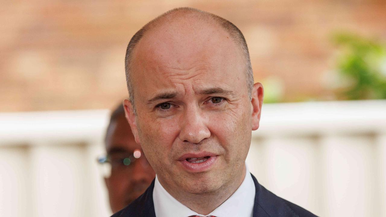
‘Weird:’ Kean unleashes on Coalition MPs
The former NSW treasurer Matt Kean has urged the Coalition to listen to voters, or risk “electoral oblivion” taking aim at prominent MPs.
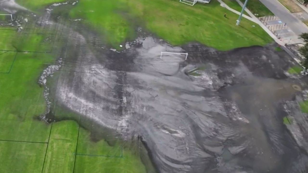
‘Like a toilet’: Sewage blankets suburbs
Australia’s longest city may have just taken a long drop down the rankings to become the county’s worst-smelling, as authorities scramble to stem a massive sewage leak.
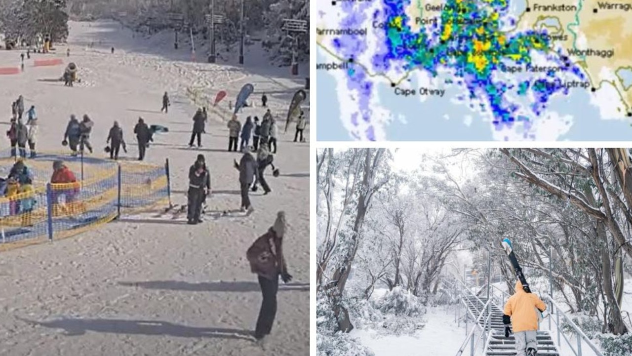
‘Amazing’ polar blast kickstarts ski season
A polar blast has triggered lashings of rain and heavy snow across NSW and Victoria, kicking off the ski season with a bang.