
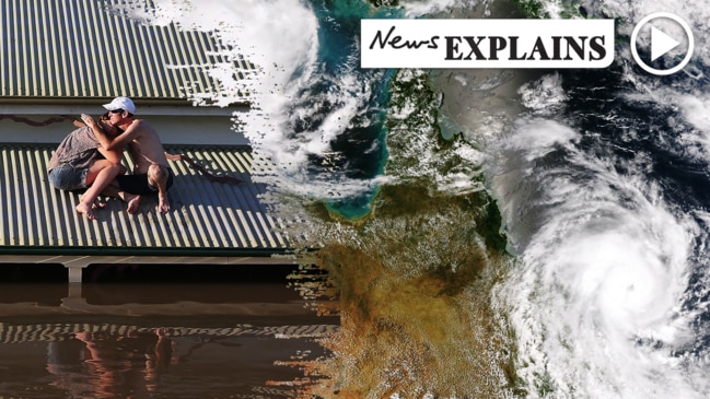
Change to two key weather systems could have major effect on the bushfires
The horror bushfires have partly been fuelled by two stubborn weather systems, but there’s been a big change to Australia’s “heat engine”.

After a series of horror blazes from Queensland to South Australia, a significant change in two key weather systems could mean Australia’s bushfire season has reached its peak.
In the past few days, parched parts of New South Wales have indeed seen a sprinkle here and there. But not nearly enough to prevent further fires or even douse the ones currently raging.
Weather watchers have warned that while more rain is welcome, there’s no guarantee that much in the way of moisture will make it down as far as the bushfire zone.
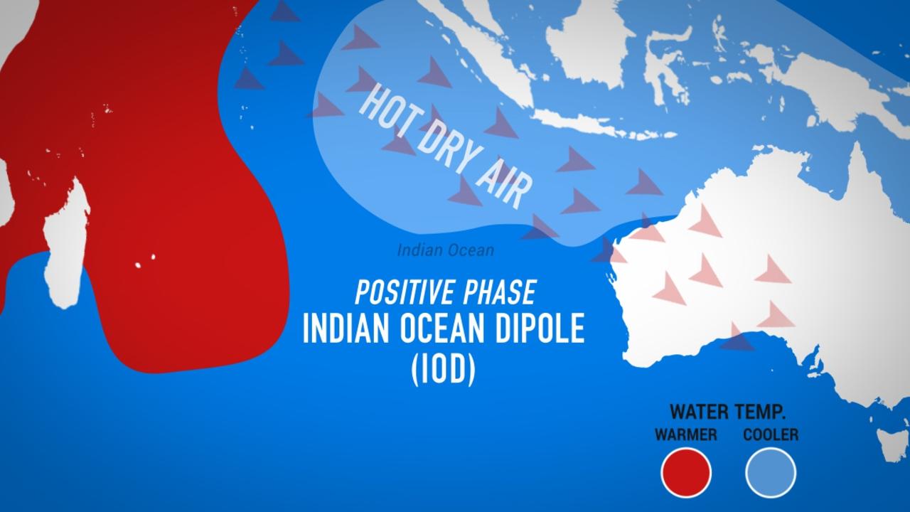
If you want a weather system or two to blame for this year’s terrible bushfire season, look no further than the Indian Ocean Dipole (IOD) to the west and the monsoon, or lack of it, to the north.
RELATED: Follow news.com.au’s live coverage of the bushfires
RELATED: Weird weather ‘anomaly’ making Sydney choke
The IOD has been in a positive phase for months and that means less rainfall for much of Australia and warmer temperatures.
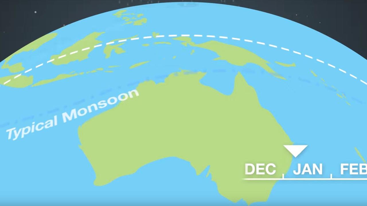
It usually turns to neutral, dialling down the heat and helping put Australia into average conditions, around November. But in 2019, that just didn’t happen.
The IOD’s positive phase coincided with the late arrival of the monsoon which brings much needed wetter weather to Northern Australia. It should have turned up in late December. But it didn’t.
The heat from the IOD and the lack of moisture from the missing monsoon helped create the perfect conditions for fires.
DARWIN A LONG WAY FROM MALLACOOTA
Now, somewhat belatedly, the IOD has moved back to neutral and the monsoon has graced us with its presence.
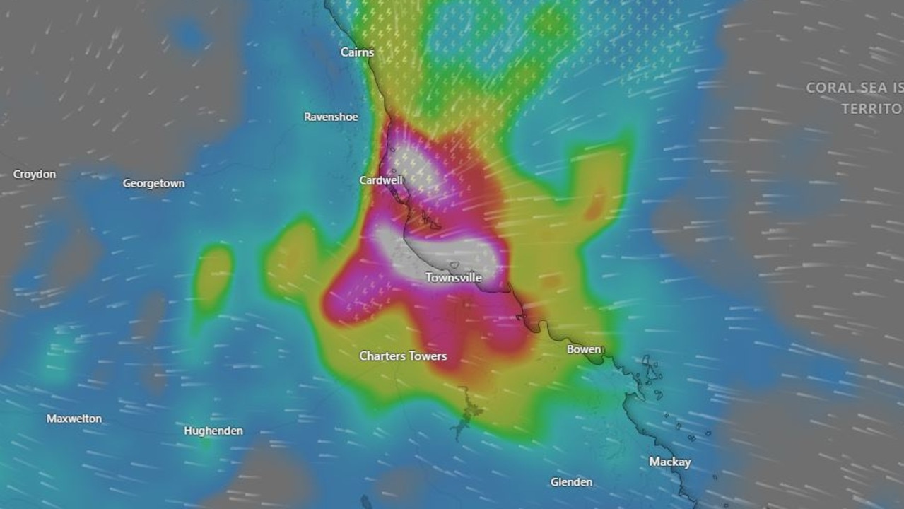
This week, the first cyclone of this year’s season, named Blake, formed off the Kimberley coast of Western Australia and it’s likely to bring rain as it crosses over land.
A second tropical low, that will likely form into Tropical Cyclone Claudia over the next few days, could bring hundreds of millimetres of rain to the Top End.
Darwin may be a long way from Eden and Mallacoota, but any rain is good news for Australia.
In its weekly climate note, the Bureau of Meteorology said one of the country’s key “drying influences,” had, well, dried up.
“Outlooks currently indicate an increased chance of average to above-average rainfall across parts of Northern Australia in the coming weeks and months,” the BOM stated.
“More broadly, if an active monsoon develops over Northern Australia it increases the chance of rainfall across not only across Northern Australia, but for regions further south.
“This is because the influx of moisture associated with the monsoon can be transported by weather systems from northern to southern Australia and potentially generate periods of more intense rainfall.”


Indeed, forecasters have said a band of rain that’s likely to sweep across bushfire ravaged areas of South Australia, Victoria and NSW in the coming days will include moisture from ex-Tropical Cyclone Blake.
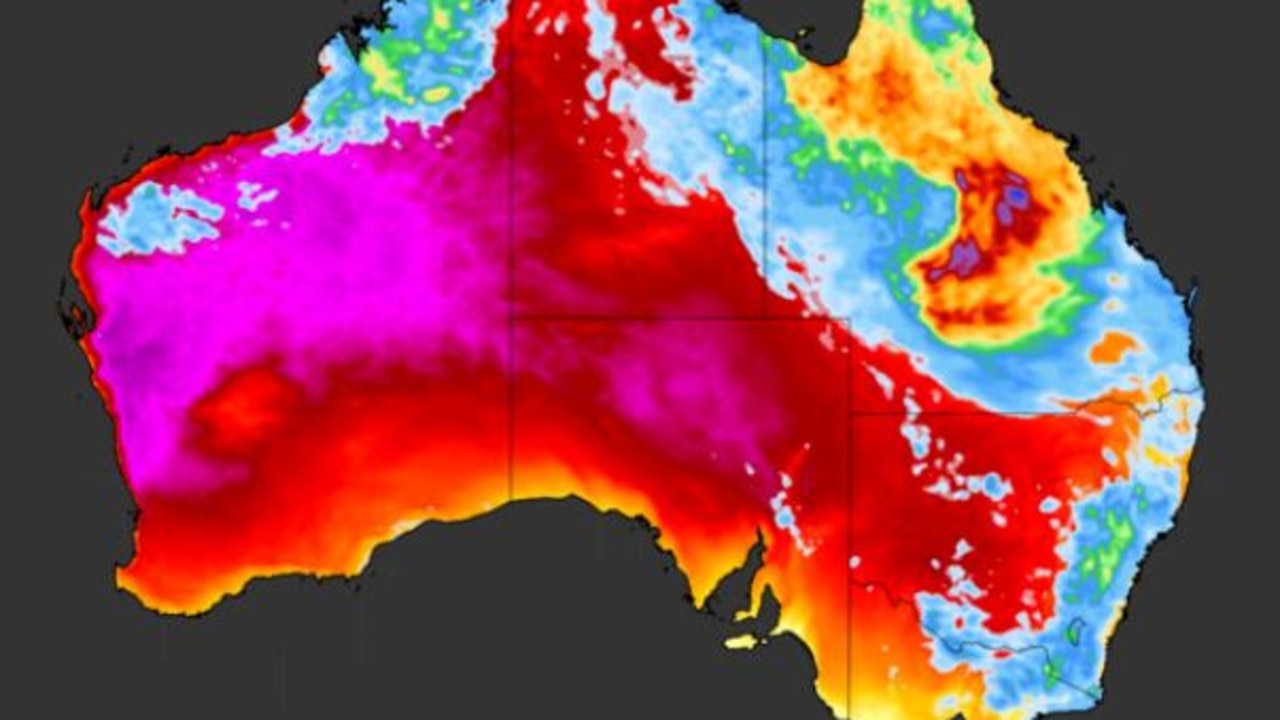
Sky News Weather channel Meteorologist Tom Saunders said the monsoon had led to cloud cover over Northern Australia. Even without rain, that was a step in the right direction.
“That cloud has dropped the temperature of the air (over Central Australia) and that’s the heat engine of Australia.”
Generally air travels from west to east across Australia. So if it’s cooler in the Red Centre it won’t be as hot on the east coast.
“Given the right weather conditions some of that moisture could come towards the south west,” added Mr Saunders.
NOT ALL GOOD NEWS
Unfortunately, there is a but. A big one.
Other weather systems also play a huge role. Rain from ex-Tropical Cyclone Blake may pour over East Gippsland and southern NSW later this week. However, because it’s being transported by a fast moving cold front rather than a slow moving through, its effects will be swift and probably not very effective.
“It’s likely only light rain will fall and that’s not enough to extinguish the bushfires. It’s not even close,” Mr Saunders told news.com.au today.
Northerly winds are also needed to bring rain from the Territory further south. If the winds are only westerly, and they usually are, it will just take rain from the Northern Territory and dump it on Queensland and parts of NSW.
“Having the monsoon is one piece of the puzzle. Yes, it probably means more rain for northern and central NSW but probably not for southern NSW, South Australia and Victoria because those areas do not get much rain in summer anyway.”
So, the shake up to the IOD and the encroaching monsoon is definitely a positive. But it may not be the bushfire breaker many were hoping for. The fire season has many weeks to go.
Extreme heatwave warning for Aussies
A very hot air mass is sloshing around the country, causing temperatures to reach the mid-to-high 40s over several states.
Devastating floods claim another life
Another person has died in flooding that is devastating large parts of the North Queensland coast, in scenes of “incredible devastation”.
‘Hoodwinked’: China is conning the world
An Australian economist says China is conning the world on an important global issue.