
Incredible ‘fogbow’ spotted as new polar surge freezes state
An incredible weather phenomenon has been spotted on a weather camera in Queensland as the state shivers through near-record low temperature.

An incredible weather event has been spotted in Queensland as it battles through a freezing polar surge from Antarctica which has sent temperatures plunging to near-record lows.
The “unusual sight” was captured on a weather camera in Toowoomba Friday morning as temperatures dropped below zero.
The Bureau of Meteorology shared a photo of the amazing phenomenon – called a fogbow – to Twitter, revealing it was commonly known as “the less colourful cousin of a rainbow”.
“Not only is there freezing fog (fog when the temperature is below 0), but there is a fogbow,” the tweet read.
Fogbows form in the same way as rainbows, with the sun’s rays being refracted and reflected by the water droplets in the fog, according to the BoM.
Fog droplets are typically much smaller than the rain drops that form rainbows, which causes smaller amounts of refraction and reflection meaning the colours in a fogbow are less distinct and generally appear white.
An unusual sight on the Toowoomba weather camera this morning. Not only is there freezing fog (fog when the temperature is below 0), but there is a fogbow. A freezing fogbow! A fogbow is the less colourful cousin of a rainbow🌈, read more here: https://t.co/x8y6nOzNR6pic.twitter.com/gDo38k2RyD
— Bureau of Meteorology, Queensland (@BOM_Qld) June 9, 2022
And according to the BoM, the chilly weather is only going to get worse.
The mercury hovered at -1.4C at Wellcamp, west of Toowoomba, just after 5am this morning, while, the Gold Coast reached a low of 1 today, and Warwick dipped to -2.8C (apparent), making it the coldest location in the Sunshine State.
The BoM’s Harry Clark told The Courier-Mail temperatures would drop ever further in the days ahead.
“Essentially what we have is a really dry air mass has been pushed over most of Queensland from down south which is bringing these clear and relatively calm, but cold, conditions,” Mr Clark said.
“We didn’t quite have an autumn so it’s been quite a sharp transition which makes it feel all that much worse. It certainly could get colder over the next few months.”
Stream more news on the environment with Flash. 25+ news channels in 1 place. New to Flash? Try 1 month free. Offer ends 31 October, 2022 >
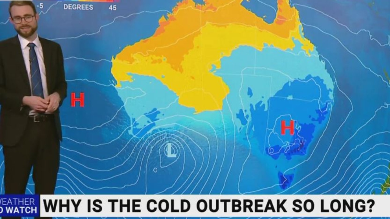
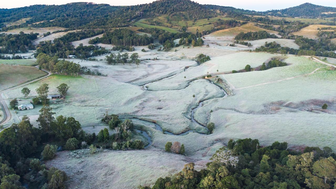
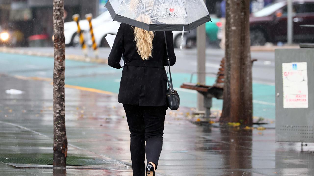
But it’s not just Queensland feeling the cold, with freezing conditions sweeping across large parts of the country and hitting lows not seen in more than a century.
The BoM’s senior meteorologist Jonathan How told Sunrise this morning that it had been the coldest start to winter for many people in decades, and that the duration of the cold temperatures had taken experts by surprise.
“We have not seen many individual records broken, but the length of time has been quite significant, especially for people in Melbourne, Sydney and Brisbane,” he said, noting that parts of Sydney plunged to 0 degrees this morning, while Brisbane experienced frost and “single digits all the way up to Mackay”.
“It has been very, very cold and very tempting to stay in bed a little bit longer.”
He also provided some warnings for the long weekend.
“Across the east coast, we are expecting sunny skies, but frosty starts and cold, windy days,” Mr How said.
“You take care along the NSW coast this weekend. We have hazardous coastal conditions.”
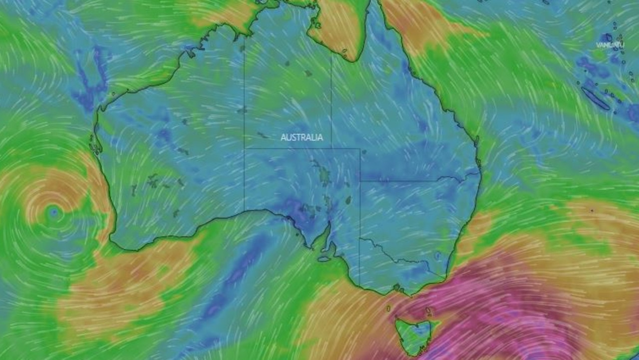
A “very, very cold snap for Tassie” is also on the cards with snow to 200m, while it will be “very windy” in parts of Victoria and NSW’s south coast.
Mr How also had some bad news for those of us hoping the early start to winter meant the worst might be out of the way soon.
“It has been a very, very cold start. That is what we are expecting for the rest of winter,” he said.
“The outlook for the rest of winter is looking to be cooler and wetter than average across eastern and southern part of the country. A little bit of a taste of what is to come.
“We still have 2.5 months of this cold, wintry weather.”
However, he said it was “good news” for skiers, with solid snowfall coming for alpine areas.
Here’s what the weather has in store for the capital cities over the long weekend.
Sydney
Sydney will enjoy a sunny day today with a high of 17, although conditions will become windy on Saturday, with a mostly sunny day and a minimum of 9 and maximum of 16.
The wind will continue on Sunday with a minimum of 9 and high of 17, with a partly cloudy day in store on Monday and a low of 6 and high of 15.
Brisbane
Despite the cold snap plaguing the state, it will be sunny and will reach a high of 18 in Brisbane today, down from the average June temperature of 21 degrees.
The sun will continue tomorrow with a minimum of 6 and high of 19, although it will be cloudy on Sunday with a minimum of 8 and maximum of 19, followed by the exact same conditions on Monday.
Melbourne
Melburnians are waking up to a shower or two today and a maximum of 14, with showers developing on Saturday with a minimum of 8 and a maximum of 13.
Showers will ease on Sunday with a low of 9 and high of 11, while Monday will bring clouds and a minimum of 7 and maximum of 12.
Canberra
It will be partly cloudy in Canberra today with a maximum of 12, with the trend continuing into the weekend.
Saturday will also be partly cloudy with a low of 1 and high of 10, with Sunday bringing a shower or two, a low of 3 and high of 10.
But Monday will be mostly sunny with a minimum of -3 and high of 10.
Cold, windy and snowy weather will continue for southeast Australia - especially in #Tas- for the rest of the week. pic.twitter.com/iJNpL2GMOz
— Bureau of Meteorology, Australia (@BOM_au) June 8, 2022
Darwin
Darwin is being spared the big freeze, with a mostly sunny day and maximum of 32 today.
It will be sunny all weekend with a low of 19 and high of 31 on Saturday, with a minimum of 19 and maximum of 32 on Sunday, and a low of 20 and high of 32 on Monday.
Hobart
There will be showers in the Tassie capital today and a maximum temperature of just 9 degrees, followed by more showers and wind on Saturday and a low of 4 and high of 11.
There are more showers on the way on Sunday although the wind will ease, with a minimum of 2 degrees and maximum of 9, while Monday will be cloudy with a low of 4 and high of 10.
Looking ahead at the #Tas w/e snow forecast: snow will fall to 600m on Fri, lowering to 200m in the south by Sat eve. Snow flurries possible to sea level, incl near #Hobart. Low-level snow plus forecast squally winds can create dangerous conditions.
— Bureau of Meteorology, Australia (@BOM_au) June 9, 2022
Img: foto.velo - Mt Wellington pic.twitter.com/171o3tQC0e
Perth
The WA capital will have a high of 22 degrees today and will experience showers with a possible storm.
It will be a similar story across the long weekend, with the city facing showers over the next three days.
On Saturday there will be a minimum temperature of 13 and a maximum of 22, followed by a low of 12 and high of 20 on Sunday and a minimum of 11 and high of 20 on Monday.
Adelaide

Adelaide will also cop showers today and a maximum temperature of 16.
On Saturday there will be a possible shower with a minimum of 9 and a maximum of 15, which will be repeated on Sunday.
Monday will be cloudy with a low of 8 and high of 15.

World stunned by development in Antarctica
It’s been shrinking for decades but latest scientific findings show a shock development in Antarctica - and it’s sparked fierce debate online.
East coast to cop more showers
With winter just weeks away Aussies are still basking in warm and sunny conditions, unless you are on the east coast.

World stunned over new Pompeii discovery
A chilling new discovery at the site of Pompeii reveals the tragic true extent of human suffering 2000 years after the disaster.