
Ash from Blue Mountains fire falls in Sydney suburbs
Sydneysiders are by now almost used to the continuous smoke haze, now there’s a new hazard as it has started “raining ash” on the city.

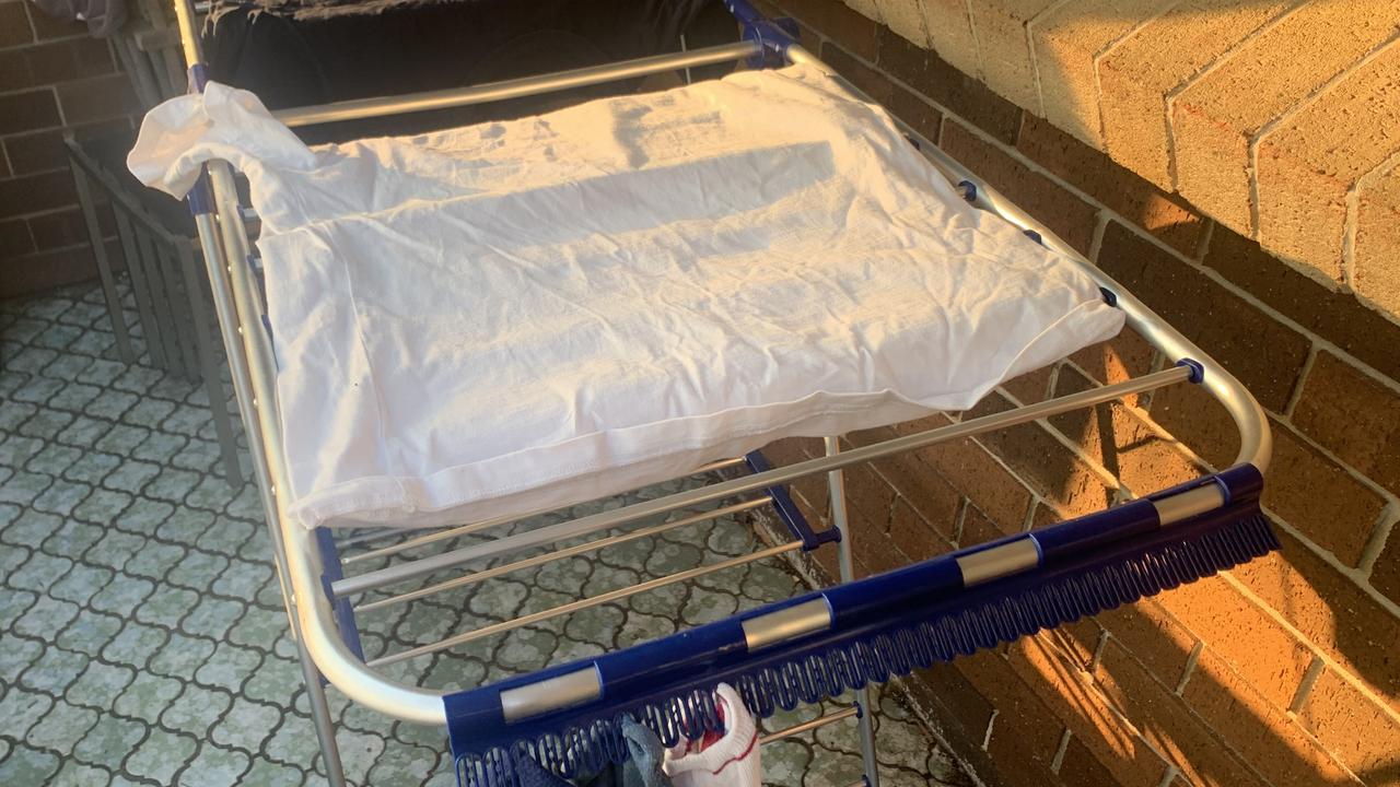
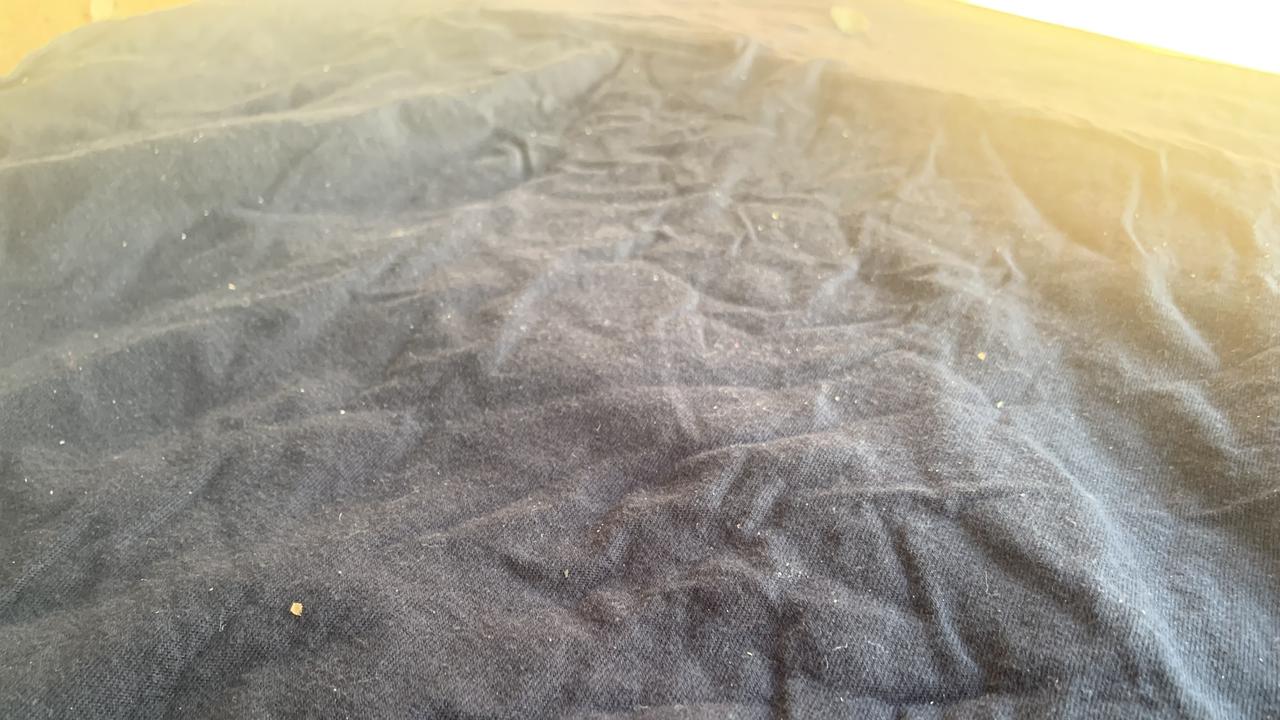
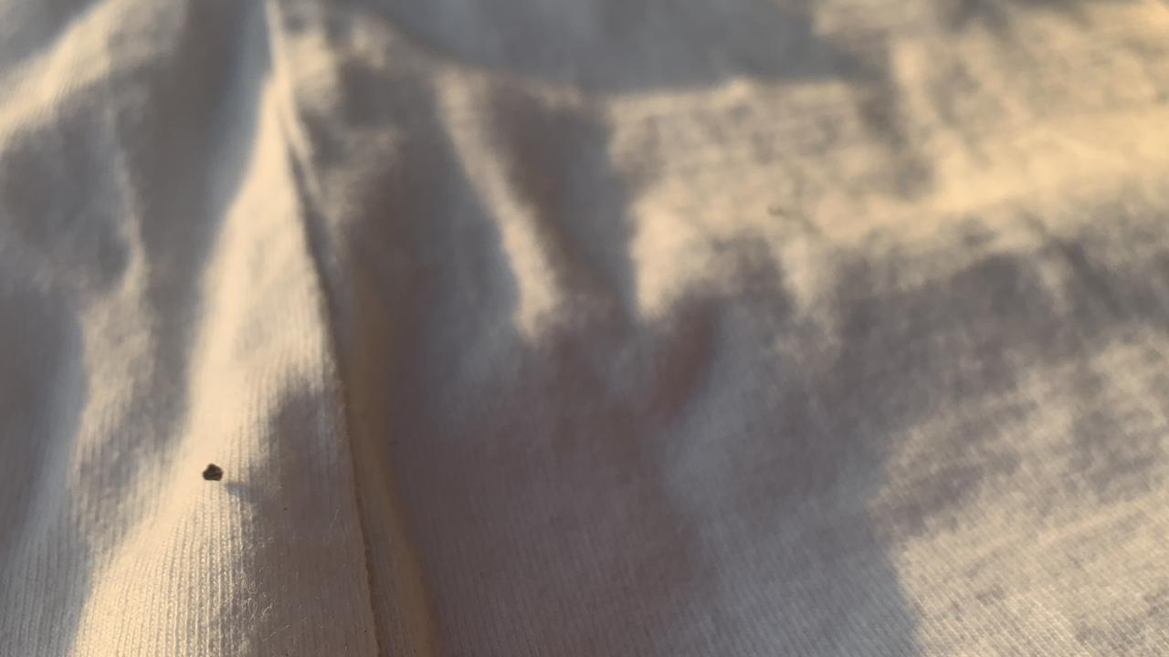
Some Sydneysiders taking in their washing this morning were faced with an unusual and disturbing sight on their cloths: large flecks of ash.
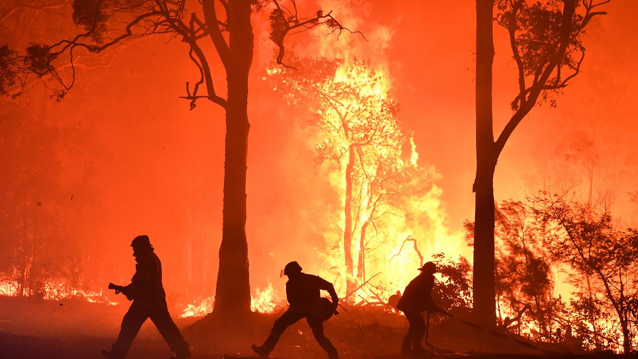
For days Sydney’s skies have been covered by a haze of smoke produced by ash particles. Now bigger particles have begun descending to the ground as millions of residents find themselves directly beneath smoke plumes from fires on the city fringe.
As one social media user said: “It’s raining ash”.
The ash has been landing over the CBD and inner suburbs far from the fires. It’s leading to yet another day of terrible air quality, by some accounts the equivalent of smoking 34 cigarettes a day.
The westerly winds transporting the ash to the city are unusual for this time of year. It’s also bringing scorching highs over the next few days, not just to Sydney but Brisbane as well. There’s no relief in the west with Perth set to hit 41C this week.
Sky News Weather Channel Meteorologist Tom Saunders told news.com.au the white and black particles attaching themselves to socks and shirts, which people have taken to social media to remark on, are the remnant of burnt bush to the west of Sydney.
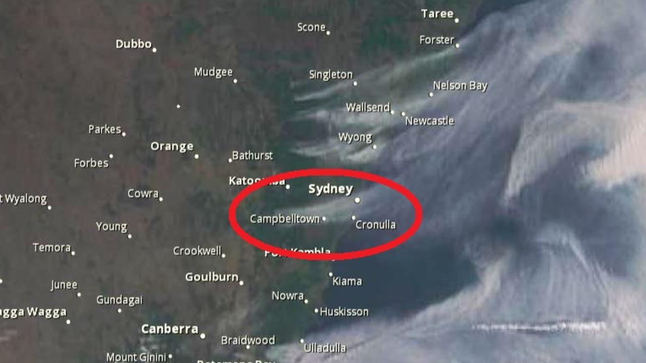
“There is definitely ash blowing across Sydney, from a fire blowing south of Blue Mountains.
“The southern part of Sydney is directly under the smoke plume that’s coming from a fire burning just south of Warragamba Dam and blowing east. That explains why there is ash over people’s washing.”
It may be sadly regular for regional communities, but ash falling in Sydney has turned heads.
There were 110 bush and grass fires burning in NSW on Wednesday, 45 still to be contained. The fires stretch from the Murray to the Tweed with scores around the Sydney basin.
The preponderance of smoke particles, soot and ash, are what’s measured to judge air quality levels. And if actual chunks of ash are falling to the ground you can guarantee that means it’s going to be another stinker of a day when it comes to pollution.
RELATED: Air in parts of Sydney as bad as smoking 34 cigarettes
Sydney’s west, south and CBD are set to choke through a day of “hazardous” air quality. That will be the worst anywhere in New South Wales. But, in contrast, Sydney’s north will actually have good air quality today.
That’s all down to the fact that the smoke plume blanketing parts of Sydney, and giving the city an eerie yellow glow, hasn’t extended far north of the harbour. There, skies are clear.
A lot of ash falling on my outdoor table during dinner from fires outside Sydney pic.twitter.com/JdARPf5CSQ
— Tom Steinfort (@tomsteinfort) December 3, 2019
Poor air quality, it’s raining ash. Sydney is choking! We need some rain #NSWbushfires pic.twitter.com/O7gJCMoUSL
— Alex Contreras (@AlexC0ntreras) December 3, 2019
There is literally ash in the air around Sydney right now from the bushfires pic.twitter.com/s4Z245V7Cp
— Melanie Dinjaski (@MelanieDinjaski) December 3, 2019
Ash just falling from the sky in the Inner West of Sydney pic.twitter.com/EPDc7SDA6b
— Alobar (@Alobar15) December 3, 2019
Rolling 24-hour levels of particles less than 2.5 micrometers in diameter, smaller fine particles that can easily be ingested and are often caused by bushfires, were at 275 in the city. Anything above 200 is in the highest warning category of hazardous. In Liverpool, in the city’s south west, levels were at 626 – more than three times what’s considered healthy.
Lingering smoke could be “unhealthy for sensitive people and could cause symptoms, especially in people with heart or lung disease”, the state’s environment department said.
Persistent westerly winds are the cause of the smoke being so lingering and so heavy in Sydney. These have blown the fires, almost continuously, directly over populated areas. What you want is the opposite – easterlies bring moisture from the Tasman over the city and towards the blazes, damping them down.
These westerlies are more a sign of winter than summer. But seasonal changes to Australia’s climate drivers have come late this year so the Southern Annular Mode, up from the pole, is continuing to influence the weather.
“The reason we are having these strong winds is the Antarctic vortex which is a temporary anomaly on the typical pattern. As we move deeper into summer the less likely the chance of westerly winds will become,” said Mr Saunders.
RELATED: Australia summer weather outlook for 2019/2020
That will mean there will be a lesser chance of winds carrying smoke from specific fires to the west of Sydney into the city. But there’s only one thing that will stop the haze and the ash completely, Mr Saunders said.
“There will be no improvement in air quality, there will be more of the same, until we have seen widespread rain.”
HEATWAVE CONDITIONS
That wind is blowing up and down the east coast and will bring hot temperatures to NSW and Queensland tomorrow.
Sydney’s CBD is facing 33C on Thursday while Penrith, in the west, will hit 36C for two days straight.
There are heatwave conditions in Brisbane where it isn’t looking to dip blow a maximum of 30C for at least the next week. Today, it will be getting to 34C and then rising to 35C on Friday. Ipswich, in the western suburbs, will top out at 41C on Friday and Saturday.
Max temperature is now 41.6°C and that's the earliest 40°C day on record for #Perth for December. Previous earliest was 40.4°C on the 5th 1977. https://t.co/saomQAtltJ pic.twitter.com/oKSiNKhu6K
— Bureau of Meteorology, Western Australia (@BOM_WA) December 3, 2019
Perth is also sweltering under heatwave conditions. Yesterday it saw it’s earliest 40C-plus day of summer ever. It will reach 36C today and then 41C on Friday. Darwin is also hot on 35C all this week.
It’s cooler elsewhere with Canberra expecting a warm rest of the week with temperatures in the mid to late twenties but chilly nights.
Melbourne will see a string of cloudy days reaching a mere 21C but there will be a spike early next week of 34C.
Hobart will get to 15C today and 18C on the weekend with showers expected. Adelaide will be on 23C today rising to 27C on Friday but watch out for a scorching Sunday when the South Australian capital will see 37C.

‘Never seen before’: Shock pics of algal bloom
A federal minister has spoken out about the dead marine life from a toxic algal bloom as new pictures reveal the extent of the devastation.

Albo reconnects with Aussie icon in China
Anthony Albanese has gotten a big dose of panda diplomacy in China, reconnecting with an Aussie favourite as he winds down his state visit.

Greens demand PM act on toxic bloom
As one Aussie state continues to suffer from a “disaster” algae bloom that is putting the future of the fisheries industry in crisis, the Greens have made a simple demand from Albo.