
Australia summer weather outlook for 2019/2020
The Bureau of Meteorology has given its first forecast for what Australia’s summer will deliver and one graph in particular is focusing minds.

With all the destructive bushfires of late you might have thought we were in for a tinder dry summer.
But meteorologists have something of a surprise in store – overall during summer we may actually see average rain across much of Australia as the weather systems that have baked the continent for the last few months break down.
It could even be wetter than average in Western Australia.
However, that good news doesn’t stretch to the east coast. If there’s part of Australia that is going to have a particularly hot and dry summer it’ll be in New South Wales and Queensland. Expect heatwaves and, yes, the possibility of bushfires.
The Bureau of Meteorology (BOM) released its outlook for summer weather today. It’s a long term forecast so it deals in general conditions rather than whether or not it will, say, be raining on a particular day.
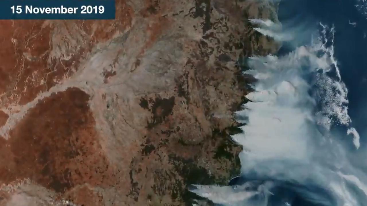
Looking back first and the heat that has enveloped Australia over the last few months is likely to see spring declared as one of the driest on record.
This was caused by the interaction between three weather systems, the effects of which will last longer into summer than usual.
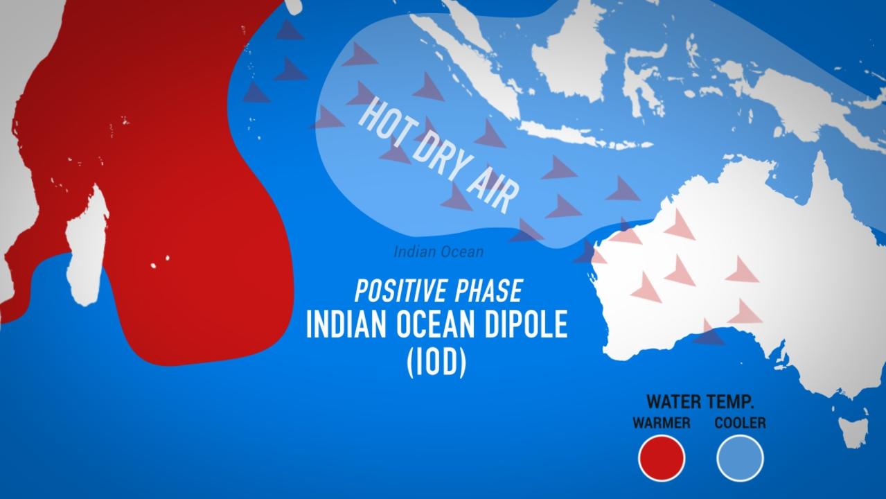
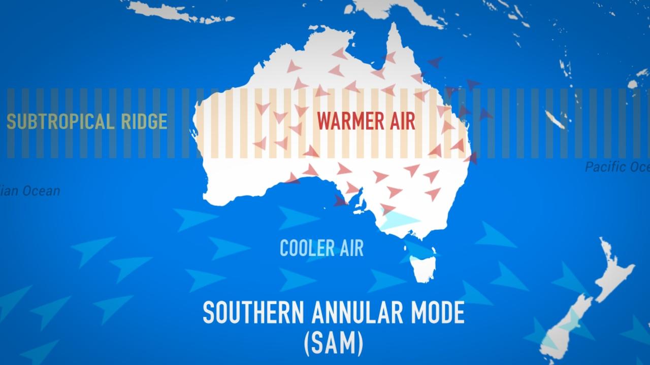
OUR WEATHER DRIVERS
The well-known El Nino and La Nina system in the Pacific has been in a neutral mode. Essentially it sat spring out. That’s meant two other weather systems have had a far greater influence.
In the waters off Western Australia the Indian Ocean Dipole (IOD) is in a positive phase and that’s seen reduced rainfall and heat across the continent.
A further system springing up from Antarctica called the Southern Annular Mode (SAM) has strengthened westerly winds. This has turbocharged the blowing of hot desert air across eastern Australia. However, it also brought cooler ocean air to the south east which is why – a few scorching days aside – Victoria and Tasmania have had a relatively cool spring.
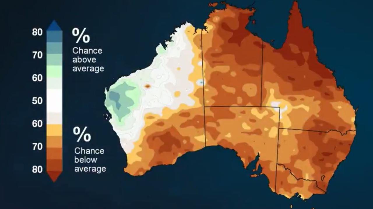
WEATHER CHART A WORRY
Those weather systems usually break down right about now. But they are stuck which means it’s much of the same – at least for a bit.
“December is likely to be hotter and drier than average with a good chance the monsoon will be delayed for tropical Australia,” said BOM Senior Climatologist Dr Andrew Watkins. On the first chart below you can see how parched the country is expected to be in December with most of central, northern, eastern and south eastern Australia with blow average rainfall.
“However that drier than usual pattern is likely to recede as summer progresses,” he added.
Indeed, as we head into 2020, the influence of the IOD and the SAM should lessen.
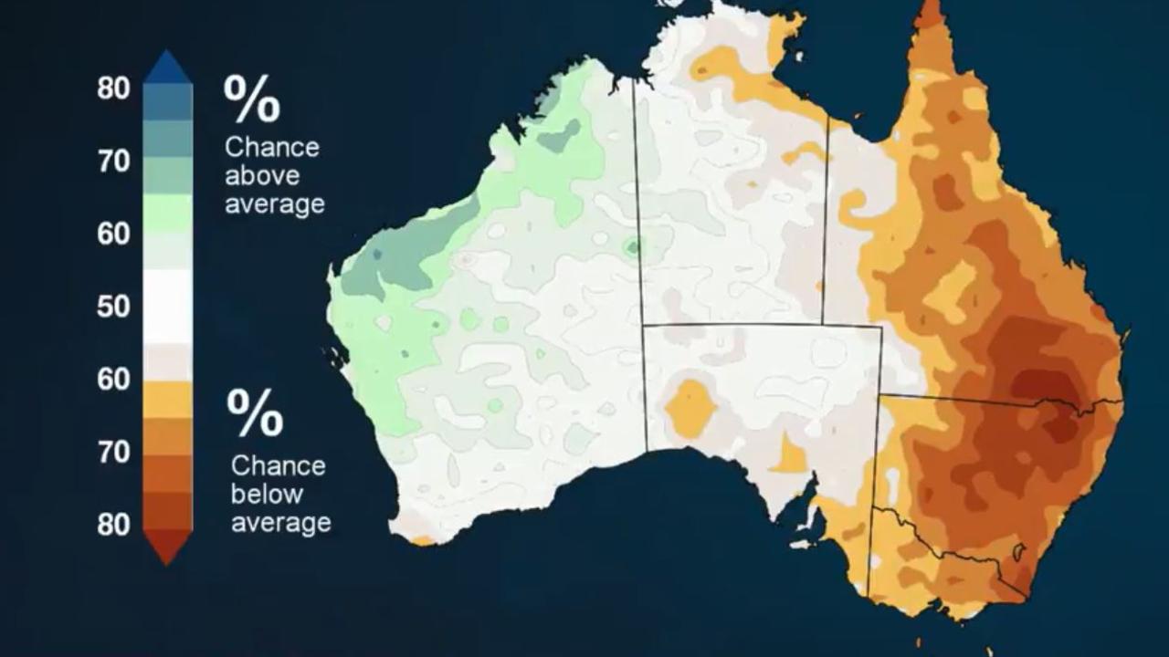
If you look on the second of the charts below you can see that the below average rainfall area massively reduces.
We could see rainfall back to average conditions across the centre of the nation and closer to average in South Australia and Victoria. In much of Western Australia it could even be wetter this summer than last, particularly so in the Kimberley.
But look at the east and not much has improved. It’s is still looking very dry, with a 60 – 70 per cent chance moisture levels will continue to be far below average.
Forecasters have warned that’s bad news for lots of reasons. One is water storages are down on last year. The Murray Darling basin for instance was 50 per cent full in 2018; this year it’s down to 38 per cent. Another is that drier than usual foliage lends itself to bushfires.
HOT SUMMER
In terms of temperatures – get set for a hot, hot summer.
“Days are very likely to be warmer than average across southern and eastern Australia. This means the risk of heatwaves and bushfires continue to be high,” said Dr Watkins.
In the north, the monsoon rains look they are going to be delayed. They were late in leaving India and are making their way to us but only sluggishly. There is an increased likelihood of a late arrival for the wet to the Top End and Queensland.
The monsoon can help break down the IOD, so its slow progress is one of the reasons Australia could hang on to its drier than usual conditions for a while longer than usual.
In summary, the weather is likely to remain pretty similar to now during December. However, later in the summer rain should increase, but if anywhere is going to miss out it will be NSW and southern Queensland.

Veteran firefighter dies in bushfire horror

Fire fears as heat blasts Aussies
