
Heat spike of 30C weather could hit five capital cities
Australia’s “heat engine” is in overdrive and that means no one should be fooled by the average temperatures – a change could be coming.

At least five capital cities could see temperatures rise north of 30C over the coming week, with some areas seeing maximums of more than 40C, as Australia’s summer-like start to spring continues.
Perth, Sydney, Canberra, Adelaide and Brisbane could all feel the heat.
The Western Australian capital will be first in the weather firing line with a top of 34C forecast for Wednesday.
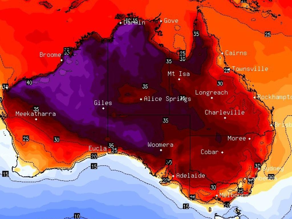
Then as the week progresses that heat could be funnelled towards the east.
But meteorologists have pointed out that the forecast for the weekend and beyond in the east is still some way out so temperatures predictions will firm up over the coming days. They could change – up or down.
“Broadly we have another round of heat building across the nation in the coming week and beyond as the tropics remain free of cloud and high pressure dominates,” Sky News Weather meteorologist Alison Osborne told news.com.au.
The warm air is being cooked up in WA’s north west around the Pilbara.
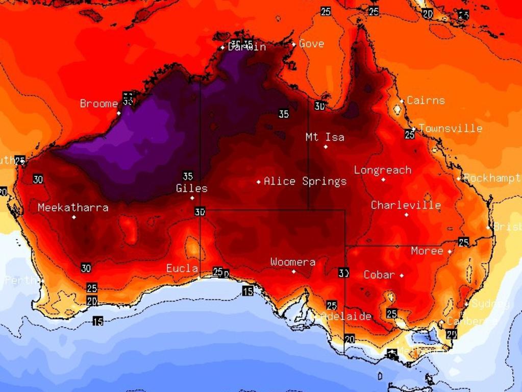
Last week, the Bureau of Meteorology said that a positive Indian Ocean Dipole (IOD) climate driver had developed, at the same time as El Nino. The IOD is helping to deprive north western WA of cloud cover which means there’s little to stop the air from baking.
Website Weatherzone has declared that “Australia’s heat engine is firing up early and September and October temperature records may be “challenged”.
Broome is looking at an unbroken week of mid-thirties highs while Port Hedland could reach 41C on Tuesday. Head inland to Marble Bar, credited as being one of Australia’s hottest towns, and its 41C all week long.
Perth could see 34C midweek
Some of that warmth will head down to southern parts of the state which could see temperatures 10 degrees higher than normal, said Ms Osborne.
“This heat pulls south over the Perth area on Wednesday with a forecast of 34C.”
But a sea breeze on Thursday morning should calm things down and push the mercury back in to the twenties. There could be some showers for the city on the weekend. By Monday it’ll be very spring like again with all the heat flushed out peaking at 18C with rain.
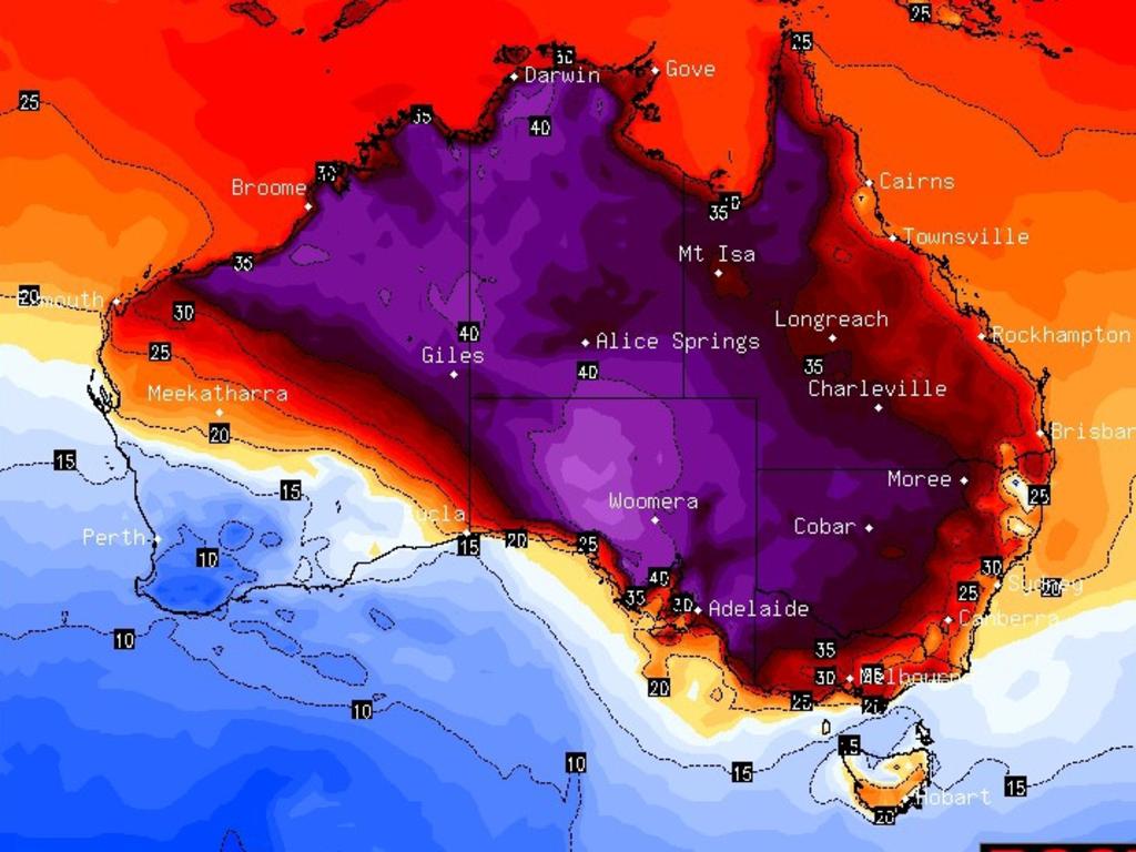
The Pilbara and Kimberley heat will also make its way slowly towards the east and south.
“From Friday to Monday, possibly longer, the hot, dry air mass from the northwest stretches through to the east coast,” said Ms Osborne.
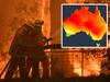
“It’s likely to peak on Sunday or Monday over the New South Wales coast with likely a couple of days of broadly elevated fire dangers.”
That could mean a sweep of days heading over the 30C barrier.
Sydney’s west looking at 36C
It won’t feel that way for much of the week in Sydney, however, with showers and a high of 23C which is only a touch above average for September.
But then on Friday there’s a forecast of 29C followed by as much as 33C on Sunday. As ever, in the city’s west, expect it to be warmer. Penrith could get to 33C on Friday and 36C on Sunday.
Broken Hill could reach 37C on Monday. Newcastle is looking at a 31C Friday, Tamworth could see 30C plus from Friday until at least Sunday, Wagga Wagga is forecast to peak at 33C on Sunday with Ulladulla at 31C on the same day.
Mid-twenties for Canberra for the week. But it will start climbing from Friday when it will be 26C, to 29C on Sunday and potentially 30C on Monday.
Tuesday will see 22C in Adelaide and then actually a bit cooler on Wednesday. But as that hot air makes its way across the desert the days will warm up with 28C on a sunny Friday, 30C on Saturday and perhaps 33C next Monday.
Melbourne will hover around its September average for the next few days with 18C on a cloudy Tuesday. On Friday it will get to 25C with the warmer days in the next week likely to be both Saturday and Monday which are forecast to reach 28C.
Tasmania will see a high of just 15C on Tuesday with a chilly 5C low. Much of the week will see mid-teen maximums but it could get to 22C on Hobart on a sunny Saturday.
A warm week for Brisbane with 28C on Tuesday and then 31C on Wednesday. Temperatures will then bob around the 30C mark during a week of mostly blue skies.
In the Northern Territory, Alice Springs is right beneath that conveyor belt of warmth. It’s forecast to see highs above 30C all week, with 34C the norm and as much as 37C on Sunday.
Darwin will be on 35C for the next seven days with 23C lows for a dry week.
Specific forecast more than a few days out have a margin of error so it could be later in the week before we know exactly if another round of heat for the east is due to kick in.

Millions brace for brutal cold fronts
A fresh wave of wild weather is preparing to lash Australia, bringing freezing winds, thunderstorms and icy blasts to millions.

Wild weather warning for this capital city
There will be “one last sting in the tail” of the polar air blast that has marched across Australia, with wild winds to continue battering the nation.

‘Lost everything’: ‘Bomb cyclone’ no fizzer
Just because you weren’t affected didn’t mean the “bomb cyclone” weather event was overhyped. Not everyone was so lucky.