
‘Destructive’ triple whammy weather threat
Parts of Australia could be smashed three times this weekend by “destructive” weather while other parts are set to see scorching heat.

A “destructive” triple whammy of cold fronts will smash through parts of Australia this weekend bringing no respite from the dangerous conditions.
One meteorologist said there was a “really nasty’ weekend ahead.
That’s in addition to sweltering, record breaking, heat for the country’s central and northern areas with temperatures closer to high summer than the last day of winter.
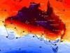
On Friday, Birdsville, in the Queensland interior, hit 39.7C. That’s around 15 degrees above average at is Queensland’s highest winter temperature on record as a hot air mass parks itself over the continent.
Locations in New South Wales, South Australia and the Northern Territory also saw their highest record winter temperatures on Friday.
Sydney’s 30.3C Friday maximum was only the third time the city has peaked past 30C during winter since records began in 1858. That’s leading to winter bush fire risks.
On Saturday Brisbane could see a maximum of 35C. And yet Hobart will merely get to 13C.

Triple whammy of fronts
It’s in the south east where conditions are particularly hectic and concerning the emergency services this weekend.
Bureau of Meteorology (BOM) meteorologist Jonathon How said three distinct cold fronts were powering through Victoria, Tasmania and southern parts of SA and NSW this weekend: one overnight on Friday and then one each on Saturday and Sunday.
All of them are set to lead to a slew of severe weather warnings for gales, damage to property, treacherous conditions and localised flooding.
“On Sunday, that’s where we’re expecting the strongest of these three cold fronts to move through … and that will bring widespread damaging to destructive winds across multiple states, as well as heavy bursts of rainfall, thunderstorms, local hail and snow down to low levels,” said Mr How.

‘Really nasty’
Sky News Weather meteorologist Rob Sharpe said after a breezy start to Saturday there might be a lull in the middle of the day but during the afternoon the weather will turn again.
“It’s the overnight windy weather that’s going to be really nasty because that’s when the fronts keep hitting the southeast,” he said.
“The end of spring and the start of winter is traditionally windy season, but this is a very windy event that’s taking place”.
Early on Saturday morning a severe weather warning was in place for south east SA close to Adelaide and down to the border. Winds gusts of 90km/h are possible.
But as with all the weather warnings it’s important to note they can change and the fiercest conditions might be on Sunday for which warnings have not yet been issued.
Adelaide will see weekend maximums of 19C and showers, some heavy. It will likely remain windy until Monday at least.
The BOM has large areas of Victoria under a severe weather warning for 50-60km/h winds into Saturday morning and 100km/h gusts in elevated areas.
South west Victoria, Geelong, the Gippsland Coast and the Alps are all affected.

Treacherous costal conditions
There are also warnings in place of most of Victoria’s coastline for abnormally high tides and damaging surf which could be dangerous to surfers, swimmers and rock fishers.
The BOM’s Mr How said waves of six to seven metres were possible off shore and potentially up to nine metres on Sunday. That applies to northern and western Tasmania too.
Maximums of 18C in Melbourne are forecast across the weekend with some showers and 25-40km/h winds, potentially increasing at night.
All of Tasmania is in a severe weather warning for damaging winds. The winds could range from 60-70km/h but gusts of 110 or even 120km/h are possible on coastal and elevated areas.
For the weekend, a rainy Hobart could see up to 20mm of moisture each day and 13C highs with winds of up to 40km/h.
NSW’s severe weather warning cover the Snowy Mountains and state’s south east up to the Illawarra and the Blue Mountains. 100km/h winds in elevated and coastal areas are possible.
Sydney’s toasty Friday high will come down a touch to 25C on Saturday and 27C on Sunday with winds of around 40km/h during parts of the day.
Gusts of up to 50km/h can be expected in Canberra this weekend with mid teen maximums and no rain.

Scorching heat
A scorcher in Brisbane of 35C on Saturday followed by 34C on Sunday. A drop in the mercury should come from Tuesday down to the mid-twenties.
Birdsville is looking at 35C on Saturday, Mt Isa and Roma could both see 37C.

Northern Queensland may well be cooler with Townsville peaking at 29C on Sunday and Port Douglas 28C.
Very reasonable conditions in Perth with weekend highs of around 20C and a few showers. WA should be clear of the severe weather warnings.
Darwin can expect 33C and dry conditions for the next few days. Alice Springs is forecast to get to 35C on Sunday.

Millions brace for brutal cold fronts
A fresh wave of wild weather is preparing to lash Australia, bringing freezing winds, thunderstorms and icy blasts to millions.

Wild weather warning for this capital city
There will be “one last sting in the tail” of the polar air blast that has marched across Australia, with wild winds to continue battering the nation.

‘Lost everything’: ‘Bomb cyclone’ no fizzer
Just because you weren’t affected didn’t mean the “bomb cyclone” weather event was overhyped. Not everyone was so lucky.