
Australia set to be hit with sweltering spring temperatures
Australia is set to be hit with a sweltering spring, kicking off with a blistering heatwave with one town forecast to sweat through 40C on Saturday.


Australia is set to be hit with sweltering temperatures as a warmer-than-average spring weather rolls in.
Over the next three months, conditions across the country are likely to be much warmer than normal, according to the Bureau of Meteorology’s spring long-range forecast.
However, for Queensland, New South Wales and the ACT, this will also come with far more rain than usual for this time of year.
South Australia and Tasmania can expect “slightly” more rain than usual, while Western Australia is likely to experience average or below average rainfall.
The Northern Territory will experience “typical” rain, according to the forecast.

The northern wet season kicks off in October, but the first significant rains are expected to start earlier than usual in Queensland and parts of the Top End, but later in most of Western Australia.
The winter has been reported to be warmer than usual, sitting at 1.5C above the 1961 - 1990 winter average, data from the government agency shows.
BOM senior meteorologist Jonathan How said: “The Spring Long-Range Forecast shows an increased likelihood of warmer than average temperatures across all states and territories this spring.
“Rainfall forecasts are more mixed, with an increased likelihood of above average for large parts of eastern Australia, and more likely below average rainfall for large parts of Western Australia.
“The Long-Range Forecast is updated weekly with the forecast accuracy steadily improving as the start of the next month approaches.”
He added: “It is worth noting that spring is typically a time when southern Australia experiences large swings in weather associated with passage of cold fronts across the south, as well as more thunderstorm activity as the weather warms.”
“Exceedingly dangerous” weather
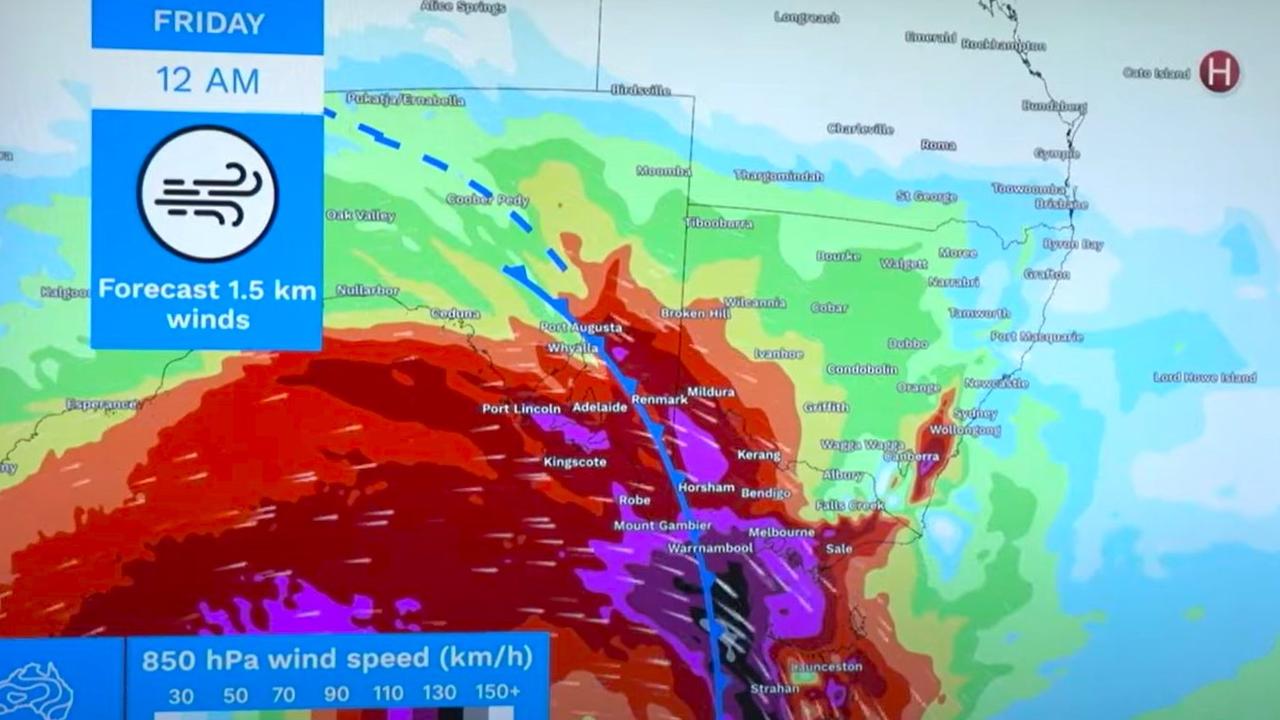
This week has been unusually warm and at least four states are set to be hit by a five-day period of “exceedingly dangerous” weather, forecasters have warned.
Meanwhile, a series of punishing cold fronts are set to smash the south east.
The SES has said it is “preparing for the worst” as winds of up to 125 km/h whip through.
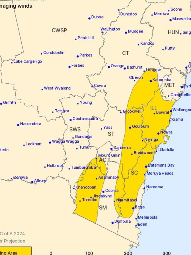
One state has a severe weather warning place for its entirety.
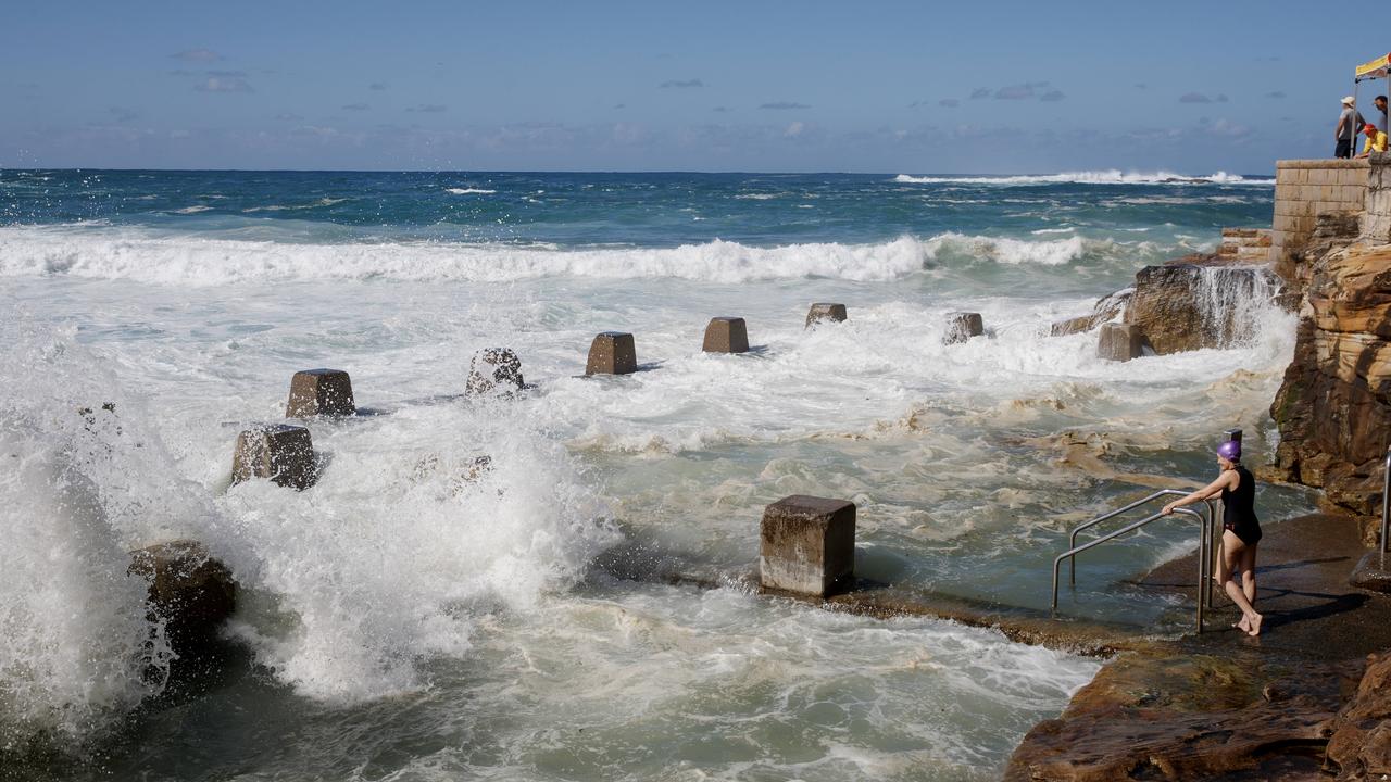
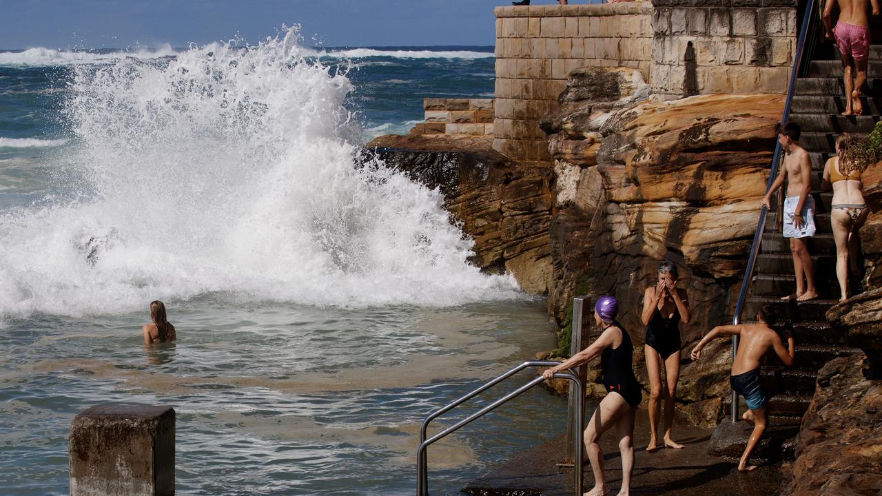
There are also warnings to not enter rough seas.
Temperatures have soared this week to 14 degrees above average in Queensland, with Birdsville expected to sweat through 40C temps on Saturday.
Sydney recorded temperatures of 30C on Friday and Brisbane is set for a 34C scorcher over the weekend.
Severe weather warnings are in place for parts of New South Wales and the Australian Capital Territory, Tasmania, Victoria and South Australia.
The unusually warm weather has sparked bushfire fears in NSW as wind speeds were forecast to reach 125km/h.
It was only on Wednesday that some parts of Victoria and Tasmania recorded winds fiercer that 150km/h.
“It’s going to be exceedingly dangerous,” said Sky News Weather meteorologist Rob Sharpe.
“Plenty more trees will come toppling down.
“We’ll watch a series of further fronts, one coming through Saturday morning, another Saturday night and then again on Sunday night.
“Right through until Monday it’s going to remain windy for the southeast – there won’t be a let up in those severe weather warnings for southeastern Australia, they’ll just be chopping and changing.”
Brisbane will be baking on the last days of winter, with 34C expected on Saturday and much the same for Sunday. In late August, highs of around 20C are far more standard.
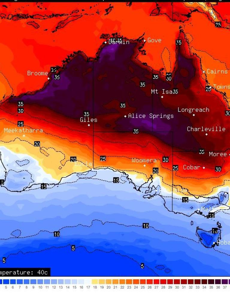
The severe weather is unlikely to reach this far north, however.
Cairns is looking at 29C and mostly sunny this weekend.
The severe weather warnings for Perth have been cancelled but that’s not to say some may reappear over the weekend associated with the various fronts.
Down south in Albany, winds of up to 50 km/h could be a feature through the weekend, while Broome is set to peak around 33C on Saturday.
Spring forecast breakdown in each state:
NSW and ACT
Warmer than usual, above-average rainfall in most areas, unusually high rainfall in NSW’s north and some central areas.
Victoria
Warmer than usual, typical rainfall in most areas, slightly increased chance of above-average rainfall in parts of the southwest.
Queensland
Unusually warm days and nights in most parts, above-average rainfall in most areas, first significant rains of the wet season likely to be earlier than usual.
Western Australia
Warmer than usual in most areas except for the south where temperatures will be average, unusually warm days and nights in the north, typical rainfall in most areas, first significant rain of the wet season likely later than usual.
South Australia
Warmer than usual with slightly above-average rainfall in southern agricultural areas and parts of the north.
Tasmania
Unusually warm days and nights, above-average rainfall in the east.


Northern Territory
Unusually warm days and nights, typical rainfall, first significant rains of the wet season likely earlier than usual.
— With Benedict Brook
Easter weekend drownings deadliest ever
A fateful combination of weather conditions has created the deadliest Easter long weekend in Australia’s recorded history.
Six dead in horror spate of Easter drownings
A sixth person has drowned after wild weather whipped up dangerous seas across the country over the Easter long weekend.
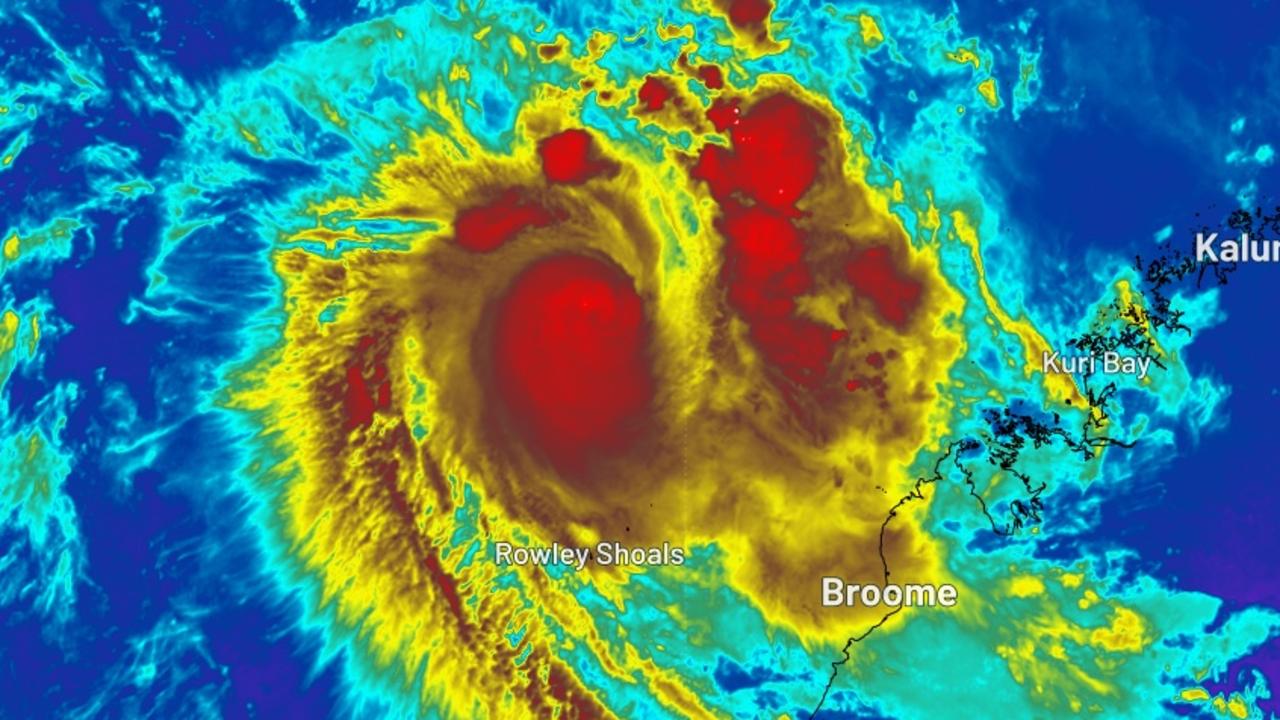
Locals on alert as cyclone nears
Residents are on alert with Cyclone Errol expected to cross the Australian coastline on Friday afternoon, bringing wind gusts of up to 140km.