Australia long weekend weather: Record breaking heatwave set to hit country’s south
The long weekend is set to be oppressive with a punishing heatwave engulfing millions and temperatures shooting into the forties.
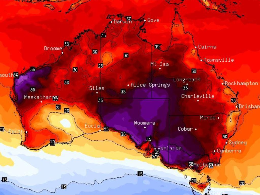
If you want to get an idea of how disgustingly hot it will get across Australia’s south this long weekend, consider the fact that at 2am – the dead of night – in Adelaide’s CBD on Saturday morning it was already 30.7C.
By 3pm it could be 40C.
Vast swathes of South Australia, Victoria and Tasmania are under heatwave conditions which will see major cities including Adelaide and Melbourne punished with temperatures pushing towards – or even – into the forties.
That’s more than nine million people set to sweat it out for days.
Melbourne could see three consecutive days from Saturday onwards of 38C or higher temperatures – something that hasn’t been seen since 1942. That’s a mere 82 years ago.
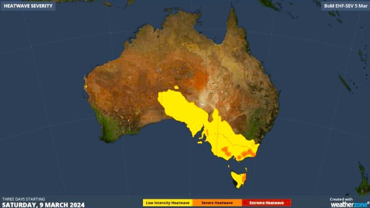
The cause of this autumn heatwave is a blocking high. This is a slow moving high pressure system which, rotating anticlockwise, is pulling hot winds from the north to the southern states.
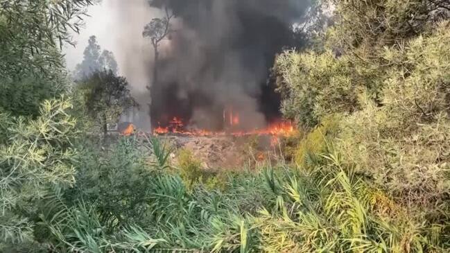
That’s also bringing an increase in bushfire risks.
As well as Tasmania, Victoria and SA, western and southern New South Wales and the ACT will also be affected.
A cold front, often associated with heatwaves, is heading towards the south east. But it’s relatively weak and relief isn’t likely until Tuesday.
The NSW coast will be cooler but will still see the mercury get into the high twenties.
While in Western Australia, the weekend could be sodden in some areas with weekly rainfall topping 100mm.
Dangerous heatwave
“A heatwave is not just one hot day and night: it’s a three-day period of unusually warm daytime and night time conditions that is really hard for the body to recover from,” Bureau of Meteorology (BOM) meteorologist Miriam Bradbury said.
“It’s a sign to us that we need to stay cool, stay hydrated and if you or someone you know is particularly sensitive to check in”.
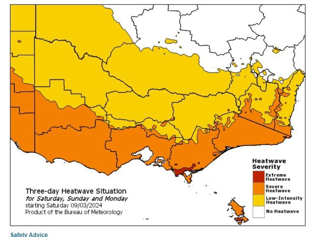
The BOM has a three day heatwave forecast stretching over all of SA, aside the remote northwest, the entirety of Victoria and Tasmania, the ACT and southern NSW.
Severe heatwave conditions, which are particularly challenging for the vulnerable, will envelop all of coastal SA and Vic and north and eastern Tasmania. Adelaide, Melbourne and Hobart are all in the heatwave zone.
Adelaide will top out at 40C on Saturday, one notch below that at 39C on Sunday and 38C on Monday.
Murray Bridge could see three days of 41C from Saturday.
With overnight temperatures in Adelaide not set to dip below 26C until early on Tuesday, the BOM has warned that “records could be set”.
Tuesday and Wednesday will still be in the thirties so it will be Thursday until more reasonable weather arrives.
Three days of near 40C in Melbourne
Prepare for 39C in Melbourne on a windy Saturday and 38C for Sunday and Monday. Tuesday should drop to 25C.
Nowhere, aside the mountains, will escape a 35C plus string of days in Victoria.
Across the Bass Strait into Hobart and a 34C high can be expected on Saturday dropping to the mid to high twenties for the following days with the possibility of some showers.
Canberra likely won’t see the maximums drop below 30C until Friday of next week. Saturday will reach 31C, a high of 32C is forecast for Sunday and Monday.
In NSW, southern areas are caught up in the same heatwave. Deniliquin will see 38C on the weekend, Griffith and Albury 37C, Wagga Wagga 36C and Ivanhoe 39C.
However, Sydney will sneak under the 30C mark on the weekend with 28-29C between Saturday and Monday. But on Tuesday a high of 32C could be reached.
Northern and coastal NSW should see high twenties maximums.
A trio of 29C days is in store for Brisbane with some showers. Then, on Tuesday, the highs will push above 30C peaking at 33C next Friday.
In Townsville some rain with 31C maximums.
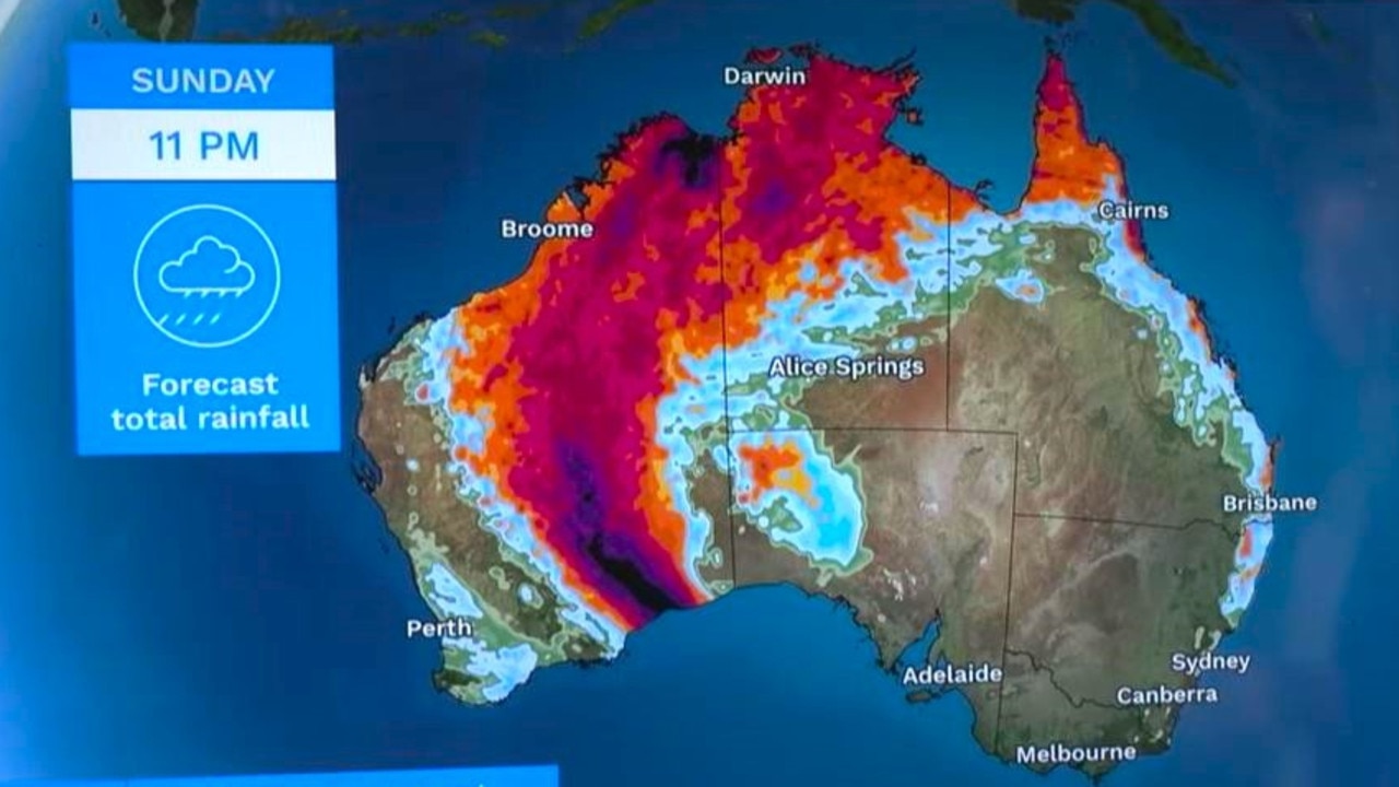
Wet in Darwin with up to 25mm of rain on Sunday coinciding with storms. The mercury should peak at 32C.
Perth will be a reasonable 27C on a sunny Saturday, rising to 29C on Sunday and 31C under blue skies on Monday.
A line of heavy rain is stretching from the south coast northwards. Kalgoorlie could see up to 20mm of rain on Saturday while Kununurra on the north coast could record between 25-130mm of moisture from Saturday and Monday.


