Brisbane suburbs in flood’s firing line as heavy rain and high tide combine
Brisbane’s Mayor has revealed new flood mapping as the Brisbane River surges above 2013 flood levels, with streets and properties inundated as more than 1400 homes in close to 100 suburbs are feeling its impact. He also said preparations have begun for the massive clean-up task ahead.
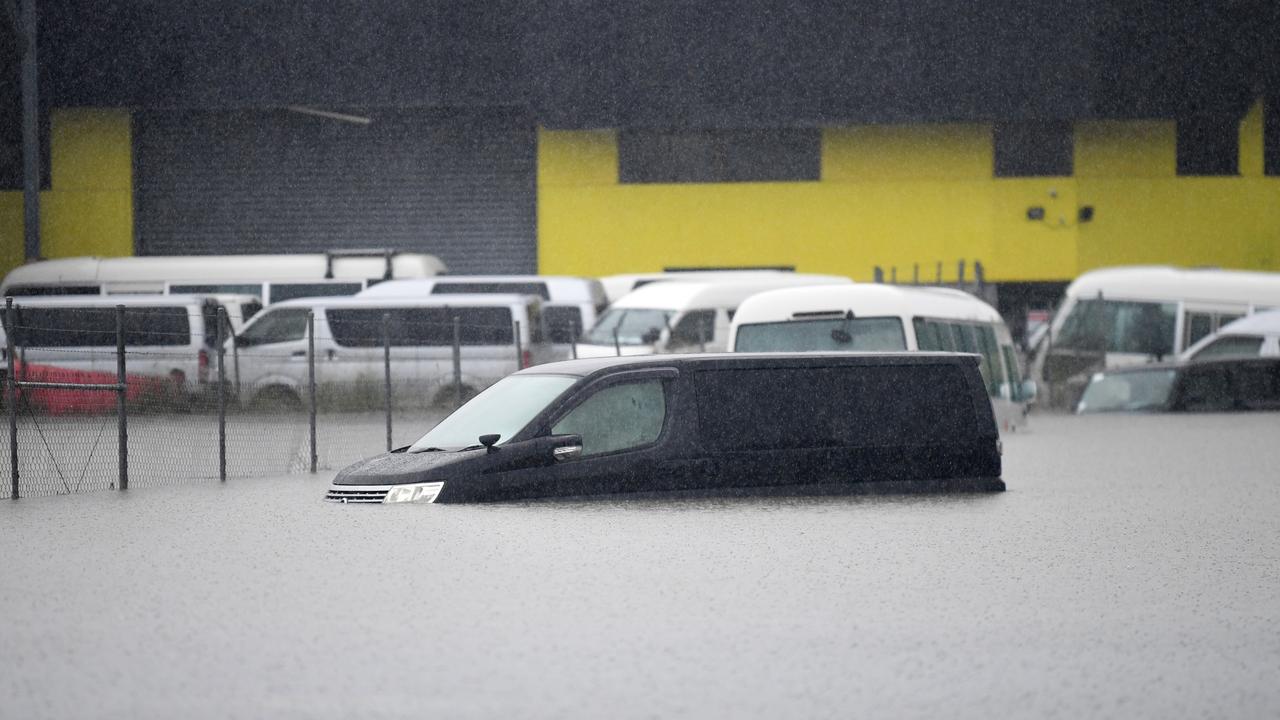
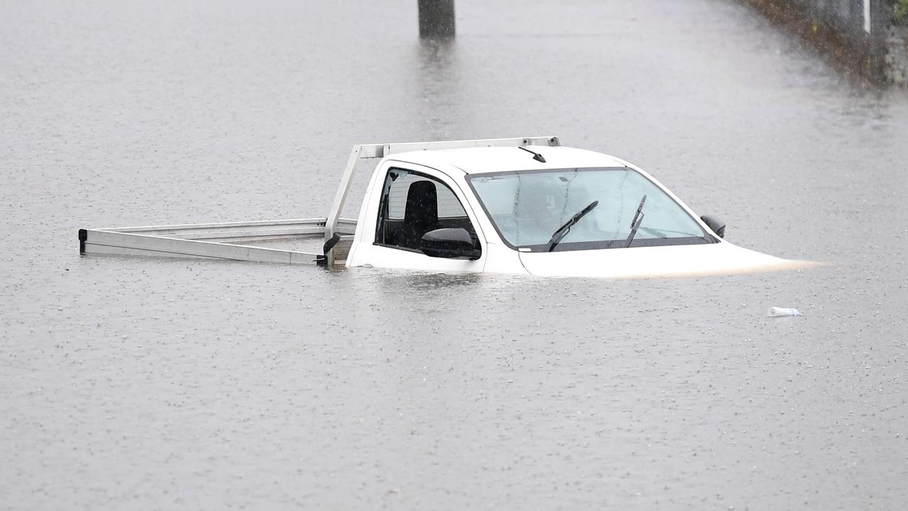
Brisbane residents are dealing with a flood crisis as days of torrential rain combine with a high tide at the mouth of the Brisbane River, more than 1400 homes have floodwater levels “above the floorboards”.
Nearly 100 suburbs, which include Brisbane CBD, Wilston, Windsor, Newmarket, Auchenflower, Hawthorne, Kelvin Grove and Hamilton, were in the firing line of inundation as the high tide was reached shortly after 7.30am, with residents scrambling to escape or to protect pets and belongings.
It began a day of dramatic rescues, and widespread inundation with authorities releasing new flood mapping and warning the threat would continue into Sunday night and Monday morning.
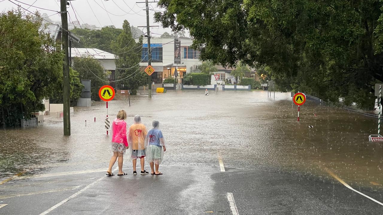
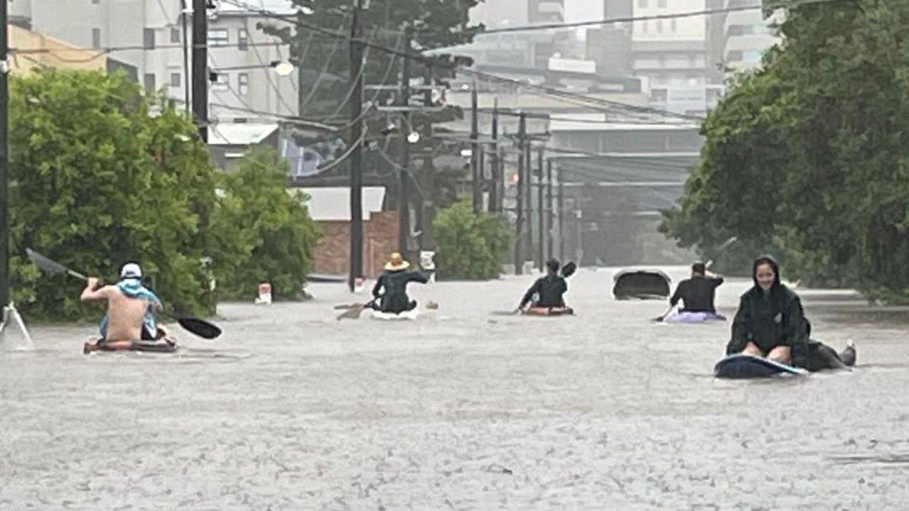
Premier Annastacia Palaszczuk said there have been calls for assistance from across the city, with dramatic roof top rescues and inner city residents rescuing their neighbours using surf and stand up paddleboards as waters flooded their homes.
The Brisbane River reached 3.1m this morning – higher than the 2013 flood peak of 2.30 metres – with at least 1430 homes in Brisbane which were impacted above the floorboards, Ms Palaszczuk said.
Wivenhoe Dam releases have occurred, but they have not impacted downstream areas yet.
There is expected to be “high levels” of water in rivers and streams for the next three days at least.
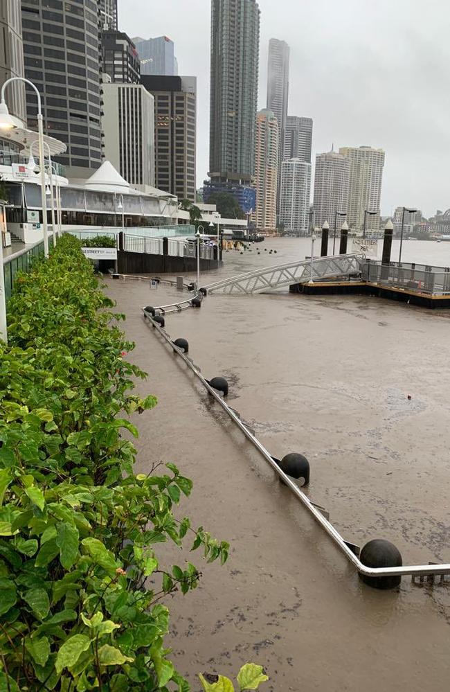
“The river level is above the level of the 2013 flood peak (2.30metres). Slightly lower levels are expected with Sunday evening’s high tide. The Brisbane River at Brisbane City is likely to reach around 3.00 to 3.20 metres with the high tide during Monday morning.
River levels are not expected to drop below minor flood levels for at least the next few days
SCROLL DOWN FOR THE FULL LIST OF BRISBANE SUBURBS AFFECTED
Lord Mayor Adrian Schrinner said thousands of properties could be affected.
“For many Brisbane residents, this terrible rain event will be reviving memories of the 2011 floods,” he said.
“Our latest modelling shows flows from the catchments and the potential for further Wivenhoe Dam releases into the Brisbane River may combine with (Sunday’s) high tide (and) this could impact thousands of residential properties.
“Households in low-lying areas should make sure they’re prepared.
“Stock up on sandbags at our depots, ensuring you have essentials and know when it’s time to leave.”
This afternoon, Cr Schrinner released new flood mapping and said preparations for Mud Army 2.0 were under way.
Cr Schrinner tweeted the new map this afternoon, and warned residents in areas shaded blue to be prepared:
“Stock up on sandbags, ensure your household has essentials and know when it’s time to leave,” he said.
Brisbane residents can check the map here.
‼ï¸UPDATED FLOOD MAPPING‼ï¸
— Adrian Schrinner (@bne_lordmayor) February 27, 2022
Updated flood modelling is now available based on tomorrow morning’s predicted high tide (approx. 8am). Click here for a detailed view: https://t.co/308o3eA7uepic.twitter.com/N7FoMsRJsd
As a massive storm lashed the CBD, Cr Schrinner referenced the clean-up job ahead.
“Let me be clear. Now isn’t the time to start cleaning up, however, we’re making plans to gear up once the rain subsides and it’s safe to do so,” he said.
“I’ll share details soon on how you can register to help with Brisbane’s recovery effort.”
Residents in Graceville earlier today said it’s getting “serious” and issued calls for help, while there were reports of evacuations at Corella St in Rocklea.
In Yeronga, residents on Astolat St moved belongings to higher levels, while a resident of Central Ave in Sherwood said his property is “almost two to three metres submerged”.
A 5am alert issued on Sunday by the Bureau of Meteorology warned a low pressure system has developed and is embedded within the surface trough that has been causing havoc over the past few days.
“This low is expected to track southward along the Southeast Queensland coast and into northeastern New South Wales today producing further heavy to locally intense rainfall with embedded thunderstorms,” the alert said.
“Heavy rainfall which may lead to flash flooding is forecast to continue over parts of southeast Queensland today. Six-hourly rainfall totals between 60mm and 120mm are likely to continue, reaching up to 150mm over areas southeast of Caloundra to Warwick.
“Locally intense rainfall leading to dangerous and life-threatening flash flooding is possible with thunderstorms during this period, particularly over coastal areas south of Caloundra and the Gold Coast hinterland.
“Six-hourly rainfall totals in excess of 200mm are possible.”
BRISBANE SUBURBS AT RISK ON SUNDAY
ACACIA RIDGE
ALBION
ANSTEAD
ARCHERFIELD
AUCHENFLOWER
BALMORAL
BELLBOWRIE
BOWEN HILLS
BRISBANE AIRPORT
BRISBANE CITY
BROOKFIELD
BULIMBA
CANNON HILL
CARINA
CARINDALE
CHAPEL HILL
CHELMER
CHUWAR
COORPAROO
CORINDA
DARRA
DOOLANDELLA
DUTTON PARK
EAGLE FARM
EAST BRISBANE
FAIRFIELD
FIG TREE POCKET
FORTITUDE VALLEY
GRACEVILLE
GREENSLOPES
HAMILTON
HAWTHORNE
HEMMANT
HERSTON
HIGHGATE HILL
INDOOROOPILLY
JAMBOREE HEIGHTS
JINDALEE
KANGAROO POINT
KARANA DOWNS
KELVIN GROVE
KENMORE
KHOLO
LAKE MANCHESTER
LYTTON
MIDDLE PARK
MILTON
MOGGILL
MOOROOKA
MORNINGSIDE
MOUNT CROSBY
MOUNT OMMANEY
MURARRIE
NEW FARM
NEWMARKET
NEWSTEAD
NORMAN PARK
OXLEY
PADDINGTON
PINJARRA HILLS
PINKENBA
PORT OF BRISBANE
PULLENVALE
RED HILL
RIVERHILLS
ROCKLEA
SEVENTEEN MILE ROCKS
SHERWOOD
SINNAMON PARK
SOUTH BRISBANE
ST LUCIA
SUMNER
TARINGA
TENERIFFE
TENNYSON
TINGALPA
TOOWONG
WACOL
WEST END
WESTLAKE
WILLAWONG
WILSTON
WINDSOR
WOOLLOONGABBA
More Coverage
WYNNUM WEST
YEERONGPILLY
YERONGA
Originally published as Brisbane suburbs in flood’s firing line as heavy rain and high tide combine
Read related topics:Brisbane


