
Ex-tropical cyclone Megan: NAB disaster relief up to $1000
Disaster relief for Territorians affected by tropical cyclone Megan could be on the way. Here’s how to access it.

Editor's note: An earlier version of this story contained reader comments that breached editorial guidelines.
March 22, 11am: Territorians affected by the aftermath of tropical cyclone Megan could access up to $1000 in disaster relief thanks to the generosity of one bank.
NAB customers in East Arnhem, West Arnhem and Roper Gulf can apply for the grants.
NAB Executive Retail NT, SA, and WA Libby Greenwood said customers could also apply for loan deferrals and reduced repayments, deferred credit card payments, and waived or refunded fees such as merchant terminal fees or early access fees to term deposits.
“To the East Arnhem, West Arnhem and Roper Gulf families, communities and businesses who have suffered significant damage to their homes, farms and premises: we are here to help,” Ms Greenwood said.
“This will be a testing time for our communities and we’re standing by them, providing immediate assistance and making $1,000 grants available to help those most affected.
“NAB customers impacted in East Arnhem, West Arnhem and Roper Gulf, are encouraged to contact us as soon as possible.”
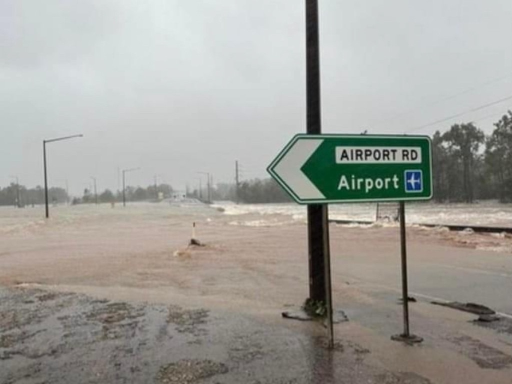
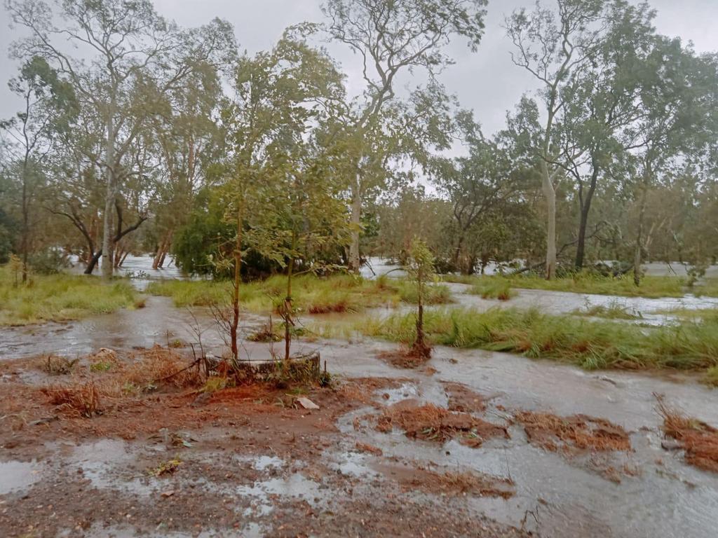
March 20, 6.20pm: Emergency services are racing against time to evacuate hundreds of Borroloola residents from an oncoming flood expected to rise 18 metres.
On Wednesday afternoon, NT Police Commissioner Michael Murphy told a press conference in Darwin that operations were under way to evacuate residents from the town, which could experience a water peak between 9.00pm and midnight.
“Due to the huge rainfall we saw attached to ex-tropical cyclone Megan, the amount of water coming through the tributaries into the McArthur River is going to reach around 18 meters at Borroloola.”
Commissioner Murphy confirmed up to 400 residents between the two residential areas of Yanyula and Garrawa were expected to be evacuated by four ADF aircraft deployed in the area, with Garrawa residents to be ferried to the airstrip by boats due to the water levels.
“The (aircraft) can take 100 passengers each that will depart between 5.30pm and 7.00pm (today),” he said.
“So we’re going to load as many people as we can that want to leave.”
Commissioner Murphy said four tonnes of food and water had been delivered for anyone who would remain behind, which could sustain residents for up to 72 hours.
The 18 metre-high prediction would eclipse the last significant flood in the region – 15 metres in 2000 – should it occur.
“(This) flood is absolutely significant and it probably just demonstrates the change in environmental conditions we’re facing with changing conditions and increased flood levels,” Commissioner Murphy said.
“You know, (a) one in a 100 year flood is really serious, we’re taking it incredibly seriously and we’re doing everything we can to make sure the residents of Borroloola are safe.”
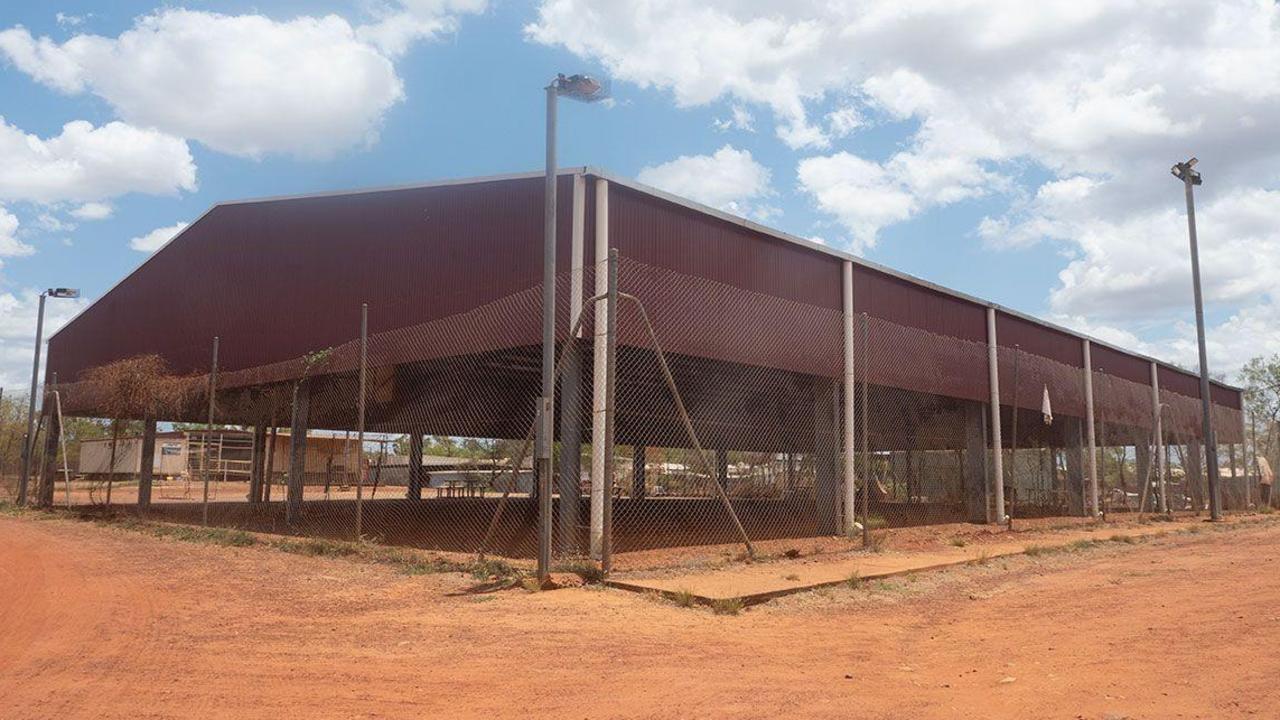
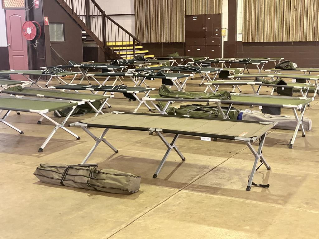
Evacuees will be accommodated at Foskeys Pavilion and Marrara Stadium.
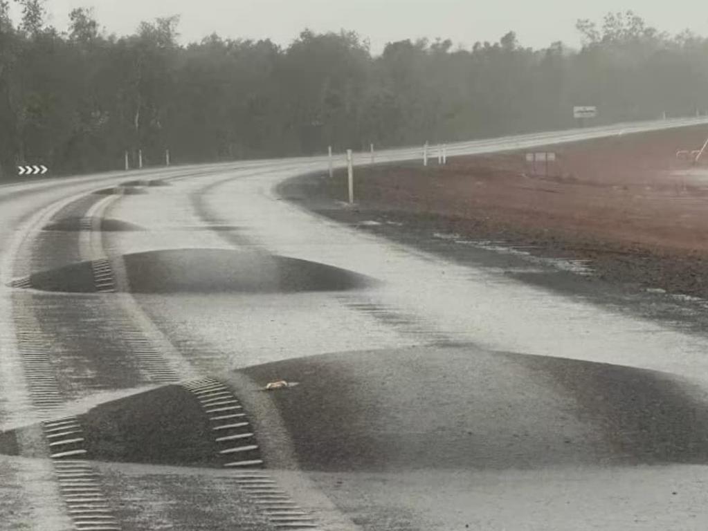
Stuart Highway reopened, High Clearance 4WDs recommended
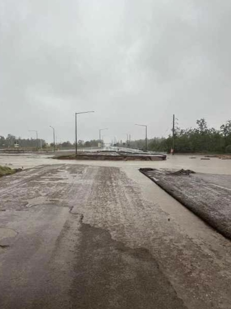
March 20, 3.50pm: The Stuart Highway has been reopened between Tennant Creek and Threeways.
SecureNT advise only High Clearance 4WD vehicles are recommended to traverse the section of reopened road.
Water remains over the road at various locations along the Stuart Highway and motorists have been reminded to drive to the conditions.
Floods cut off section of Stuart Highway, motorists warned
March 20, 3.30pm: The Stuart Highway has been closed between Tennant Creek Bridge North Abutment and Threeways due to flooding.
Road Report NT confirmed the closure was due to water had sweeping over various locations across the Highway.
Motorists near the affected region are advised to drive to conditions as the situation unfolds.
The announcement comes as Ex-tropical cyclone Megan continues to move westwards, with heavy rainfall identified as a threat to regions in its path.
Ex-tropical cyclone Megan to dissipate but warnings remain
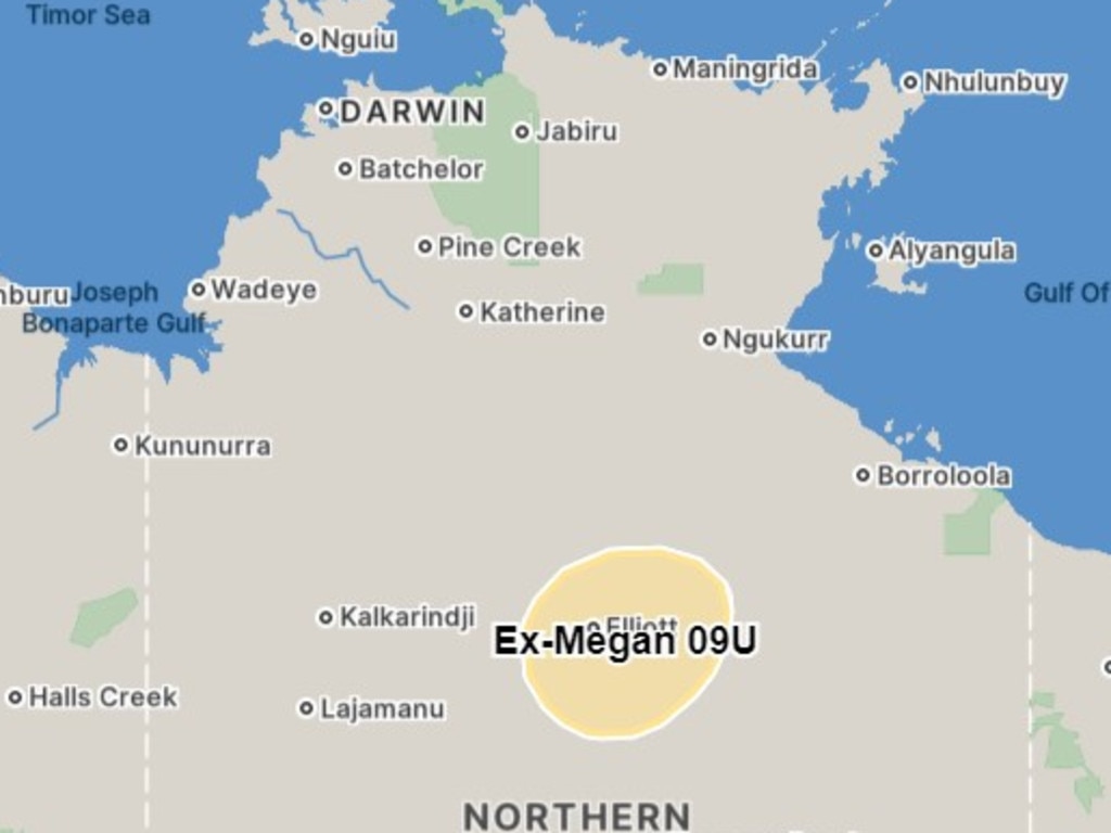
March 20, 7am: Ex-tropical cyclone Megan is set to dissipate when it approaches the Western Australian border, but major flood warnings remain for the NT as the system leaves its mark.
The tropical low hovered over the northern Barkly region – near Elliott – on Wednesday morning and continued moving west towards the Kimberley region.
The Bureau of Meteorology said a severe weather warning and flood watch was in place for inland parts of the NT and Carpentaria Coastal Rivers.
There is a major flood warning in place for McArthur River and a moderate flood warning for the Daly River.
Parts of the Barkly and Carpentaria districts have been issued a severe weather warning for heavy and locally intense rainfall.
“Heavy to intense rainfall will remain a threat with the system, primarily over its southern flank and widespread heavy rainfall is expected to extend to the WA border over the next few days,” the Bureau said.
“Rain and storms with isolated heavy falls are forecast over the next few days.”
The Bureau said daily rainfall totals of 60-150mm were on the cards during the flood watch area.
In some areas, isolated highs of 200mm could occur, most likely near the system’s centre.
Ex-cyclone Megan is expected to dissipate as it approaches the Western Australia border later this week.
The catchments likely to be affected include:
> Upper Victoria River
> Victoria River below Kalkarindji
> Waterhouse River
> Roper River
> Towns River
> Limmen Bight River
> Rosie River
> Robinson River
> Calvert River
> Settlement Creek
> Nicholson River
> Tanami Desert
> Barkly
> Central Desert
Speaking on local radio on Wednesday morning, NT Police Commissioner Michael Murphy said emergency services were preparing for “more water to come downstream” at Borroloola.
Speaking on the botched ADF evacuation on March 18, Mr Murphy said they had done “everything we could” at the time.
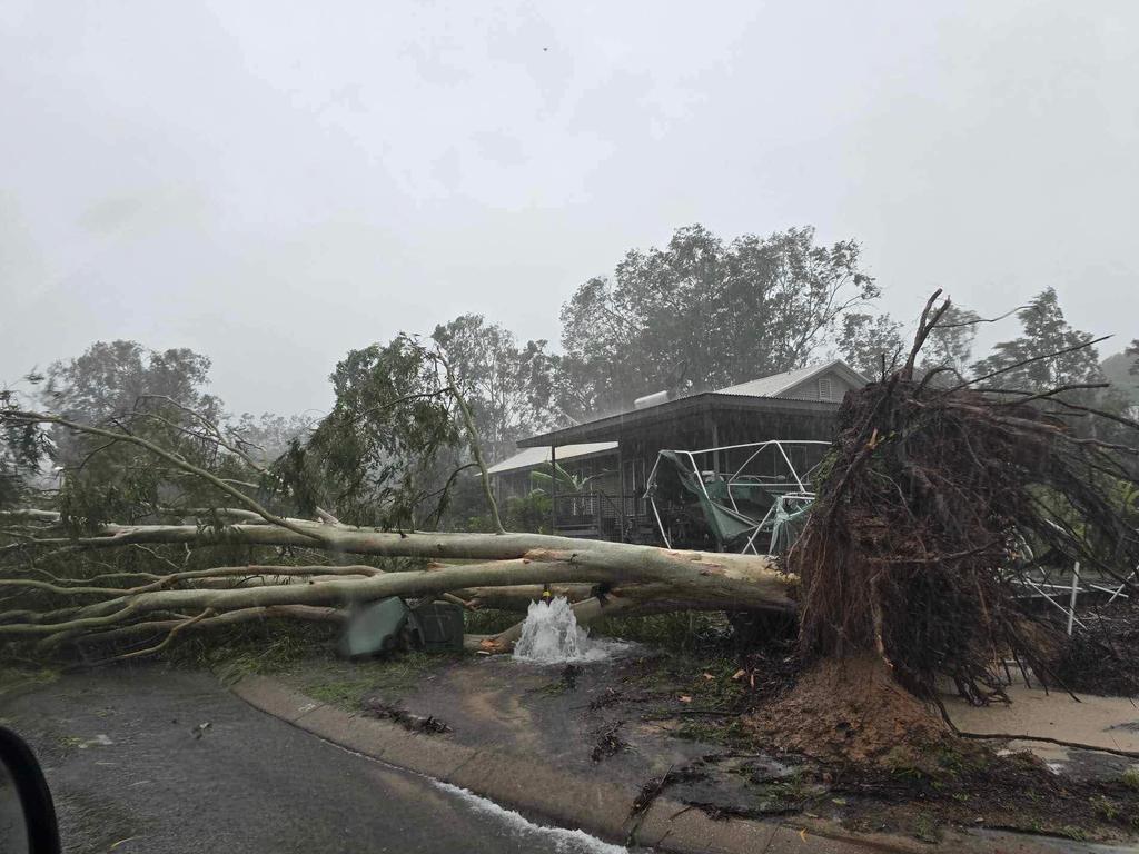
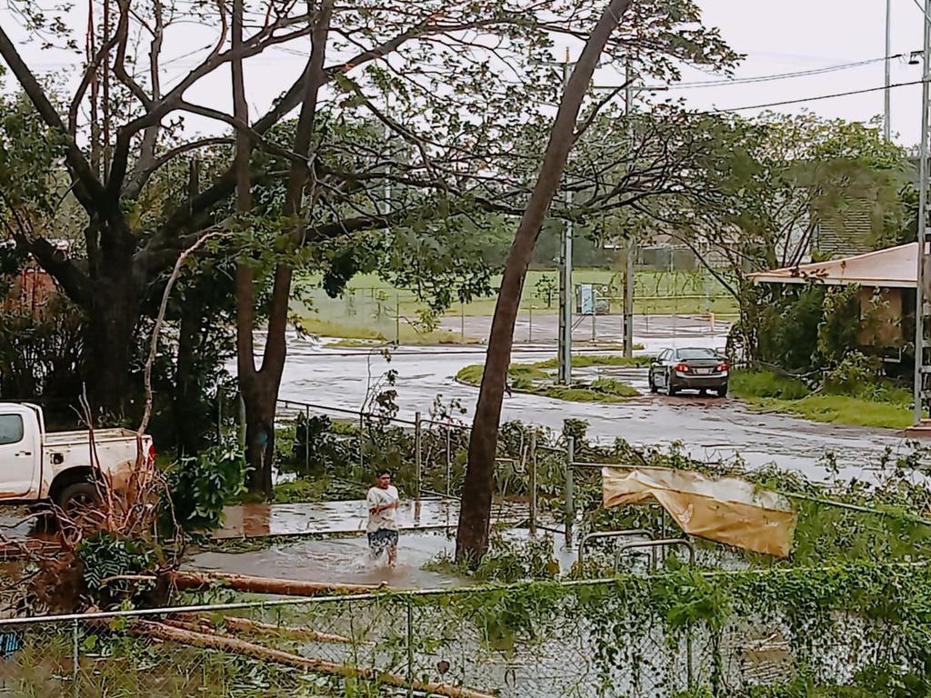
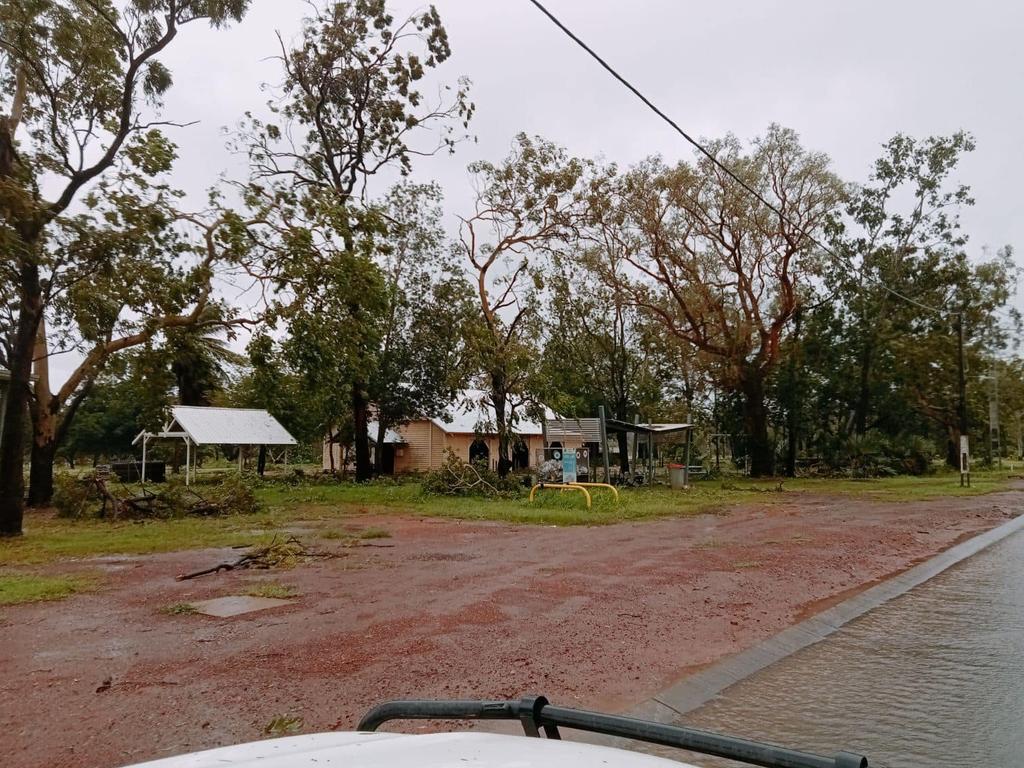
March 19, 1pm: Ex-cyclone Megan dealt minimal damage to Borroloola’s infrastructure but could stop the Top End’s supplies in their tracks as the system sweeps the Territory as a tropical low.
Borroloola residents suffered through “horrible” conditions shortly after ex-tropical cyclone Megan made landfall.
The Bureau of Meteorology’s Shenagh Gamble said the regional town had a long period of “very near category one cyclone strength winds” but the storm had not been equivalent to a tropical cyclone by the time it reached Borroloola.
It comes after a failed attempt to evacuate about 700 people when the system was considered a category three cyclone.
Incident Controller Sonia Kennon said a rapid assessment of Borroloola on Tuesday morning revealed minimal damage to the town’s infrastructure.
“The airstrip currently has some residual water overlay at one end … which we need to be cognisant of,” Superintendent Kennon said.
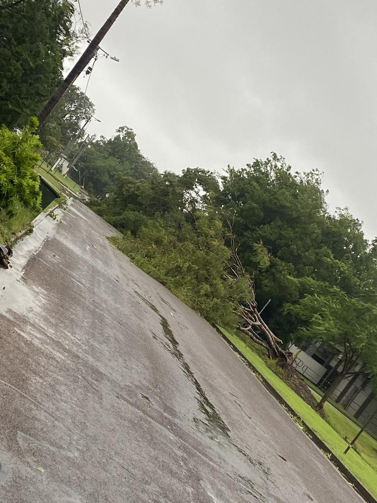
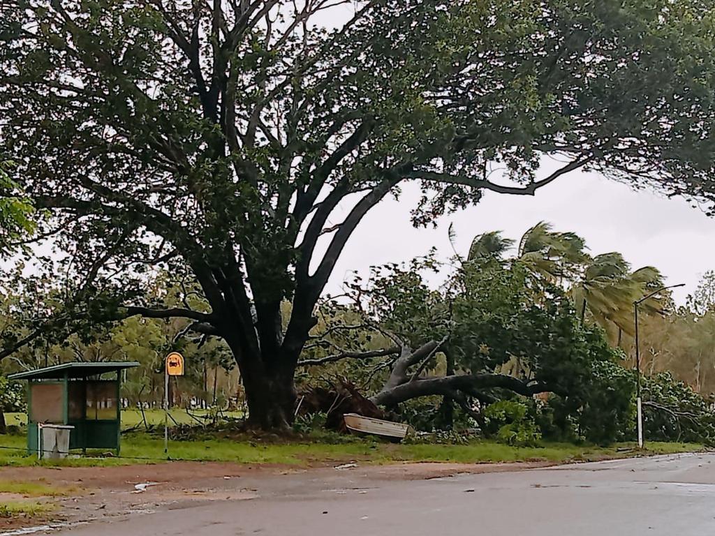
“There has been minimal damage throughout the community — basically there were some fallen trees.
“Minimal rain has been inundated into some of the infrastructure there – including the school – but not enough debris to cause any ongoing effects.”

Superintendent Kennon said a contingent would try to use the Borroloola airstrip on Tuesday afternoon to deliver resources and support.
She said the town’s most vulnerable people were her team’s priority.
“In that township, we have the police station, the clinics, there’s a shop, there’s fuel – they have all the infrastructure in place to support life,” she said.
Superintendent Kennon said the local controller estimated about a dozen homes had suffered power outages but was confident power would be restored quickly.
Chief Minister Eva Lawler said a team of 30 Australian Defence Force engineers would be travelling to Borroloola on Tuesday to further assess any damage.
Ms Lawler said Darwin’s Foskey Pavilion would remain open, but denied the evacuation efforts had come too late.
“I thank the people of Borroloola for their resilience, weather systems are dynamic and they change rapidly,” she said.
“The community worked with us to bunker down and to take shelter.
“I’m happy to report that there were no injuries and there were two calls to the clinic but both of those were for minimal assistance.”
Ms Lawler said there was a strong possibility the Stuart Hwy could close again due to expected downpours across the NT.
“The Department of Infrastructure Planning, and Logistics is having conversations with the rail and road freight companies,” she said.
“There is a strong possibility with the amount of rain that we’re seeing with this low depression that there could be a closure of the Stuart Hwy again.”
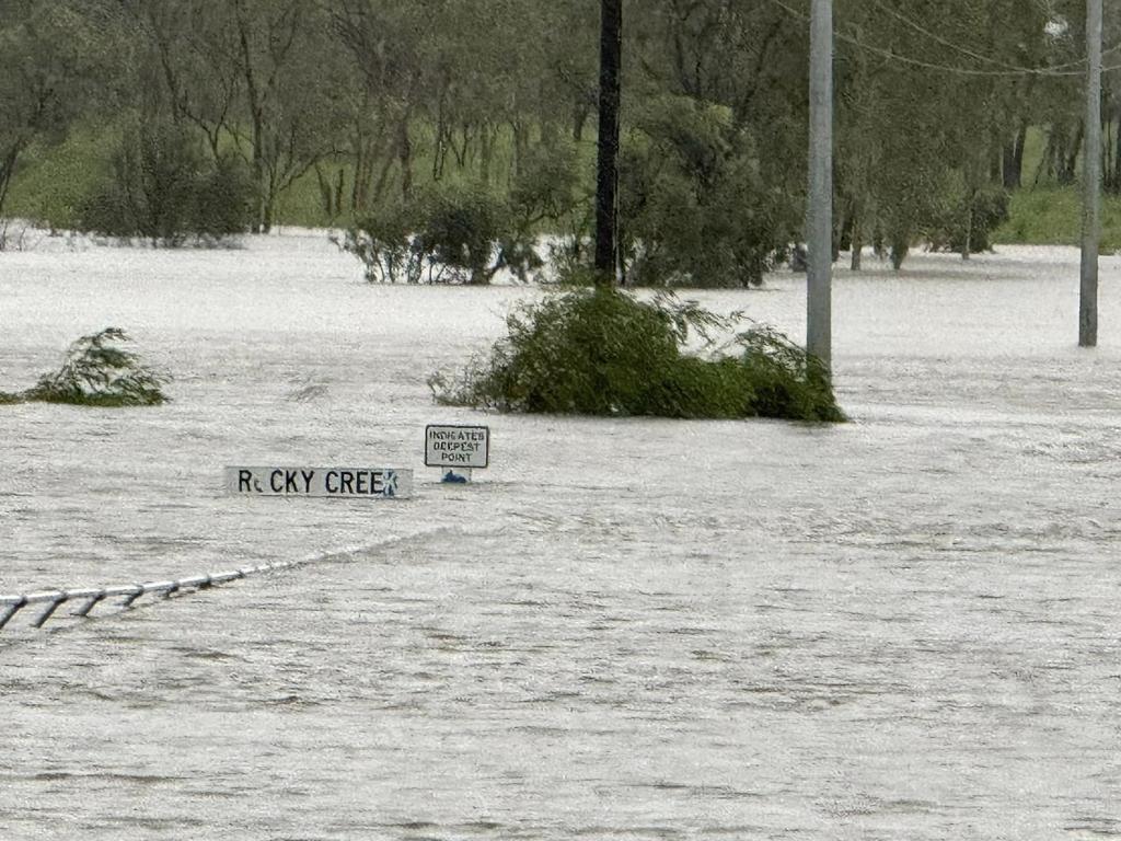
Ms Gamble said Centre Island recorded more than 500mm of rain over a 48-hour period, 289mm of which were recorded since 9am Monday.
She said McArthur River Mine recorded 274mm since 9am Monday and Borroloola recorded 255mm.
Ms Gamble said the now-tropical low was expected to move west across the base of the Top End and bring heavy rain and locally intense rain with it.
“Our attention is very much focused on the flooding situation for the MacArthur River and Borroloola,” she said.
“It’s currently forecast to reach major flood levels.
“We expect it to pass through moderate flood levels during today and major flood levels during tomorrow.”
March 19, 7.40am: Cyclone Megan has been downgraded to a tropical low, 16 hours after it made landfall in the Gulf of Carpentaria.
But the Bureau of Meteorology said flooding is still a possibility as heavy rainfall and high tides continue to plague residents in affected areas.
The Bureau said large waves could lead to minor flooding in low-lying coastal areas.
“Heavy to locally intense rainfall and damaging winds will continue in the Carpentaria forecast district, while extending into the northern Barkly during today,” they said.
“A severe weather warning is current and a flood watch continues for inland parts of the NT and Carpentaria Coastal Rivers.”
March 19, 7am: Tropical cyclone Megan has weakened to a category one cyclone, soon after it made landfall on the southwestern Gulf of Carpentaria coast.
The Bureau of Meteorology said the cyclone made landfall at 3.30pm Monday and is expected to weaken to a tropical low on Tuesday morning.
“Megan continues to weaken as it tracks inland of the Gulf of Carpentaria coast,” the Bureau said.
The warning zone includes Bing Bong to the NT/Queensland border, extending inland to Borroloola, McArthur River Mine, and Robinson River.
Port Roper to Bing Bong is no longer considered a warning zone.
The Bureau said heavy and intense rainfall would continue in the Carpentaria and extend into the northern Barkly throughout Tuesday morning.
“Tides will be continue to be higher than normal along the southern Gulf of Carpentaria coast over the next few days,” they said.
“Large waves may produce minor flooding of low-lying coastal areas.”
Incident Controller, Superintendent Sonia Kennon at 7.30pm Monday urged everyone in the area to “prioritise their safety”.
“The safety and wellbeing of all affected residents remains our top priority
“We urge everyone to stay informed, heed all safety instructions, and co-operate with emergency services during this critical time.”
About 700 Borroloola residents were forced to take shelter in the regional town despite planned efforts to evacuate the group.
Poor weather conditions on Monday made it impossible for the Australian Defence Force to land in order to relocate the residents.
TC Megan: Hundreds stranded as conditions too dangerous for evacuations
March 18, 4.20pm: Seven hundred people in Borroloola are being forced to shelter in place as a Category 3 cyclone approaches, with evacuation plans cancelled last minute amid intensifying weather.
Tropical Cyclone Megan is expected to hit the remote town between 3.30pm and 9.30pm on Monday.
At 1.30pm Chief Minister Eva Lawler announced the evacuation had been suspended due to Australian Defence Force planes being unable to land safely.
“We’re working with the local emergency management team to keep the community safe,” she said.
“There are enough buildings in Borroloola that are rated to withstand a Category 3 cyclone to keep the community safe.
Severe Tropical #CycloneMegan is moving slowly towards the south and is expected to cross the south-western Gulf of Carpentaria coast, south-east of Port McArthur, later this afternoon or evening. Latest forecasts: https://t.co/jlOoTZL1iFpic.twitter.com/8LQpyB81vO
— Bureau of Meteorology, Australia (@BOM_au) March 18, 2024
“These include the police station, the health centre and dozens of homes in the community.
There are between 50 and 71 buildings in Borroloola graded to withstand a Category 3 cyclone, according to emergency services.
Earlier on Monday Ms Lawler insisted the evacuations had not come too late, with Darwin’s Foskey Pavillion set up to house the evacuees.
Emergency Services Minister Brent Potter said it was a decision of the pilots on the ground not to fly, and another evacuation attempt would be made on Monday night or Tuesday morning once the cyclone had passed.
“Or, if it’s safe to do so, we’ll keep those people there and bring supplies into Borroloola,” he said.
“Unfortunately, these things are dynamic and fluid and the cyclone has moved faster than we initially anticipated.”
Barkly MLA Steve Edgington said he had heard from local residents who felt they should have been evacuated over the weekend.
“Not this morning,” he said, citing food shortages and confusion on the ground.
“At the moment what we have is a large number of frustrated people in Borroloola who are concerned for their welfare.”
He said hundreds had gathered at the council offices adjacent to the airport waiting for a plane to land, and there were about 240 medically vulnerable residents who remained stranded in the community.
Half-built shelter angers locals
Funding for a $7m cyclone shelter in Borroloola was committed in 2021, with initial estimates it would be completed in 2022.
The Roper Gulf council provided an update on the project in October 2023 to say “works are progressing well” and a new finish date was set for February 8 this year.
However the structure remains under construction, something Mr Edgington said was “a real sticking point” for local residents.
Former chief minister Shane Stone said it was “a disgrace” there was no shelter in the community.
Mr Potter said the government wanted to see cyclone shelters in all remote communities and the one at Borroloola would be completed by the end of the year.
* #AUSTRALIA: #94S
— Hurricane/Typhoon/Cyclone Alerts (@RoshinRowjee) March 18, 2024
- #NorthernTerritory#Queensland#Megan#CycloneMegan#TropicalCycloneMegan#TCMegan#Darwin#Brisbane#09U#19P#SirEdwardPellewGroup#PellewIslands#NorthIsland#Borroloola#PortMcArthur#BingBongpic.twitter.com/TVBXwsubcZ
‘A worrying time’
Mayor Tony Jack told the ABC council staff and emergency services on the ground were helping residents to shelter, and it was “a worrying time” for all.
Borroloola was cut off for three weeks when Cyclone Lincoln hit last month, with much of the region still saturated from recent storms.

Providing an update at 2.30pm on Monday, Incident Controller Superintendent Sonia Kennon said it was not safe for Borroloola residents to attempt to leave by themselves and asked people not to drive out of the community.
She said it was expected conditions would have eased considerably by Tuesday morning.
“It will still be very important to await advice from emergency services to ensure that there hasn’t been any damage in the community before leaving any of your safe locations, but really the overnight period tonight is the time which is going to be the wettest, the windiest and the most uncomfortable,” she said.
“We are just reminding everybody to enact your household emergency plan now.”
March 18, 12.30pm: The Incident Controller at 12.20pm has warned the use of Australian Defence Force aircraft to evacuate the town was being hampered by worsening weather conditions.
They said the aircraft was still attempting to land and would remain in the area until 12.30pm.
“If the aircraft land, passengers will be conveyed from Borroloola to the McArthur River Mine then transferred to a larger aircraft for onwards transfer,” they said.
“The most vulnerable people will be transferred as a priority.
“Alternatively, if the aircraft continue to be prevented by the prevailing weather conditions, and cannot make a safe landing, the aircraft will remain within the Northern Territory to provide assistance if required after Tropical Cyclone Megan has passed.”
NT Police Assistant Commissioner Matt Hollamby said no injuries had been reported throughout the evacuation process.
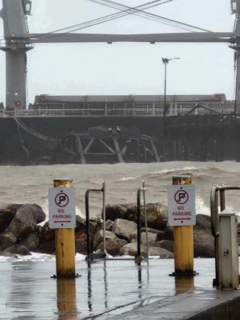
Assistant Commissioner Hollamby said Groote Eylandt had also suffered substantial damage thanks to the intense rainfall of cyclone Megan.
The Bureau of Meteorology on Sunday said the region had recorded up to 500mm of rain in a 24-hour period.
“There was a ship that has severely damaged the port at Groote Eylandt,” Assistant Commissioner Hollamby said.
“The Australian Maritime Safety Authority is managing that incident.
“We can also say the power is out and vehicular traffic between Angurugu and Alyangula is limited.”
March 18, 8.45am: Evacuations have begun after Tropical Cyclone Megan intensified to a category three storm on Sunday.
Senator Malarndirri McCarthy said Borroloola residents who wanted to leave the town for the duration of Cyclone Megan should report to the evacuation point at the Roper Gulf Council area.
Ms McCarthy said two planes would take evacuees from Borroloola to McArthur River Mines where two RAAF aircraft take them further north to Darwin.
“The elderly and vulnerable will go first,” she said in a statement.
“The RAAF aircraft will be making a number of trips so let NT Police know you would like to be on the evacuation list.”
Ms McCarthy said residents needed to pack a small carry-on bag of personal items including a small water bottle, wear closed in shoes, and recommended eating before the flight.
She told the ABC the evacuees would likely take refuge at the Darwin showgrounds.
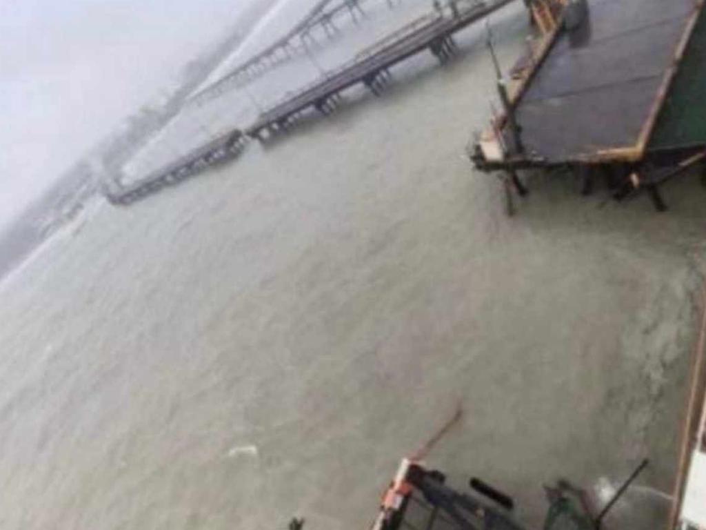
A Gemco employee said Groote Eylandt and the neighbouring mine site had “received massive damage” after Tropical Cyclone Megan swept through.
He said Port Wharf had been “severely damaged” and speculated it could take months to repair, preventing ore from being loaded onto ships.
“The roads are damaged to an extensive level and no road trains will able to haul ore to the port for many months,” he said.
“The mine pits are all full of water and are unable to be pumped out due the loss of pumps, generators, et cetera.”
The Bureau of Meteorology said at 7.17am Monday the cyclone warning zone included Alyangula in the NT to Mornington Island in Qld – but not including Mornington Island – and extended inland to Borroloola, McArthur River Mine, and Robinson River, but did not include Ngukurr.
The Bureau said Megan’s “very destructive core” had wind gusts up to 200km per hour that were impacting the Sir Edward Pellew Group and would extend to nearby regions between Bing Bong and the NT/Queensland border throughout Monday.
The severe cyclone is moving south at 6km per hour and is expected to track west and weaken to a tropical low after it makes landfall.
In response to the heavy rainfall tropical cyclone Megan is expected to bring, there were 25 catchments on flood watch across the NT as of 12.03pm Sunday, including:
Mary River
Daly River above Douglas River
Katherine River
South Alligator River
Wild man River
Buckingham River
Goyder River
Blyth River
Liverpool River
Goomadeer River
East Alligator River
Koolatong River
Walker River
Groote Eylandt
Waterhouse River
Roper River
Towns River
Limmen Bight River
Rosie River
McArthur River
Robinson River
Calvert River
Settlement Creek
Nicholson River
Barkly
March 17, 4pm: Remote Territorians are being advised to consider self-relocating to avoid the worst of Tropical Cyclone Megan after the “severe” weather event intensified to a category three storm on Sunday.
Incident Controller Sonia Kennon said while there was no evacuation order in place for the affected communities – including Alyangula, Borroloola, McArthur River Mine, and Robinson River.
But Superintendent Kennon said self-extraction was “the preferable outcome”.
She said anyone who wished to relocate for the duration of the cyclone should report to their local police station to provide their contact details, vehicle registration and intended destination.
“This is to ensure that we can follow up on you and make sure that you advise whoever you’re going to go and stay with, that they’re aware that you’re coming so that if you do not arrive then they can make a call and contact police,” Superintendent Kennon said.
“We ask that if that is your choice, that you ensure that you are driving a capable vehicle as we understand there is slight damage to the Carpentaria Hwy.
“We recommend that you have a four-wheel drive vehicle if you are leaving the community.”
She urged anyone who chose to stay in the Cyclone Watch zones to ensure their cyclone kits were ready and their household and belongings were secured.
The Bureau of Meteorology’s Shenagh Gamble said there was a “moderate chance” the severe cyclone could intensify to category four.
“The Bureau of Meteorology is forecasting that severe Tropical Cyclone Megan will intensify – it is a low level category three tropical cyclone at the moment,” she said.
“Our current forecast is not that it will reach category four tropical cyclone.
“However, if this system slows down it is in a favourable enough environment that it can strengthen to a category for tropical cyclone.”
Ms Gamble said the severe cyclone was currently sustaining wind speeds of 120km per hour and gusts of 165km per hour.
She said Tropical Cyclone Megan had dumped about 400-500mm of rain over Groote Eylandt in a 24-hour period.
“The very destructive core of severe tropical cyclone Megan is expected to cross the coast during Monday and those very destructive winds will be gusting up to 220 kilometres per hour,” she said.
It is the first category three cyclone to make landfall in the NT since Tropical Cyclone Trevor in 2019.
More Coverage

Chief Minister Eva Lawler urged Territorians to stay safe in light of the dangerous weather conditions.
“Strong winds and a lot of rain is likely over coming days – and flash flooding is a possibility,” she said.
“We’re no strangers to cyclones and floods but we all should remember to take precautions and stay safe.”
Join the conversation

Origin 2: Where to watch the decider in Darwin and surrounds
Origin fever will hit the Top End as the Maroons fight to level the series against the Blues in Perth. Here’s where to watch Game 2 across Darwin and surrounds.
Read more

Emerging oyster and seaweed farming in Fiji and northern Australia
The Department of Agriculture and Fisheries has partnered with the University of the Sunshine Coast, Fiji Ministry of Fisheries and SPC division of Fisheries, Aquaculture and Marine Ecosystems on a project aimed at advancing oyster and seaweed farming.
Read more

Another weekend, another fabulous two days of food, festivals and fun
Another weekend, another fantastic food and culture festival to immerse yourself in! Darwin’s multicultural heart is beating again, writes Kate Dinning.
Read more