
Full list of road closures affected by fires in NSW and QLD
Here is the full list of road closures as a result of the Queensland and New South Wales bushfire emergency.
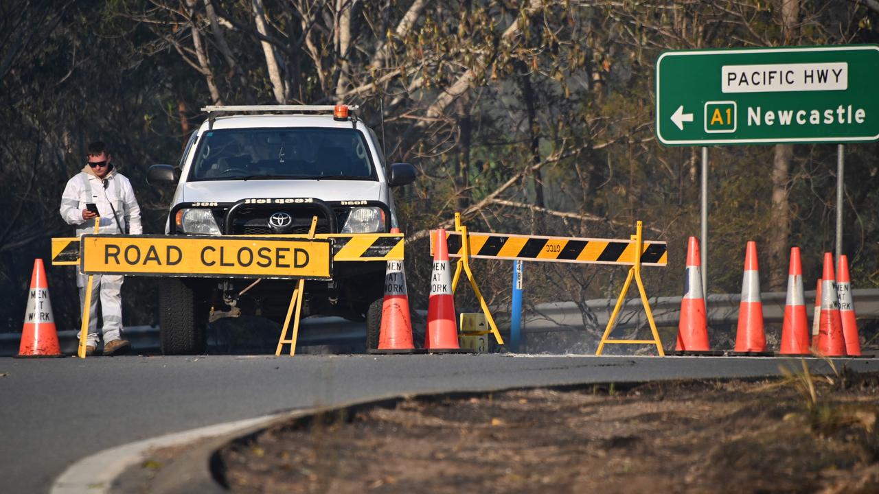
These are the road closures as a result of the NSW and Queensland bushfire emergency, as of Tuesday, November 12.
There are currently 71 fires burning in NSW, 40 of which are not contained, and a state of emergency has been declared.
Residents currently evacuating from areas affected by the fires are being told by Live Traffic NSW to take extreme care on the roads and delay any non-essential travel due to the high amount of traffic.
Motorists are also strongly advised to avoid any areas affected by fires, and have water, food supplies, a full tank of fuel and a fully-charged mobile phone as conditions are changing and rapidly.
Experts have warned that the worst is yet to come in both states and motorists should be prepared for road closures to change.
Check the latest traffic information for NSW here and for Queensland here.
RELATED: Firefighters are battling 60 bushfires across NSW and Queensland. Follow our live coverage
NEW SOUTH WALES
• Pampoolah (South Taree): Old Bar Road is closed between the Pacific Highway and Saltwater Road
• Rainbow Flat: Godfrey Hill is closed between the Pacific Highway and The Lakes Way
• Taree South to Burrell Creek: The Bucketts Way is closed between Manning River Drive and Gloucester Road Burrell Creek
• Failford: Bullocky Way is closed between the Pacific Highway and Failford Road
• Rothbury: Wine Country Drive is closed between Hunter Express and Tuckers Lane
• Harrington to Crowdy Head: Crowdy Head Road is closed
• Bald Nob to Eatonsville: Gwydir Highway is closed between Bald Nob Road and Tindal Road
• Walcha to Wauchope: The Oxley Highway is closed between Brackendale Road and The Paddock Road
• Buccarumbi to Bald Nob: Old Glen Innes Road and Old Grafton Road are closed between Buccarumbi Bridge and Gwydir Highway
• Lower Creek to Yarravel: Kempsey Road/Armidale Road is closed between Raspberry Road and Link Road
• Upper Fine Flower: Clarence Way closed between Carnham Road and Baryulgil
• Whittingham: The New England Highway is closed between Range Road and the Golden Highway
• Wallabi Point: Saltwater Road is closed between Old Bar Road and Wallabi Point
• New Italy: The Pacific Highway is closed between Watson St and Carrolls Lane
• Failford: The Lakes Way is closed between the Pacific Highway and Failford Road.
• Colo to Milbrodale: Putty Road is closed between Millbrodale Road and Long Weeney Creek Trail
• Moonbi to Bendemeer: The New England Highway is closed in both directions
• Telegraph Point: Red Hill Road is closed from Rollands Plains Road and Cooperabung Range Road
• Nowendoc to Knorrit Flat: Nowendoc Road is closed
• Coutts Crossing to Clouds Creek: Armidale Road is closed
• Bulahdelah to Taree: The Pacific Highway is closed between The Lakes Way and Old Bar Road
• Elands to Marlee: Bulga Road is closed between Middlebrook Road and Colling Road

Plane vanishes over NSW Snowy Mountains
A desperate search has so far failed to find a missing plane that took off from Victoria, with its last known location in the Snowy Mountains.

How to see year’s ‘best meteor shower’
The famous Perseids return to night skies tonight. Here’s when it peaks, how it works, and how Aussies can catch a glimpse.

‘Freak off’: Escort’s Mark Latham claims
A sex worker who Mark Latham described as a “good rooter” has claimed he and his ex-girlfriend contacted her.