
‘Prolonged, major rain event’ to hit much of Australia
Savour any sun on the east coast as it won’t last with fresh warnings that a month’s worth of rain could fall in the next week across large parts of the nation.

The clouds may briefly have parted along parts of the east coast today, but it won’t last. A “major rain event” is under way during what has now been the wettest beginning to a year for nearly a decade in some places.
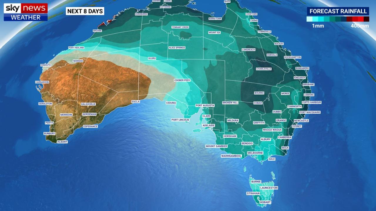
More than March’s average monthly rainfall could descend on Sydney over the next eight days.
But while people in the top two-thirds of Australia might be wise to keep an umbrella handy, across the far south of the country – from Perth to Melbourne – the weather will remain dry and in some places hot as well.
RELATED: Wet conditions sent to linger until May
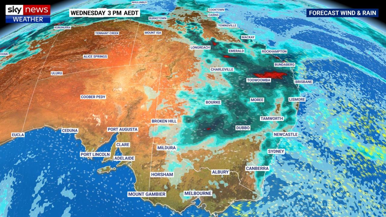
“We’ve got a major, prolonged rain event on our hands this week across Australia,” said Sky News Weather on Foxtel meteorologist Rob Sharpe today.
“It started on the weekend and it’s now pushing into southeast Queensland but there is a lot more where that came from.”
A high-pressure system in the Tasman Sea is scooping up moisture and pushing it back towards Australia.
In good news for farmers, that rain won’t be confined to the coast, with large swathes of the interior, particularly in Queensland and northern NSW, set to get a soaking. However, that may prove challenging for some trying to harvest crops.
There could be flooding in some parts of Queensland where 67 per cent of the state remains in drought.
For NSW, this week looks even more sodden than last with at least eight consecutive wet days for the coast.
“The heaviest rain will arrive from midweek as rain spreads back south from Queensland. Most of the NSW coast will see close to 100mm, including Sydney,” said Mr Sharpe.
“Pockets of flooding are possible along the coast from Thursday onwards.”
The La Nina climate driver, which has led to a wetter than usual summer, may be on the way out but as this week is set to prove, it still has some power in yet.
“This rain event is typical of a La Nina phase and there are early signs next week will bring another round of soaking rain to eastern Australia.”
RELATED: The weather forecast where you live
In Brisbane, do yourself a favour and keep the brolly close. There will be significant showers most days this week, with up to 20mm in each 24-hour period. Highs will be in the mid to late twenties.
Elsewhere in Queensland, Townsville will also be soggy, as well Cairns. inland, the rain looks set to be in abundance with up to 55mm falling on Longreach on Tuesday and Wednesday and potentially more than 100mm in Charleville.
The region from Rockhampton to Bundaberg to Kingaroy has had a near-record dry start to the year with rain as low as 20 per cent of the average. However from 50 to 100mm could be recorded in the gauge this week.
There will be a brief reprieve from the wet weather in Sydney on Monday, but the grey clouds will return on Tuesday. That might be a mere a 6mm to begin with, a fairly modest amount, but it’s just the start. Heavy and persistent downpours look to be the typical conditions all the way into the weekend with as much as 40mm set to fall on Thursday.
Overall, the Harbour City could see 50 – 130mm of precipitation, meaning the monthly average of 101mm could well be bettered over just the next few days.
It should be still be relatively warm, however, with maximums of around 25C or more.
Canberra will start off sunny this week but the rain is on its way. Thursday and Friday could both be soggy days in the capital. Mild maximums bouncing around 20C with overnight lows dipping to 8C early on Tuesday.
Darwin is looking wet and stormy with highs of 31C and around 10mm of rainfall daily.
Melbourne will see highs in the mid-twenties this week and should mostly escape the wet with cloudy days and some sun. But rain is possible in inland areas of Victoria, particularly in the north, towards the end of the week.
It should be dry in Hobart. Highs of around 20C at the beginning of the week will rise to around the mid-twenties with Thursday the sunniest day.
A cloudy week with some sunny spells in Adelaide. Warming up with highs of 29C from Wednesday to Friday.
Perth is also looking sunny and it will be toasty in the west with maximums above 30C all week, and as high as 36C on Friday. But further north in WA it will be wet with Broome, Kununurra and Karratha all set for showers which will be heavy at times.
Originally published as ‘Prolonged, major rain event’ to hit much of Australia

