
Australia weekend weather: Forecasters warn of ‘dangerous’ winds, snow blizzards
Forecasters are warning of “dangerous” weather conditions this weekend as “destructive” winds smash four states.

Environment
Don't miss out on the headlines from Environment. Followed categories will be added to My News.
Forecasters are warning the weather could be “destructive” and “dangerous” across Australia’s south this weekend.
Gale force winds are on the cards, while a polar blast could bring up half a metre or more of snow for the ski slopes.
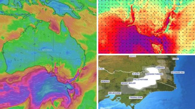
The Bureau of Meteorology (BOM) has issued severe weather warnings this weekend for Adelaide and Melbourne as well as areas close to Sydney and northern Tasmania.
“There is the potential for really windy conditions throughout the day on Saturday in the southeast,” said Sky News Weather meteorologist Bradlyn Oakes.
“Gusts upwards of 90km/h are likely throughout the alpine regions, with higher wind gusts at higher elevations.”
A “polar blast” would bring more cold air and more snow, she added, as the cold front made its way across SA and then the south eastern states.
“When you pair winds and snow together, there is the potential for blizzard conditions and reduced visibility.”
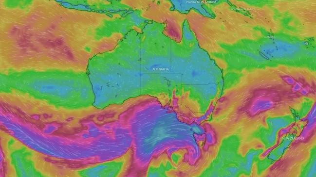
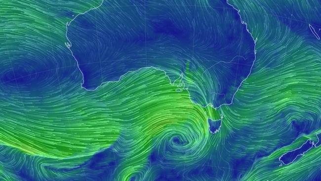
Website Weatherzone said the “dangerous synoptic pattern” could bring wild conditions across four states and the ACT right through until Sunday.
A severe weather warning for damaging winds is in place for Adelaide and much of south and south east SA.
Winds averaging up to 65km/h and gusts of as much as 100km/h could hit the state as Saturday morning dawns.
“Isolated destructive wind gusts exceeding 125 km/h are possible with thunderstorms in the upper and lower south east districts (of SA),” the BOM added.
Adelaide can expect heavy showers on Saturday morning with possible thunderstorms. Conditions should ease as the day continues. Expect a high of 15C.
More showers are expected on Sunday but totals should be low and the winds will have calmed down a lot. A high of 16C and low of 10C is forecast.
Moving into Victoria, and a severe weather warning covers much of the state with the exception of the north and Gippsland east of Traralgon.
Similar conditions to South Australia could see damaging wind gusts and blizzards on higher ground. Again the worst of the weather could ease during Saturday.
Areas affected include Melbourne, Geelong, Ballarat, Horsham and Warragul.
Heavy showers are forecast on Saturday morning for Melbourne with a high of 14C and the possibility of a storm.
The city could see winds of around 55 km/h decreasing as evening approaches.
Sunday may bring more rain but it should be lighter paired with a low of 10C and high of 16C.
Blizzards: more than half a metre of snow
Saturday could bring blizzards on the slopes. Mount Buller is looking at 15-35mm of powder falling with a top up of 8mm on Sunday as temperatures fall to -3C.
Falls Creek could see as high as 60mm on Saturday.
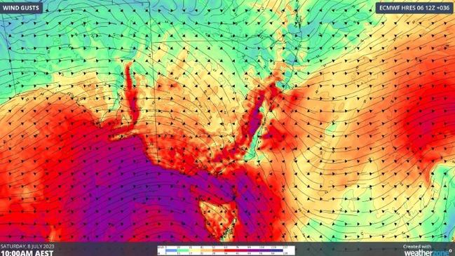
The entire north coast of Tasmania as well as the Bass Strait islands are in a severe weather warning zone. As far south as Launceston, there could be 70 km/h winds and 110 km/h gusts on Saturday following a “vigorous north westerly flow,” said the Bureau
Hobart will be less affected but could still see showers mostly on Saturday afternoon and evening with a high of 14C.
Sunday will see up to 7mm of rain and a low of 8C peaking at 13C around 3pm.
A severe weather warning is in force for south eastern New South Wales and the ACT stretching from the mountainous regions in the south, skirting Canberra but then hitting the Southern Highlands, the Illawarra and Blue Mountains almost surrounding Sydney.
The Snowy Mountains could see 70km/h winds and 90-110km/h gusts from early Saturday morning and blizzards above 1300 metres. Those conditions are expected to persist into Sunday.
A chilly -3C in Thredbo on Saturday and then -4C early on Sunday. Most of the snow action will be on Saturday with 25-50mm falling and possibly to 10mm the next day.
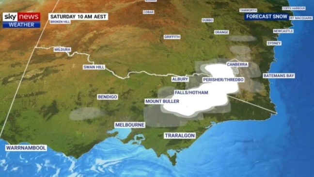
On lower ground, winds of 55 km/h and gusts of 100 km/h are still possible during Saturday and into Sunday.
A very windy Saturday in Wollongong could see winds of as much as 70km/h.
Canberra is looking at rain on Saturday late morning with around 6mm falling and some strong winds. Rain should dissipate on Sunday. A low of 3C in the capital this weekend with highs of around 10C.
Becoming windy in Sydney on Saturday morning with up to 50 km/h by early afternoon. It should remain sunny however with a warm 20C high and 8C low.
Still windy in Sydney on Sunday and still sunny with a 10C minimum and 18C maximum.
A bright and warm weekend in Brisbane with 21-22C highs and 9C lows. Winds will be around 20-30km/h.
Townsville can expect blue skies and maximums in the high twenties for the next couple of days.
Sunny and topping out at 32C in Darwin on Saturday and Sunday with 21C overnight.
Perth will have some showers, albeit mostly light, on the weekend with highs of 20C and 9C lows.

Originally published as Australia weekend weather: Forecasters warn of ‘dangerous’ winds, snow blizzards
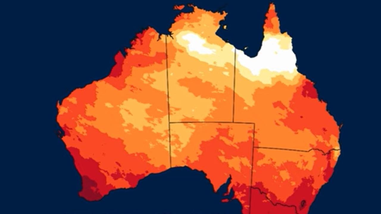
Aussies to face one of warmest winters ever
Aussies could bake through one of the warmest winters on record, with temperatures expected to soar above average across the nation.
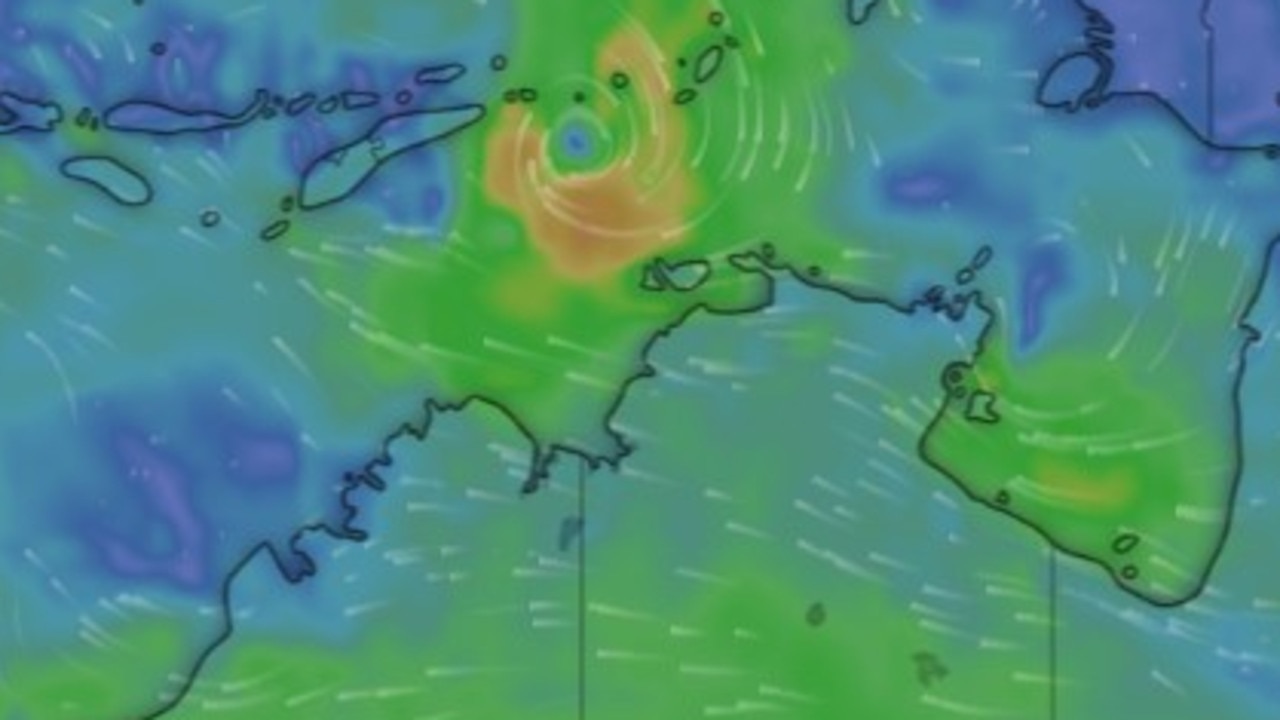
Warning amid ‘high chance’ of tropical cyclone
Australian coastal communities have been warned over a “high chance” a tropical cyclone may develop over the next week, with the potential for a second to also develop.