
Australia weather: ‘Record challenging extreme heat’ set to hit
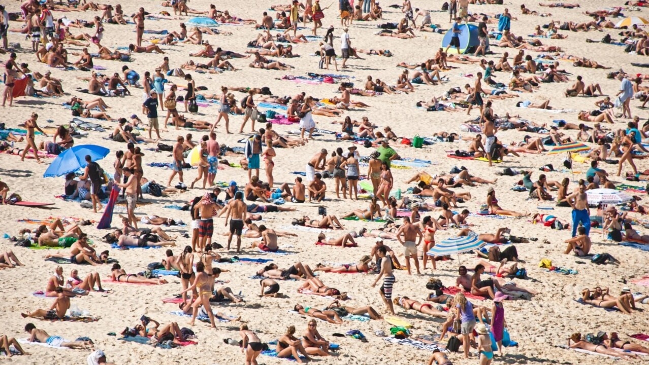
Get ready to sizzle as a heatwave sweeps through Australia bringing temperatures above 40C and possibly the hottest day of summer.

Environment
Don't miss out on the headlines from Environment. Followed categories will be added to My News.
Forecasters are warning of “record challenging extreme heat” over the coming days and into next week as a huge heatwave sweeps the country.
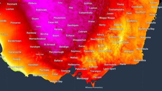
Victoria could nudge 40C on Friday, the searing heat will bake New South Wales on Saturday and early next week parts of Western Australia may even hit 50C – only the second time that’s happened during the month of February.
Sydney could see its hottest – and most punishing – day of summer. While Melbourne may end up being more sweltering than its been for the past 1113 days.
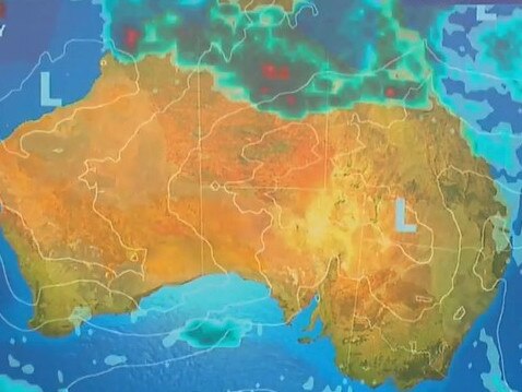
“Thanks to drier than average conditions over the northwest of the country, the blazing February sun is heating up the landscape,” said Sky News Weather meteorologist Alison Osborne.
“That hot air then travels with systems sweeping through southern Australia.”
And while there is a cool change associated with the system, it’s likely it will only be a brief interlude with more heat expected next week.
In Queensland, monsoonal rains could bring a different problem – massive downpours and flash flooding.
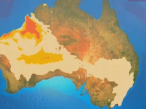
A huge chunk of Western Australia – although not Perth or the south west – is in heatwave conditions. In some parts the heatwave is classified as severe or even extreme.
Heading into the weekend, those conditions will also cover some areas of South Australia, most of Victoria, all of Tasmania and NSW, aside from the far north east.
From Sunday or Monday, the heatwave will still be ferocious in WA and much of SA and northern NSW, but will have left the south east.
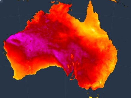
The Pilbara is the heart of the heat engine with Broome looking at a string of days around 35C while Karratha could get to 42C on Friday and Monday.
But the mercury could go much higher still, said Ms Osborne.
“At this stage, we cannot rule out at least one weather station in the Pilbara or Nullarbor exceeding 50C on Tuesday.
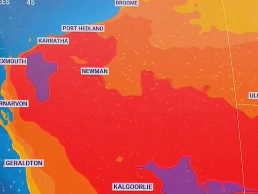
“That would only be the second time this has happened in February in Australia‘s history.”
A sunny and dry Perth will top out a balmy 28C on Friday but will be back in the thirties for the weekend with 34C on Saturday. Overnight lows will be in the high teens.
After peaking at 39.7C on Thursday, just a whisker below 40C, Adelaide will be much more pleasant over the coming days.
A cold change has swept through and that means 28C for Friday, even a bit cooler on Saturday and then 29C for Sunday. On Saturday and Sunday morning expect a low of 13C.
But it will warm up next week with 33C on Monday and then up to 38C on Thursday.
Melbourne could break 1113 day heat record
Victoria will see that cold change on Friday. How high the temperatures get will depend on what time it sweeps through.
“In central Victoria and Melbourne it could reach as high as 39C on Friday, or that cool change could move through earlier in the afternoon, stopping that happening and bring some relief,” said Ms Osborne.
The Bureau of Meteorology’s Michael Efron told the Herald Sun that if the temperature goes up just a smidgen higher to 40C it would break a heat record that has stood for 1113 days.
“If that were to happen, it would be the first time since the 31st of January, 2020.
“That’s all due to La Nina throughout the last few summers, which has kept things relatively cool.”
However, the winds are not expected to be high so the bush fire danger is less pronounced.
Saturday will certainly be cooler with a high of 23C. Sunday will see 26C and it could be just 21C on Tuesday. Dawn temperatures will be around 15C in Melbourne.
But come midweek and the mercury will start heading towards the thirties once more.
A maximum of 32C in Hobart on Friday dropping to 24C on Saturday and then 27C on Sunday where it’s possible some showers will come through. Weekend mornings will start at 14C.
NSW could see hottest day of summer so far
“Temperatures across NSW will spike on Saturday. In outback NSW it will be over 40C in many areas,” said Ms Osborne.
Sydney’s CBD will bob around 30C for the next couple of days and then 27C on Sunday before pushing back up towards the thirties to start the week. Lows will be around 20C.
Much hotter in the city’s west, however, with 35C on Friday and 38C on Saturday. Temperatures will go down to 30C on Sunday but then push up to 34C on Monday. That could see Penrith recording it’s hottest day since summer last year.
Nyngan, in the state’s west is looking at 41C on Saturday, Dubbo is forecast to peak at 39C the same day, Hay should reach 42C on Friday and Tamworth will see 37C every day from Saturday until Tuesday.
Toasty in Canberra with a high of 33C on Friday and 35C on Saturday with a possible afternoon storm. Sunday is looking at 30C with Monday on 33C. Lows should be in the mid-teens for the capital.
Brisbane is stuck on 31C highs, 21C lows and partly cloudy days for the next week.
It will be much more unsettled in Queensland’s north as the monsoon takes hold. Flood watches are in place for coastal rivers in the far north of the state.
Cairns could see up to 150mm of rain over the next five days. Cooktown could get the same amount in just about three days.
Darwin will peak at 33C on Friday. A light shower may occur on Saturday and they heavier falls into next week.
Originally published as Australia weather: ‘Record challenging extreme heat’ set to hit

Greens push for $4bn cut to insurance costs
The minor party has proposed a five-pronged attack to lower rising insurance premiums which they say could save households a total of $4bn.
Aussies freeze as temperature plummets
Australians have been warned not to pack away their puffer jackets just yet after one state recorded temperatures up to 10C below average.