
Fears of ‘serious’ bushfire risks as freak triple wet weather cycle to be replaced with drier season
Despite flooding still devastating some regions, forecasters are predicting the wet weather will be replaced by another fierce threat.
Environment
Don't miss out on the headlines from Environment. Followed categories will be added to My News.
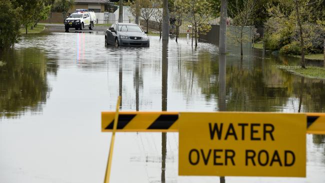
The wet weather cycle that has wrought devastating storms and floods across Australia’s eastern seaboard is set to end – only to be replaced with another cycle that could bring fiercer droughts and bushfires.
The Bureau of Meteorology’s (BOM) latest climate update has predicted the La Nina weather event is set to end between April and May this year.
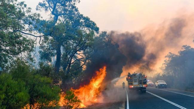
In its place, forecasters say El Nino conditions will prevail, with climatologist Janette Lindesay warning “serious” bushfire risks are on the horizon.
“There’s a lot of fuel out there, and it doesn‘t take very long – with no rain and high temperatures – for that fuel load to dry out,” Professor Lindesay told ABC News.
“Once it’s cured, it just takes a spark to start a fire and that’s something I think we’re going to have to be extremely mindful of as we go through this year.”
BOM’s report predicts ocean temperatures are likely to warm towards El Nino neutral levels in the coming weeks.
The change marks an end to the third consecutive year of the La Nina cycle – something Australia has only experienced three times since records started being kept.
During an El Nino cycle, reduced rainfalls and warmer-than-average temperatures are more likely to occur as a result of ocean temperatures in the central and eastern tropical Pacific gradually warming up.
“Decreased cloud cover results in warmer-than-average daytime temperatures, particularly in the spring and summer months,” a BOM fact sheet states.
“Higher temperatures exacerbate the effect of lower rainfall by increasing evaporative demand.”
The decreased rainfalls and higher maximum temperatures also increase the risk of bushfires, especially across southeast Australia.
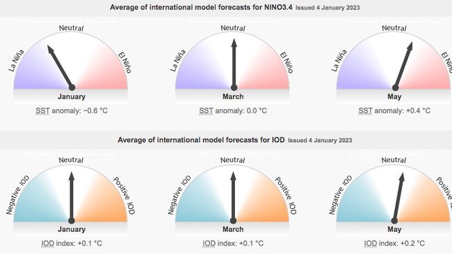
BOM has cautioned that an El Nino event may not even form at all as modelling could be “less accurate” leading up to April.
The Southern Annular Mode (SAM) is strongly positive, which increases the likelihood of above average rainfall in NSW, Victoria and Tasmania over the year.
The SAM is predicted to be positive until mid-January at the earliest.
Originally published as Fears of ‘serious’ bushfire risks as freak triple wet weather cycle to be replaced with drier season

‘Never seen before’: Shock pics of algal bloom
A federal minister has spoken out about the dead marine life from a toxic algal bloom as new pictures reveal the extent of the devastation.

Albo reconnects with Aussie icon in China
Anthony Albanese has gotten a big dose of panda diplomacy in China, reconnecting with an Aussie favourite as he winds down his state visit.