
Gusty storm fields 300 SES calls for help across Victoria
Wild winds and rain have lashed the state in the past 24 hours, with flood warnings still in place in the northeast.
Victoria
Don't miss out on the headlines from Victoria. Followed categories will be added to My News.
This coronavirus article is unlocked and free to read in the interest of community health and safety.
- Click here for full digital access to trusted news from the Herald Sun and Leader for just $1 for the first 28 days
SES has responded to more than 300 requests for help in the past 24 hours as storms hit the state on Friday.
A State Control Centre spokeswoman said the emergency service had already cleared 292 jobs.
“There are 13 outstanding across the state, so we’ve mopped that up pretty quick out of those 305,” a SCC spokeswoman said.
“One in three were trees down and 61 were damaged buildings.
“It’s predominantly in the North East with a little impact on Melbourne’s South East and the Mornington Peninsula.”
The three hardest hit suburbs were in the state’s north and the Mornington Peninsula.
SES responded to 18 call-outs in Cobram, 15 in Rosebud and 14 in Katunga, despite the small town recording a population of less than a thousand people in the 2016 census.
The cold front also saw damaging winds of 126km/hr batter Mt Buller. And a flood warning has been issued for the Kiewa River and upper Murray catchments, in Victoria’s north east.
The State Emergency Service (SES) said low lying caravan parks and camping grounds in the region may flood and roads and bridges would be closed, if they were underwater.
The State Control Centre spokeswoman said the weather was now starting to settle.
“There’s a little bit of the storm right on the North East, in the east corners of the state out towards the NSW border,” she said.
“Then it’s fairly stable weather for the next few days, more sunny in the north and a little bit cooler and midler in the south with no really high temperatures until Thursday and Friday.”
The spokeswoman said there were no reports of any injuries from fallen trees despite the number of incidents.
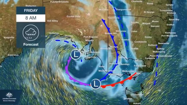
Severe Weather and Flood Watch Warnings issued yesterday are still in place for a number of regions in the North East with an update expected just before midday today.
It comes as the BOM issued a number of Marine Wind Warnings along Victoria’s coastline, including a Gale warning for the East Gippsland Coast.
A Strong Wind Warning has been issued for the waters off Port Phillip, Western Port, West Coast and Central Coast with winds of more than 33 knots forecasted.
CONDITIONS SLIGHTLY EASE BEFORE RAINY MORNING
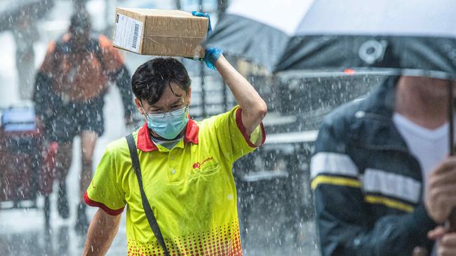
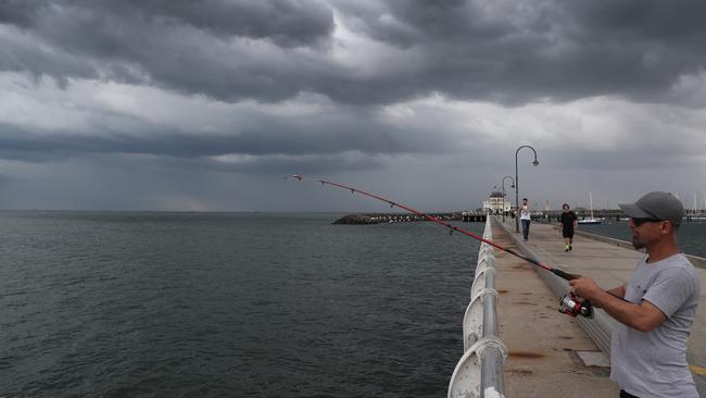
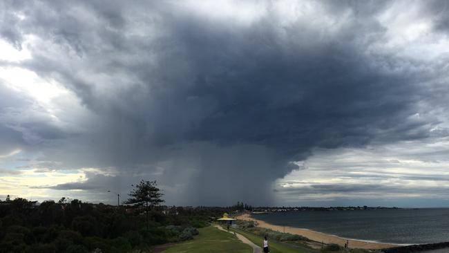
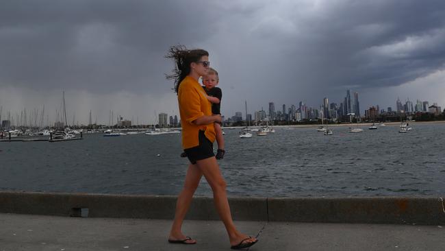
Early morning showers lashed Melbourne on Saturday and southeastern suburbs were last night on alert for gale-force winds, hail and heavy rain.
Ominous black skies failed to deliver for most of the state on Friday but by 8.30pm new severe weather warnings were issued for damaging storms in the outer suburbs
Cranbourne, Dandenong and Narre Warren were all in the firing line and the storms were then set to move south towards French Island.
Parts of the state’s northeast are tipped to record low flooding this weekend as the low pressure trough linked to the chaos continues to move across the rest of the country.
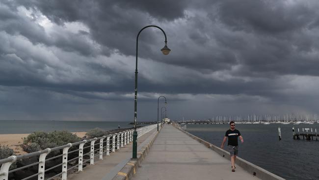
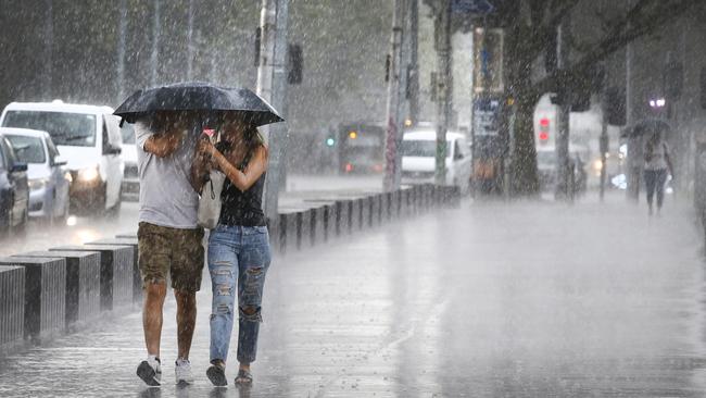
But storms predicted to wreak havoc on Friday passed with just a rumble of thunder and a few millimetres of rain across Melbourne and most regions.
While some alpine areas in Victoria’s northeast copped strong winds and a drenching — Mount Buffalo’s 33mm topped the state — much of Melbourne got less than 5mm of rain.
Predictions roads would be awash across Melbourne and its suburbs at school pick-up time failed to eventuate.
“The intensity of the rain that we forecast was nowhere near close to what we observed; we were quite under which is quite bizarre,” the Bureau of Meteorology’s Vernon Carr said.
“We rely on high-powered computers to do a lot of the forecasting and nearly all of them were predicting very heavy rain in the northeast and we actually thought we’d undercooked it (the storm threat) for Melbourne, but in the end we got just a few millimetres and that was it.”
The highest-recorded rainfall near Melbourne was 20mm at Kinglake, he said.
One computer had forecast nearly 200mm of rain in the northeast, while others indicated upwards of 80mm, Mr Carr said.
The forecasts had caused the northeast to be placed on flood watch and prompted State Emergency Centre warnings.
Another band of rain coming through from South Australia overnight could deliver more rain on Saturday, but severe storms were unlikely, Mr Carr said.
Despite the lack of widespread storms, strong winds and rain in some areas resulted in the State Emergency Service responding to 188 requests for assistance in the 24 hours to 6pm on Friday.
The most common requests related to fallen trees (125 calls), building damage (23) and flooding (17), a State Control Centre spokesman said.
Cobram in the northeast, Rosebud on the Mornington Peninsula and Wodonga were the worst affected areas, he said. Earlier in the day, Inspector Greg Barras of the search and rescue squad and water police, said rescue teams were on standby with a helicopter for flash flooding in the northeast.
Drivers were warned about the dangers of entering floodwaters.
Join the conversation

Why you’ll be crawling along Chapel St at 30km/h
A reduced speed limit will be applied on the iconic street as part of a road safety trial, with one councillor saying “the safety of our community is more important than a few seconds saved on a journey”.
Read more

CBD bike lane ‘funding cut’: Cyclists peddle anger at Lord Mayor
Cyclists have vented their fury at Lord Mayor Nick Reece, claiming he is short-changing investment in city bike lanes by millions of dollars per year.
Read more