
Wetter than usual winter forecast in Victoria
Storms, snow and hail are set to hit parts of Victoria and the city is expected to mark its coldest day of the year on Monday.
Victoria
Don't miss out on the headlines from Victoria. Followed categories will be added to My News.
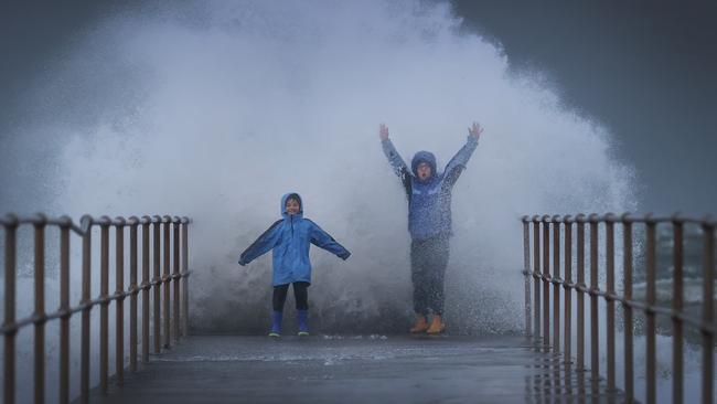
Victorians are being warned to brace for the coldest day of the year so far bringing blizzardous conditions and hail across some parts of the state.
Monday is forecasted to be the coldest day of the year so far for Melbourne as a low pressure system will sweep across Victoria bringing a cold air mass over northern parts of the state.
The drop in the mercury will bring the potential for showers, storms, snow and small hail across Victoria.
Maximum temperatures are forecasted to drop to between 2C and 8C below average across Victoria.
May has seen record lows for the year, the previous lowest temperature on record for this year was 4.6C on May 21.
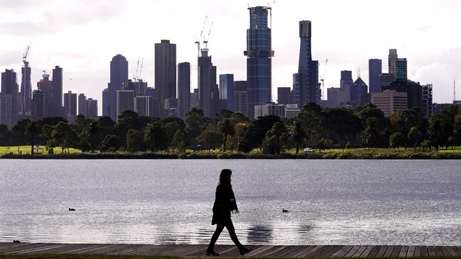
The city will reach a top of 12C on Monday, 12C on Tuesday, 12C on Wednesday, 14C on Thursday and 12C on Friday.
There is good news for snow sports enthusiasts planning to make the most of the first full winter season for the first time in two years.
Snow is forecast to sweep across the alpine region as ski resorts look towards opening weekend in June.
The alps are expecting 10-20cm on Monday and 10-15cm of snow on Tuesday.
Snow level is forecasted to drop from 1500m to around 1200m on Monday, dropping to a further 800m by Tuesday.
The snow level will potentially be as low as 700m which could bring snow flurries to the Grampians, Mt Macedon and possibly Mt Dandenong on Tuesday.
Drivers are to remain vigilant when driving in the alpine regions.
The Bureau of Meteorology warns that strong wind gusts are likely to coincide with the falling snow, resulting in blizzard conditions and very hazardous driving conditions on Tuesday.
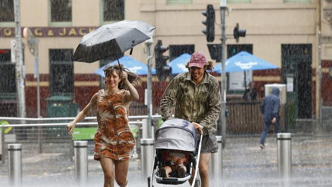
Wetter than usual winter ahead
The Bureau of Meteorology on Thursday predicted that rain across the entire east of the country this winter would exceed median falls.
Eastern Australia – capturing all states bar Western Australia and Tasmania – is two to three times more likely than normal to have “unusually high” rainfall from June to August, according to the BOM’s climate outlook.
However, those planning to flee to the Sunshine State are likely to face colder and wetter weather than usual up north.
Conditions across parts of Queensland and NSW are likely to be wetter than 80 per cent of previous winters.
But Bureau of Meteorology head of long-range forecasts, Andrew Watkins, said while Victoria could expect wet weather, Melbourne might not bear the brunt.
“It’s looking like a wetter than average winter in Victoria, with particularly high odds of getting above-normal rainfall across northern Victoria,” Dr Watkins said.
“But some places closer to the coast, as you get down on to the southwest coast in particular … are not likely to get the above-average rainfall.”
Dr Watkins said La Nina on the Pacific Ocean, which drove wet weather, was weakening. But he said another driver would trigger rainfall.
“Out on the Indian Ocean, we have a thing called the negative Indian Ocean Dipole,” he said. “It’s a bit of a mouthful, but it’s really like La Nina but out on the Indian Ocean.
“It’s warm water near Australia and Indonesia, cooler water near Africa, that tends to favour the clouds forming in our part of the world.”
There is more good news for Melburnians, with Dr Watkins predicting temperatures in Victoria from June to August to be “cool in the north, possibly warmer in the south”.
“Parts of northern Victoria might be cooler than normal, but in the south and particularly in the coastal regions, possibly including Melbourne, it could actually be slightly warmer than normal, particularly with warm ocean temperatures offshore as well.”
Warmer nights were also a possibility.
“With that extra cloud trapping the heat a bit overnight, we are expecting warmer nights than usual,” he said.
A wet and windy blast will arrive in Victoria on Monday and linger into Tuesday to mark the first week of winter.
“It does look like being our coldest outbreak of the year so far,” senior meteorologist Bradley Wood said. Melbourne will reach a top of only 13 degrees on Monday and Tuesday.


Campbell: Two years after Dan, Allan still lacks authority
The mealy-mouthed response from two Labor MPs to Victoria’s full-blown crisis of Jew hatred shows that Jacinta Allan still hasn’t established her authority over the government.

Labor MP demands changes to controversial Vic renewable energy zones
A Victorian Labor MP has called for renewable energy zone proposals to be dumped for the Grampians and Wimmera regions as angry regional Victorians prepare to rally against the rollout.