
Sweeping cold front brings snowfall, frigid temperatures
Spring is just nine days away, but snow flurries have fallen at lower elevations as another cold front blasts Victoria.

Victoria
Don't miss out on the headlines from Victoria. Followed categories will be added to My News.
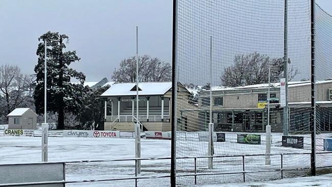
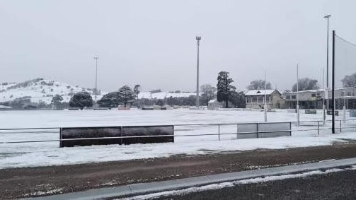
Snow has been reported in several areas across Victoria on Tuesday morning as the state was hit by a late blast of winter.
Just nine days out from spring, snow was reported in Bungaree, Ballarat, with light falls also expected as close to Melbourne as the Dandenongs.
Snow flurries down to 500m were forecast on Tuesday, caused by a “vigorous cold front” that moved across the state on Monday.
The cold front has sent the mercury plummeting and heavy rainfall across the state.
Temperatures dropped to as low as -4.7C at Mount Hotham and -4.4C at Mount Buller overnight on Monday, while Swan Hill recorded a low of 3.6C and Horsham 0.9C.
Across Melbourne, Ballarat was the coldest spot with the temperature dropping to 1.7C by 6am Tuesday.
It comes as the Bureau of Meteorology issued a warning to sheep graziers on Tuesday morning for rain and cold temperatures expected to affect Northern Victoria and Gippsland areas.
“There is a risk of losses of lambs and sheep exposed to these conditions,” the warning read.
Melbourne will hit a top of just 12C on Tuesday with heavy rain and a possible thunderstorm and hail to hit the city in the morning.
The mercury will fall to 7C overnight with a maximum of 13C on Wednesday and 14C on Thursday.
The Bureau last week declared there was a 70 per cent chance of a third consecutive La Nina year, meaning another wet year in store for Australia.
For more weather, head to the Herald Sun weather page. Enter your town or postcode for region-specific weather information including a Melbourne radar and seven-day forecast.
More Coverage


Lynn learns fate for missing camper murder
High country killer Greg Lynn has been sentenced for the murder of missing camper Carol Clay, but has told the court he will appeal the jury’s guilty verdict.

Police say Elizabeth St victim knew his accused killer, say he may be hiding in CBD
The man who died after he was assaulted along Elizabeth St in Melbourne’s CBD last week is believed to be the victim of a targeted attack.