
Severe thunderstorm for Melbourne’s north and east cancelled
A SEVERE thunderstorm warning for Melbourne’s north and outer east has been cancelled, but a more general warning for parts of country Victoria remains in place.
VIC News
Don't miss out on the headlines from VIC News. Followed categories will be added to My News.
A SEVERE thunderstorm warning for Melbourne’s north and outer east has been cancelled, but a more general warning for Victoria’s north central and parts of the central, northern country and Gippsland district remains in place.
The bureau says a storm cell was detected on radar near Whittlesea about 8.15pm and the storm is now moving southeast through Hurstbridge, east of Whittlesea and south of Kinglake.
WHY IT WILL FEEL REALLY HOT THIS LONG WEEKEND
YOUR GUIDE TO SURVIVING A BUSHFIRE
The storm was expected to hit Kangaroo Ground and Yarra Glen by 9.15pmm, but the bureau cancelled its warning about 9pm.
Severe Thunderstorm Warning for parts of NE #Melbourne #Melbweather has been cancelled: https://t.co/pfSMWdEmUh - further warnings will be issued if necessary. pic.twitter.com/wdXFXSmqgR
— Bureau of Meteorology, Victoria (@BOM_Vic) January 26, 2018
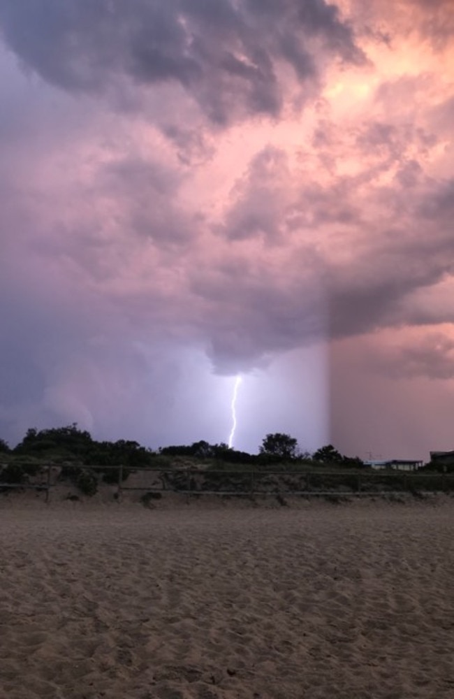
Stormy skies north of Kyneton bringing a serious electrical storm. Nice to shoot rain instead of fire although @CFA_Members busy with 5 lightning strikes & 2 floods as cells head easterly towards Melbourne's north @JaneBunn @PaulHiggins #melbweather pic.twitter.com/iyUcUuK8JS
— Brian Wilson (@ietsystems) January 26, 2018
Rain has moved slowly across a large part of Victoria on Friday evening, with Broadford — which copped 33.4mm in 15 minutes just before 8pm — one of the hardest towns hit.
The bureau states over the next several hours severe thunderstorms are likely to produce heavy rainfall that may lead to flash flooding in the state’s central north and northeast, with west and south Gippsland also affected.
Locations which may be affected include Bendigo, Seymour, Kyneton, Mansfield, Mt Baw Baw and Mt Buller.
SEND YOUR WEATHER PICS TO NEWS@HERALDSUN.COM.AU
The bureau earlier warned severe thunderstorms might bring large hailstones, but the threat has now passed.
The State Emergency Service has fielded 69 call outs in the six hours up to 7pm.
An SES spokesperson said the number included 33 calls for fallen trees, 18 for building damage, 12 for flooding and one road rescue following a minor traffic incident.
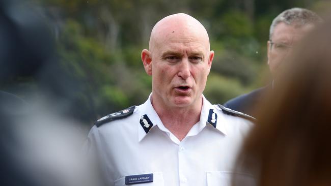
Earlier, Emergency Management Commissioner Craig Lapsley said Victoria’s hot and humid weekend could be the turning point for the bushfire season after severe thunderstorms and lightning struck overnight on Thursday, with firefighters battling remote fires.
Mr Lapsley said after the hot and humid Australia Day long weekend, they’d assess the level of upcoming fire danger.
“Post this weekend, we will do a stronger analysis of the fuel conditions to understand what it means for February,” Mr Lapsley said.
“Historically in Victoria, our major fires do occur in the first two or three weeks of February.”
He said ongoing extreme, dry heat in the north of the state had started “baking” the landscape.
Concern comes as aircraft attack blazes in Gippsland this morning caused by overnight lightning.
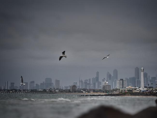
The Bureau of Meteorology issued several severe thunderstorm warnings on Thursday night as at least three large storm cells appeared off Mordialloc Beach, near Melton and in central Victoria.
The State Emergency Service responded to 49 calls for help in 12 hours, from fallen trees to flooding.
An SES spokesman said most calls for help came from the Bayside area including Beaumaris, Chelsea, Parkdale and Edithvale.
While Wallan resident Shaun feared his house had been struck by lightning last night.
“A big flash of light, massive crack and I called the SES because I did believe my house had been struck,” he told 3AW.
The lightning is believed to have struck a transformer outside his home, 60km north of Melbourne, knocking out the power.
The city is sweating through a muggy start to the Australia Day weekend.
Essendon and Tullamarine were at 100 per cent relative humidity since midnight while Ferny Creek, 33km from the CBD, had been sitting at 99 per cent.
Senior forecaster Rod Dickson said the outer northern and eastern suburbs experienced humidity above 90 per cent this morning.
Mr Dickson said the humidity would ease as the temperature rose.
The relative humidity in Darwin this morning was at 91 per cent.
YOUR GUIDE TO SURVIVING A BUSHFIRE
Keysborough had the highest rainfall of all metropolitan Melbourne suburbs with 57mm.
Lyndhurst, 25km from the city, had 39mm while Rockbank, west of the city, had 31mm of rain.
The thunderstorms travelled southeast, dumping heavy rain, with Dandenong Creek near Greens Rd, Keysborough copping 36mm in the hour leading up to 11pm.
Eumemmerring Creek in Lyndhurst and Hallam Valley Contour Drain near Narre Warren (20mm) were also hit hard.
Lightning strikes caused signalling faults on the Sunbury and Frankston train lines, with Metro reporting trains delays of up to half an hour.
Thunderstorms also hit regional Victoria and a warning was issued for the state’s north central and central districts.
Night sky getting lit up in bayside Melbourne #melbweather pic.twitter.com/VVPQgoxJFU
— Ben Newton (@thebennewton) January 25, 2018
Senior forecaster Rod Dickson said more thunderstorms were expected over Melbourne this long weekend but it was not known which suburbs were at risk.
“We have been dragging a lot of tropical air mass from NSW and Queensland and it will persist until Monday,” Mr Dickson said.
“We will have a few uncomfortable nights until Tuesday.”
The city is expected to reach 29C today with showers and thunderstorms.
Melbourne’s humidity was at 85 per cent, higher than Darwin’s 80 per cent, before 8am.
Romsey in the Macedon Ranges has recorded 38mm between 9 and 10pm EDT, while Rockbank has recorded 28mm in the 30 minutes to 10:15pm: https://t.co/ogyp0VP2xu
— Bureau of Meteorology, Victoria (@BOM_Vic) January 25, 2018
The temperature will rise to 33C on Saturday before soaring to 39C on Sunday.
High humidity will plague the state this long weekend.
Health authorities are urging residents to remain vigilant by staying cool, keeping an eye on the elderly and never leaving children in cars.
“We know that every time there is a succession of very hot days, that there will be a number of deaths,” chief health officer Charles Guest said.
Lifesaving Victoria lifesaving operations manager Greg Scott urged beachgoers to swim between the flags, with most drownings outside patrolled areas.
It has been the worst summer on record for drownings in Victoria, with more rip currents this season than in previous years.
“It’s not a case of near enough is good enough,” Mr Scott said.
“Near enough might be where the rip currents are.”
Monday will dip to 28C with more showers and thunderstorms.
Tuesday cools to 20C with Wednesday and Thursday hovering at 23C.
During storms, the State Emergency Service urges Victorians to:
* Move vehicles under cover or away from trees;
* Secure or put away loose items around your house, yard and balcony;
* Keep clear of fallen power lines;
* Keep clear of creeks and storm drains;
* Don’t drive, ride or walk through flood water;
* Be aware that in fire affected areas, rainfall run-off into waterways may contain debris such as ash, soil, trees and rocks;
* Be alert that in areas recently affected by fires, heavy rainfall increases the potential for landslides and debris across roads;
* Stay indoors if possible;
* Avoid using the phone during storms;
* If you are outside, avoid sheltering under trees;
* Listen to the radio for storm updates;
* Switch off your computer and electrical appliances.

‘Angels’: Hero Coles workers save mum’s life
A mother of three has opened up on how her life was saved after she suddenly collapsed while doing a routine supermarket shop.

Wildlife and traffic fears over music festival
Wildlife advocates fear a weekend music festival in central Victoria will endanger native animals including rescued joeys.