
Satellite images show areas left blackened by bushfires
True extent of the bushfire devastation in Victoria has been revealed in satellite images and the data shows if it weren’t for our dedicated firefighters, some large country towns would have been burnt.

VIC News
Don't miss out on the headlines from VIC News. Followed categories will be added to My News.
New data has revealed the true extent of the bushfire devastation in Victoria and how terrifyingly close the flames came to some large country towns.
It also shows how many thousands of structures were in fire zones, many of which were saved by our hardworking firefighters.
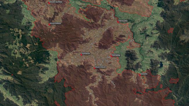
More than 7200 structures — including houses, garages, sheds, silos and water tanks — were within fire boundaries, with nearly 2500 in the Corryong district alone, the data prepared exclusively for the Sunday Herald Sun reveals.
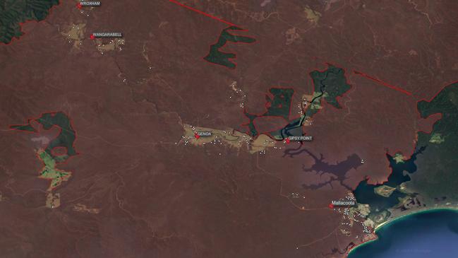
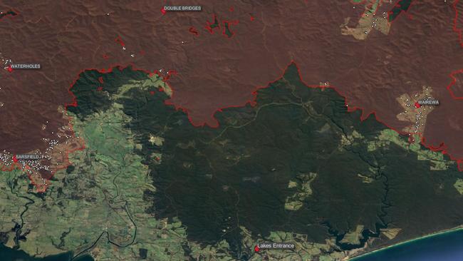
It shows some towns in Victoria’s east had extremely close calls, with fire just 2km from Orbost, about 7km from both Falls Creek and Bright and less than 15km from Lakes Entrance.
Special analysis of satellite photos and other data by Melbourne’s Digital Agriculture Services (DAS) shows 1,416,743ha was burned in the fires.
“That’s about the equivalent of one-and-a-half times the size of Melbourne or 800,000 MCGs,” DAS chief executive Anthony Willmott said.
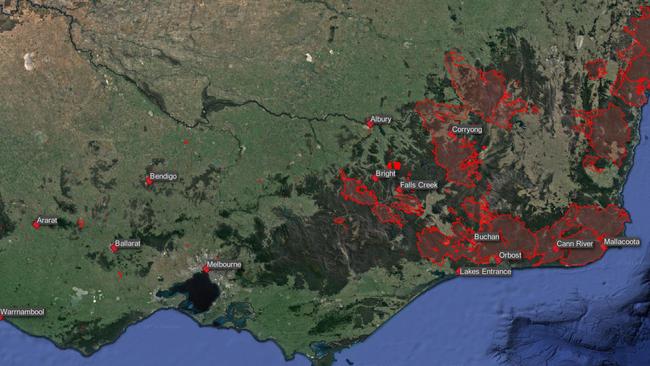
Most of the land destroyed was forestry plantations (809,689ha) and park bushland (428,872ha) but more than 160,000ha of farming land and 16,500ha of residential land had also been lost.
The technology had not yet been used to determine how many of the structures within the fire boundaries had actually been destroyed, Mr Willmott said.
What was known, however, was that tens of thousands of hectares of bushland had been wiped out in the Alfred National Park, Lind National Park, Mount Elizabeth Nature Reserve and Wabba Wilderness Park, with huge implications for wildlife — nationally, more than 1.2 billion animals are thought to have died. And 20 per cent of the state’s forestry and logging plantations had been razed.
MORE NEWS
US FIREFIGHTERS ARRIVE INTO MELBOURNE
YELLOW WIGGLE’S HOSPITAL BED PLEDGE
TODDLER CLINGS TO LIFE AS FAMILY KEEPS VIGIL
DAS had integrated the latest bushfire boundary maps and other fire, emergency services and government data with existing satellite photos and its own technology to come up with statistics and maps that could now be used to aid disaster relief and recovery efforts, Mr Willmott said.
The analysis incorporated all Victorian bushfire boundaries reported since July 1 last year.
1,416,743 HECTARES have burned in Victoria alone, the equivalent of one-and-a-half times the size of Melbourne or 800,000 MCGs
TWENTY PER CENT of the state’s logging plantations have been lost
UP TO 300 HOMES are feared razed in Victoria
1.25 BILLION ANIMALS have died and hundreds-of-billions of insects have been wiped out nationally