
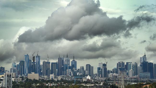
Rain to drench Melbourne over next two days but humidity to continue
LATEST: MELBOURNE’S west has copped a lashing of heavy rain during the afternoon commute. Flash flooding still expected this evening.
VIC News
Don't miss out on the headlines from VIC News. Followed categories will be added to My News.
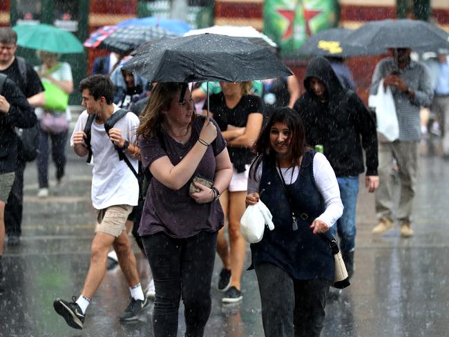
MELBOURNE’S west has copped a lashing of heavy rain during the afternoon commute.
The city’s outer east and north felt the brunt of the first storm front, with up to 37mm falling in Glen Waverly and 26mm in Bendigo.
SEND US YOUR STORM PICS: heraldsun@news.com.au
Earlier up to 49mm fell in Warnambool and Port Fairy.
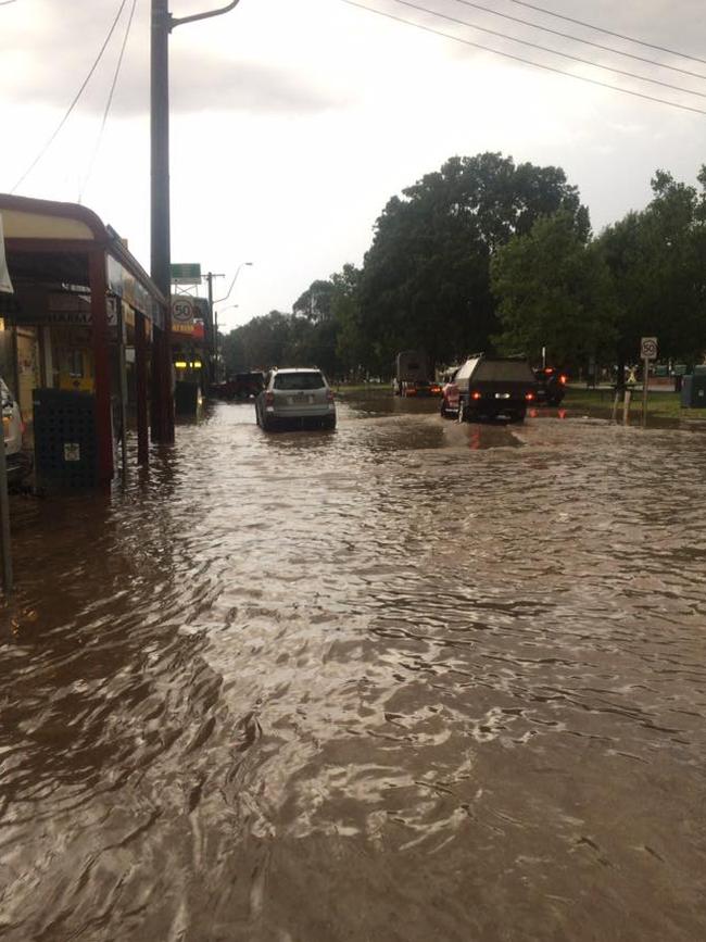
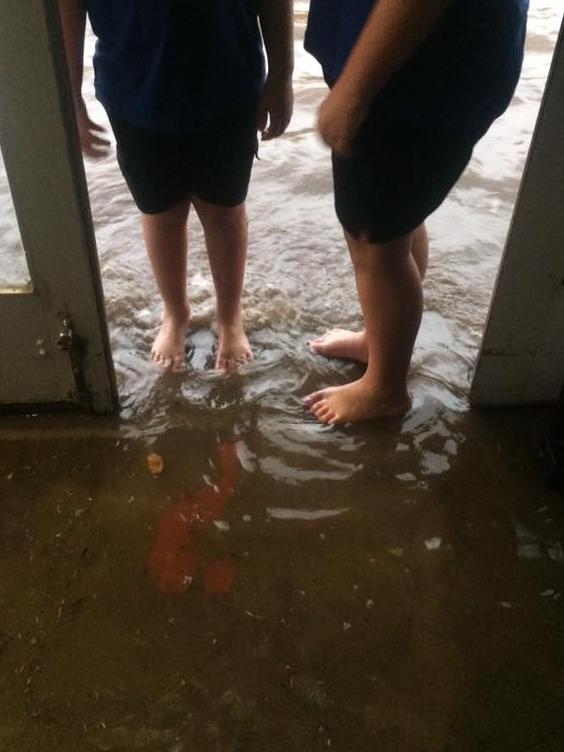
Consistent showers will continue across the eastern suburbs until 9pm tonight — with rainfall so heavy it could lead to flash flooding.
SES duty officer Laura Dewildt said pockets of heavy rain could fall across Melbourne tonight, as previously seen in the west earlier today.
“Sometimes we will get little pockets of storms brewing across the state, which is what creates heavy rain and flash flooding,” she said.
“(The west has) had pockets of heavy rain come through. It’s not fast moving, it’s really intense short bursts of rain.”
Melbourne’s metropolitan area has already seen 15mm and is expected to get 15mm into the evening.
Here comes the rain again, Melbourne!! #melbourne #melbourneweather #victoria #stormy #portmelbourne pic.twitter.com/Dtfv12Dygc
— Briana Ruggiero (@briana_ruggiero) March 21, 2017
There are some dark clouds over #Melbourne's east â˜ï¸ #melbweather pic.twitter.com/aKULNdk7dN
— Andie Noonan (@AndieNoonan) March 21, 2017
The rain will bring thunderstorms and lightning to the city, with the Bureau of Meteorology issuing a severe weather warning for Melbourne, Geelong and other parts of the state.
A severe thunderstorm warning has also been issued for Mildura, Ouyen and Warracknabeal, with the Bureau preductibng heavy rainfall and large hailstones.
Drivers are warned to be extra careful once the rain arrives, with hazards hard to see in wild conditions.
Shout out to @vicsesnews & @VictoriaPolice who were out about just south #Lascelles today clearing road of trees & makin it safe #storm pic.twitter.com/ahzq4AU26Y
— Rebecca Wells (@Wellsbec) March 21, 2017
The downpour began in the state’s northeast last night, turning Yea’s main street into a river after receiving 45mm of rain in the last 24 hours
The town’s hospital, 100 kilometres from Melbourne, was also struck by lightning — luckily leaving little damage.
Nearby Strath Creek copped the brunt of the storm — receiving 63mm of rain within half an hour.
Both Melbourne and Geelong are among a handful of places told to be on high alert for severe weather.
A State Control Centre spokeswoman said the SES had received more than 100 calls for help in the past 24 hours — 20 of those from Yea, Alexandra and Kinglake.
The extreme weather conditions felt by those in the state’s northeast overnight and west this morning is expected to make its way to Melbourne during peak hour.
“We have a low pressure system slowing moving east across Victoria, ” the spokeswoman said.
“It’s moving along Warnambool, and Geelong is a main area of focus for us — it looks like it will hit there in the mid-late afternoon.
“And then it will come through Melbourne around home time — about 5 or 6pm.”
She said the rain would continue in Melbourne throughout the day — and could bring isolated showers and flash flooding in some areas.
SES volunteers are on standby and drivers are warned to take it easy on the roads.
Melbourne’s temperature was hovering at a balmy 25 degrees at 1.30pm.
Senior forecaster Stephen King said the warm and humid weather is “particularly unusual” for this time of year.
“It’s been a pretty dry March so far, with only 2mm of rain falling in Melbourne — so we’ll likely get most of March’s rainfall within a day or two,” he said.
“But it should clear up on Wednesday, with a top of 21C forecast.
Temperatures are set to warm up again on Thursday, with 27C and a possible late shower forecast for the Australian Grand Prix.
It’s been the second warmest March on record for Melbourne, so far, with temperatures reaching six degrees higher than average.
Melbourne’s warm spell is due to a lack of cold fronts over across the state — caused by a blocking high over the Tasman Sea.
The State Emergency Service is warning people to never drive, walk or drive through flood waters, and to keep clear of creeks and storm drains.
Torrential rain in Melbourne (water coming out of the drain) 3/4 #melbourneweather #melbourne pic.twitter.com/YWqswMJkfz
— Peter Tonoli (@peter_tonoli) March 21, 2017
Torrential rain in Melbourne (water coming out of the drain) 2/4 #melbourneweather #melbourne pic.twitter.com/PRWLJBYyQw
— Peter Tonoli (@peter_tonoli) March 21, 2017
#flashflood soon in #Melbourne #rain #heavyrain #weather #australia pic.twitter.com/IMq2XCRGfB
— Shashi (@ShashiKumarShaw) March 21, 2017
Surf's up kew #melbourneweather pic.twitter.com/aXNbCrYVAS
— Jane Marijones (@wanet80) March 21, 2017
A new river in Brunswick #melbourneweather #upfield pic.twitter.com/28SiYAehCp
— Lou•Is•A•Fox®™ (@loufox13) March 21, 2017
— with AAP

‘Angels’: Hero Coles workers save mum’s life
A mother of three has opened up on how her life was saved after she suddenly collapsed while doing a routine supermarket shop.

Wildlife and traffic fears over music festival
Wildlife advocates fear a weekend music festival in central Victoria will endanger native animals including rescued joeys.