
Vic Floods: Swollen Gippsland rivers to peak Saturday after state’s east drenched
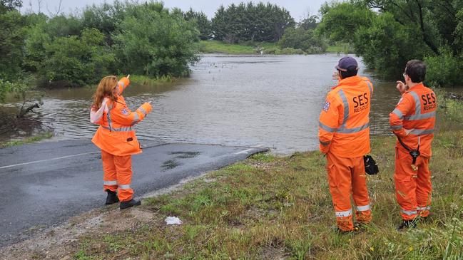
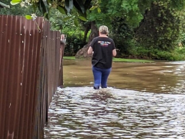
A woman trapped in floodwaters in Gippsland has been rescued as several major rivers are expected to peak on Saturday afternoon as rain continues to lash the state’s east.
Victoria
Don't miss out on the headlines from Victoria. Followed categories will be added to My News.
A woman trapped in flash flooding has been rescued from her car overnight as heavy rain continues to hammer Victoria’s east.
SES volunteers were called to assist a woman caught in rising flood waters outside the southeast town of Alberton just before 11.30pm on Friday.
Crews were able to pull the woman from the scene at the intersection of Gelliondale Rd and Forest Lodge Rd before police arrived.
Emergency services are urging residents in Gippsland to exercise caution and remain aware of their surroundings.
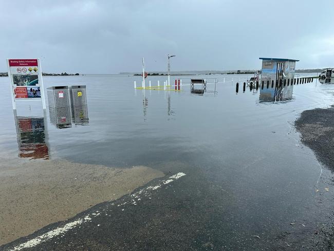
Watch and act alerts were issued for the towns of Buchan, Jarrahmond and Orbost on Saturday morning, with locals told to avoid flooded areas as a number of rivers reach their peaks while others overflow.
The Snowy River at Jarrahmond is currently at 6.11 metres and rising, with a VicEmergency alert stating it may exceed the moderate flood level and reach a peak of 6.6 metres on Saturday afternoon.
Further east, the same river in Orbost is currently at 5.86 metres and steady with minor flooding, however further rises are possible later in the day.
WATCH & ACT - RIVERINE FLOOD - Avoid the Flooded Area - Snowy River downstream of McKillops Bridge.
— VicEmergency (@vicemergency) December 2, 2023
Stay safe. Be aware of potential hazards caused by flooding and never enter floodwater.
More details at https://t.co/OPDmZUI3fKpic.twitter.com/YkRnQH2yvl
In some better news for those near Snowy River D/S Basin Creek, the river peaked at 5.26 metres about 6am on Saturday, with levels falling for now.
In the West Gippsland catchment, residents living along the Thomson River Cowwarr Weir to Wandocka are advised to move to higher ground with prolonged flooding and renewed rises likely, according to the Bureau of Meteorology (BOM).
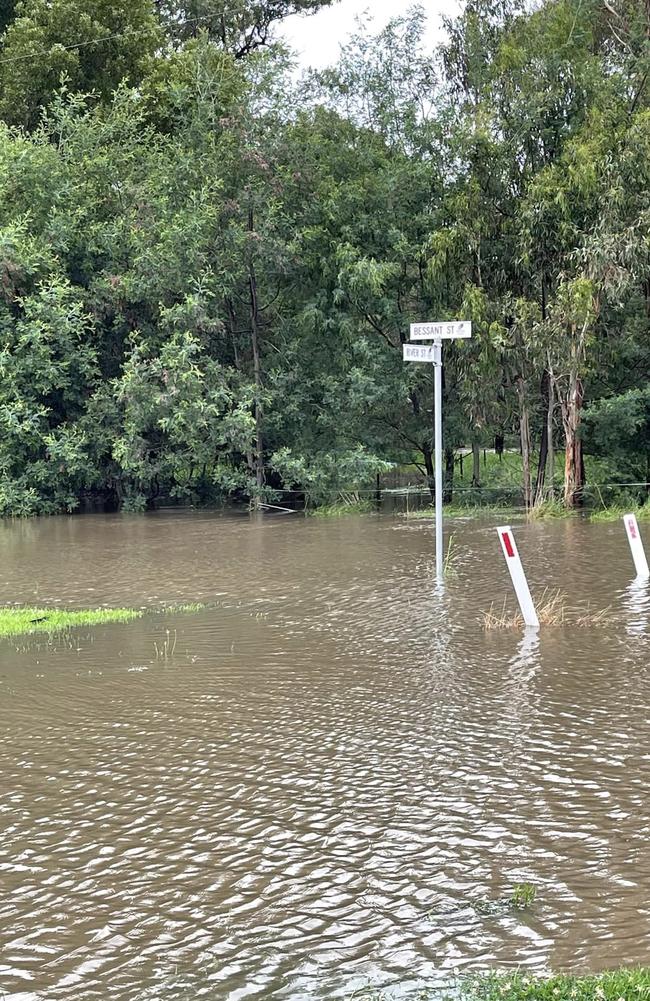
Stay informed advice was also issued for those living along the Cann, Genoa and Bemm River catchments after 30mm of rain was recorded in the 24 hours before 9am Saturday.
“Stay safe. Be aware of potential hazards caused by flooding and never enter floodwater,” Victoria SES said in a social media post.
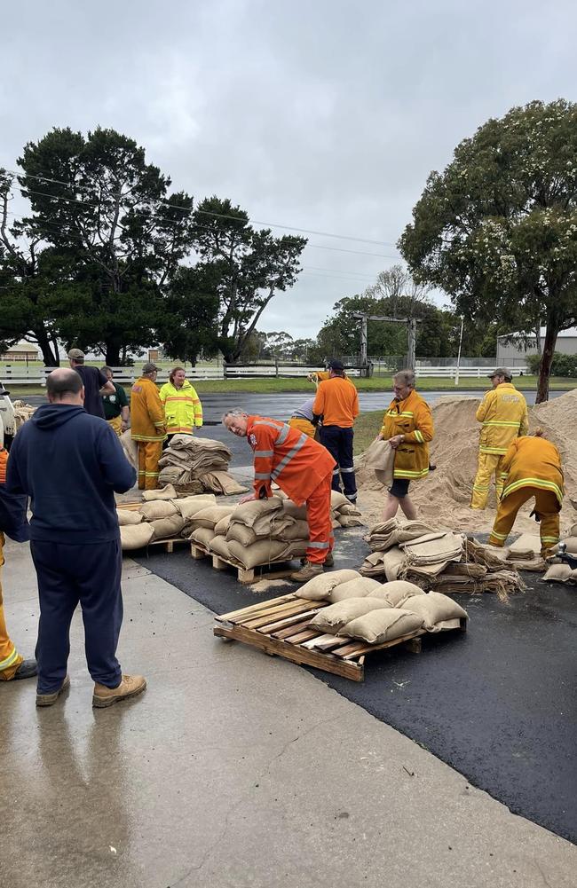
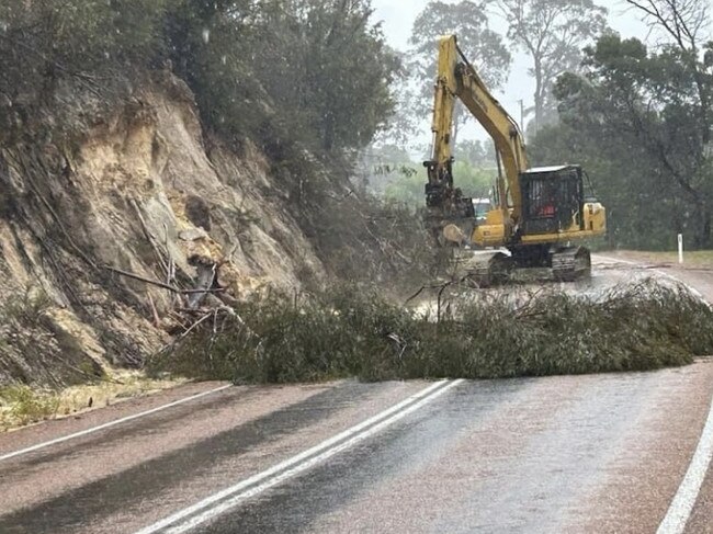
In the past 24 hours, the SES has responded to 39 call-outs in the Gippsland region, 20 of which were for fallen trees and four for flood rescue.
Just before 12.30pm, there were four active requests for assistance.
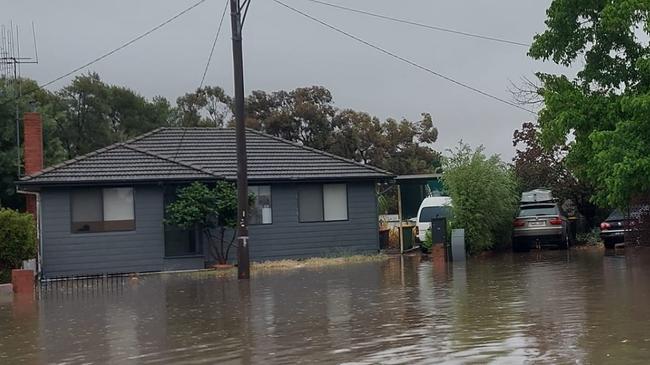
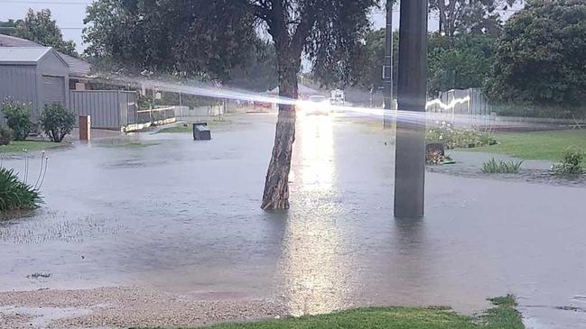
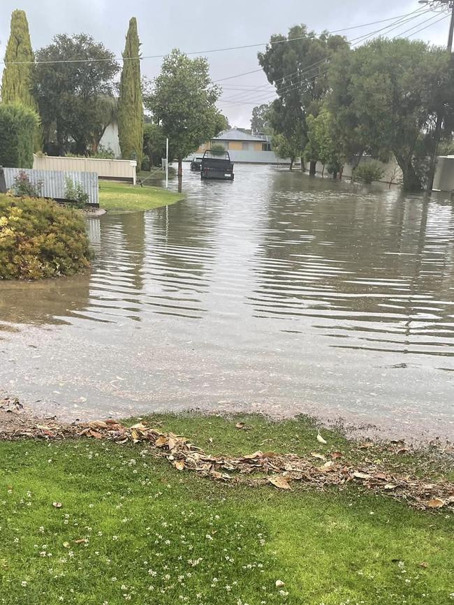
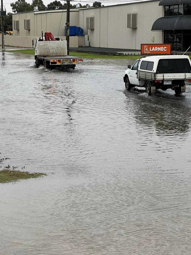
Flooding has also contributed to the closure of a number of Gippsland roads, including the South Gippsland Hwy in both directions between Longford and Sale, according to VicRoads.
Data obtained by the BOM shows more than 33mm of rain has fallen across parts of West and South Gippsland since 9am on Saturday, while East Gippsland saw 21.8mm.
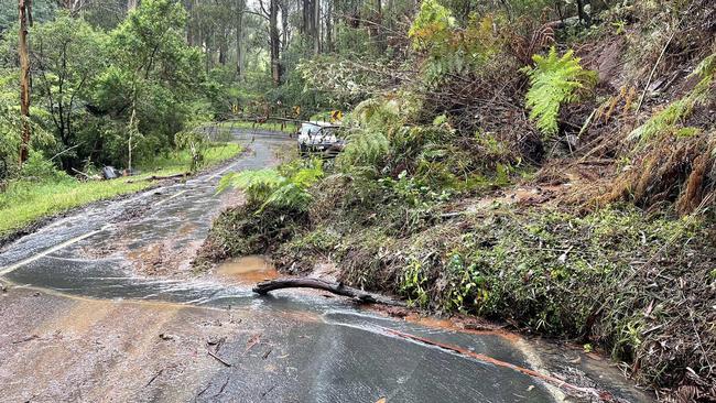
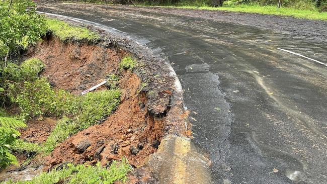
It comes after parts of the region encountered four landslides in the past two days which blocked roads and cut off tourists and residents from housing and accommodation.
Friday: Mallacoota landslide cleared
Mallacoota locals say Mallacoota-Genoa Rd has now been reopened after an earlier landslide.
Just before 1pm on Friday it was reported the road was successfully cleared and open, allowing locals and tourists to leave or get into town.
Emergency services had worked to clear the landslide that had cut access to Mallacoota as residents in eastern Victoria braced for swollen rivers to peak on Friday.
Four landslides were reported along Mallacoota-Genoa Rd in the East Gippsland region, with the first occurring about 8.30am Thursday.
Mallacoota resident of 22 years Mark Tregellas said the township was used to being cut off and had measures in place to help locals wait it out.
“Five years ago before the battery backup generator was put in place, we averaged 52 power outages a year,” Mr Tregellas said.
“During the Black Summer fires we were cut off from power for three weeks.
“A lot of homes are now wired with generators and a lot of people have them connected up to be able to run their fridges and freezers.”
Mr Tregellas said there were multiple effects from being cut off, such as tourists unable to leave and also tourists wanting to come to their accommodation but they cannot.
“Our two supermarkets are looking quite bare as food deliveries are unable to be brought in,” he said.
“We also have local restaurants in town wanting to operate but if they can’t get food delivered that makes it a problem, and if locals do not have generators, they go to these restaurants to get a hot meal and it just compounds itself.
“We just have to wait it out.”
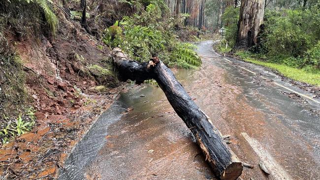
Friday: Walhalla landslide makes a mess
Walhalla, a regional town 2 hours and 30 minutes east of Melbourne, experienced its own landslide.
The town was dumped with 92.2mm of rain in the 24 hours to 8am Friday morning.
Since Tuesday, a total of 259.1mm of rainfall has been reported to have hit the small town.
A large tree had fallen onto Walhalla Rd, leaving debris scattered on half of the road.
A steady flow of water was also seen.
The fallen tree has also caused damage to the side of the road.
Friday: SES logs 527 calls for help
The SES logged 527 calls for help across Victoria in the 24 hours to 7am Friday,
The South Gippsland region was hit with the most rain in the state with 161.4mm recorded in the 24 hours to 7am Friday.
Melbourne recorded 6.8mm of rain over the same period.
Watch and Act - Moderate Flood Warning for Gippsland. You should Avoid the Flooded Area. For more info: https://t.co/SNM1LlHCgY#vicfloods
— VicEmergency (@vicemergency) November 30, 2023
VicEmergency on Friday morning warned the major Gippsland town of Bairnsdale was at ‘moderate risk’ of flooding.
There was already some flooding occurring at Glenaladale, it said.
“Rainfall during Wednesday and overnight into Thursday across the Mitchell River catchment has resulted in river level rises and flooding,” VicEmergency said.
“River levels rises and areas of minor flooding are occurring along the Mitchell River. Moderate flooding may develop at Bairnsdale on Friday afternoon.”
Weather bureau meteorologist Stephanie Miles said they are hoping to see most of the riverine flooding to peak by Friday morning following four days of continuous rainfall.
“There’s still rainfall forecast for Gippsland on Friday and Saturday, however those totals won’t be anywhere near what we got on Wednesday or Thursday — only up to about 20 or 30 millimetres,” she said.
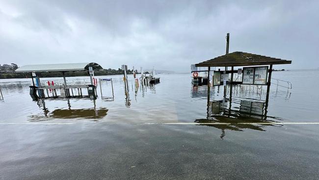
Flood warnings are expected to remain in place across the state over the weekend including the Thomson, Macalister, Buchan, Snowy, Genoa, Bemm and Cann rivers.
In Melbourne, south-easterly winds of up to 25km/h are expected to hit the city on Friday.
However, conditions are set to ease early next week according to the Bureau of Meteorology.
Over the weekend, most of the state can expect partly cloudy and dry conditions, by Monday temperatures are set to warm up.
The big wet has confounded many Victorians, who expected a dry late spring and summer after being told the country had entered an El Nino period.
The Bureau of Meteorology on Wednesday said while El Nino events tended bring a reduction in cloud coverage and rainfall over eastern parts of the country, “significant rainfall is still possible, especially those of short duration”.
“El Nino increases the probability for drier conditions, but it is not a guarantee. We can still have both dry and wet periods,” it said in a statement.
Stay informed messages have been issued for all towns in Gippsland to as far the NSW border, including Maffra, Sale, Morwell, Erica and Traralgon
Record rainfall on Wednesday
Parts of Victoria have received record rainfall, with some areas in the northwest of the state now flooded.
By 11.30am on Wednesday, Vic SES had responded to 180 calls over a 24-hour period — 45 for flooding, 80 for trees down and 16 for building damage.
There had also been nine rescue calls.
Most calls for help had come from Swan Hill and the northwest of the state, while Fawkner and Essendon had the most call outs in the Melbourne metropolitan area, a spokeswoman said.
Swan Hill was awash on Wednesday morning with at least one school closed, after the town was hit with about 85mm of rain by 8.30am. About 77mm of rain fell in just six hours.
One resident reported about 11am that water was still rising, adding “please do not come driving through the flood waters, cars are sending waves into houses”.
By noon Wednesday there had also been a call to Vic SES for flooding in Echuca, which was one of the towns most at risk in last October’s devastating floods.
“And that’s (the rainfall) still climbing,” Christie Johnson from the Bureau of Meteorology said. “It is expected that sort of rainfall would cause flash flooding … it breaks what would be considered for Swan Hill, over six hours, the one-in-50-year rain rate.”
The flooding has caused the closure of the Swan Hill RSL, due to flood damage, and St Mary’s Primary School.
On Wednesday the school informed families it was closed and town buses were not running.
Country bus children who had already started their commute to school had been taken to Swan Hill Secondary College, where their parents were asked to collect them as soon as possible.
Ms Johnson said the next heaviest rainfall had been in the Gippsland hills.
And about 46mm had fallen in Walpeup in the Mallee, near Ouyen, which had unofficially recorded its highest rainfall for November since records started 85 years ago.
“That’s a significant rain record there,” Ms Johnson said.
Melbourne had avoided the worst of the deluge, and did not appear to be in the firing line on Wednesday, she said.
“It will obviously get rainfall but we’re probably looking at more in the 10 to 20 or possibly 30mm range for Melbourne,” Ms Johnson said.
“But when it comes to say out in the Dandenongs or out in the hills to the northwest of Melbourne, or down along the Surf Coast — that’s where we expect some heavier rainfall. “And we do actually have a severe weather warning for the Otways, with the potential of up to 100mm of rain there. And, and also the Strzelecki Ranges out in Gippsland.
“There’s also some pretty heavy rainfall expected out in the Baw Baw plateau and Yarra Ranges areas … and on the outskirts of Melbourne.”
There were also high wind warnings for the Otways — with damaging gusts of up to 90km/h predicted — and for Port Phillip Bay and the Gippsland lakes.
Across Melbourne and the rest of the state it would be very windy, but the gusts would not be as strong as in those areas, Ms Johnson said.
“It will be a windy day, particularly over elevated parts and in the south of the state,” she said.
Already there had been winds of up to 90km/h recorded at Wilsons Promontory and at South Channel Island in Port Phillip Bay.
EARLIER
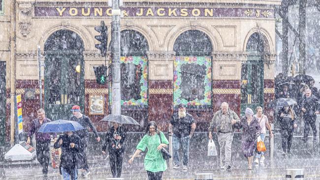
Reports of trees down and flooding rolled in from across Victoria as high winds and rain lashed the state.
Vic SES received reports of trees down in Armadale, Hastings, Ocean Grove, Woodside, Olinda, Gherang and Cowes.
There were also reports of flooding at Kerang, Lucknow and Swan Hill.
It came as the Bureau of Meteorology warned heavy rainfall and high winds was set to pummel parts of Victoria for much of this week, with flooding feared in some areas.
The Bureau of Meteorology on Tuesday issued minor to major isolated flood warnings for the Otway ranges and eastern districts, and said Melbourne was also set for heavy rainfalls — potentially for days to come.
Temperatures, however, would remain reasonably warm.
Between 10 to 25mm of rain was expected to hit the city on Wednesday.
South-easterly winds of up to 35km/h were expected on Tuesday evening and up to 45km/h on Wednesday.
Strong wind warnings were issued at 4:40pm on Tuesday for Port Phillip Bay, the Gippsland Lakes, west coast, central coast, central Gippsland Coast and east Gippsland coast.
On Saturday Sky News meteorologist Alison Osborne said wet, windy and humid conditions were set to lash the state all week.
“Unsettled weather with stormy days coming and going is the general gist for Victoria for the last week of November,” she said.
“As a low pressure system crosses the state, some of these storms may be severe with heavy downpours and flash flooding.”
Ms Osborne said torrential rain might fall in some parts of the state on Wednesday and Thursday.
“Wednesday is the next big day of weather for Victoria with strong and gusty winds across the south,” she said.
“Rain and storms are expected statewide as a low pressure system crosses New South Wales.
“Some pockets of Gippsland and the northeast ranges could collect a month of rain in one day under the more severe storms … the low will move into the Tasman Sea on Thursday but there is the potential for torrential rain on the Gippsland coast.”
Ms Osborne said showers would continue into next month.
“There’s ongoing potential for some wet weather with light falls on the first week of December,” she said.
“This reducing the likelihood of the city ringing in the new season with high heat.
“From mid to late December, drier weather looks to settle in.”
Bureau of Meteorology’s Morgan Pumpa urged Victorians to look at the weather warnings.
“I definitely recommend people to keep an eye on the warnings if they are heading out and about,” she said.
“Keep an eye on the radar and just keep in mind that any possibility of heavy rainfall that we see could lead to some flash flooding as well. There’s a bit of uncertainty at the moment.”


Join the conversation

Macca’s in Northcote? That’s not cool for Kat
Northcote MP Kat Theophanous is hot under the collar over plans for McDonald’s to open a 24-hour restaurant in Northcote, and she’s taking her fight to the council.
Read more

Mernda shop targeted in overnight firebombing
A group of arsonists are at large after a firebombing a shop in the city’s north overnight.
Read more